Jet streams shape the practical reality of long-distance flight. For pilots, student pilots, flight instructors, and operational planners, understanding jet streams means better fuel planning, more efficient routings, and clearer recognition of turbulence and wind shear risks. This article explains the science behind jet streams and translates that science into usable flight planning and cockpit decision-making.
In the next sections you will find the meteorology that creates jet streams, how they behave seasonally and geographically, and precise operational consequences for climb, cruise, descent, and in-flight decision-making. The primary keyword jet streams appears early because winds aloft and their cores are among the single most influential meteorological features for cruise performance and safety on many flights.
What Are Jet Streams and How They Form
Jet streams are narrow, fast-flowing bands of wind in the upper levels of the atmosphere. They form where there are strong horizontal temperature gradients, most commonly between cold polar air masses and warmer mid-latitude air. The atmosphere’s thermal structure combined with Earth’s rotation produces a geostrophic balance: pressure gradient forces are largely balanced by the Coriolis force, producing strong westerly winds concentrated into relatively narrow zones.
At a practical level, jet streams are not continuous ribbons. They are sinuous and variable, with distinct cores of maximum wind speed, adjacent regions of strong wind shear, and embedded disturbances. Two commonly referenced jets at midlatitudes are the polar jet and the subtropical jet. The polar jet sits nearer the polar front and usually shows the strongest seasonal variation, while the subtropical jet sits closer to the tropics and can influence long-range routings.
Key Physical Characteristics Pilots Should Know
Several meteorological characteristics of jet streams are directly relevant to flight operations.
- Jet core: the axis of maximum wind speed. Staying near the core on an eastbound flight can produce large groundspeed gains; conversely, crossing the core westbound can produce substantial headwinds.
- Wind shear: strong gradients in wind speed and direction on either side of the core. Vertical and horizontal shear near the core can increase the risk of clear-air turbulence.
- Meanders and Rossby waves: jet streams move in long-wave patterns that change on synoptic timescales. These meanders create regions where the jet accelerates or weakens and where troughs and ridges develop.
- Embedded disturbances: short-wave troughs, jet streaks, and transient cores can produce localized zones of enhanced winds and shear that matter for routing and turbulence forecasting.
Why Jet Streams Matter in Real-World Aviation
Jet streams influence nearly every aspect of flight planning and cruise operations for turbine aircraft and can affect operations for higher-performance turboprops and some pressurized piston aircraft. The most immediate operational consequences are on groundspeed, route selection, fuel burn, time-on-task, and turbulence exposure.
For long-haul flights, choosing a routing that utilizes favorable tailwinds can reduce en route time and fuel burn. Conversely, failing to account for a strong opposing jet can increase fuel consumption and time, which has cascading effects on reserve planning, payload decisions, and crew scheduling. Tactical decisions in the cockpit—such as accepting a step climb, initiating a reroute, or requesting a different flight level—are often motivated by the location and strength of jet streams.
Clear-air turbulence (CAT) associated with jet streams is of special concern because it often occurs without visible cloud cues. CAT can lead to injuries and requires pilot awareness and passenger preparation. Wind shear associated with jet cores can also affect descent and climb profiles, particularly when strong gradients descend into terminal areas or interact with mountain waves.
How Pilots Should Understand Jet Streams for Flight Planning
Transforming meteorological knowledge into operational decisions requires three steps: forecast interpretation, performance assessment, and contingency planning.
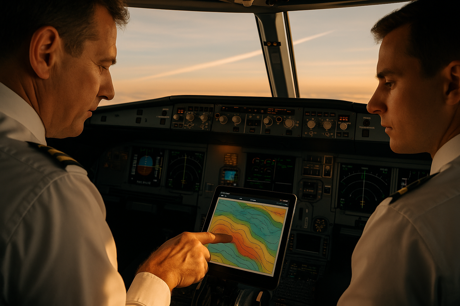
Forecast interpretation begins with winds aloft products. Meteorological services provide winds, temperatures, and prognostic charts at fixed pressure levels and model vertical grids. Pilots should compare planned flight levels with the forecasted jet core altitude, cross-track location, and expected speed. A basic mental model is helpful: the jet core produces the largest groundspeed impact; the flanks have strong shear and higher turbulence risk; downstream of a trough or near a jet exit region conditions change rapidly.
Performance assessment ties the forecast wind and temperature fields to your aircraft’s performance. For turbine aircraft, tailwinds on the order of tens of knots materially change true airspeed required for a given ground speed and affect fuel flow and cost index decisions. For piston aircraft, encountering the upper portions of a jet stream is uncommon, but strong low-level jets or mountain-induced jets can still impact performance and safety.
Contingency planning is essential. Forecasts change. Include alternate fuel for unexpected headwinds, and ensure briefings discuss likely turbulence, possible reroutes, and suitable diversion fields should inflight conditions degrade. Plan for the expected vertical and lateral variability of the jet so that step climbs, step descents, and level changes can be executed without surprise.
Jets, Wind Shear, and Turbulence: Practical Considerations
Wind shear associated with jet streams can be both horizontal and vertical. Vertical shear matters for climb and descent phases when winds aloft change significantly with altitude; horizontal shear matters when crossing the jet core or passing from the warm to cold side of the jet. Both forms can produce clear-air turbulence when thermal and mechanical instabilities develop.
Pilots should interpret turbulence forecasts and SIGMETs in the context of the jet’s location. Regions near the jet core and especially near jet streaks, entrance or exit regions, and the left-front/right-rear quadrants of a jet streak frequently show enhanced turbulence potential. Anticipate the need to secure the cabin, adjust vertical speed, and modify speeds to recommended turbulence penetration speeds where applicable.
Common Mistakes or Misunderstandings
Pilots and dispatchers commonly make several mistakes when planning around jet streams.
- Treating winds aloft as static: jet streams shift with time and react to evolving synoptic features. Relying on a single briefing without periodic updates can lead to inefficient or unsafe decisions.
- Ignoring vertical structure: the jet core has a vertical dimension. Selecting a flight level based solely on surface winds or a single forecast level can miss the optimal layer for tailwinds or the safest layer to avoid severe shear.
- Underestimating CAT risk: clear-air turbulence near the jet is often not visible and may not show up on onboard weather radar. A lack of visible clouds is not a guarantee of smooth air.
- Over-reliance on single-model outputs: different forecast models and ensemble members can show different jet locations and strengths. Comparing products reduces surprise.
Practical Example: Eastbound Transcontinental Routing
Imagine a turbine-operated transcontinental flight where the jet stream lies along a corridor roughly parallel to the planned route. The operational goal is to maximize groundspeed while managing turbulence risk and fuel planning. Dispatch and flight crew review winds aloft at candidate cruise levels, identify the jet core’s lateral position, and calculate expected groundspeeds for alternate flight levels.
If the jet core is offset from the direct track, a strategic lateral offset of a few degrees combined with a slightly higher cost index may produce better trip fuel and time outcomes than simply climbing to the highest available flight level. Conversely, if the jet core crosses the route and provides strong tailwinds at a single optimum level, remaining on-track and selecting that level yields the best performance. Planning should include contingency fuel for a late-developing headwind or turbulence that forces a descent.
During the flight, crews monitor updated winds, pilot reports of turbulence, and aircraft performance trends. If updated forecasts move the jet core northward, the crew may request a step climb or tactical reroute to intercept stronger tailwinds. If turbulence reports increase near the jet core, crews prepare the cabin and consider vertical or lateral offsets to reduce exposure.
Best Practices for Pilots and Flight Planners
Applying jet stream knowledge reliably requires consistent habits.
- Check multiple forecast products: compare modeled winds, operational analyses, and pilot reports. Look for consistency in jet location and magnitude.
- Plan alternate flight levels: compute performance estimates at two or three likely cruise levels so tactical changes can be made without lengthy recalculation.
- Monitor pilot reports: PIREPs are invaluable for real-time turbulence and cross-checks on forecasted jet-related conditions.
- Brief the crew on turbulence risk and escape routes: ensure flight attendants and passengers are prepared if CAT is likely.
- Use the aircraft’s systems intelligently: automated flight planning and cost-index adjustments can help intercept beneficial winds, but crews should verify results against human judgment and operational constraints.
Training Implications
Jet streams are a teaching opportunity at several levels. For student pilots, the concept reinforces the link between large-scale meteorology and aircraft performance. Advanced students and instructors should study how jet-induced winds affect true airspeed, groundspeed, and fuel consumption calculations, and practice tactical decision-making simulations that include re-routes, step climbs, and turbulence avoidance.
For airline and corporate flight crews, recurrent training should include scenario-based exercises where crews must weigh time/fuel trade-offs, manage cabin safety during CAT, and coordinate with dispatch for in-flight reroutes. Simulators can recreate turbulence encounters and test procedures for altitude changes in regions of strong shear.
Common Operational Questions and Short Answers
Can a jet stream help me save fuel?
Yes. A substantial tailwind near your cruise altitude increases groundspeed and reduces time in cruise, which typically lowers total fuel burn for a given trip. The benefit depends on the aircraft, the jet’s strength and alignment with your route, and whether intercepting the jet requires extra fuel for detours or climbing costs.
Do jet streams always cause turbulence?
No. Jet streams often coincide with regions of stable flow. However, strong wind shear gradients near the jet core, and transient features around jet streaks or exit regions, frequently produce clear-air turbulence. Forecasting and PIREPs help identify the higher-risk zones.
Should I always choose the flight level with the strongest tailwind?
Not always. The strongest tailwind might coincide with higher turbulence, operational restrictions, or inefficient climb and descent penalties. Evaluate net trip fuel and time, cabin safety, and available alternates before committing.
How should I use winds aloft forecasts?
Use them to compare expected groundspeeds across candidate flight levels and routes. Translate winds aloft into estimated true airspeed and fuel flows for your aircraft, then consider uncertainty by comparing multiple forecast updates and model outputs.
Can small aircraft encounter jet stream effects?
Most small general aviation aircraft operate below the typical altitude of major jet streams. However, smaller aircraft can still encounter strong low-level jets, mountain waves, or shear associated with frontal systems that derive from the broader synoptic dynamics that produce jet streams.
Frequently Asked Questions
What altitudes are jet streams typically found at?
Jet streams commonly occur in the upper troposphere and lower stratosphere near commercial cruise altitudes. Their exact altitude varies with latitude, season, and the strength of the underlying temperature gradients.
How often do jet streams move or change significantly?
Jet streams change with synoptic weather evolution. They can shift position over hours to days, with short-term fluctuations driven by transient troughs and ridges. Regular briefing updates are essential for accurate tactical planning.
How should I brief passengers when jet stream turbulence is likely?
Provide a clear, calm explanation that turbulence is expected and that the crew may change altitude or routing to find smoother air. Advise passengers to keep seat belts fastened when seated and secure loose items. Crew coordination and a timely cabin secure are important safety steps.
Do onboard weather radars detect jet stream turbulence?
No. Onboard weather radar detects hydrometeors like rain and hail. Clear-air turbulence associated with jet streams often occurs in cloud-free environments and will not be visible on radar, so pilots must rely on forecasts and reports.
What tools should pilots use to visualize jet streams?
Common tools include upper-level wind charts, gridded model forecasts, meteograms, and operational briefing products that show winds at pressure levels. Many flight planning systems overlay winds on route maps and calculate estimated groundspeeds and fuel burn by level.
Key Takeaways
- Practical takeaway: Use winds aloft and multiple model products to identify the jet core and evaluate groundspeed benefits versus turbulence risk.
- Safety takeaway: Anticipate clear-air turbulence near jet cores and brief the cabin early; radar will not show CAT.
- Training takeaway: Incorporate jet-related scenario training to practice tactical reroutes, step climbs, and cost-index decisions under changing jet conditions.
Understanding jet streams turns abstract meteorology into concrete operational advantage. By interpreting forecast products carefully, planning alternate levels and fuel reserves, and maintaining situational awareness inflight, pilots and dispatchers can convert knowledge of upper-level winds into safer and more efficient flights.
If you are an instructor, consider using a simulator or desktop flight-planning exercise to practice intercepting favorable winds while managing turbulence risk. For students, focus on translating wind vectors into groundspeed changes and understanding why the jet produces strong shear and the potential for CAT. For operational crews, emphasize communication, updates, and balancing efficiency with safety when the jet stream is a dominant planning factor.