
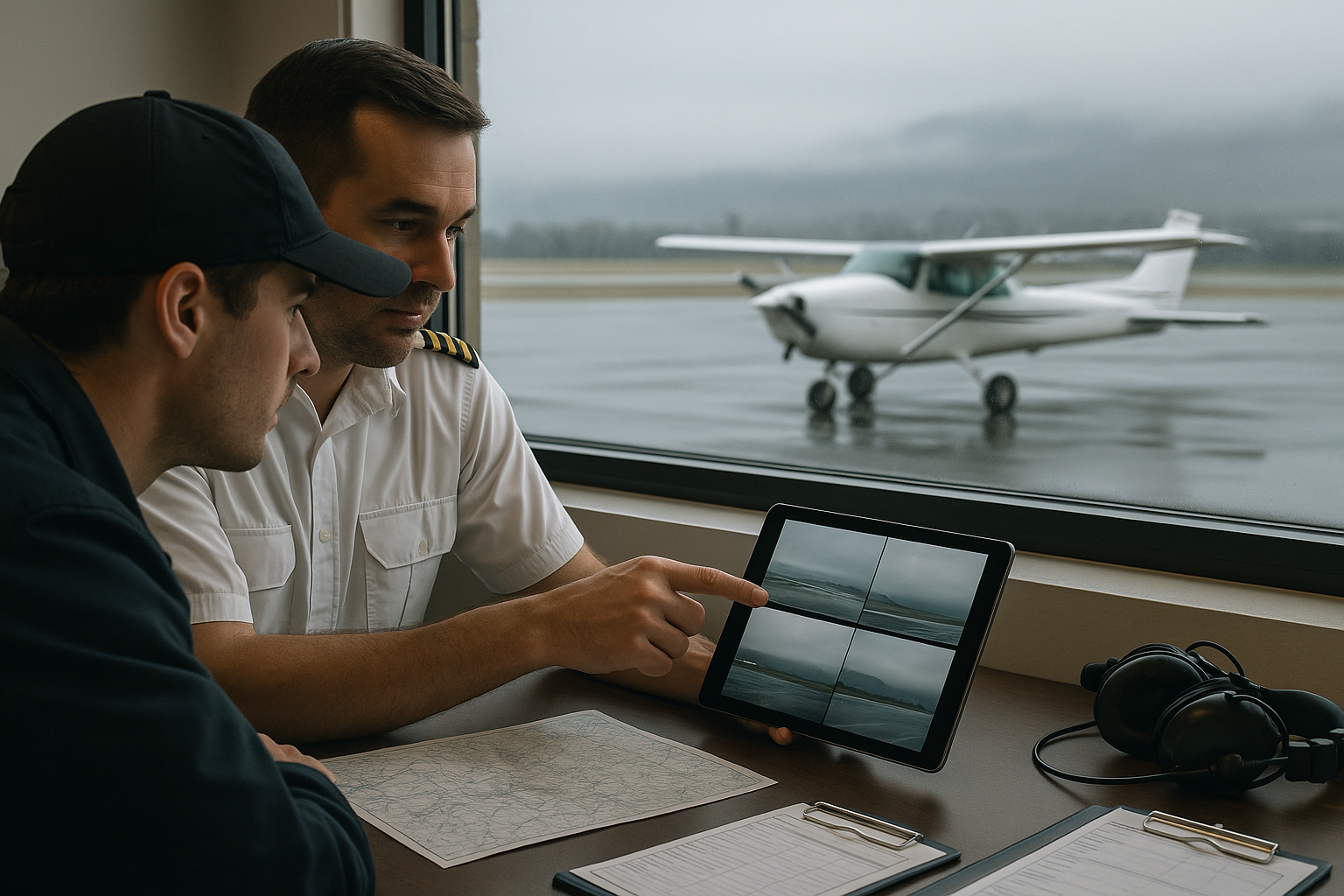
Aviation weather cameras give pilots something no METAR, TAF, or radar image can fully provide: a current visual impression of what the sky, terrain, runway environment, and local visibility may actually look like from a specific location. For pilots planning a VFR flight, instructors teaching weather decision-making, or operators working near mountains, coastlines, valleys, or rapidly changing weather, aviation weather cameras can be a powerful supplemental tool.
The important word is supplemental. Airport webcams and aviation weather cameras are not a replacement for a standard weather briefing, aeronautical decision-making, or compliance with applicable weather minimums. A camera can show a useful scene, but it cannot tell the whole story. It may be pointed away from the weather threat, delayed by several minutes, obscured by precipitation, installed at a poor viewing angle, or unable to capture hazards such as low-level wind shear, icing potential, convective turbulence, or conditions beyond the camera’s field of view. The skill is learning how to read webcam data intelligently, compare it against official aviation weather products, and use it to ask better go, no-go, divert, and delay questions.
What Aviation Weather Cameras Actually Show
An aviation weather camera is a fixed visual sensor, usually installed at or near an airport, pass, shoreline, valley, or other weather-sensitive location. The camera may show the runway environment, ramp, approach path, nearby terrain, horizon, sky condition, or a published visual reference. Some systems include multiple directions, such as north, south, east, and west views. Others provide only one airport ramp or runway view.
Airport webcam data is valuable because aviation weather is local. A METAR may report conditions at the official observing point, but the approach corridor, departure path, nearby ridgeline, or valley exit may look very different. A webcam may reveal lowering clouds over a pass, fog pooling near a river, snow obscuring a runway edge, or sunlight breaking through along a coastal route. It can also confirm that a reported ceiling or visibility value is consistent with what a pilot can reasonably expect to see out the windshield.
Most pilots use weather cameras for three broad purposes. First, they use them to evaluate visual conditions where aviation observations are sparse or where terrain creates sharp local variation. Second, they use them to compare the trend between a reported observation and what is visually happening. Third, they use them to build a mental picture of the route, especially during marginal VFR, changing ceilings, precipitation, smoke, haze, snow showers, or mountain obscuration.
However, a camera image is not an aviation observation in the same way as a certified weather report. The camera may not be calibrated for visibility. It may not provide measured ceiling height. It may not show the full sky. It may update at intervals that matter operationally. A pilot should treat it as one layer in a larger weather analysis, not as a standalone answer.
Why This Matters in Real-World Aviation
Weather cameras matter because many pilot weather decisions are not made in perfect VFR or obvious IFR. The most difficult decisions often happen in the gray area: a lowering ceiling that might still permit legal VFR but offers little margin, a mountain pass that appears open from one side but obscured on the other, a coastal airport with fog just offshore, or an airport with a METAR that looks acceptable while nearby terrain is disappearing into cloud.
For student pilots, weather cameras can help connect classroom weather theory to real-world flying. A student may learn the definition of ceiling, visibility, obscuration, and precipitation from training materials, but a camera image helps translate those terms into what the pilot will actually see. A low overcast, scattered rain shower, fog bank, or snow-covered runway environment becomes more meaningful when viewed against terrain, hangars, runway lights, or a horizon.
For flight instructors, webcams are useful teaching tools because they support scenario-based discussion. An instructor can ask, “What do you see in this image that supports or conflicts with the METAR?” or “If this is the destination and the alternate route has no camera coverage, what else do you need before launching?” These questions encourage students to think like pilots, not like weather consumers passively accepting a single data point.
For experienced pilots and aviation professionals, cameras can add operational context. A dispatcher, charter pilot, medevac crew, seaplane operator, helicopter pilot, or backcountry pilot may need to understand not only the official weather report, but also the practical condition of a route, landing area, or weather-sensitive corridor. Even then, camera interpretation must be disciplined. The best users of aviation webcams are not looking for reassurance. They are looking for evidence, inconsistencies, and risk cues.
How Pilots Should Read Aviation Weather Cameras
Reading an aviation weather camera starts with orientation. Before interpreting the weather, identify where the camera is located, which direction it is facing, what time the image was captured, and what reference points are visible. If the camera shows terrain, buildings, runway markings, lights, towers, or a known shoreline, those references help estimate visibility and cloud position. Without orientation, it is easy to overvalue a pretty picture or misunderstand a threatening one.
The timestamp matters. A beautiful image from 25 minutes ago may be useless if showers are moving quickly or fog is forming near sunset. In dynamic weather, an old image can be worse than no image because it creates false confidence. Always verify whether the image is live, recently updated, or archived. If a camera provides a sequence or loop, use it. A single image shows a moment. A series of images shows a trend.
Next, look at the horizon and contrast. Can you see distant terrain or structures that are normally visible? Are ridgelines sharp, fading, or gone? Are runway lights or buildings visible only as blurred shapes? Reduced contrast may indicate haze, mist, smoke, precipitation, or low cloud. In aviation decision-making, the cause matters. Smoke and haze may reduce visibility without necessarily lowering ceiling. Fog and low stratus may reduce both visibility and vertical clearance. Snow or heavy rain can reduce visibility rapidly and also affect runway condition, braking action, and pilot workload.
Then assess ceiling clues. A camera does not measure ceiling for you, but it can show whether cloud bases are above, at, or below nearby terrain. If familiar hills are obscured, the route through that area may be affected even if the airport observation appears acceptable. If the camera faces an approach path and the tops of nearby obstacles are disappearing into cloud, that is a meaningful caution sign. Be careful, however, not to turn a rough visual impression into a precise ceiling estimate. Webcams are poor measuring devices. They are better for recognizing broad patterns and obvious conflicts.
Finally, compare the image with official aviation weather products. Does the camera match the latest METAR? Is the reported visibility consistent with the visible distance? Does the TAF trend support improvement or deterioration? Is radar showing precipitation upstream? Are satellite images consistent with the cloud pattern? Does the area forecast or graphical weather information suggest mountain obscuration, convection, icing, or turbulence that the camera cannot reveal? The camera is most useful when it is integrated into the full weather picture.
Understanding Webcam Limitations Before You Trust the Image
Every aviation weather camera has limitations. Some are obvious, such as darkness, snow on the lens, glare, condensation, or a blocked view. Others are more subtle. A camera may face the downwind side of an airport while weather approaches from the opposite direction. It may be mounted low on a building, showing the ramp clearly but missing cloud bases. It may auto-adjust exposure, making visibility appear better or worse than it is. At night, the camera may show lights but not the surrounding terrain, creating an illusion of better conditions.
Camera technology also affects interpretation. Wide-angle lenses can distort distance. Compression can reduce detail. Low-light settings can brighten a dark scene. Infrared or enhanced-night views may not look like the view from a cockpit. Rain or snow close to the lens may appear more intense than it is in the broader area, while precipitation beyond the camera’s field of view may not appear at all.
Latency is another concern. A camera image is only as current as its update time and distribution system. Some camera networks update frequently, while others may lag or fail without obvious warning. If the timestamp is missing, unreadable, or inconsistent, treat the image cautiously. For fast-moving convective weather, fog formation, lake-effect snow, sea breeze changes, and mountain wave cloud development, timing can be operationally significant.
Another limitation is that cameras show what is visible from the camera location, not necessarily the conditions aloft or en route. A ramp camera may show VFR conditions at the departure airport, while low ceilings, turbulence, icing potential, or convective activity exist along the route. Conversely, a camera might show a local fog patch that does not represent conditions a few miles away. The pilot’s job is to determine whether the camera view is representative, misleading, or simply one small piece of the picture.
What to Compare Webcam Data Against
Aviation webcam interpretation becomes much stronger when paired with standard weather information. The METAR gives a current coded observation for airports that have reporting capability. The TAF provides a forecast for selected airports. Radar helps identify precipitation location and movement. Satellite imagery gives cloud coverage and movement clues. Pilot reports, when available, can provide real-world information about cloud tops, turbulence, icing, visibility, and ride conditions. NOTAMs and airport information may also be relevant, especially if weather affects lighting, runway surfaces, navigation equipment, or airport services.
The most useful comparison is often between the camera and the nearest observation. If a METAR reports high visibility and a scattered layer, but the camera shows a valley filled with fog in the planned departure path, the observation may not represent the route. If a METAR reports marginal VFR and the camera shows a clearly visible horizon, distant terrain, and a lifting trend over the past hour, conditions may be improving, but the pilot still needs to confirm the broader forecast and route conditions.
Radar and satellite are especially important because a webcam cannot see what is approaching from outside its field of view. A camera looking west may show blue sky while showers approach from the east. A ramp view may look acceptable while satellite shows low stratus expanding from the coast. A single airport camera can never replace awareness of weather movement.
For route planning, pilots should think in segments. Departure airport, initial climb area, en route terrain, passes or choke points, destination, and alternates may each have different weather concerns. One camera at the departure airport is not enough to evaluate a cross-country route. Multiple cameras, when available, can help build a visual chain along the route, but gaps in that chain should increase caution rather than invite assumptions.
Reading Visual Cues: Ceiling, Visibility, Terrain, and Runway Environment
When looking at an aviation weather camera, start with big-picture visibility. Can you see the horizon? Can you see distant landmarks? Are mountains, towers, tree lines, or airport buildings clear or washed out? Compare those cues to what you know about the area. If a camera normally shows a ridge ten miles away and today the ridge is gone, visibility is reduced even if the near ramp looks clear.
Ceiling clues require more care. If cloud bases are clearly above surrounding terrain, that is useful context. If the terrain is partially obscured, the route may be compromised. If clouds are below ridge height or appear to be flowing through a pass, visual navigation through that area may become unsafe or impractical. Avoid trying to assign exact ceiling numbers from a camera unless the system provides verified reference markers or other reliable tools. A pilot needs a defensible decision, not a guessed measurement.
Precipitation cues can be easy to miss. Rain may appear as streaks, reduced contrast, wet pavement, or blurred lights. Snow may be visible as streaks near the lens, whitening surfaces, or reduced distance visibility. Virga, precipitation that evaporates before reaching the ground, may be visible below cloud bases and can indicate changing local conditions. None of these visual cues tells the whole story, but they can prompt better questions about visibility, ceilings, turbulence, runway surface condition, and whether conditions are trending worse.
The runway environment can also provide useful clues, but it should not be overinterpreted. Wet pavement, snow accumulation, standing water, blowing snow, or low visibility near runway lights may affect operational planning. However, a webcam image alone does not provide runway braking action, contamination depth, official runway condition information, or aircraft performance data. Treat what you see as a reason to investigate further, not as a final runway condition report.
Day, Night, and Low-Light Interpretation
Weather camera interpretation changes significantly at night. During daylight, a pilot can evaluate terrain, cloud texture, visibility, and horizon definition more naturally. At night, the camera may show only lights, reflections, and a limited portion of the ramp or runway environment. Lights can be visible through mist or precipitation even when the surrounding horizon is not. This can make conditions look better than they would from the cockpit, particularly for VFR pilots relying on outside visual references.
Glare and exposure also matter. A ramp light shining into a wet lens can make precipitation look worse or obscure useful detail. A camera’s automatic exposure may brighten a scene so that clouds and terrain appear more visible than they would to the unaided eye. Conversely, a dark image may underrepresent actual visibility if the camera is not sensitive enough in low light. The key is humility. Night webcam images can be helpful, but they are often less reliable for judging VFR visual reference than daytime images.
Low sun angles can create another trap. Near sunrise or sunset, glare can wash out one direction while the opposite direction looks much clearer. Fog and haze may also be more visible with certain lighting angles. A pilot should avoid making a broad weather judgment from one camera direction during challenging lighting conditions. Multiple views and a recent image sequence are much more useful.
Common Mistakes or Misunderstandings
The most common mistake is treating a webcam image as permission to fly. A pilot sees blue sky in the camera view and mentally upgrades the entire route. This is especially risky when the camera looks in only one direction or when weather is changing rapidly. A clear ramp view does not prove that the departure path, destination, alternate, or en route terrain is acceptable.
Another mistake is ignoring the timestamp. In marginal conditions, a stale image can be misleading. Fog may form or dissipate quickly. Snow showers can move through a valley in minutes. Convective cells can change the weather picture faster than a pilot expects. If the image age is unknown, the camera should carry less weight in the decision.
Pilots also sometimes overestimate visibility from a wide-angle image. A camera may make nearby objects look sharp and the scene may feel open, but distant visibility can still be poor. Without known reference distances, visual estimates can be unreliable. The same problem occurs with ceilings. Seeing a patch of brighter sky does not mean the ceiling is high enough for the intended operation.
A fourth mistake is confirmation bias. The pilot wants to go, so the camera becomes evidence supporting departure. The safer habit is to use the camera to challenge the plan. Ask what the image does not show. Ask what could be hidden behind the camera, beyond the hill, under the cloud deck, or along the route. A camera should not be a tool for rationalizing a marginal decision.
Finally, some pilots misunderstand the relationship between legal and safe. A flight may appear possible based on minimum regulatory requirements, but still offer little margin for terrain, traffic avoidance, pilot workload, passenger comfort, fuel planning, or diversion options. Webcams are particularly useful when they reveal that a technically legal flight may not be operationally wise.
Practical Example: Evaluating a Marginal VFR Cross-Country
Consider a private pilot planning a daytime VFR cross-country from a non-towered airport to a destination 90 nautical miles away. The departure airport has no control tower but has a nearby weather observation. The METAR indicates VFR conditions with a scattered cloud layer. The TAF at the destination suggests ceilings may lower later in the afternoon. The route crosses a low ridge line and follows a river valley for part of the trip.
The pilot opens airport webcams at the departure airport, a midpoint airport near the ridge, and the destination. The departure camera shows clear ramp visibility and a visible horizon. That supports the METAR, but it does not answer the route question. The midpoint camera, facing the ridge, shows cloud bases brushing the higher terrain and reduced contrast in the valley beyond. The destination camera shows acceptable visibility over the ramp, but a sequence over the previous hour shows the cloud base slowly lowering and distant buildings becoming less distinct.
A less disciplined pilot might focus on the departure image and launch, expecting to turn around if needed. A more disciplined pilot recognizes a pattern: the departure is acceptable, the terrain segment is becoming questionable, and the destination trend may reduce options. The pilot checks updated forecasts, radar, satellite, and any available pilot reports. The pilot also considers alternate airports, fuel, daylight, passenger needs, and personal minimums. Based on the combined picture, the pilot may delay departure, choose a route with lower terrain and better alternates, fly with an instructor for training value, or cancel.
The key lesson is that the webcam did not make the decision by itself. It revealed a risk area that required further analysis. It helped the pilot avoid a simplistic conclusion based on the departure airport alone.
Best Practices for Pilots Using Weather Cameras
The best way to use aviation weather cameras is to build a repeatable habit. Start with an official weather briefing and standard aviation weather products. Then use cameras to add visual context, verify trends, and identify inconsistencies. If the image agrees with the broader weather picture, it can increase confidence. If it conflicts with the broader picture, the conflict deserves attention.
It is also helpful to learn the normal view from cameras you use frequently. A local pilot who knows what a specific ridge, tower, shoreline, or hangar looks like in good visibility can more accurately detect reduced visibility later. Familiarity improves interpretation. For training, instructors can compare the same camera during clear days, haze, snow, low ceilings, rain, and night conditions to help students learn visual cues.
Use multiple camera views when possible. A north-facing camera may show a clear route while the south-facing view shows a lowering deck. A destination camera may look acceptable while the alternate airport is already below practical comfort. A route camera may reveal that a mountain pass is closed in cloud even though both airports on either side are reporting acceptable conditions. Multiple views help reduce the risk of a one-image conclusion.
Good webcam use also includes knowing when not to trust the image. Be cautious when the image is old, the timestamp is missing, the lens is wet or obscured, the camera is pointed away from the weather threat, lighting is poor, or the view does not include the terrain or route segment that matters. If the camera is not helping answer a meaningful aviation question, do not give it decision-making weight.
- Check the image time before interpreting the weather.
- Identify the camera direction and visible reference points.
- Compare the image with METARs, TAFs, radar, satellite, and pilot reports when available.
- Look for trends using image sequences rather than relying on one snapshot.
- Treat camera data as a prompt for better questions, not as a standalone go decision.
Using Weather Cameras in Flight Training
Weather cameras can be excellent tools for teaching aeronautical decision-making. Instructors can use them before a lesson to discuss whether the training objective is appropriate for the conditions. For example, a planned first solo, traffic pattern lesson, simulated instrument lesson, or cross-country flight may each require different weather margins and workload considerations. A camera image can make those margins visible to the student.
A strong training exercise is to compare a camera image against the current METAR and ask the student to explain whether they agree. If the METAR reports good visibility but the camera shows obscured terrain, the student must consider local effects, terrain, fog, haze, smoke, or precipitation. If the camera looks acceptable but the TAF shows deterioration, the student must think beyond the departure moment.
Another useful exercise is trend analysis. Instead of showing one image, review several images from the last hour if the system provides them. Ask whether conditions are improving, deteriorating, or variable. This teaches students that weather decisions are time-based. A flight that is reasonable now may be unwise an hour later, especially if training delays, fuel stops, or return flights are involved.
For instrument students, cameras can help visualize why instrument procedures and weather planning are important, but they should not be used to shortcut instrument decision-making. A camera may show that the runway environment is visible at a moment in time, but instrument flight requires much more: current weather, forecasts, approach planning, alternate considerations when applicable, aircraft capability, pilot proficiency, and regulatory compliance. The camera simply adds visual context.
Special Considerations for Mountains, Coastlines, and Remote Airports
Weather cameras are especially valuable in areas where conditions vary sharply over short distances. Mountains are a classic example. An airport valley may look open while a pass is obscured. A ridge may generate clouds or turbulence that are not obvious from a flatland observation. Wind flowing over terrain can produce conditions that a camera cannot fully capture, but the camera may show lenticular clouds, blowing snow, obscured slopes, or cloud bases interacting with terrain.
Coastal areas create different challenges. Marine layers, sea fog, and low stratus can move inland or retreat quickly. A camera pointed toward the shoreline may show the leading edge of fog before the airport observation changes. Conversely, an inland-facing camera may look clear while fog sits just offshore. Pilots operating near coastlines should be careful to evaluate both the airport and the route over or near water.
Remote airports often have fewer aviation weather reporting resources, making any visual information valuable. At the same time, limited data increases the risk of overreliance on a single image. If a remote camera is the only visual cue available, pilots should be even more conservative about what it can and cannot prove. Weather beyond the camera view, surface conditions, fuel availability, communications, terrain, and daylight may all become more important.
How to Build Webcam Data Into a Weather Decision
A disciplined pilot can integrate weather cameras into a simple decision flow. Begin with the mission: aircraft, pilot, passengers, route, terrain, daylight, fuel, alternates, and training or operational objective. Then gather standard weather information. After that, use cameras to examine the specific visual questions that remain.
For example, if the question is whether a mountain pass is visually open, a camera pointed at the airport ramp is less useful than one showing the pass or surrounding terrain. If the question is whether fog is lifting at the destination, a recent image sequence from the destination is valuable. If the question is whether a line of showers is approaching, radar and satellite may be more important than a local webcam.
Once the image is reviewed, state the uncertainty plainly. “The camera shows the ramp is clear, but it does not show the south departure corridor.” “The ridge is partly obscured, so I cannot assume the pass is usable.” “The destination appears acceptable now, but the trend is lowering and the forecast suggests deterioration.” This kind of language helps prevent casual optimism from creeping into the decision.
The final decision should be based on margins. If the camera supports a comfortable margin, the weather products agree, and the pilot has strong alternates and proficiency, the flight may be reasonable. If the camera reveals uncertainty, the weather is trending down, terrain is involved, or alternates are limited, delaying or canceling may be the better professional choice.
Frequently Asked Questions
Are aviation weather cameras official weather reports?
In normal pilot use, aviation weather cameras should be treated as supplemental visual information, not as a replacement for official weather observations, forecasts, briefings, or regulatory weather requirements. They can add context, but they do not remove the pilot’s responsibility to use appropriate weather information and judgment.
Can I estimate visibility from an airport webcam?
You can sometimes make a broad visual assessment if you know the camera view and the distance to visible landmarks. However, a webcam is not a precise visibility measuring tool. Use it to identify trends and obvious concerns, then compare it with reported visibility and other weather products.
What is the biggest risk when using webcam data?
The biggest risk is overconfidence. A camera may show one clear-looking view while hazardous weather exists outside the frame, along the route, above the airport, or later in the flight. Always check the timestamp, direction, trend, and broader weather picture.
Are webcams useful for IFR pilots?
Yes, they can be useful for visual context, especially at departure and destination airports, but they do not replace instrument flight planning requirements, approach planning, alternates when required, aircraft equipment considerations, or pilot proficiency. An IFR pilot should treat webcam information as one supporting detail.
How should flight instructors use airport webcams with students?
Instructors can use webcams to teach weather interpretation, trend analysis, personal minimums, and risk management. A strong exercise is to compare webcam images with METARs, TAFs, radar, and satellite imagery, then ask the student to explain what decision they would make and why.
Should I cancel if the webcam looks bad?
A concerning webcam image is a reason to investigate further and possibly cancel, delay, or change the route. The final decision should consider the full weather picture, aircraft capability, pilot proficiency, terrain, alternates, daylight, and operational purpose of the flight.
Key Takeaways
- Aviation weather cameras are valuable supplemental tools that help pilots visualize local conditions, but they do not replace official weather information or sound aeronautical decision-making.
- The safest webcam interpretation includes timestamp, camera direction, visible reference points, trend, and comparison with METARs, TAFs, radar, satellite, and pilot reports when available.
- Use airport webcams to identify uncertainty and improve decisions, not to justify a marginal flight that lacks weather margin, route options, or pilot comfort.