Aviation weather information deserves extra attention when it changes the risk picture faster than a pilot’s original plan can absorb. A routine METAR, TAF, radar image, winds aloft forecast, or pilot report may look familiar at first glance, but certain details should immediately slow the briefing down. Those details often point to reduced margins, changing conditions, or a weather hazard that may not be obvious from a single headline number.
For pilots, student pilots, flight instructors, dispatchers, and aviation professionals, the skill is not just knowing where to find weather. The more important skill is recognizing which pieces of weather information deserve a second look, a comparison with other products, or a change in the flight plan. This article focuses on practical interpretation: what to notice, why it matters, and how to turn weather data into safer aeronautical decision-making.
What Makes Weather Information Worth Extra Attention?
Weather information deserves extra attention when it suggests uncertainty, rapid change, limited escape options, or a condition that could exceed the pilot’s ability, aircraft capability, or operational plan. A single weather product rarely tells the whole story. The value comes from comparing products, identifying trends, and asking whether the conditions are stable, improving, deteriorating, or simply too uncertain to rely on.
One of the most useful habits is to separate ordinary weather facts from decision-driving weather cues. A temperature, wind direction, or cloud layer may be routine in one context and significant in another. A 15-knot wind may be manageable on a long, dry runway aligned into the wind, but it may deserve extra attention if it creates a strong crosswind on a short runway, combines with gusts, or occurs at an unfamiliar airport surrounded by terrain.
The same is true of ceilings and visibility. A ceiling that looks comfortably VFR at departure may be less reassuring if the destination and alternates show a downward trend, if the route crosses higher terrain, or if the forecast includes temporary reductions. Pilots should be cautious about treating any single number as a green light. Weather becomes operationally meaningful only when it is connected to the route, timing, aircraft, pilot proficiency, and available options.
Weather information also deserves extra attention when it contains qualifiers or conditional language. Forecast groups such as temporary conditions, probability groups, vicinity weather, showers, thunderstorms, low-level wind shear, or changing visibility are not decoration. They are signals that the forecast environment may be variable. Variable weather is not always unsafe, but it demands a more flexible plan and a clearer personal minimum.
Why This Matters in Real-World Aviation
In real-world aviation, weather decisions rarely fail because a pilot saw no weather information at all. More often, the problem is that important information was present but did not receive enough weight. A pilot may notice a gust spread but dismiss it. A student may read a TAF ceiling but overlook the timing of deterioration. An instrument pilot may see convective activity well off route and underestimate how quickly cells can affect the surrounding airspace, arrival path, or diversion choices.
Weather affects more than visibility and cloud clearance. It influences aircraft performance, fuel planning, route selection, passenger comfort, workload, radio communication, airport selection, and alternate strategies. A flight that is technically legal may still be a poor operational choice if the weather leaves little room for delays, missed approaches, diversions, or changing conditions.
For instructors, this topic is central to scenario-based training. A student can memorize METAR and TAF formats, but still miss the practical meaning of a falling ceiling, a close temperature-dew point spread, or a line of precipitation moving toward the destination. Training should help pilots develop weather judgment, not just weather decoding. The goal is to teach students to ask, “What is this information trying to tell me about risk?”
For experienced pilots, extra attention is equally important because familiarity can create complacency. A pilot who has flown the same route many times may focus on the weather products that confirm the expected plan and skim past the parts that challenge it. The most valuable weather cue may be the one that does not fit the original expectation.
Weather Products That Often Contain Decision-Driving Clues
Most pilots are familiar with common preflight weather products, but the key is knowing where subtle warnings tend to appear. METARs, TAFs, area forecasts, graphical weather tools, radar, satellite imagery, winds aloft forecasts, AIRMETs, SIGMETs, convective advisories, and PIREPs can each carry information that deserves special attention. None should be read in isolation.
METARs provide current reported conditions at an airport, but they are snapshots. Extra attention is warranted when METARs show gusty winds, rapidly changing visibility, low ceilings, precipitation, mist, fog, thunderstorms in the vicinity, or a temperature-dew point spread that suggests moisture saturation may become a concern. A single METAR can also be misleading if the weather is changing quickly or if the airport is located in terrain that produces localized conditions.
TAFs provide forecast conditions for specific airports and are especially important for timing. Pilots should slow down when they see forecast changes near the planned departure or arrival time. Temporary groups, probability language where used, wind shifts, reduced visibility, low ceilings, thunderstorms, rain showers, snow, freezing precipitation, or low-level wind shear all deserve extra scrutiny. A forecast that is acceptable for most of the period may still be unacceptable during the window that matters to the flight.
Radar imagery is useful for precipitation and convective awareness, but it should not be treated as a precise tactical avoidance tool unless using appropriate airborne or approved real-time systems and procedures. Ground-based radar images may be delayed, and precipitation returns do not show every form of aviation weather hazard. A clean-looking gap on a display may not mean smooth, clear, or safe air. Radar is most useful when combined with the forecast trend, storm movement, cloud tops, lightning information where available, and broader weather context.
PIREPs can be especially valuable because they describe conditions actually encountered by aircraft. Reports of icing, turbulence, cloud tops, bases, visibility, wind shear, or unexpectedly smooth conditions can refine the mental picture. The absence of PIREPs, however, is not proof that the air is free of hazards. It may simply mean no one has reported them, or that traffic in the area is limited.
Ceilings, Visibility, and the Trend Behind the Numbers
Ceiling and visibility deserve extra attention because they directly affect visual reference, approach planning, terrain avoidance, and workload. Pilots should avoid looking only at whether the reported conditions meet a category such as VFR, marginal VFR, IFR, or low IFR. Those categories are helpful, but the trend is often more important than the label.
A stable 2,500-foot ceiling with good visibility may be less concerning than a 4,500-foot ceiling that has been lowering every observation for the last hour. A pilot flying toward rising terrain, water, or sparse lighting at night should be even more cautious. The practical question is not merely, “Is it VFR now?” The better question is, “Will it remain safely usable for my route, aircraft, proficiency, and escape options?”
Visibility reductions also deserve careful interpretation. Mist, haze, smoke, blowing dust, precipitation, and fog affect pilots differently depending on lighting, sun angle, terrain, and flight phase. Three miles of visibility in daylight over flat terrain is not the same operational problem as three miles at night near unlit terrain or obstacles. Student pilots should be taught that reported visibility at the airport may not match what they perceive in flight, especially in precipitation, haze, or low sun conditions.
Temperature and dew point are not a complete fog forecast by themselves, but a small spread can be a useful cue that the air is moist and near saturation. If winds are light, skies are clearing, or the flight occurs near dawn or evening, a small spread may deserve extra attention. Pilots should avoid making a go decision on that factor alone, but they should use it as a prompt to examine forecasts, trends, local effects, and alternate plans.
Wind Information That Should Slow the Briefing Down
Wind deserves more attention than many pilots give it. Surface wind affects takeoff, landing, taxi, crosswind control, runway selection, and go-around planning. Winds aloft affect groundspeed, fuel burn, turbulence, terrain clearance strategy, and timing. Wind shear and gusts can rapidly increase pilot workload during critical phases of flight.
Gust spread is one of the most practical warning signs. A wind reported as 12 knots gusting 24 knots is not just a 12-knot wind with occasional personality. The gust factor tells the pilot that the airplane may experience meaningful changes in airspeed and control response. That matters on final approach, during flare, during rotation, and during climb-out. Pilots should compare gusts with runway alignment, aircraft handling characteristics, personal proficiency, and the available runway environment.
Crosswind components also deserve operational context. Published aircraft information, flight school policies, company procedures, and pilot proficiency may all affect the decision. A student pilot working near a training limit has a different risk picture than an experienced pilot current in the same aircraft. The same reported wind may be acceptable for one operation and inappropriate for another.
Winds aloft can be equally important. A strong headwind may make fuel planning more critical, especially when combined with reroutes, holds, or an uncertain destination forecast. A strong tailwind on descent may increase workload and make altitude and speed management more demanding. Wind over terrain can create mechanical turbulence, mountain wave activity, rotor conditions, and downdrafts that may not be obvious from the surface observation alone.
Thunderstorms, Convective Weather, and Fast-Changing Risk
Thunderstorms and convective weather demand extra attention because they can combine multiple hazards in the same area: heavy precipitation, turbulence, lightning, wind shear, hail, rapid visibility changes, and strong updrafts or downdrafts. Even pilots who have no intention of flying into a thunderstorm must consider how convective weather affects routing, arrival timing, alternate airports, fuel reserves, and air traffic delays.
A common error is treating thunderstorm avoidance as a simple line-drawing exercise around radar returns. Convective weather is dynamic. Cells build, move, merge, weaken, and redevelop. Outflow boundaries can affect surface winds away from the visible precipitation. A storm that is not on top of the airport at departure may still affect the climb corridor, return path, or route shortly after takeoff.
Forecast language involving thunderstorms in the vicinity, cumulonimbus clouds, showers, or convective activity should trigger a deeper review. Pilots should examine timing, movement, coverage, tops where available, and escape routes. For VFR pilots, convective weather can quickly reduce visibility and create ceilings that make continued visual flight difficult. For IFR pilots, an instrument clearance does not remove the need for strategic convective avoidance.
The best practical habit is to build a plan that assumes the weather may not behave exactly as hoped. That may mean leaving earlier, delaying, choosing a different route, adding fuel, selecting alternates away from the weather movement, or deciding that the flight does not need to go.
Icing, Freezing Levels, and Cold-Weather Moisture
Icing information deserves extra attention whenever visible moisture and temperatures supportive of ice accumulation may overlap. The exact risk depends on aircraft equipment, certification, route, altitude, temperature profile, cloud type, precipitation, and pilot training. Because icing can degrade aircraft performance and handling, pilots should treat it as a serious operational consideration rather than a technical footnote.
Freezing rain, freezing drizzle, and supercooled liquid water are especially concerning terms. Forecast or reported freezing precipitation should prompt a conservative review of whether the flight is appropriate for the aircraft and operation. Pilots should also be careful not to assume that climbing or descending will always provide a simple escape. Terrain, airspace, traffic, aircraft performance, and cloud structure may limit options.
For aircraft not approved or equipped for flight in known icing conditions, the presence of potential icing along the route is not a minor inconvenience. Even for aircraft with ice protection, performance, procedures, limitations, and training matter. Pilots should rely on the approved aircraft documentation, applicable operating procedures, and conservative decision-making when icing is possible.
PIREPs are particularly useful in icing evaluation, but they must be interpreted carefully. A report from a turbine aircraft at one altitude may not match the conditions a light training aircraft will experience at another altitude and location. Likewise, no report of icing does not guarantee that icing is absent.
Turbulence, Mountain Weather, and Terrain Effects
Turbulence deserves extra attention when forecasts, PIREPs, terrain, frontal systems, strong winds aloft, or convective activity suggest rough air. Turbulence can affect aircraft control, passenger comfort, structural margins, instrument scanning, and pilot workload. The operational significance depends on intensity, duration, altitude, aircraft type, passenger considerations, and mission necessity.
Mountain weather requires a particularly careful mental model. Wind flowing across terrain can produce turbulence, downdrafts, and wave activity. Conditions on one side of a ridge may not describe conditions on the other side. A surface observation in a valley may not reflect winds and turbulence above surrounding peaks. Pilots operating near terrain should pay close attention to winds aloft, cloud formations, PIREPs, local knowledge, and route alternatives.
Mechanical turbulence can also occur away from mountains. Strong winds over buildings, tree lines, hangars, hills, or uneven terrain can create challenging conditions close to the surface. This is especially relevant during takeoff and landing, where airspeed, altitude, and time to recover are limited.
Extra attention is appropriate whenever turbulence is forecast near the pilot’s comfort limit, passenger tolerance, or aircraft operating considerations. A flight may be technically possible but operationally poor if turbulence significantly increases workload, creates anxiety for passengers, or makes training objectives unproductive.
How Pilots Should Understand Conflicting Weather Information
Conflicting weather information is not unusual. A METAR may look acceptable while the TAF predicts deterioration. Radar may show precipitation nearby while the airport remains clear. A PIREP may describe turbulence where a forecast suggested smoother air. These conflicts should not be ignored. They are invitations to investigate.
When weather products disagree, pilots should consider timing, location, product purpose, and update cycle. A METAR is current but local. A TAF is forecast but airport-specific. Radar can show precipitation movement but may not fully describe ceilings, visibility, icing, or turbulence. PIREPs are real observations, but they are tied to a particular aircraft, altitude, time, and route.
The practical question is, “Which product is most relevant to the risk I am evaluating?” If the issue is whether the destination ceiling is lowering, recent METAR trends and the TAF timing matter. If the issue is turbulence in cruise, PIREPs and winds aloft may be more informative. If the issue is convective development, radar trends, satellite imagery, lightning information where available, and convective forecasts may be important.
Conflicting information should usually lead to a more conservative plan, not a search for the most favorable product. A pilot who chooses only the weather source that supports the desired answer is no longer briefing the weather. That pilot is negotiating with it.
Common Mistakes or Misunderstandings
One common mistake is focusing on departure weather and giving less attention to destination, alternate, and route weather. A safe departure does not guarantee a safe arrival. Conditions may deteriorate while the aircraft is en route, and the best decision point may occur before the engine starts.
Another mistake is treating weather categories as complete risk decisions. VFR, MVFR, IFR, and similar labels are useful shorthand, but they do not account for pilot proficiency, terrain, night conditions, aircraft equipment, passenger needs, fuel strategy, or available outs. A marginal VFR flight in familiar flat terrain during daylight may be very different from marginal VFR near rising terrain at night.
Pilots also sometimes underestimate timing. A forecast change one hour after the planned arrival may still matter if there is a delay, stronger headwind, reroute, extended taxi time, or missed approach. Weather windows are not guarantees. They are planning assumptions that should be protected with fuel, alternates, and decision points.
A fourth misunderstanding is assuming that technology eliminates uncertainty. Modern weather displays are valuable, but they can also create overconfidence. Weather data may be delayed, incomplete, or misinterpreted. A cockpit display should support decision-making, not replace weather judgment.
Finally, pilots sometimes fail to define what would make them stop, divert, delay, or return. Without a preplanned trigger, it is easy to continue as conditions slowly worsen. The better habit is to decide in advance which weather cues will require a new decision.
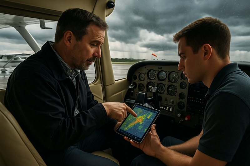
Practical Example: A Short Cross-Country With Changing Weather
Consider a private pilot planning a 160-nautical-mile daytime cross-country in a normally aspirated single-engine training aircraft. The departure airport is reporting good VFR conditions with light wind. The destination is also VFR, but recent METARs show the ceiling lowering from 5,000 feet to 3,200 feet, then to 2,400 feet. Visibility remains acceptable, but the temperature and dew point are close. The TAF shows temporary lower ceilings near the planned arrival time and a wind shift later in the afternoon. A few PIREPs mention light turbulence below 4,000 feet along part of the route.
A superficial briefing might conclude that the flight is legal and likely fine. A more disciplined briefing sees several items that deserve extra attention. The destination trend is downward. The arrival window overlaps with forecast variability. The small temperature-dew point spread suggests moisture is relevant. Turbulence below 4,000 feet may affect comfort and workload. The wind shift may influence runway selection, crosswind component, and arrival planning.
The pilot does not need to panic or automatically cancel. But the plan should become more deliberate. The pilot might choose an earlier departure, identify an alternate airport with better weather away from the lowering trend, carry additional fuel within aircraft limitations, review terrain along the route, and set a decision point before passing the last good diversion airport. The pilot might also call a flight service specialist or consult additional approved weather resources for a more complete picture.
The lesson is that none of the individual clues is dramatic by itself. Together, they show a flight with narrowing margins. Recognizing that pattern early allows the pilot to make calm decisions while options are still plentiful.
Best Practices for Pilots
The best weather briefings are not rushed searches for a yes or no answer. They are structured reviews of hazards, trends, timing, and alternatives. A pilot should begin by understanding the broad weather pattern, then work toward specific products for the departure airport, route, destination, and alternates. This prevents the pilot from becoming fixated on one favorable observation while missing the larger system.
It is also helpful to brief weather in layers. First, identify large-scale hazards such as fronts, convective areas, widespread low ceilings, icing potential, or strong winds. Next, review airport-specific conditions and forecasts. Then examine route-specific issues such as terrain, winds aloft, turbulence, freezing levels, and PIREPs. Finally, decide what will trigger a delay, diversion, return, or cancellation.
Use short written notes when the weather is complicated. A note such as “destination ceiling lowering, reassess before crossing ABC VOR” can be more useful than trying to remember a vague concern. Instructors should encourage students to verbalize the weather risk in plain language: “The risk is not the departure. The risk is arriving after the ceiling lowers.”
The following habits help pilots recognize weather information that deserves extra attention without turning the briefing into a mechanical checklist:
- Compare current conditions with forecasts, not just one airport observation.
- Look for trends in ceilings, visibility, winds, pressure, and precipitation.
- Treat temporary, vicinity, convective, icing, wind shear, and gust information as decision cues.
- Consider whether the weather affects the route, not just the departure and destination airports.
- Build decision points before options become limited.
- Use conservative personal minimums that reflect proficiency, recency, aircraft, terrain, and time of day.
Good weather judgment improves with experience, but only if pilots actively learn from each flight. After landing, compare the forecast with actual conditions. Ask what was accurate, what changed, what was missed, and whether the plan left enough margin. This habit turns every flight into a weather training event.
How Flight Instructors Can Teach Weather Attention
Flight instructors play a major role in shaping how pilots think about weather. Early training often focuses on decoding weather products, which is necessary, but decoding is only the first step. Students need to practice connecting weather information to real operational decisions.
A useful instructional technique is to ask students to identify the three most important weather threats for a proposed flight. The answer should be specific. “Bad weather” is not enough. A better answer might be, “Lowering ceilings at the destination, gusty crosswind at the alternate, and possible turbulence near the ridge line.” This helps students move from reading data to prioritizing risk.
Instructors should also present scenarios where the weather is not clearly good or clearly bad. These are the flights that develop judgment. The student should learn to explain what additional information is needed, what options remain available, and what conditions would change the decision.
Another valuable exercise is post-flight weather review. Compare the preflight briefing with the actual flight experience. If the forecast mentioned temporary reductions that did not occur, discuss why the forecast still mattered. If turbulence was stronger than expected, review which clues might have suggested it. The objective is not to criticize the forecast or the pilot. The objective is to improve recognition.
Frequently Asked Questions
What weather information should pilots pay the most attention to before a flight?
Pilots should pay particular attention to weather that affects flight safety, legality, performance, workload, and available alternatives. Ceilings, visibility, thunderstorms, icing, turbulence, wind shear, gusty winds, freezing levels, winds aloft, and changing trends often deserve the closest review. The most important item depends on the specific route, aircraft, pilot proficiency, and timing.
Is a legal weather forecast always a safe weather forecast?
No. Legal minimums and safe personal operating margins are not the same thing. A flight may meet basic regulatory requirements but still be a poor decision because of terrain, night conditions, pilot proficiency, fuel margin, passenger considerations, or rapidly changing weather. Pilots should evaluate operational risk, not only minimum compliance.
How can a pilot tell if a TAF needs extra scrutiny?
A TAF deserves extra scrutiny when it includes temporary changes, probability groups where used, thunderstorms, low ceilings, reduced visibility, gusts, wind shifts, low-level wind shear, freezing precipitation, or conditions changing near the planned arrival or departure time. The timing of the forecast is often as important as the forecast condition itself.
Are PIREPs reliable enough to base a decision on?
PIREPs are valuable because they describe actual conditions encountered by aircraft, but they should be used with context. A PIREP reflects a specific time, location, altitude, and aircraft. It should be compared with forecasts, radar, satellite, and other weather products rather than treated as the only source of truth.
What is the biggest weather briefing mistake student pilots make?
A common student mistake is decoding the weather without interpreting its operational meaning. For example, a student may correctly read the ceiling and visibility but miss a downward trend, terrain concern, wind shift, or arrival-time issue. Instructors should teach students to explain how each important weather element affects the actual flight.
When should a pilot delay or cancel because of weather uncertainty?
A pilot should consider delaying or canceling when the weather picture is uncertain enough that safe options are narrowing or when the conditions may exceed the pilot’s proficiency, aircraft capability, or operational plan. If the flight depends on everything going exactly right, the margin is probably too thin.
Key Takeaways
- Weather information deserves extra attention when it shows trends, uncertainty, rapid change, or conditions that reduce escape options.
- Ceilings, visibility, thunderstorms, icing, turbulence, wind shear, gusts, and conflicting reports should be interpreted in the context of the actual route and timing.
- Good pilot judgment comes from comparing weather products, setting decision points early, and choosing conservative margins before conditions deteriorate.