Strong weather briefing habits are one of the most practical ways pilots improve safety before the engine ever starts. A good briefing is not simply a quick glance at a radar image or a last-minute check of the airport forecast. It is a disciplined way of building a mental picture of the atmosphere, identifying hazards, comparing options, and deciding whether the flight still makes sense.
For student pilots, weather briefing is often introduced as a preflight requirement. For experienced pilots, it can become either a powerful decision-making tool or a routine task that gets rushed. The difference usually comes down to habit. Pilots who brief well tend to look beyond a single forecast product, ask better questions, and keep updating their plan as conditions change. This article explains how to build better weather briefing habits in a way that is practical, repeatable, and useful for real-world flying.
What a Good Weather Briefing Is Really For
Aviation weather briefing is not about collecting every possible weather product. It is about understanding what the weather is likely to do to your specific flight. That distinction matters. A pilot flying a local training lesson, a cross-country flight, an IFR trip through multiple weather systems, or a night VFR flight near rising terrain will not use the same weather information in the same way.
A good briefing answers several practical questions. What is happening now? What is expected to happen during the planned departure, enroute, and arrival periods? What hazards could affect climb, cruise, descent, approach, landing, or diversion? What are the trends? What are the gaps in the information? Where is the plan most vulnerable?
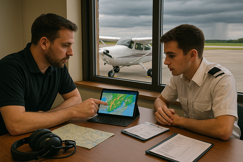
Many pilots start by looking at current conditions and terminal forecasts. Those are useful, but they are only part of the picture. A more complete weather briefing includes the larger weather pattern, surface observations, forecasts, radar and satellite trends, winds aloft, turbulence and icing potential when relevant, convective outlooks, NOTAMs and operational constraints where applicable, and pilot reports when available. The goal is not to memorize products. The goal is to form a cockpit-ready weather strategy.
Weather briefing is also a time-management skill. Rushing a briefing five minutes before departure can create pressure to launch, especially when passengers are waiting or a training schedule is tight. Better habits move the first look earlier, then use later updates to refine the decision. A pilot who checks the weather the night before, again several hours before departure, and again close to launch is more likely to notice trends that a single snapshot would miss.
Why This Matters in Real-World Aviation
Weather affects nearly every part of a flight. It can change aircraft performance, visibility, ceiling, fuel planning, route selection, passenger comfort, workload, and the availability of alternates or escape routes. Even when the weather is legal for the operation, it may not be wise for the pilot, aircraft, terrain, airport environment, or mission.
In training, weather briefing habits shape how pilots learn aeronautical decision-making. A student who is taught to ask, “Can we legally go?” may miss the better question: “Is this a sound plan for my current skill, aircraft, route, and available outs?” A flight instructor who teaches weather as a living part of the flight, rather than a box to check before dispatch, helps students develop judgment that will serve them well after the checkride.
For instrument pilots, weather briefing supports decisions about alternates, fuel, approach options, missed approach planning, icing exposure, convective avoidance, turbulence, and changing ceilings and visibility. For VFR pilots, briefing supports cloud clearance planning, terrain and obstacle awareness, visibility margins, wind decisions, and the ability to remain clear of weather that may become unsuitable for continued visual flight.
Weather also interacts with human factors. A pilot may interpret a marginal forecast too optimistically because the flight is important. A renter may feel pressure to return an aircraft on time. A new instrument pilot may trust the existence of an approach without fully considering the weather, workload, terrain, or personal proficiency. A cross-country pilot may focus on destination weather while underestimating deteriorating conditions along the route. Better briefing habits help counter those pressures by making uncertainty visible before the pilot is already airborne.
Start With the Big Picture Before the Details
One of the most useful weather briefing habits is to begin with the big picture. Before examining individual airport observations, look at the broader weather system. Is there a front moving through the area? Is moisture increasing? Are winds strengthening with altitude? Is there widespread low cloud cover, convective development, mountain obscuration, or a pressure system driving strong surface winds?
This big-picture approach gives context to the smaller products. A METAR may show good VFR at the departure airport, but if the regional picture shows a lowering ceiling trend along the route, that single observation can be misleading. A TAF may suggest improving conditions at the destination, but radar, satellite, and nearby observations may show whether the forecast trend is already developing or lagging.
Thinking from large scale to local scale also improves communication. When speaking with Flight Service, dispatch, another pilot, or a flight instructor, the conversation is more productive if the pilot already has a basic understanding of the system. Instead of asking only, “Is the weather good?” the pilot can ask, “The route looks VFR now, but the ceiling trend near the destination appears to be lowering. What are you seeing in the latest forecasts and reports?” That type of question leads to a better operational discussion.
A practical sequence is to first look at the route on a map, then examine regional weather patterns, then check current observations, forecasts, hazards, and trends. This does not have to be complicated. Even a short local flight benefits from a quick mental model: wind direction, cloud bases, visibility, temperature and dew point spread, precipitation, convective potential, and expected changes during the lesson.
Build a Route-Based Weather Picture
Pilots sometimes brief the departure and destination while giving less attention to the airspace between them. That habit can work on a short local flight, but it becomes risky on cross-country operations. Weather does not care about airport pairs. A route-based briefing considers what the aircraft will encounter from taxi to shutdown, including climb, cruise, descent, and possible diversion.
Start by asking what altitude band matters. A low-level VFR flight has different weather concerns than an IFR flight in the flight levels or a piston single operating near freezing temperatures. A route crossing high terrain raises questions about visibility, cloud bases, winds over ridges, turbulence, and escape paths. A route near coastal areas may involve marine layers, fog, sea breezes, or rapidly changing ceilings. A route through summer air mass thunderstorms requires a very different mindset from a winter route involving low ceilings and possible icing.
Next, look for weather that could block the route rather than merely inconvenience it. A scattered cloud layer may be manageable. Widespread low IFR across the only reasonable diversion airports is a different problem. Light rain may be acceptable in many operations, but embedded convective cells or a fast-moving line of storms may make the plan unsuitable. Moderate surface winds down the runway may be manageable, while a strong crosswind at a short unfamiliar runway may exceed the pilot’s comfort or capability.
A route-based briefing also includes timing. The weather at 0900 may not matter if you will arrive at 1130 after a front passes or daytime heating begins. The most useful habit is to brief the weather against the planned timeline: departure, top of climb, enroute decision points, destination arrival, and alternate arrival if needed. That timeline helps prevent a common error: making a go decision based on conditions that will not exist when the aircraft actually gets there.
Understand the Main Aviation Weather Products
Pilots do not need to become meteorologists to brief effectively, but they do need to understand what each product can and cannot tell them. Every weather product has a purpose, a time frame, and limitations. A strong briefing habit is to combine products so they support or challenge each other.
METARs provide current observed conditions at reporting airports. They are valuable because they describe what has recently been observed, but they are point observations. They may not represent conditions a few miles away, over terrain, or between stations. SPECI reports can show significant changes, but the absence of a new report does not mean conditions are stable everywhere nearby.
TAFs provide forecasts for specific terminal areas. They are useful for planning, especially when timing changes in wind, visibility, ceiling, and weather. However, they are forecasts, not guarantees. A pilot should compare the TAF against nearby observations, radar, satellite, and the broader weather pattern to decide whether the forecast is behaving as expected.
Radar is useful for precipitation and convective awareness, but it should be treated carefully. Display age, update intervals, altitude, beam geometry, and data processing can all affect what the pilot sees. Radar information on a cockpit display or mobile device may not show the exact real-time location or intensity of hazardous weather. Good pilots use radar strategically, especially for preflight planning and broad avoidance, rather than attempting close-range tactical maneuvering around dangerous cells.
Satellite imagery helps pilots understand cloud cover, cloud movement, and larger-scale moisture patterns. It can be especially useful when ceilings and visibility are changing over a region. Surface analysis charts, graphical forecasts, winds aloft information, AIRMETs, SIGMETs, convective products, icing and turbulence guidance, and pilot reports can all add important detail depending on the flight.
PIREPs are especially valuable because they come from aircraft operating in the air mass. They can confirm turbulence, cloud tops, icing, visibility, or ride conditions. At the same time, a lack of PIREPs does not mean a lack of hazards. It may simply mean few aircraft have been flying in that area or reporting conditions. Treat PIREPs as helpful evidence, not as the only evidence.
How Pilots Should Understand Forecast Uncertainty
Weather briefing becomes much more useful when pilots accept that forecasts contain uncertainty. The goal is not to find a forecast that supports the desired flight. The goal is to understand the range of likely conditions and decide whether the flight can be conducted with adequate margins.
Uncertainty increases with time, distance, and complexity. A stable high-pressure day may be relatively straightforward. A day with scattered convection, low-level moisture, a frontal boundary, or marginal freezing levels is less predictable. When the atmosphere is changing quickly, a pilot should expect the plan to need adjustment.
A practical way to think about uncertainty is to identify the decision triggers before departure. For example, a VFR pilot might decide that if ceilings along the route are lower than expected at the first enroute checkpoint, the flight will turn back or divert rather than continue into narrowing options. An IFR pilot might decide that if tops, icing reports, or destination trends are worse than expected, the route will be changed or the flight delayed. These triggers are not regulations. They are personal and operational guardrails that reduce improvisation under pressure.
Forecast uncertainty should also influence fuel planning and alternate thinking. A legal plan may still be thin if it leaves little room for weather deviations, holding, runway changes, or a missed approach. Better weather briefing habits encourage pilots to think in margins rather than minimums. More fuel, more daylight, better alternates, higher ceilings, wider visibility margins, and an earlier departure can all turn a stressful flight into a manageable one.
Common Mistakes or Misunderstandings
One common mistake is treating the weather briefing as complete once a single app shows green, VFR, or a favorable route color. Color-coded displays can be helpful, but they simplify complex conditions. A green symbol at an airport does not describe terrain clearance, cloud layers along the route, wind shear, turbulence, convective risk, or deteriorating trends.
Another mistake is briefing only the departure and destination. Many weather problems occur enroute, especially when pilots cross terrain, frontal zones, coastal areas, or regions with sparse reporting stations. A pilot who does not consider enroute conditions may find that the destination remains acceptable while the route becomes impractical.
A third misunderstanding is assuming that an instrument rating makes weather less significant. An instrument rating expands capability, but it does not remove hazards. Low ceilings, embedded storms, icing, turbulence, high workload, equipment limitations, and approach environment challenges still matter. Instrument pilots need weather briefing habits that are at least as disciplined as those of VFR pilots.
Pilots also sometimes misread temporary or conditional forecast groups as minor details. Changes in timing, visibility, ceiling, wind, or thunderstorms can be the difference between an easy arrival and a diversion. Rather than memorizing forecast coding, pilots should make sure they understand what the forecast means operationally: when conditions may change, how low they may go, and how that affects the plan.
Another risk is confirmation bias. This happens when a pilot gives more weight to information that supports the desired flight and discounts information that argues against it. For example, a pilot may focus on a favorable destination TAF while ignoring worsening observations along the route. A better habit is to actively look for the reason not to go. If the plan still looks sound after that challenge, the decision is usually stronger.
Finally, some pilots stop briefing once the flight begins. Weather briefing does not end at engine start. Conditions can evolve, forecasts can be amended, and pilot reports can appear after departure. In-flight updates through appropriate avionics, ATC, Flight Service, or onboard weather tools can help pilots keep the plan current. The key is to use those tools early enough to preserve options.
Practical Example: A Cross-Country Weather Decision
Consider a private pilot planning a daytime VFR cross-country in a single-engine training aircraft from a familiar home airport to a destination 180 nautical miles away. The departure airport is reporting good visibility and a comfortable ceiling. The destination TAF suggests VFR conditions through the expected arrival time. A quick glance might make the flight look straightforward.
A better briefing starts with the regional picture. A weak front is moving slowly across the route, and satellite imagery shows an expanding area of low clouds near the midpoint. Several airports along the route are still VFR, but ceilings have been trending downward over the last two hours. Winds are forecast to increase slightly by afternoon, creating a stronger crosswind at the destination than the pilot usually prefers.
The pilot now has a more realistic decision. The question is no longer, “Is my departure and destination VFR?” The better question is, “Will I have a safe VFR route with good options throughout the flight?” The pilot identifies two airports before the area of lower ceilings that could serve as conservative decision points. The pilot also checks whether a route farther south offers better ceilings and more alternates. After comparing timing, fuel, daylight, and personal comfort, the pilot decides to depart earlier only if updated observations confirm the trend is stable. If the midpoint ceilings continue lowering, the pilot will delay or cancel.
This example is intentionally ordinary. It does not rely on severe weather, emergencies, or dramatic conditions. Most weather decisions are built from small pieces: a ceiling trend, a timing issue, a wind increase, a less favorable diversion picture, and the pilot’s own proficiency. Better weather briefing habits help those small pieces become visible before they combine into a high-workload situation.
Best Practices for Pilots
Better weather briefing habits are built through consistency. The best pilots do not brief only when the weather is obviously poor. They brief well on good-weather days too, because that is how pattern recognition develops. When you regularly compare forecasts to what actually happens, you become better at recognizing when a day is behaving normally and when it is not.
One practical best practice is to brief in phases. Start with an early outlook when the flight is first being considered. Follow with a planning briefing when route, timing, fuel, and alternates are being selected. Then complete a departure briefing close enough to launch to capture current conditions, updated forecasts, and operational changes. For longer flights, plan how you will update weather enroute.
Another useful habit is to write down the weather decision, even briefly. This can be as simple as noting the main hazards, expected trends, and decision points. Writing forces clarity. It also helps instructors teach students how to think rather than simply what to click.
Pilots should also set personal weather minimums that reflect experience, recency, aircraft capability, route familiarity, terrain, night conditions, and available alternates. Personal minimums are not a substitute for regulations or aircraft limitations. They are an added layer of judgment. A newly certificated private pilot, a rusty instrument pilot, and a highly current professional pilot should not necessarily make the same decision in the same weather.
For instructors, a powerful teaching technique is to ask students to explain the weather story in plain language. Instead of asking, “What is the METAR?” ask, “What is the weather doing, what do you expect it to do, and what would make you stop or change the plan?” That approach connects weather products to aeronautical decision-making.
Useful briefing habits include:
- Look at the big weather picture before focusing on individual airports.
- Brief the route and timing, not just the departure and destination.
- Compare forecasts with current observations and trends.
- Identify hazards that are relevant to the aircraft, pilot, and mission.
- Decide in advance what conditions will trigger a delay, diversion, or cancellation.
- Update the weather picture before departure and during flight when conditions warrant.
The most important habit is humility. Weather can be subtle, fast-moving, and locally different from what a broad forecast suggests. A conservative decision made on the ground is usually easier, cheaper, and safer than a difficult decision made after options have narrowed in flight.
Using Technology Without Letting It Replace Judgment
Modern pilots have access to excellent weather tools. Electronic flight bags, online aviation weather services, datalink weather, graphical forecasts, and route planning platforms can make a briefing more visual and efficient. These tools are valuable, but they work best when the pilot understands the underlying weather question.
A moving map with weather overlay can create a false sense of precision. Radar images may be delayed. Forecast graphics may smooth over local variation. Automated route briefings may include large amounts of information that the pilot must still interpret. The tool can organize the data, but the pilot must decide what it means for the flight.
A healthy technology habit is to use at least two views of the weather. For example, compare a graphical route depiction with raw or decoded observations. Compare a terminal forecast with nearby stations. Compare radar with satellite. Compare an automated briefing with a plain-language discussion from a qualified briefer when the weather is complex or the decision is close. This is not about mistrusting technology. It is about avoiding single-source thinking.
Pilots should also understand the difference between strategic and tactical weather use. Strategic weather planning happens before the aircraft is near the hazard. It supports routing, timing, fuel, altitude, and go/no-go decisions. Tactical weather avoidance happens closer to the hazard and can be limited by workload, aircraft speed, airspace, terrain, and the age or resolution of weather data. The safest weather decisions are often strategic decisions made early.
Weather Briefing Habits for VFR Pilots
VFR pilots should pay special attention to ceilings, visibility, terrain, airspace, daylight, and escape routes. Legal VFR minimums do not automatically make a route comfortable or wise. A pilot scud-running under lowering clouds may technically remain clear of clouds for a time while steadily losing options. Good briefing habits help prevent that situation by identifying where VFR margins may shrink.
For VFR cross-country flights, cloud bases along the route matter as much as conditions at airports. Visibility can vary in haze, smoke, precipitation, or low sun angles. Terrain can turn a marginal ceiling into a significant hazard. Night VFR adds another layer because visual references, horizon cues, and emergency landing options may be reduced.
VFR pilots should develop a habit of naming specific escape options. “I will stay west of the rising terrain,” “I will turn back if I cannot maintain comfortable altitude below the ceiling,” or “I will divert before entering the area with fewer reporting stations” are more useful than a vague plan to “watch the weather.”
Weather Briefing Habits for IFR Pilots
IFR pilots should brief not only whether an approach is available, but whether the entire operation is sound. That includes departure conditions, climb performance considerations, enroute weather, freezing levels, turbulence, convective activity, destination trends, alternate options, fuel margins, avionics status, and pilot proficiency.
Icing deserves particular respect. A pilot should understand the aircraft’s equipment, limitations, and approved operating envelope, and should avoid assumptions about the ability to continue in icing conditions. Freezing level forecasts, cloud layers, precipitation, pilot reports, and route altitude options all matter. If the weather picture suggests possible icing exposure, the briefing should become more conservative and more specific.
Convective weather also demands early planning. Thunderstorms can involve severe turbulence, lightning, hail, heavy precipitation, strong updrafts and downdrafts, and rapidly changing wind. The best practice is to avoid convective hazards with generous margins and sound timing rather than relying on close-in maneuvering.
For IFR arrivals, pilots should think beyond the published approach. What happens if the first approach is missed? Is the alternate truly better? Is the weather improving or deteriorating? Are there nearby airports with better conditions, services, runway alignment, or lower workload? A good IFR weather briefing includes the plan after the plan.
Turning Briefing Into a Training Habit
Weather briefing should be integrated into flight training from the beginning. Students often learn the names of weather products before they learn how to make a weather decision. Instructors can close that gap by making every lesson include a short weather discussion, even on clear days.
For a local lesson, the instructor might ask the student to describe wind, cloud cover, visibility, temperature, density altitude considerations if relevant, and expected changes during the lesson. For a cross-country lesson, the student can explain the route weather, alternates, fuel strategy, and decision points. For an instrument lesson, the discussion can include ceilings, visibility, approach options, missed approach planning, and enroute hazards.
Debriefing is equally important. After the flight, compare the forecast with what actually occurred. Were the winds as expected? Did the ceiling lift or lower? Was the ride smoother or rougher than forecast? Did any PIREPs appear that would have changed the decision? This feedback loop builds judgment because the pilot learns how forecasts behave in the local area and season.
Instructors should also model conservative decision-making. Students remember when an instructor cancels, delays, or changes a flight for good reasons. Those moments teach that weather judgment is not a sign of fear or weakness. It is a professional skill.
Frequently Asked Questions
What is the best way to start a weather briefing?
Start with the big picture. Look at the route, major weather systems, cloud patterns, precipitation, winds, and expected trends before focusing on individual airport observations and forecasts. This gives context to the detailed products and helps you understand whether the overall weather story makes sense.
Is checking a weather app enough for a preflight briefing?
A weather app can be a useful tool, but it should not replace pilot judgment. The pilot still needs to understand the source, age, limitations, and operational meaning of the information. For complex or marginal weather, use a more complete briefing process and consider speaking with an aviation weather briefer or other qualified resource.
How far ahead should pilots check the weather?
For most planned flights, it is useful to look at the weather well before departure, then update the briefing as the flight time approaches. The early look helps with route and timing decisions. The final preflight update helps confirm current conditions, forecasts, trends, and any changes that affect the decision.
What weather information matters most for VFR pilots?
VFR pilots should pay close attention to ceilings, visibility, terrain, cloud trends, precipitation, winds, daylight, and escape routes. The key question is not only whether conditions meet minimums, but whether the pilot can maintain comfortable margins throughout the route.
What weather information matters most for IFR pilots?
IFR pilots should evaluate departure weather, enroute hazards, freezing levels, icing potential, turbulence, convective weather, destination and alternate trends, approach options, missed approach planning, and fuel margins. The approach is only one part of the weather decision.
How can flight instructors teach better weather briefing habits?
Instructors can ask students to explain the weather in plain language, connect weather products to decisions, set realistic decision points, and compare forecasts with actual conditions after each flight. This turns weather briefing from a memorization exercise into a practical judgment skill.
Key Takeaways
- Build weather briefing habits around the flight you are actually planning: route, timing, altitude, aircraft, pilot capability, and available options.
- Use weather products together. Current observations, forecasts, radar, satellite, winds, hazards, and PIREPs each provide only part of the operational picture.
- Make decisions before pressure builds. Identify personal limits, decision points, and diversion options while you are still on the ground or early enough in flight to preserve choices.