
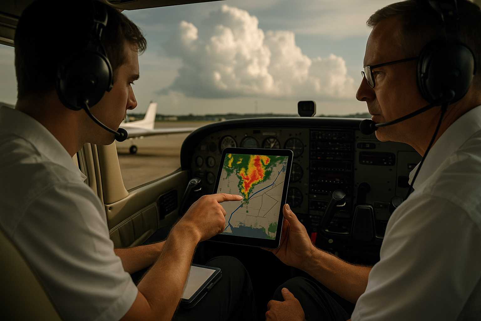
Convective SIGMETs are among the most important weather products a pilot can review before launching into an active thunderstorm environment. They do not simply tell you that thunderstorms exist. They identify convective weather that is significant enough to affect aviation safety across a defined area, route, or region. For pilots, student pilots, flight instructors, dispatchers, and aviation professionals, understanding what a Convective SIGMET means is a practical route-planning skill, not just a weather theory topic.
Thunderstorms can change a routine cross-country into a flight with rapidly shifting hazards: severe turbulence, strong updrafts and downdrafts, hail, lightning, heavy precipitation, low visibility, gust fronts, wind shear, and instrument conditions. A Convective SIGMET helps pilots recognize when convective activity has reached a level that deserves serious operational attention. The key is knowing how to interpret the product, compare it with radar and other weather information, and translate it into a safe go, no-go, delay, divert, or reroute decision.
This article explains what Convective SIGMETs are, how they differ from ordinary thunderstorm forecasts, what they mean for your route, and how to use them in real-world flight planning. The goal is not to memorize weather-code trivia. The goal is to help pilots think clearly when the route crosses an area of organized or severe convection.
What Is a Convective SIGMET?
A Convective SIGMET is an aviation weather advisory that highlights significant convective weather affecting flight operations. In plain aviation language, it is a warning that thunderstorm activity in a particular area is not isolated background weather. It has become organized, embedded, severe, or widespread enough that pilots should treat it as a serious operational hazard.
In U.S. aviation weather practice, Convective SIGMETs are associated with thunderstorm activity such as severe thunderstorms, embedded thunderstorms, lines of thunderstorms, or broader areas of intense convective activity. They are issued for the contiguous United States and adjacent coastal waters and are grouped by broad regions. Pilots may see them in aviation weather briefings, flight planning applications, cockpit weather displays, and aviation weather websites.
The word “convective” matters. Convection refers to vertical motion in the atmosphere, typically driven by warm, moist, unstable air rising and condensing into clouds and precipitation. When that process becomes strong enough, it can produce towering cumulus, cumulonimbus clouds, thunderstorms, heavy rain, hail, lightning, wind shear, and violent turbulence. A Convective SIGMET is therefore focused on the kind of weather that can affect an aircraft across a wide range of altitudes, from takeoff and landing through en route cruise.
The word “SIGMET” also matters. A SIGMET identifies significant meteorological information that may affect the safety of aircraft operations. A Convective SIGMET is specifically tied to convective weather. It is separate from non-convective SIGMETs that may address other hazards such as severe turbulence, severe icing, widespread dust storms, or volcanic ash, depending on the product and region.
Why Convective SIGMETs Matter in Real-World Aviation
Convective weather is one of the most dynamic hazards a pilot can face. Unlike a broad area of stable stratus clouds or a predictable headwind, thunderstorms can build, intensify, merge, weaken, and move in ways that require constant reassessment. A route that looked acceptable during preflight planning may become impractical an hour later if a line of thunderstorms develops across the intended path.
For visual flight rules pilots, a Convective SIGMET can signal that visual navigation, cloud avoidance, and maintaining safe separation from weather may become difficult or impossible. A VFR pilot may be able to see towering clouds from a distance, but visibility near precipitation shafts, terrain, haze, and lowering ceilings can make real-time decision-making more challenging than it appears on a map. The safest decision may be to delay, land early, or choose a route that keeps a wide margin from the convective area.
For instrument flight rules pilots, a Convective SIGMET is not permission to proceed simply because the flight is on an IFR clearance. Instrument capability helps with clouds and visibility, but it does not make an aircraft immune to thunderstorm hazards. IFR pilots still need to avoid convective cells and associated hazards. Air traffic control may provide assistance, but pilots remain responsible for safe operation of the aircraft, including weather avoidance decisions. In busy convective weather, controllers may be managing many aircraft, deviations, reroutes, and traffic constraints at the same time.
For flight instructors, Convective SIGMETs are valuable teaching tools because they connect weather theory to actual aeronautical decision-making. Students can learn how instability, moisture, lift, frontal boundaries, outflow boundaries, and daytime heating show up in operational weather products. More importantly, they can learn that the presence of a Convective SIGMET should trigger deeper questioning: Where is it? How fast is it moving? What is the trend? Does my route cross it, parallel it, or only pass nearby? What are my outs?
For commercial operators and aviation professionals, Convective SIGMETs affect dispatch planning, fuel planning, alternate planning, passenger expectations, crew workload, arrival sequencing, and diversion strategy. The product is not just a weather note. It may affect whether a route is operationally reasonable at a given time.
How Pilots Should Read a Convective SIGMET
A Convective SIGMET is most useful when the pilot reads it as a geographic and operational message. It usually defines an area, describes the convective hazard, and provides timing information. Many modern flight planning tools translate the text into a graphical overlay, but pilots should still understand what the product is communicating.
Start with location. A Convective SIGMET is not meaningful until you compare it with your actual route, departure airport, destination, alternates, and possible diversion airports. A SIGMET that lies well away from your route may still matter if storms are moving toward your path, but it has a different operational meaning than one directly across your departure corridor or arrival route.
Next, look at timing and validity. Convective weather products are time-sensitive. A product that is valid now may not describe the exact situation two hours from now, especially during a rapidly developing afternoon thunderstorm pattern. Pilots should check the issuance time, valid period, movement, and any outlook information when available. The practical question is not only “Where are the storms now?” but also “Where will they likely be when I get there?”
Then consider the type of convective activity being described. A line of thunderstorms across your route is different from isolated cells you may be able to avoid with large margins. Embedded thunderstorms are especially concerning because they may be hidden within broader cloud layers or precipitation, making visual avoidance unreliable. Severe thunderstorms carry additional concern because they may include damaging winds, hail, tornado potential, or extreme turbulence.
Finally, compare the Convective SIGMET with other weather information. Radar, satellite imagery, METARs, TAFs, area forecasts, graphical aviation weather products, pilot reports, and convective outlooks can all add context. The Convective SIGMET identifies significant convective activity, but it is not the only information source a pilot should use.
What a Convective SIGMET Means for Your Route
The most important route-planning question is simple: does the Convective SIGMET affect the airspace you intend to use during the time you intend to use it? If the answer is yes, the next question is not “Can I legally go?” but “Is this route still operationally wise?”
A Convective SIGMET directly along your route usually means you should evaluate delay, reroute, diversion options, or cancellation. Thunderstorms are not weather to penetrate intentionally in typical general aviation operations. Even aircraft with advanced avionics, onboard weather displays, autopilots, and instrument capability should be kept well clear of convective cells. Weather avoidance is not just about staying out of the colored radar returns. It is about avoiding the surrounding hazards that may extend beyond the visible precipitation core.
If the Convective SIGMET lies near but not directly on your route, it still deserves attention. Thunderstorms can move, expand, and generate outflow boundaries that create gusty surface winds and new convective development. A route that passes close to active convection may leave little room for deviation, especially near restricted airspace, terrain, busy terminal areas, coastlines, or international boundaries.
If the product affects your departure area, the safest plan may be to wait. Departing into a developing convective environment can quickly reduce options. A pilot may launch in acceptable weather, only to find the intended climb path, return route, or nearby alternates compromised by cells, heavy precipitation, or rapidly lowering visibility. When convective weather is near the departure airport, a delay on the ground often preserves far more safety margin than an airborne attempt to “take a look.”
If the product affects your destination area, the issue becomes arrival timing and alternate planning. A destination may be VFR or above minimums now, but an approaching line of storms may make the arrival window narrow. Pilots should consider whether they will arrive before the weather, whether holding or deviation fuel is available, and whether alternates remain clear of the same convective system.
Convective SIGMETs Versus Radar: Why You Need Both
Many pilots rely heavily on radar imagery, and radar is an excellent tool when used correctly. However, radar and Convective SIGMETs answer different questions. Radar shows precipitation returns at or near a given time. A Convective SIGMET identifies significant convective weather that aviation weather specialists have determined is important enough to highlight for flight operations.
Radar can help you see storm structure, movement, intensity trends, lines, gaps, and precipitation coverage. A Convective SIGMET helps you understand that the activity has crossed a threshold of aviation significance. When both point to the same area of concern, the message is strong: do not treat that airspace casually.
There are also limitations. Cockpit weather displays may not show real-time radar. Many datalink weather systems involve processing, transmission, and display delays. A storm can change significantly during that time. A gap that appears acceptable on a display may close before the aircraft reaches it. A cell that looked moderate may intensify. A route through a broken line may become unavailable.
For training, it is useful to teach pilots that radar is a strategic tool, especially when delivered through datalink. It supports route planning and broad avoidance decisions, but it should not be used as a close-range thunderstorm penetration tool. Convective SIGMETs reinforce that strategic mindset by encouraging pilots to step back and evaluate whether the route belongs in that weather environment at all.
Understanding the Hazards Behind the Product
A Convective SIGMET is not dangerous because of the text itself. It is important because of the hazards it represents. Those hazards may include severe turbulence, strong vertical currents, hail, lightning, heavy precipitation, reduced visibility, icing in and near convective clouds, microbursts, gust fronts, and wind shear. The exact hazards vary by storm type, season, geography, and stage of development.
Turbulence is one of the primary concerns. Thunderstorms contain strong updrafts and downdrafts, and the air near a cell can be disturbed even outside the heaviest precipitation. Severe turbulence can exceed the comfort and control margins expected in normal flight. In smaller training aircraft, even moderate convective turbulence can be disorienting and workload-intensive.
Hail is another serious hazard. Hail may be carried aloft by strong updrafts and can occur outside the visually darkest part of the storm. It can damage windshields, leading edges, propellers, engine inlets, antennas, and other exposed surfaces. A pilot should not assume that avoiding the deepest red radar return alone eliminates hail risk.
Lightning is often discussed because it is dramatic, but it is not the only issue and often not the most operationally controlling one. Lightning indicates electrical activity and storm maturity, but a cell can be hazardous even before frequent lightning is visible. Conversely, waiting until lightning is observed may mean the decision to avoid the area has already come too late.
Heavy precipitation can reduce visibility dramatically and create spatial disorientation risk. At low altitude, heavy rain and gusty winds can make airport operations hazardous. During approach and landing, convective outflow can produce rapid changes in wind direction and speed. A runway that seemed aligned with the wind may suddenly experience a gusty crosswind or tailwind component.
Microbursts and strong downdrafts are especially important near airports. A microburst is a localized, intense downdraft that spreads outward after reaching the surface. The resulting wind shear can create rapidly changing performance demands during takeoff or landing. Pilots should treat convective activity near the airport environment with particular caution, even if the storm core is not directly over the runway.
How Convective SIGMETs Fit Into a Weather Briefing
A good weather briefing is not a collection of disconnected products. It is a story about the atmosphere along your route. Convective SIGMETs fit into that story by highlighting where significant thunderstorm activity exists or is expected during the relevant time period.
Begin with the big picture. What is causing the convective weather? Is there a cold front, warm front, dryline, sea breeze, upper-level disturbance, terrain-driven lift, or afternoon instability pattern? Understanding the setup helps you anticipate whether storms may weaken after sunset, build with daytime heating, organize into a line, or remain scattered.
Then examine your route in segments: departure, climb, en route, descent, arrival, and alternates. A Convective SIGMET near the middle of a long route may be manageable if there are clear diversion options and a practical reroute. The same product near the destination, with limited fuel and worsening weather behind you, may create a much more serious situation.
Next, evaluate movement and trend. A storm complex moving away from your route may create a different decision than one moving across it. Slow-moving storms can produce prolonged impacts in one area, while fast-moving lines can quickly block a route and affect multiple airports in sequence.
Finally, build decision points into the plan. Instead of launching with a vague hope that the weather will improve, decide ahead of time where you will turn back, divert, hold, or land. Convective SIGMETs are especially useful for establishing those decision points because they define areas where the risk picture has already been elevated.
Common Mistakes and Misunderstandings
One common mistake is treating a Convective SIGMET as a simple yes-or-no legal boundary. Pilots sometimes ask whether they are “allowed” to fly through a SIGMET area. That question misses the operational point. A Convective SIGMET is a safety advisory about significant weather. Whether a flight is legally possible does not answer whether it is safe, prudent, or consistent with the pilot’s experience, aircraft capability, passenger needs, and available escape options.
Another misunderstanding is assuming that instrument-rated pilots can safely handle convective weather because they can fly in clouds. Thunderstorms are not ordinary instrument meteorological conditions. A smooth cloud layer and an active cumulonimbus cloud are entirely different environments. The instrument rating is essential for many operations, but it is not a thunderstorm penetration qualification.
A third mistake is using cockpit weather tactically. Datalink radar is valuable, but pilots should not use delayed radar imagery to pick their way between close cells at short range. By the time the aircraft reaches the displayed gap, the actual weather may have changed. Strategic avoidance means making route decisions early enough to maintain generous spacing and preserve options.
Some pilots also underestimate embedded thunderstorms. If storms are embedded in a larger cloud or precipitation area, visual identification may be difficult. A pilot in instrument conditions may not see the buildups, precipitation shafts, or cloud shapes that would provide warning in visual conditions. Embedded convection can remove the visual cues pilots often rely on for avoidance.
Another common error is focusing only on the en route portion while ignoring departure and arrival. Many convective weather accidents and serious incidents occur in the terminal environment, where aircraft are low, slow, configured for takeoff or landing, and close to terrain. A Convective SIGMET near the destination may be more operationally important than one along a cruise segment with plenty of altitude and diversion options.
Finally, pilots may overvalue a single gap in a line of storms. A gap on radar may look tempting, especially when the destination is close or passengers are eager to arrive. But gaps can close, outflow can trigger new cells, and the surrounding air may still be turbulent. If the route depends on one narrow opening remaining available, the plan may have too little margin.
Practical Example: A Cross-Country Route Near a Convective Line
Consider a private pilot planning an afternoon IFR cross-country in a well-equipped single-engine airplane. The route is 280 nautical miles, with a planned departure at 1900Z. The weather briefing shows warm, moist air over the region, scattered thunderstorms developing along a boundary, and a Convective SIGMET for a line of thunderstorms that currently lies west of the direct route. The destination is east of the line, and the storms are moving east-northeast.
At first glance, the direct route appears possible. The departure airport is VFR, the destination is reporting good weather, and the aircraft has GPS, autopilot, and datalink weather. But the Convective SIGMET changes the planning conversation. The line is not simply a few isolated showers. It is organized convective weather significant enough to be highlighted for aviation. The route, timing, and storm movement suggest the aircraft may meet the line during the en route or arrival phase.
The pilot compares the Convective SIGMET with radar and sees several strong cells embedded in the line. There are gaps, but they are narrow and changing. The pilot also notices that several airports behind the line have rapidly shifting winds and heavy rain reports. The destination is still good, but the storms may reach the area near the planned arrival time.
A safer plan might include delaying departure until the line passes and the route stabilizes, choosing a route that remains well away from the line, or selecting a nearer intermediate airport and reassessing from the ground. If the flight is not time-critical, delaying may be the best risk management choice. If the flight must operate, the pilot should consider whether the aircraft, fuel, alternates, route structure, and pilot proficiency support a conservative deviation strategy. The important lesson is that the Convective SIGMET prompts a deeper operational review before the airplane ever leaves the ramp.
Now consider how the same scenario might be used in training. A flight instructor could ask the student to identify the SIGMET area, estimate storm movement relative to the route, choose possible alternates, calculate additional fuel needed for deviations, and define a no-further-than decision point. This turns a weather product into a practical aeronautical decision-making exercise.
Best Practices for Pilots
The first best practice is to treat every Convective SIGMET as a prompt for route reassessment. Do not simply acknowledge it and continue planning as before. Ask what has changed about the route, timing, alternates, fuel, and available weather margins.
Second, use multiple weather sources. A Convective SIGMET is powerful information, but it should be integrated with radar, satellite, METARs, TAFs, graphical weather products, pilot reports, and a complete weather briefing. No single product tells the whole story.
Third, think in terms of margins, not minimums. Convective weather is dynamic. A route that barely avoids a SIGMET area may not remain acceptable once storm movement, deviations, ATC constraints, passenger comfort, and fuel reserves are considered. Build enough room into the plan so that one unexpected development does not create an emergency.
Fourth, brief passengers honestly. If thunderstorms may delay or change the flight, explain that weather avoidance is normal and safety-driven. Passenger pressure is easier to manage on the ground than in the air. A professional explanation before departure can reduce pressure to continue when conditions deteriorate.
Fifth, plan diversion options early. Do not wait until you are near the storm line to start looking for airports. Identify airports with suitable runways, weather, services, approaches if needed, and fuel. Also consider whether those airports are ahead of the weather or likely to be affected by the same convective system.
Sixth, respect the terminal environment. Thunderstorm hazards near departure or arrival airports can be especially serious because aircraft have less altitude and less time to recover from wind shear, turbulence, or rapidly changing conditions. If convective weather is near the airport, waiting can be the most professional decision.
- Review Convective SIGMETs before departure and continue monitoring weather during flight.
- Compare the SIGMET area with your route, alternates, fuel plan, and timing.
- Avoid using delayed cockpit radar as a close-range thunderstorm navigation tool.
- Be cautious with embedded thunderstorms and lines of convection.
- Make diversion and delay decisions early, while options remain available.
How Flight Instructors Can Teach Convective SIGMET Decision-Making
Convective SIGMETs are ideal for scenario-based training because they require students to combine weather knowledge, aircraft performance awareness, risk management, and route planning. Rather than asking a student to decode a product in isolation, instructors can present a realistic flight and ask the student to make operational decisions.
A useful training exercise begins with a proposed cross-country route. The instructor provides current weather, a Convective SIGMET, radar imagery, METARs, TAFs, and a fuel plan. The student then identifies the hazard, explains how it affects the route, and recommends whether to go, delay, reroute, or cancel. The instructor can then introduce changes: the storm line accelerates, the destination TAF worsens, an alternate becomes unavailable, or the passenger schedule becomes more urgent.
This kind of training helps students understand that aviation weather decisions are rarely made from one data point. It also helps them practice resisting continuation bias. When a pilot has already planned the route, loaded the airplane, briefed passengers, and received a clearance, it becomes psychologically harder to stop. Practicing conservative weather decisions in training makes those decisions easier in real operations.
Instructors should also teach students to verbalize uncertainty. A student who says, “I do not know whether that gap will remain open, and I do not have a good alternate east of the line,” is demonstrating healthy aeronautical judgment. Weather risk management is not about sounding certain. It is about recognizing uncertainty early enough to stay safe.
What Convective SIGMETs Do Not Tell You
A Convective SIGMET is important, but it does not answer every operational question. It does not guarantee the exact position of each storm cell at the time your aircraft arrives. It does not show every possible area of turbulence, lightning, hail, or wind shear. It does not replace a full weather briefing or real-time judgment.
It also does not mean that every point inside the outlined area has identical weather. Convective products describe significant weather areas, but thunderstorms are three-dimensional and variable. Some parts of an area may contain intense cells, while other parts may temporarily appear less active. Pilots should not interpret that variability as permission to push into a marginal route. Instead, they should recognize that the atmosphere in that area is capable of producing hazardous convection.
Conversely, the absence of a Convective SIGMET does not guarantee benign weather. Thunderstorms may be developing, isolated, below issuance thresholds, outside the product area, or not yet organized. A pilot should still evaluate all available weather information and maintain visual and instrument weather awareness.
Decision-Making: Delay, Reroute, Divert, or Cancel?
When a Convective SIGMET affects your intended route, the available choices usually fall into four categories: delay, reroute, divert, or cancel. Each has a place, and the best choice depends on timing, aircraft capability, pilot experience, mission urgency, terrain, airspace, fuel, and alternatives.
Delay is often the most underused option. Many convective systems move through an area and leave improved conditions behind, although not always immediately. Waiting on the ground allows the pilot to reassess with updated weather, avoid airborne uncertainty, and reduce pressure. For training flights and personal travel, delay is often the simplest and safest answer.
Rerouting may be reasonable when there is a clear path around the convective area with adequate spacing, fuel, alternates, and airspace access. A reroute should not be a narrow thread through active cells. It should preserve meaningful separation and provide options if the weather changes.
Diverting is a normal and professional decision when weather begins to reduce margins. A diversion made early is usually uneventful. A diversion made late, after fuel has decreased and options have narrowed, can become stressful. Convective SIGMETs should encourage pilots to identify diversion triggers before those triggers are needed.
Canceling may be the best answer when the route, timing, and weather environment leave too little margin. There is no training value or operational value in proving that a flight can be forced through convective weather. Good aviation judgment includes knowing when the airplane should stay parked.
Frequently Asked Questions
Does a Convective SIGMET mean I cannot fly?
A Convective SIGMET does not automatically answer the legal go or no-go question for every flight, but it does identify significant convective weather that may affect safety. The practical response is to reassess the route, timing, alternates, fuel, aircraft capability, and pilot proficiency. Many flights should be delayed, rerouted, diverted, or canceled when a Convective SIGMET affects the intended route.
Can I fly around a Convective SIGMET?
Possibly, if the route provides generous clearance from the convective weather, the storms are not moving into your path, and you have adequate fuel, alternates, and escape options. The key word is “around,” not through. A safe weather deviation should preserve margins and should not depend on a narrow or uncertain gap between cells.
Are Convective SIGMETs only important for IFR pilots?
No. Convective SIGMETs are important for both VFR and IFR pilots. VFR pilots may face reduced visibility, lowering ceilings, gust fronts, and difficulty maintaining safe visual separation from storms. IFR pilots may be able to fly in clouds, but thunderstorms are not ordinary clouds and should be avoided.
How are Convective SIGMETs different from regular radar returns?
Radar shows precipitation patterns and intensity at a given time, while a Convective SIGMET highlights significant convective weather from an aviation hazard perspective. Pilots should use both. Radar provides visual context, and the Convective SIGMET helps identify areas where thunderstorm activity is operationally significant.
What should student pilots learn first about Convective SIGMETs?
Student pilots should learn that a Convective SIGMET is a major weather warning sign for route planning. The first practical skill is to plot it against the route and then explain how it affects departure, en route flight, arrival, alternates, fuel, and go or no-go decisions.
Is it safe to use cockpit weather to pick through storm gaps?
Cockpit weather is useful for strategic awareness, but datalink radar may be delayed and should not be used as a close-range tool to penetrate or weave between thunderstorms. If the route requires threading a tight gap in convective weather, the safer decision is usually to avoid, delay, or divert.
Key Takeaways
- A Convective SIGMET identifies significant thunderstorm-related weather that should trigger a serious route, timing, and fuel reassessment.
- The safest strategy is to avoid convective weather with generous margins rather than trying to penetrate or closely navigate between cells.
- Good pilot decision-making means integrating Convective SIGMETs with radar, forecasts, reports, alternates, and clear delay or diversion triggers.