
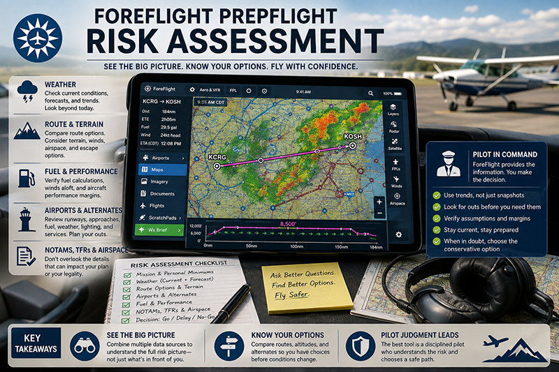
ForeFlight preflight risk assessment is not about tapping through screens faster. It is about using an electronic flight bag to build a disciplined picture of weather, airspace, terrain, aircraft performance, fuel, alternates, and pilot readiness before the airplane ever moves. For student pilots, instructors, aircraft owners, and professional crews, ForeFlight can be an excellent planning environment, but only when it supports sound aeronautical decision-making rather than replacing it.
The best pilots do not treat ForeFlight as a magic yes-or-no machine. They use it as an organized way to ask better questions. What is changing along the route? Where are the escape options? Is the forecast improving, deteriorating, or merely uncertain? Does the aircraft have adequate performance margin for the conditions? Are the pilot, passengers, mission, and environment all aligned? This article explains how to use ForeFlight more effectively as part of a practical preflight risk assessment process while keeping the pilot in command at the center of the decision.
What ForeFlight Can and Cannot Do for Risk Assessment
ForeFlight is an electronic flight bag, not a decision-maker. It can display weather, airport information, NOTAMs, charts, airspace, route planning tools, terrain information, fuel planning data, and other operational information depending on the subscription, device, data connection, aircraft profile, and installed equipment. Those tools can significantly improve the way a pilot organizes preflight information, but the quality of the risk assessment still depends on pilot judgment.
A useful way to think about ForeFlight is as a risk visualization tool. It helps turn scattered preflight information into a more usable picture. A text weather briefing may describe ceilings, visibility, winds, convective outlooks, AIRMETs, SIGMETs, and NOTAMs, but a graphical view can help a pilot see how those hazards relate to a route, destination, terrain, and available alternates. That visual relationship is where ForeFlight can be especially valuable.
At the same time, every digital planning tool has limitations. Weather products have update cycles. Forecasts are uncertain. Device batteries can fail. Data can be misread. A route that looks clean at one zoom level may reveal important airspace, terrain, or obstacle considerations at another. Aircraft performance information is only as useful as the pilot’s aircraft profile, weight and balance assumptions, fuel planning inputs, and understanding of the airplane’s approved operating data.
Effective use of ForeFlight begins with a simple mindset: the app helps you collect, compare, and monitor information, but the pilot remains responsible for evaluating whether the flight can be conducted safely and legally. That distinction matters because risk assessment is not a software feature. It is a pilot skill.
Start with the Mission Before Opening the Map
Many pilots begin preflight planning by opening the map and drawing a direct route. That is natural, but it can also narrow the pilot’s thinking too early. A better approach is to define the mission first. Is this a local training flight, a VFR cross-country, an IFR trip through changing weather, a night flight over sparsely populated terrain, or a passenger-carrying flight with schedule pressure? The same weather and route may carry very different risk depending on the mission.
ForeFlight can support this process when the pilot enters accurate basics: aircraft, departure, destination, route, estimated departure time, cruise altitude, fuel assumptions, and expected loading. Without realistic inputs, the displayed results may create a false sense of precision. A route planned for midmorning may not represent the risk of an afternoon departure. A fuel calculation based on a generic aircraft profile may not reflect the actual airplane, winds, taxi time, climb fuel, reserve strategy, or operational constraints.
Before studying the route in detail, ask what would make the flight unacceptable. For a student pilot, the answer may include wind beyond personal limitations, marginal visibility, a low ceiling, or crosswind above training limits. For an instrument-rated pilot, the answer may include thunderstorms near the route, icing potential, destination weather near minimums, lack of reasonable alternates, or fatigue after a long duty day. For an instructor, the answer may include whether the conditions support the lesson objective without overwhelming the student.
When those boundaries are clear before the pilot examines the app, ForeFlight becomes a planning tool rather than a persuasion tool. The goal is not to find a way to make the trip work. The goal is to decide whether the flight, as planned, leaves enough margin.
Build a Weather Picture, Not Just a Weather Snapshot
Weather is one of the most important parts of preflight risk assessment, and ForeFlight gives pilots several ways to view it. The key is to avoid looking only at the current conditions. A safe preflight assessment needs both the current picture and the trend. Current METARs may look acceptable while forecasts show worsening ceilings. Radar may look quiet while convective outlooks, surface analysis, or forecast discussions suggest later development. Winds may be manageable at departure but stronger at the destination or alternate.
Use ForeFlight to compare multiple weather layers and products rather than relying on a single green-or-red impression. Current surface observations help establish what is actually happening at reporting stations. TAFs and other forecast products help estimate what may happen during the flight window. Radar and satellite imagery can reveal precipitation, cloud cover, and movement trends, but they must be interpreted with awareness that displayed weather may not be real-time. Winds aloft matter for groundspeed, fuel planning, turbulence potential, and route selection. Temperature, dew point spread, freezing levels, and cloud information become especially important when icing, fog, or low ceilings are possible.
For VFR pilots, one of the most common traps is focusing on whether the departure and destination are technically VFR while ignoring the route between them. Terrain, water, rising ground, unlit areas at night, restricted airspace, and a lack of suitable divert airports can all change the risk picture. ForeFlight’s map view can help the pilot connect weather to geography. If ceilings are forecast to lower along a route crossing hills or mountains, the risk may be greater than the raw METAR category suggests.
For IFR pilots, the risk assessment should go beyond whether the pilot and aircraft are legal for the flight. Consider the quality of the available approaches, the weather trend at destination and alternate airports, winds at altitude, expected turbulence, potential icing, convective activity, runway conditions when relevant, and the realism of the escape plan. ForeFlight can help visualize many of these elements, but the pilot still has to decide whether the combination is appropriate for the aircraft, equipment, proficiency, and mission.
Use Route Planning to Identify Risk, Not Just Efficiency
Route planning tools can make cross-country planning faster, but the shortest route is not always the safest route. A more effective ForeFlight preflight risk assessment uses routing to compare options. Sometimes the safest route adds distance to remain near better weather, lower terrain, more airports, familiar airspace, or improved communication coverage. Other times a higher or lower altitude may reduce headwind, avoid turbulence, improve glide options, or remain clear of forecast cloud layers.
When reviewing a proposed route, zoom in and out deliberately. A wide view shows the big picture: weather systems, terrain, large airspace areas, and the relationship between departure, destination, and alternates. A closer view helps reveal details such as special use airspace, obstructions, airport layouts, charted procedures, terrain contours, and local route considerations. Changing scale is not just a display technique. It is a risk management habit.
Profile views and altitude planning tools, when available, can help pilots think vertically. That matters because many risks are altitude-dependent. Terrain clearance, winds, freezing levels, turbulence, cloud layers, oxygen considerations, and aircraft performance may all change with altitude. A route that looks acceptable laterally may be less attractive when viewed against terrain or forecast conditions at the planned altitude.
Fuel planning deserves the same attention. Digital planning can calculate estimated fuel burn and time en route, but the pilot must understand the assumptions behind those numbers. Winds aloft may change. Routing may be amended. Taxi, climb, vectors, holding, missed approaches, diversions, or traffic delays can add fuel demand. ForeFlight can assist with planning, but the pilot’s reserve strategy should be based on regulatory requirements where applicable, aircraft performance data, operational conditions, and conservative judgment.
Make Airports and Alternates Part of the Risk Picture
A route is only as strong as the options available when conditions change. ForeFlight makes it relatively easy to review airports along and near the route, but pilots sometimes wait until they need an alternate before studying one. A better practice is to use preflight planning to identify realistic escape options before departure.
When evaluating an airport as a potential alternate or diversion field, look beyond runway length alone. Consider runway orientation, surface type, lighting, instrument approaches if needed, fuel availability, weather reporting, terrain, services, operating hours where relevant, and whether the airport is suitable for the aircraft and pilot. A long runway may not be a good diversion option if weather, terrain, lighting, or fuel availability make it impractical for the situation.
For VFR cross-country flights, suitable airports along the route can reduce the pressure to continue into deteriorating weather. For IFR flights, alternates and diversion airports should be evaluated realistically, not merely selected to satisfy a planning requirement. For training flights, instructors can use ForeFlight to show students how alternate selection changes when wind, ceilings, time of day, fuel, or aircraft performance changes.
ForeFlight can also help pilots brief destination details more thoroughly. Airport diagrams, runway information, frequencies, traffic pattern notes where available, NOTAMs, and taxiway geometry should be reviewed before the pilot is busy in the terminal area. This is especially important at unfamiliar airports, airports with complex taxi layouts, or fields where runway closures, construction, or lighting outages could affect the plan.
NOTAMs, TFRs, and Airspace: Avoiding the Hidden Gotchas
Preflight risk assessment is not limited to weather. A perfectly clear day can still produce a poor flight plan if the route conflicts with temporary flight restrictions, special use airspace, runway closures, navaid outages, unavailable services, or charted constraints the pilot did not review carefully. ForeFlight can help organize these items, but pilots must give them more than a quick glance.
NOTAMs can be dense and easy to skim, especially when many are irrelevant to the flight. The risk is that an important item hides among routine notices. Runway closures, lighting outages, changes to approach availability, taxiway closures, fuel limitations, communication outages, or special events can affect the safety and feasibility of a flight. When using ForeFlight, review NOTAMs for the departure, destination, alternate airports, and route environment. If a NOTAM affects a critical part of the plan, treat it as a planning factor, not an administrative footnote.
TFR awareness requires equal discipline. Pilots should verify that TFR information is current and applicable to the route and timing of the flight. A TFR that begins after departure may still affect the return flight or a delayed arrival. A route that is clear at the planned time may become unacceptable if the departure slips. ForeFlight can display TFR information, but it should be part of a broader preflight review and not the only reason a pilot assumes the route is clear.
Airspace review should include both lateral and vertical awareness. It is possible to plan a route that avoids a controlled or restricted area laterally but creates a workload problem because of altitude constraints, nearby shelves, or frequent frequency changes. Students and newer pilots benefit from using ForeFlight to visualize airspace in relation to checkpoints, altitudes, and likely ATC communications. Instructors can turn that review into a teaching moment by asking the student to explain not only where the airspace is, but how the flight will remain clear of it or comply with the necessary procedures.
Connect ForeFlight to a Personal Minimums Framework
Personal minimums are practical limits a pilot sets for conditions such as ceiling, visibility, wind, crosswind, turbulence, runway length, night operations, terrain, fuel reserves, and instrument approach conditions. They are not a substitute for regulations or aircraft limitations. They are a safety buffer that reflects experience, proficiency, aircraft capability, and mission complexity.
ForeFlight becomes more powerful when pilots use it to compare conditions against those personal minimums. Instead of asking, “Is it legal?” ask, “Is this inside my demonstrated comfort and proficiency range today?” A pilot who is newly certificated, out of recent practice, unfamiliar with the aircraft, carrying passengers, or flying into an unfamiliar airport should normally choose more conservative margins than a highly current pilot flying a familiar mission in stable conditions.
The same applies to instructors. A training flight should be evaluated against both safety and learning value. Gusty crosswinds may be excellent training for an advanced student who is ready for that lesson, but a poor choice for a first solo cross-country. Low ceilings may support instrument training with an instructor in an appropriately equipped aircraft, but they may be unsuitable for a VFR navigation lesson. ForeFlight provides the situational data. The instructor decides whether the conditions support the instructional objective.
One practical technique is to write personal minimums down before planning and then use ForeFlight to test the flight against them. If the pilot keeps adjusting the plan to make the flight fit the minimums, that is a signal to pause. A risk management process should reveal pressure, not hide it.
Use ForeFlight During the Briefing, Not Instead of a Briefing
A complete preflight briefing is more than looking at a map with weather overlays. Pilots should ensure they have reviewed the information necessary for the flight, including weather, fuel requirements, alternatives, known traffic delay information where applicable, runway lengths, takeoff and landing performance considerations, and other information relevant to the operation. ForeFlight can support this process through briefing and planning tools, but the pilot should understand what has and has not been reviewed.
A strong briefing habit includes reading the details behind the graphics. Graphical products are excellent for awareness, but text products often provide nuance. Forecast timing, temporary conditions, amended reports, remarks, and area-wide advisories may not be fully appreciated if the pilot only looks at icons. For IFR flights, procedure details, alternate planning, lost communications considerations, and missed approach planning still require careful study.
If using ForeFlight’s briefing features, pilots should confirm the route, time, aircraft, and flight rules are correct before relying on the briefing output. An outdated departure time, wrong aircraft profile, or incorrect route can lead to incomplete planning. This is not a ForeFlight problem. It is a human factors problem that applies to any planning system.
For crews and instructional flights, ForeFlight can also improve communication. A CFI can point to the same weather layer, airport diagram, or route profile that the student is seeing. A two-pilot crew can brief the route, hazards, fuel plan, and diversion points from a common display. The value is not just information access. It is shared understanding.
Human Factors: The Biggest Risk Is Often How We Use the Tool
Electronic flight bags reduce workload in many ways, but they can introduce new human factors risks. One is confirmation bias. A pilot who wants to complete a flight may focus on the data that supports going and minimize the data that suggests waiting, delaying, rerouting, or canceling. ForeFlight’s polished presentation can make a plan feel more complete than it really is if the pilot has not challenged the assumptions behind it.
Another risk is automation complacency. When the app calculates a route, fuel estimate, heading, and arrival time, it is tempting to accept the result without asking whether the calculation makes operational sense. Good pilots still perform reasonableness checks. Does the estimated groundspeed match the winds? Does the fuel burn align with the aircraft’s performance data and expected power setting? Does the arrival time account for taxi, climb, routing, and possible delays? Does the altitude make sense for terrain, weather, aircraft capability, and direction of flight?
Device management is also part of risk assessment. A tablet with low battery, poor mounting, overheating risk, outdated downloads, or no backup plan can create workload at the worst time. Preflight planning should include confirming chart and data currency, battery status, charging capability, screen readability, and backup navigation resources appropriate to the flight. For some operations, the backup may be another device. For others, it may include paper charts, installed avionics, or both.
Finally, pilots should avoid allowing ForeFlight to consume all attention during critical phases of flight. Preflight familiarity reduces heads-down time later. If a pilot has already studied the taxi route, departure procedure, terrain, frequencies, alternates, and likely weather changes, the app becomes a quick reference in flight rather than a distraction.
Common Mistakes When Using ForeFlight for Preflight Risk Assessment
One common mistake is treating color-coded weather icons as the whole weather briefing. Those symbols are helpful, but they do not replace understanding the full weather picture. A green airport icon does not guarantee comfortable VFR conditions along the route, and an IFR category does not explain whether conditions are stable, improving, or worsening. Pilots should read the underlying observations and forecasts.
Another mistake is failing to update the plan when the departure time changes. Weather, TFRs, winds aloft, airport conditions, and daylight can all change with time. A plan built the night before may be stale by morning. A plan built at noon may not be valid for an evening departure. ForeFlight makes updating easier, but the pilot has to recognize when the plan needs to be refreshed.
A third mistake is overconfidence in direct routing. Direct routes can be efficient, but they may cross less favorable terrain, reduce diversion options, pass near complex airspace, or place the aircraft closer to weather. A slightly longer route may provide better risk margin. The question is not simply, “Can we go direct?” It is, “What does direct do to our options?”
Some pilots also neglect aircraft-specific planning. A generic aircraft profile or incomplete performance setup can produce fuel and time estimates that do not reflect the actual flight. Even when the profile is accurate, pilots should verify performance using the approved aircraft information and conservative assumptions. This is especially important for high-density-altitude operations, short runways, heavy loading, strong winds, or operations near performance margins.
Another misunderstanding is assuming that an app display is always current. Weather and airspace products have update cycles, and a device may not have the latest information if it has not refreshed properly. Before flight, pilots should confirm that downloads, charts, databases, weather, and route information are current for the intended operation.
Practical Example: A VFR Cross-Country with Changing Weather
Consider a private pilot planning a daytime VFR cross-country in a single-engine airplane from a familiar home airport to an unfamiliar airport 180 nautical miles away. The direct route is simple on the map, the destination is reporting VFR, and the flight appears easy at first glance. A more careful ForeFlight preflight risk assessment reveals a more nuanced picture.
The pilot starts by entering the aircraft profile, departure time, planned altitude, and route. The map shows a line of lower ceilings developing near the midpoint of the route, with better conditions to the west. METARs along the direct route are currently VFR, but forecasts suggest ceilings may lower during the expected arrival window. Winds aloft indicate a stronger-than-expected headwind at the planned altitude, increasing time en route and fuel burn. The destination runway is adequate, but the crosswind component may be near the pilot’s personal comfort limit if the forecast wind direction materializes.
Instead of focusing only on whether the flight is legal, the pilot uses ForeFlight to compare options. A western route adds distance but keeps the airplane closer to airports reporting higher ceilings and gives more diversion choices. A fuel stop midway would reduce fuel pressure and create a natural decision point. The pilot reviews destination and alternate airport information, checks NOTAMs for runway and lighting issues, and studies the airport diagram for the unfamiliar destination. The pilot also considers whether delaying departure would improve or worsen the weather picture.
The final decision may be to take the western route with a planned fuel stop, delay until conditions are more certain, or cancel if the trend continues downward. The important point is that ForeFlight did not make the decision. It helped the pilot see the risk, compare alternatives, and avoid being trapped by the first plan.
Best Practices for Pilots
The most effective ForeFlight users develop a repeatable planning flow without becoming mechanical. They start with the mission, build the weather picture, evaluate the route, study airports and alternates, review NOTAMs and airspace, check aircraft performance and fuel, then make a decision based on risk margins. This flow is flexible enough for different types of flying but disciplined enough to catch important details.
Use the app actively. Touch airports along the route. Open the details. Read the raw and translated weather. Compare forecast times to the actual flight window. Move the route line and see what changes. Examine altitude options. Look for outs. Think about what you would do if the destination went below minimums, the passenger felt sick, the winds were stronger than forecast, or a fuel stop became necessary.
For student pilots, ForeFlight should be paired with foundational planning skills. Learn to understand weather reports, chart symbology, airspace, performance data, fuel planning, and navigation principles. The app can make those tasks easier, but it should not hide the underlying knowledge. Instructors should periodically ask students to explain why the app is showing what it is showing.
For instrument pilots, use ForeFlight to support a full IFR risk review. That includes departure weather, en route conditions, freezing levels when relevant, convective potential, alternates, approach availability, missed approach planning, fuel strategy, and workload. An IFR clearance does not make weather risk disappear. It changes how the pilot manages it.
For all pilots, create a backup plan for the EFB itself. Confirm that data is downloaded before leaving reliable internet coverage. Charge the device. Manage heat and mounting. Carry an appropriate backup. Know how to use the panel avionics and basic navigation resources if the tablet becomes unavailable.
- Begin with personal minimums and mission requirements before building the route.
- Use more than one weather product to understand both current conditions and trends.
- Compare route options for risk margin, not just distance and time.
- Study diversion airports before departure, including runway, weather, fuel, and lighting considerations.
- Refresh the briefing when time, route, aircraft, weather, or mission details change.
- Perform reasonableness checks on fuel, time, winds, and performance assumptions.
How Instructors Can Teach Better ForeFlight Risk Assessment
Flight instructors have an important role in preventing students from becoming button-pushers instead of decision-makers. ForeFlight can be a powerful teaching aid because it makes invisible risk more visible. A CFI can ask a student to compare two routes, explain why one altitude is better than another, identify alternates, interpret weather trends, or describe how a NOTAM affects the plan.
One effective instructional technique is to have the student plan a flight twice. First, the student builds the route that appears most efficient. Then the instructor introduces realistic constraints such as lowering ceilings, stronger headwinds, a runway closure, a passenger schedule request, or a fuel availability issue. The student then revises the plan using ForeFlight and explains the risk tradeoffs. This teaches flexibility and aeronautical decision-making rather than rote app operation.
Instructors should also teach students to recognize when ForeFlight is not enough. If a forecast is complex, an airport is unfamiliar, a NOTAM is unclear, or a performance calculation is near the margin, the right answer may be to seek additional information, call flight service or an appropriate aviation resource, consult aircraft documentation, or choose a more conservative plan. Good risk management includes knowing when more information is needed.
Frequently Asked Questions
Can ForeFlight replace a standard preflight briefing?
ForeFlight can support preflight briefing and planning, but pilots should not think of any app as a substitute for understanding the required information for the flight. The pilot should verify that weather, NOTAMs, fuel planning, airport data, route information, and other relevant items have been reviewed for the correct aircraft, route, time, and operation.
What is the best ForeFlight layer for risk assessment?
No single layer is best for every flight. Risk assessment works best when pilots combine current observations, forecasts, radar or satellite imagery when relevant, winds aloft, airspace, terrain, airport information, NOTAMs, and route planning tools. The value comes from comparing information, not from relying on one display.
How often should I update my ForeFlight briefing?
Update the briefing whenever meaningful information changes. That includes a delayed departure, route change, aircraft change, weather trend, fuel stop decision, destination change, or any uncertainty about whether the displayed information is current. A plan that was accurate earlier may not remain accurate throughout the day.
Should student pilots use ForeFlight during training?
Yes, when it is integrated with proper instruction. Student pilots should learn both the app workflow and the underlying aviation knowledge behind it. ForeFlight can strengthen learning when students are asked to interpret weather, airspace, performance, route choices, and alternatives rather than simply follow magenta lines.
How can I avoid becoming too dependent on ForeFlight?
Use ForeFlight as a planning and situational awareness tool while maintaining core pilot skills. Understand charts, weather products, performance data, fuel planning, radio navigation, and aircraft systems. Carry an appropriate backup, keep data current, and practice solving planning problems without relying on one device.
Key Takeaways
- ForeFlight preflight risk assessment works best when pilots use the app to compare weather, route, aircraft, airport, fuel, airspace, and alternate options rather than simply confirming a preferred plan.
- The most important safety habit is looking for trends and escape options before departure, especially when weather, fuel, terrain, night operations, or unfamiliar airports increase complexity.
- ForeFlight supports decision-making, but the pilot in command remains responsible for understanding the information, verifying assumptions, and choosing a conservative course when risk margins are thin.