Convective SIGMETs are among the most important weather products a pilot can review before launching on a cross-country flight. They identify areas where thunderstorms or related convective activity have reached a level of aviation significance that can affect routing, timing, altitude selection, fuel planning, and the basic go or no-go decision. For student pilots, they are often introduced as a weather briefing item. For experienced pilots, they are a practical reminder that convective weather is not just a cloud or precipitation problem. It is a hazard environment that can include severe turbulence, lightning, hail, strong surface winds, rapid visibility changes, icing at altitude, and intense updrafts and downdrafts.
Interpreting Convective SIGMETs well requires more than recognizing a colored polygon on a weather display. A pilot must understand what the product is designed to communicate, what it does not communicate, and how it fits into a broader cross-country planning process. This article explains how pilots should read Convective SIGMETs in plain aviation language, how to use them with radar and forecasts, and how to avoid common errors that can lead to unsafe decisions around convective weather.
What a Convective SIGMET Means
A Convective SIGMET is an advisory for significant convective weather that may affect aircraft operations. In practical terms, it is a warning to pilots that thunderstorm activity in a defined area is serious enough to deserve special attention during preflight planning and in-flight decision-making. The exact text format and display style may vary depending on the source used, but the operational message is consistent: do not treat the affected area as routine weather.
Convective SIGMETs are commonly associated with thunderstorms that are severe, embedded, organized in lines, or widespread enough to create a meaningful aviation hazard. They may also relate to thunderstorm activity producing heavy precipitation signatures or conditions associated with severe convective cells. A pilot should not read a Convective SIGMET as a precise boundary between safe and unsafe air. Weather does not conform to the edge of a polygon. Instead, the advisory identifies an area where the atmosphere is already producing, or is expected to produce, convective hazards of operational significance.
The term convective refers to vertical atmospheric motion. When warm, moist, unstable air rises, cools, and condenses, it can create towering cumulus and thunderstorms. The stronger and more organized that vertical motion becomes, the greater the potential for hazards. A thunderstorm can contain powerful updrafts and downdrafts, intense precipitation, lightning, hail, wind shear, and turbulence that may exceed the capability or comfort level of many aircraft and pilots. Even aircraft that are certified for instrument flight are not designed to make thunderstorm penetration a normal procedure.
For cross-country flight planning, the presence of a Convective SIGMET changes the nature of the trip. It is no longer enough to ask whether the destination is VFR or IFR. The better question is whether the route, timing, aircraft capability, pilot experience, available alternates, and escape options are compatible with the developing convective environment.
Why This Matters in Real-World Aviation
Cross-country flying exposes a pilot to a wider range of weather than local pattern work or short training flights. A route that begins in smooth morning air may encounter afternoon heating, moisture convergence, terrain effects, frontal lifting, or sea-breeze boundaries several hours later. Convective SIGMETs help pilots identify when those ingredients have become operationally significant.
The real danger is not simply that a thunderstorm exists somewhere near the route. The problem is that convective weather can change quickly and can create hazards well outside the visible precipitation core. A cell may build vertically while the aircraft is still many miles away. A line of storms may accelerate or bow outward. New cells may develop along an outflow boundary that was not obvious during the first look at the weather briefing. A pilot who plans only around the current radar image may be surprised by what the atmosphere does next.
For a VFR pilot, a Convective SIGMET may indicate that visual navigation and cloud avoidance could become unreliable. Visibility can drop rapidly in heavy rain. Lowering ceilings can close off terrain clearance options. Gust fronts can make takeoff or landing conditions difficult even before a storm reaches the airport. Lightning and turbulence can make continued flight near a cell uncomfortable or unsafe, even when the aircraft remains technically clear of clouds.
For an IFR pilot, a Convective SIGMET is not solved by being in the system. An instrument clearance provides separation from other IFR traffic, but it does not separate an aircraft from thunderstorms unless the pilot, controller, and available equipment support a safe deviation strategy. Radar vectors may be limited by traffic, airspace, terrain, military operations, or the size of the convective area. A pilot flying in IMC near embedded storms may have fewer visual cues and less time to recognize a deteriorating situation.
Flight instructors should treat Convective SIGMET interpretation as a decision-making topic, not just a weather decoding exercise. Students need to understand that a weather advisory is only one piece of evidence. The more important training objective is learning how to build a mental model of the weather, compare that model to real-time observations, and make conservative decisions before options become limited.
How to Read the Information in a Convective SIGMET
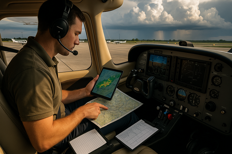
A Convective SIGMET typically provides a geographic area, valid time, movement or development information, and a description of the convective hazard. Depending on how it is displayed, a pilot may see it as text, a graphical polygon, or both. The graphical version is useful for route planning, but the text can add details that are easy to miss on a map.
The first task is to identify whether the advisory intersects the planned route, departure area, destination area, alternate airport area, or likely diversion paths. Many pilots look only at the magenta or red area over the route line. That is too narrow. A cross-country plan also depends on whether the pilot can safely turn around, divert, hold, or land before reaching the hazard. If convective activity blocks the route and also reduces practical alternate choices, the risk is much higher than the map may suggest at first glance.
The second task is to evaluate timing. Convective SIGMETs are time-sensitive. A departure delay, faster or slower groundspeed, fuel stop, or headwind change can move the aircraft into a very different weather situation. A route that appears workable at noon may be a poor choice two hours later if the advisory is expanding or new development is forecast along the route.
The third task is to compare the advisory with other weather products. A Convective SIGMET should be reviewed with radar, satellite imagery, METARs, TAFs, surface analysis, prog charts, winds aloft, PIREPs when available, and a broader convective outlook or forecast product appropriate to the operation. No single product gives the whole picture. Radar shows precipitation returns, but it may not show turbulence, lightning, all developing cells, or what conditions will be when the aircraft arrives. TAFs are airport forecasts, not route forecasts. Satellite may show cloud growth and organization but not all hazards inside the cloud. Each tool answers a different question.
Finally, the pilot should interpret the advisory in relation to aircraft and mission. A light training aircraft, a high-performance single, a turbine aircraft, and a transport category aircraft may have different performance, equipment, and operational support. However, the basic safety principle remains the same: thunderstorms are to be avoided, not challenged. Aircraft capability does not turn convective weather into ordinary weather.
Understanding the Boundary: A Polygon Is Not a Wall
One of the most common misunderstandings about Convective SIGMETs is treating the displayed boundary as if the hazard begins and ends at a sharp line. In reality, a polygon is a communication tool. It outlines the area where the issuing meteorologists identify significant convective conditions, but the surrounding atmosphere may still be unstable, changing, or affected by outflow and developing cells.
For pilots, this matters because a flight path just outside the polygon may still be exposed to turbulence, lightning, rapidly changing ceilings, reduced visibility, or new development. Conversely, an area inside the polygon may contain portions that look relatively quiet at a given moment. Neither observation should create false confidence. The correct interpretation is that the air mass and convective pattern require heightened caution, continuous updates, and a willingness to change the plan.
Distance from thunderstorms is not the only concern. The direction of movement, growth trend, storm organization, and the availability of escape routes matter. A cell moving away from the route may be less immediate than a line building across the route. A scattered pattern may allow wide deviations in some environments, while an embedded or solid line may leave few safe options. The pilot must think in terms of trends and margins, not just map colors.
Convective SIGMETs and Cross-Country Route Planning
Route planning around convective weather begins before the aircraft is fueled. The first planning question is whether the trip should happen on the intended schedule. If Convective SIGMETs are already active along a route, or the broader weather picture suggests they are likely to develop during the flight window, the safest and simplest decision may be to delay, depart earlier, choose a different route, or cancel.
If a pilot considers flying near a convective area, the route should be planned with conservative lateral margins, practical alternates, and clear decision points. A decision point is a location or time at which the pilot will reassess the weather and commit to a specific action, such as continuing, diverting, landing short, or returning. This helps prevent a gradual slide into deteriorating conditions.
Fuel planning becomes more important around convective weather. Deviations around cells, reroutes from air traffic control, holding for airport weather, and diversion to a more distant airport can all increase fuel burn and time aloft. A legal fuel reserve should not be confused with a comfortable operational reserve. Pilots should plan enough fuel to make decisions without feeling trapped by the fuel gauges.
Altitude planning also deserves attention. Some pilots assume they can climb over convective weather, but thunderstorm tops can extend well above the capability of many general aviation aircraft and may vary significantly across a storm complex. Flying beneath a thunderstorm is not a safe shortcut either, especially where heavy rain, gust fronts, turbulence, wind shear, or reduced visibility are present. The safest strategy is usually strategic avoidance at a distance, not vertical threading.
Communication planning should be part of the route strategy. A pilot should know where flight service, center, approach, or other appropriate resources may be available. In flight, ATC can often help with deviations and traffic coordination, but controllers may not have the same weather display detail as the pilot’s onboard equipment, and their primary responsibility is traffic separation. The pilot in command remains responsible for weather avoidance decisions.
Using Convective SIGMETs With Radar and Datalink Weather
Modern cockpit displays make weather easier to visualize, but they can also encourage overconfidence. Datalink weather is extremely useful for strategic planning, yet it is not the same as looking out the windshield or using airborne weather radar in real time. Depending on the system and product, displayed radar information may be several minutes old by the time the pilot sees it. In a fast-developing convective environment, a few minutes can matter.
A Convective SIGMET helps place radar returns in context. A small cell on radar inside an active convective advisory may deserve more respect than the same return in a stable environment. If the advisory describes organized or embedded activity, the pilot should assume that not all hazards will be obvious visually or on a single display. The question is not simply, “Where is the red?” A better question is, “What is the convective system doing, and where will it be when I get there?”
Radar intensity colors can also be misunderstood. Heavy precipitation often correlates with strong convection, but turbulence and wind shear do not always align neatly with the brightest color on the display. A pilot may encounter significant turbulence near a cell, near an outflow boundary, or in an area where precipitation is not yet intense. Lightning information, if available, can help identify active convection, but absence of displayed lightning should not be interpreted as proof that the area is safe.
When airborne weather radar is available, pilots need proper training in tilt management, attenuation, range selection, and interpretation. Airborne radar can be a powerful tool, but it is not automatic protection. For many general aviation pilots using only datalink weather, the best use is strategic avoidance: remain well clear, choose large-scale reroutes early, and avoid being forced into tactical maneuvering near cells.
How Pilots Should Understand the Risk
The most practical way to interpret a Convective SIGMET is to view it as a planning trigger. It should prompt the pilot to slow down the decision process, gather more information, and consider whether the original plan still makes sense. It does not automatically mean every flight in the region is impossible, but it does mean the pilot must make a deliberate and well-supported decision.
Several risk factors should raise concern. The first is embedded convection, where thunderstorms are obscured by clouds or precipitation and may not be visually avoidable. The second is a line of thunderstorms, particularly if it blocks the route and leaves no easy gap or diversion. The third is fast movement or rapid development, which can invalidate a route plan quickly. The fourth is poor alternate availability, especially at night, over mountains, near large bodies of water, or in congested airspace. The fifth is pilot workload. A pilot dealing with turbulence, reroutes, radio congestion, passenger concerns, fuel planning, and instrument conditions may run out of mental bandwidth before the aircraft runs out of performance.
VFR pilots should be especially cautious about scud running or attempting to remain below convective cloud bases. What begins as a visual workaround can become a low-altitude trap with poor visibility, rising terrain, towers, gusty winds, and limited landing options. IFR pilots should be cautious about accepting clearances that take them toward embedded cells without a clear deviation plan. The phrase “unable due weather” is an important tool when a clearance or vector is not acceptable.
A professional interpretation of convective risk includes humility. The atmosphere does not care about a schedule, passenger expectation, hotel reservation, maintenance appointment, or training syllabus. Good pilots are willing to land short, wait, or try another day.
Common Mistakes or Misunderstandings
One common mistake is looking at a Convective SIGMET only at the beginning of preflight planning and then treating it as static information. Convective weather evolves. A pilot planning a long cross-country should update the weather picture shortly before departure and continue monitoring in flight using appropriate resources.
Another mistake is focusing only on the destination. A destination airport may report acceptable conditions while the route between departure and destination is blocked by convective weather. Cross-country safety depends on the entire route, including terrain, alternates, fuel stops, and the ability to maneuver around weather without creating new risks.
A third mistake is assuming that an instrument rating makes convective weather manageable. Instrument proficiency is essential, but thunderstorms are not ordinary IMC. Embedded convection can remove visual avoidance cues, and an IFR clearance can create a false sense of structure in an environment where weather deviation decisions remain critical.
A fourth mistake is using datalink radar tactically. If a pilot is close enough to a storm that minute-by-minute cell position determines survival of the plan, the aircraft is probably too close for comfort. Datalink weather should support broad, early decisions rather than last-second threading between cells.
A fifth mistake is trying to salvage the mission after the margins have already disappeared. Pilots often get into trouble by accepting a series of small compromises: depart a little later, continue a little farther, accept a slightly narrower gap, descend a little lower, or postpone the diversion decision. Convective SIGMETs should encourage earlier, cleaner decisions.
Practical Example: Planning a Training Cross-Country
Consider a private pilot student and instructor planning a daytime VFR cross-country in a single-engine training aircraft. The route is 170 nautical miles with one planned fuel stop and a destination near a busy terminal area. The morning weather is VFR at departure and destination, but the forecast discussion and convective outlook suggest afternoon thunderstorm development along a weak boundary. By late morning, a Convective SIGMET is issued for an area that includes the second half of the planned route.
A weak interpretation would be, “The radar is still clear near our departure airport, so we can go and see what happens.” A stronger interpretation begins by recognizing that the advisory changes the training value and risk profile of the flight. The instructor and student compare the valid time of the advisory to the estimated time en route. They note that the aircraft would reach the affected area near the time of maximum heating. They review alternates before the advisory area and discover that good landing options exist during the first half of the route but become less convenient later. They also consider the return leg, since launching outbound may create pressure to come home through a more active weather environment.
The safer plan may be to shorten the route, move the lesson earlier, choose a local flight with clear escape options, or postpone the cross-country. If the instructor elects to use the day as a ground lesson, the student can still learn valuable skills: reading the Convective SIGMET, comparing it with radar and satellite, identifying alternates, calculating timing, and discussing personal minimums. That may be better training than launching into a scenario where the weather becomes the instructor’s problem rather than the student’s learning opportunity.
Now consider the same scenario from an instrument-rated pilot’s perspective. The pilot plans to file IFR and expects ATC to help with deviations. The Convective SIGMET still matters. The pilot should ask whether the route has room for deviations, whether fuel reserves support rerouting, whether embedded cells are possible, and whether destination or alternate airports may be affected by gust fronts or heavy precipitation near arrival time. Filing IFR improves traffic management and may provide useful support, but it does not eliminate the need for strategic weather avoidance.
Best Practices for Pilots
The best practice is to treat Convective SIGMET interpretation as part of a continuous weather decision cycle. Start with the big picture, identify the convective setup, compare official advisories with current observations, plan conservative routes, and update the plan as conditions evolve.
Before departure, review whether a Convective SIGMET affects the route, nearby alternates, fuel stops, or likely deviations. Look at movement and development trends, not just the current boundary. If the weather is expected to grow into the route, plan as if it will affect you unless strong evidence suggests otherwise. If you cannot explain why the flight remains safe with the advisory in place, that is a good reason to delay or redesign the plan.
During flight, maintain options. That means preserving fuel, staying ahead of the airplane, monitoring updated weather, and making deviation decisions early. If the route begins to narrow between cells, ask for deviations before the situation becomes urgent. If the weather picture becomes unclear, land at a suitable airport and reassess from the ground. A safe precautionary stop is a mark of sound judgment, not a failure of skill.
For instructors, teach students to verbalize their weather reasoning. Ask them what the Convective SIGMET means for timing, route selection, alternates, fuel, and personal minimums. Encourage them to draw a route line and then identify where the decision points should be. The goal is not memorizing a weather product. The goal is developing disciplined judgment around one of aviation’s most dynamic hazards.
- Use Convective SIGMETs as a strategic warning, not a tactical steering tool.
- Compare the advisory with radar, satellite, METARs, TAFs, forecasts, and pilot reports when available.
- Plan deviations and alternates before the aircraft is close to convective weather.
- Respect embedded storms, lines of thunderstorms, fast-moving cells, and limited escape routes.
- Be willing to delay, divert, land short, or cancel when the convective picture does not support safe margins.
Personal Minimums and Training Value
Convective weather is an ideal topic for personal minimums because it forces pilots to define acceptable risk before the pressure of flight. A personal minimum might address how close the pilot is willing to operate near convective activity, whether night flight is acceptable near active storms, what fuel reserve is desired when deviations are possible, and whether the pilot will launch when Convective SIGMETs are active along the route. The exact limits should be tailored to pilot experience, aircraft equipment, geography, and mission, but they should be written and reviewed before the day of flight.
Student pilots should not be taught that all weather decisions are binary. Real-world planning often involves shades of risk. A day with a Convective SIGMET along the original route might still support a shorter local lesson away from the activity, a ground session, simulator training, or a delayed departure after the system passes. The training objective is to choose the right mission for the conditions, not to force the original mission into a changing environment.
Experienced pilots benefit from the same discipline. Familiar routes can produce complacency. A pilot who has crossed a region many times may underestimate a new convective setup because the airports and terrain feel familiar. Convective SIGMETs help break that pattern by providing a formal prompt to reassess the environment objectively.
Frequently Asked Questions
Does a Convective SIGMET mean I cannot legally fly?
A Convective SIGMET is a weather advisory, not by itself a blanket prohibition on flight. The practical issue is safety and decision-making. Pilots must evaluate whether the route, aircraft, pilot qualifications, weather trends, alternates, and fuel planning support a safe operation. Always verify current regulatory requirements and operating rules for the specific flight.
Can I fly around a Convective SIGMET if the radar shows gaps?
Sometimes a route may be planned around convective activity with large margins, but radar gaps can close quickly and displayed data may not be real time. The pilot should avoid relying on narrow gaps, especially near embedded storms, lines of thunderstorms, or rapidly developing cells. Strategic avoidance is much safer than last-minute threading.
How is a Convective SIGMET different from ordinary thunderstorm information?
A Convective SIGMET highlights convective weather that has reached a level of aviation significance within a defined area and time period. Ordinary weather observations or forecasts may mention thunderstorms, but the Convective SIGMET is specifically intended to draw attention to significant convective hazards affecting flight operations.
Should VFR pilots and IFR pilots interpret Convective SIGMETs differently?
Both VFR and IFR pilots should treat Convective SIGMETs seriously, but the risk pathways may differ. VFR pilots may face visibility, ceiling, terrain, and escape-route problems. IFR pilots may face embedded storms, workload, reroutes, and limited visual avoidance cues. Neither flight category makes thunderstorm penetration acceptable as a normal plan.
Is datalink weather enough to stay safe near thunderstorms?
Datalink weather is valuable for strategic planning, but it should not be used as the sole basis for close-in maneuvering around thunderstorms. Displayed weather may be delayed, and not all hazards are visible as precipitation returns. Use datalink to make early, conservative decisions and keep substantial margins from convective activity.
What should I do if a Convective SIGMET appears along my route after departure?
Reassess early. Compare the advisory with current weather, fuel, alternates, terrain, airspace, and your remaining options. Request deviations if appropriate, consider landing short, and do not wait until the route is blocked. A diversion made with time and fuel available is usually far easier than one made under pressure.
Key Takeaways
- Convective SIGMETs are strategic decision-making tools that should shape route, timing, fuel, alternates, and departure decisions.
- The boundary of a Convective SIGMET is not a precise safety line. Significant hazards may exist near or beyond the displayed area as weather evolves.
- Safe cross-country planning requires comparing Convective SIGMETs with current observations, forecasts, radar, satellite imagery, and pilot judgment.
- Datalink weather is useful for broad avoidance planning, but it should not encourage close-in maneuvering around thunderstorms.
- When convective weather reduces margins, delaying, diverting, landing short, or canceling is often the most professional decision.