
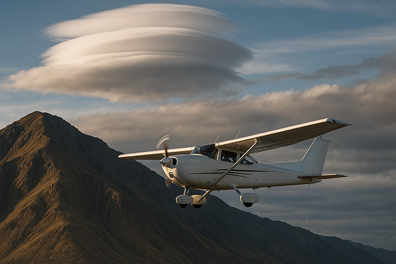
Mountain wave turbulence is one of the most important weather hazards for general aviation pilots to understand because it can be invisible, powerful, and poorly appreciated until an aircraft is already committed to the terrain environment. A smooth-looking sky near mountains does not always mean smooth air. Under the right wind and stability conditions, airflow crossing a mountain range can form waves, rotors, strong updrafts, and downdrafts that affect aircraft control, performance, passenger comfort, and pilot decision-making.
For student pilots, flight instructors, and experienced GA pilots alike, the practical question is not simply, “What is a mountain wave?” The more useful question is, “How should this change my preflight planning, altitude selection, route choice, and willingness to continue?” This article explains mountain wave turbulence in plain aviation language, connects the meteorology to cockpit decisions, and highlights the common mistakes that make mountain flying weather more hazardous than it needs to be.
What Mountain Wave Turbulence Is
Mountain wave turbulence develops when strong airflow moves across a mountain barrier and the atmosphere is stable enough for the displaced air to oscillate vertically after crossing the ridge. Picture air flowing over terrain like water moving over a submerged rock. The air is forced upward on the windward side, accelerates over or around the crest, and then descends on the lee side. If the air is stable, it resists displacement and tends to rebound, setting up a wave pattern downwind of the mountains.
In aviation, the term “mountain wave” usually refers to this standing wave pattern in the atmosphere. The wave can include regions of relatively smooth but strong vertical motion, as well as areas of severe turbulence. The strongest turbulence is often associated with rotors, which are horizontal, rolling eddies that can form below the wave crest on the lee side of the ridge. Rotors can be especially hazardous to light aircraft because they may involve rapid changes in vertical speed, airspeed, attitude, and control feel.
Mountain wave turbulence is not limited to high mountain ranges or large transport aircraft operations. General aviation aircraft crossing ridges, operating in valleys, flying near passes, or cruising downwind of terrain can encounter wave effects. The intensity depends on several interacting factors, including wind speed and direction relative to the ridge, atmospheric stability, terrain shape, moisture, and the vertical wind profile. Because those factors vary by altitude and location, the conditions can change quickly across a relatively short distance.
A key point for pilots is that mountain wave conditions can exist with little or no visible cloud. Lenticular clouds, cap clouds, and rotor clouds are useful signs when they appear, but their absence does not guarantee safe or smooth air. Dry air can support significant wave activity without producing clouds. That is why pilots should treat cloud clues as helpful evidence, not as the only method of detecting the hazard.
How Mountain Waves Form
Mountain waves generally require wind crossing a ridge or mountain range, a stable layer of air, and enough wind speed to carry the flow over the terrain rather than simply around it. The wind does not need to be exactly perpendicular to the ridge, but a stronger cross-ridge component usually makes wave formation more likely and more significant. When winds aloft increase with altitude, the wave pattern may become stronger and may extend well above the mountain tops.
Stability is central to the process. In unstable air, displaced air keeps rising or mixes more freely, which tends to produce convective turbulence rather than a clean wave pattern. In stable air, displaced air tends to return toward its original level, then overshoot and oscillate. That oscillation can create alternating areas of lift and sink downwind of the mountains.
The lee side of the ridge is often where GA pilots encounter the most operationally significant effects. Air descending the lee slope can produce strong downdrafts, and the lower-level flow may separate into a rotor. Above the rotor, the wave itself may contain smoother updrafts and downdrafts, but “smooth” does not mean harmless. A smooth downdraft can still create an alarming loss of altitude if it exceeds the aircraft’s climb capability or if the pilot is operating close to terrain.
The terrain shape also matters. Long ridgelines, steep lee slopes, narrow passes, and complex valley systems can focus or disturb airflow. A route that appears direct on a chart may place the aircraft in the most active lee-side zone, while a slightly longer route may provide better terrain clearance, more options, and less exposure to descending air.
Visible Clues: Lenticular, Cap, and Rotor Clouds
Clouds associated with mountain wave activity can provide valuable warning. Lenticular clouds are smooth, lens-shaped clouds that often form near the crest of a wave where moist air rises and cools. They may appear stationary even while strong winds are flowing through them. A line or stack of lenticular clouds downwind of a ridge can indicate a standing wave pattern extending away from the mountains.
Cap clouds form over the crest or windward side of a mountain when moist air is lifted to saturation as it flows over the terrain. A cap cloud streaming over a ridge can indicate strong cross-mountain flow. The cloud itself may look scenic from a distance, but it can be a sign that the terrain is actively disturbing the airflow.
Rotor clouds are often ragged, turbulent-looking clouds below the wave level on the lee side. They may appear as rolling or fragmented cloud lines parallel to the ridge. If rotor clouds are present, pilots should assume that significant turbulence may exist nearby. However, the lack of a rotor cloud does not prove that no rotor exists. If the air is too dry for cloud formation, the same mechanical process may still be present without a visual marker.
Cloud interpretation should be combined with winds aloft, pilot reports, forecasts, terrain analysis, and local knowledge. A single cloud type is rarely enough information for a complete go/no-go decision, but wave-related clouds should immediately raise the pilot’s weather awareness.
Why This Matters in Real-World Aviation
Mountain wave turbulence matters because it affects the aircraft in ways that can reduce safety margins very quickly. In flat terrain, an unexpected downdraft may be uncomfortable and inconvenient. Near mountains, the same downdraft can become a terrain clearance problem. A pilot may respond with pitch and power, but the airplane cannot always outclimb the surrounding air mass. If the air mass is descending faster than the aircraft can climb, maintaining altitude may not be possible until the aircraft exits the downdraft.
Wave activity also complicates airspeed control. In turbulence, abrupt gusts can momentarily increase or decrease indicated airspeed. Pilots may be tempted to chase altitude or airspeed with large control inputs, but that can increase workload and may worsen passenger discomfort. Flying at an appropriate turbulence penetration speed, when specified by the aircraft manufacturer, and using smooth control inputs are basic turbulence management principles. Pilots should always refer to the aircraft’s approved operating information for the correct speeds and limitations for their specific aircraft.
For flight instructors, mountain wave turbulence is a valuable teaching topic because it ties together weather theory, aircraft performance, terrain clearance, and aeronautical decision-making. Students often learn mountain waves as a weather concept, but the operational lesson is broader: do not plan as if the atmosphere is static. A route that looks reasonable in calm conditions may be unsuitable when winds aloft are strong across the terrain.
For aviation professionals and serious enthusiasts, mountain waves also illustrate why weather risk cannot be judged only by surface observations. A calm airport in a valley may coexist with strong winds and wave activity above or nearby. A smooth departure can transition into rough air as the aircraft climbs into the wave environment. Conversely, a valley may be turbulent while the air above a wave crest is relatively smooth. The vertical structure matters.
How Pilots Should Understand Mountain Wave Risk
The most useful way for GA pilots to understand mountain wave risk is to think in terms of exposure, escape options, and margins. Exposure means how long the aircraft will remain in the hazard area and whether the route crosses the lee side, passes, or ridge tops. Escape options include the ability to turn away from terrain, descend or climb safely, divert to an airport, or remain in visual conditions. Margins include terrain clearance, fuel, daylight, aircraft performance, pilot proficiency, and passenger tolerance.
A common misconception is that the main hazard is only turbulence. Turbulence is important, but it is not the only problem. Mountain waves can produce strong vertical currents that affect climb performance and altitude control. They can also generate wind shear and rapid changes in groundspeed. In a light aircraft, these effects can create a high workload at exactly the time the pilot needs to navigate terrain and communicate effectively.
Another practical way to think about mountain wave risk is to identify the windward side and the lee side. The windward side is where air approaches the mountains and is forced upward. The lee side is downwind of the ridge, where descending air, rotors, and wave activity are often most concerning. Many pilots prefer to cross ridges with enough altitude to remain well above terrain and with a plan that avoids prolonged flight in the immediate lee of the ridge. The exact safe altitude and route depend on the aircraft, weather, terrain, and pilot capability, so there is no universal number that applies to every flight.
When planning, pilots should look beyond the airport METAR. Winds aloft, area forecasts, graphical weather products, pilot reports, and local aviation weather discussions can all help build a picture of the atmosphere. Reports of moderate or greater turbulence, mountain obscuration, strong surface gusts, or pronounced wind changes with altitude should be taken seriously. If pilots are unfamiliar with the local terrain, speaking with a knowledgeable instructor, local flight school, or experienced mountain pilot can add practical insight that charts and forecasts may not fully provide.
Preflight Planning for Mountain Wave Conditions
Preflight planning should begin with the question, “What is the wind doing at ridge level and above?” Surface wind at the departure airport may not reflect the conditions at the pass or ridge crossing. A valley airport can be sheltered from the stronger flow aloft. If winds at mountain-top level are strong and aligned across the terrain, pilots should consider the possibility of wave activity even if conditions at the airport seem manageable.
Next, pilots should consider stability and cloud clues. Stable air near mountain-top level supports wave formation. Lenticular clouds, cap clouds, and rotor clouds are visual evidence that the atmosphere is responding to terrain. If these clouds are present, the pilot should not simply ask whether the flight is legal. The better question is whether the aircraft and pilot have enough performance, altitude, and flexibility to manage the conditions safely.
Route selection is often the most powerful mitigation tool. A direct line across the highest terrain may be efficient in calm air, but it can be a poor choice in strong cross-mountain flow. A route that crosses lower terrain, avoids the immediate lee side, remains near suitable landing areas, or provides wider valleys for maneuvering may be safer. In some cases, the best option is to delay, take a different route, or cancel the mountain portion of the flight.
Pilots should also plan communication and contingency options before entering the terrain. That includes knowing nearby airports, minimum safe altitudes, terrain elevations, weather reporting points, and the availability of flight following or other ATC services as appropriate. These steps do not eliminate mountain wave turbulence, but they reduce the chance that the pilot will be forced to improvise while already under stress.
In-Flight Recognition and Cockpit Management
Mountain wave encounters often announce themselves through a combination of vertical speed changes, difficulty maintaining altitude, variations in indicated airspeed, and turbulence that appears tied to terrain and wind direction. A pilot may notice that the aircraft is in a strong climb or descent even with a normal pitch attitude and power setting. If the airplane is being carried downward by the air mass, adding power and pitching for best climb may not immediately solve the problem.
Good cockpit management begins with maintaining aircraft control. Smooth, measured control inputs are preferable to abrupt corrections. If turbulence is significant, pilots should use the aircraft manufacturer’s guidance for turbulence penetration speed and configuration. The goal is to reduce structural stress and maintain controllability while avoiding excessive airspeed excursions. Pilots should avoid becoming fixated on holding an exact altitude if doing so requires aggressive pitch changes in turbulent air.
Terrain clearance should remain the dominant concern. If the aircraft is on the lee side and experiencing a downdraft, turning away from the terrain or toward lower ground may be more effective than trying to climb straight ahead. The best escape maneuver depends on the specific situation, but the principle is consistent: do not continue deeper into descending air and rising terrain without a clear margin.
Passenger and crew management also matter. Unsecured objects, loose charts, and startled passengers can distract the pilot. Before entering expected turbulence, it is prudent to ensure seat belts are secure, loose items are stowed, and passengers understand that turbulence is possible. In instructional flying, the instructor should brief the student on roles, communication, and transfer of controls before the workload increases.
Common Mistakes and Misunderstandings
One common mistake is assuming that mountain wave turbulence only occurs in instrument meteorological conditions or near obvious clouds. In reality, dry air can produce substantial wave activity without cloud formation. A pilot who relies only on visual cloud cues may miss the hazard entirely.
Another misunderstanding is treating the forecast wind at the departure airport as the deciding factor. Mountain wave conditions are driven by airflow over terrain, especially at ridge level and above. A light valley wind does not necessarily mean weak winds over the mountain. Pilots should review winds aloft and consider how the wind direction interacts with the terrain.
A third mistake is planning a ridge crossing with minimal terrain clearance because the aircraft normally climbs well. Normal climb performance is not the same as performance in descending air. If the surrounding air mass is moving downward, the aircraft’s climb relative to the ground can be reduced or eliminated. This is especially important for normally aspirated aircraft operating at higher density altitudes, but pilots should avoid making aircraft-specific assumptions without checking the approved performance data.
Pilots also sometimes chase altitude aggressively in wave conditions. In smooth wave lift or sink, it may be tempting to force the aircraft back to an assigned or desired altitude with large pitch changes. In turbulence, that can create airspeed deviations and unnecessary stress. When operating under ATC instructions, pilots should communicate promptly if unable to maintain altitude due to turbulence or mountain wave activity. In VFR operations, the better answer may be to change course, increase clearance, or leave the area rather than fight the atmosphere.
Finally, some pilots underestimate fatigue and workload. Mountain wave turbulence may not be a single bump. It can involve sustained attention, repeated corrections, route changes, and passenger concerns. A pilot who is already tired, unfamiliar with the terrain, or flying near personal minimums has less capacity to manage the encounter effectively.
Practical Example: A GA Cross-Country Near a Ridge
Consider a pilot planning a daytime VFR cross-country in a normally aspirated single-engine airplane. The route crosses a mountain ridge and then continues downwind toward a destination airport in a broad valley. The departure airport is reporting manageable surface winds, good visibility, and scattered clouds. At first glance, the flight appears straightforward.
During preflight planning, the pilot notices that winds aloft near ridge-top altitude are significantly stronger than the surface wind and are blowing nearly perpendicular to the ridge. The forecast discussion mentions stable air aloft, and several pilot reports in the region include turbulence near the mountains. Looking toward the route of flight, the pilot sees smooth lens-shaped clouds downwind of the ridge.
A less cautious pilot might focus on the good visibility and depart on the direct route. A more disciplined pilot recognizes the pattern: strong cross-ridge flow, stable air, terrain, and visual wave clues. Instead of treating the trip as a simple VFR navigation exercise, the pilot changes the plan. Options might include delaying until winds decrease, selecting a route that avoids the immediate lee side, crossing at a location with lower terrain and better escape options, or choosing not to cross the mountains that day.
If the pilot elects to continue after a conservative reassessment, the cockpit plan should include generous terrain clearance, a clear turn-around point, careful airspeed management, and a willingness to divert. The pilot should brief passengers about possible turbulence, secure loose items, monitor vertical speed trends, and avoid pushing into a downdraft near rising terrain. The important lesson is that mountain wave risk is best managed before the aircraft is trapped between weather, terrain, and limited performance.
Best Practices for GA Pilots
Good mountain wave decision-making is not based on bravado or a single rule of thumb. It is based on conservative planning, honest performance assessment, and respect for terrain-driven weather. The following practices are useful for GA pilots, instructors, and operators who fly near mountainous areas.
- Review winds aloft at ridge level and above, not just surface observations at nearby airports.
- Look for evidence of stable air, strong cross-ridge flow, lenticular clouds, cap clouds, rotor clouds, and relevant pilot reports.
- Plan routes that preserve terrain clearance, turning room, and diversion options.
- Avoid prolonged flight in the immediate lee of ridges when strong mountain wave conditions are likely.
- Use the aircraft’s approved operating information for turbulence penetration speed, maneuvering limitations, and performance planning.
- Brief passengers, secure loose items, and reduce cockpit workload before entering expected turbulence.
- Be willing to delay, reroute, divert, or turn around before the situation becomes urgent.
For instructors, mountain wave training should emphasize judgment more than memorization. Students should learn to connect weather products with terrain analysis and to recognize when a “legal” VFR flight still carries unacceptable risk. Scenario-based training is especially valuable because it forces the pilot to weigh competing pressures such as schedule, passenger expectations, and a seemingly short route across the mountains.
Training Value for Student Pilots and Flight Instructors
Mountain wave turbulence is not only a mountain-flying topic. It is a weather decision-making topic that applies broadly to aviation training. It teaches students that the atmosphere is three-dimensional, that surface conditions can be misleading, and that aircraft performance must be considered in the air mass in which the aircraft is flying.
Flight instructors can use mountain wave scenarios during ground lessons even if the local training area is not mountainous. A chart, winds aloft forecast, and terrain map can support a realistic discussion about route selection, escape planning, and personal minimums. The goal is not to make every student a mountain specialist. The goal is to build the habit of asking better weather questions.
For pilots pursuing advanced training, mountain wave topics also connect to instrument flying, high-altitude weather, oxygen planning when applicable, and abnormal situations. Wave lift can carry aircraft upward quickly, while wave sink can make altitude control difficult. In instrument conditions, the lack of outside visual references can increase reliance on instruments and disciplined control inputs. Even when operating VFR, pilots should avoid letting impressive cloud formations or smooth air near a wave create complacency.
Frequently Asked Questions
Can mountain wave turbulence occur on a clear day?
Yes. Mountain wave activity can occur without visible clouds if the air is too dry for condensation. Lenticular or rotor clouds are useful warning signs when present, but clear skies do not rule out wave turbulence, downdrafts, or rotors.
Are lenticular clouds always dangerous to fly near?
Lenticular clouds are not automatically dangerous by themselves, but they are a strong clue that wave activity is present. The surrounding air may include strong vertical currents and turbulence, especially below the wave and on the lee side of terrain. Pilots should evaluate the full weather and terrain picture before operating nearby.
What is the biggest hazard for a light aircraft in mountain wave conditions?
The biggest hazard is often the combination of turbulence, downdrafts, and terrain. A light aircraft may be unable to maintain altitude in a strong downdraft, particularly if the pilot is close to rising terrain or has limited room to turn away.
Should pilots try to outclimb a mountain wave downdraft?
Not necessarily. Adding power and using an appropriate climb attitude may be part of the response, but the safest action may be to turn away from the terrain, move toward lower ground, or exit the downdraft. The correct response depends on altitude, terrain, aircraft performance, and available escape routes.
Can mountain wave turbulence affect areas far downwind of the mountains?
Yes, wave patterns can extend downwind from the terrain, and their effects may be felt beyond the immediate ridge area. The distance and intensity vary with atmospheric conditions, terrain, and wind profile, so pilots should consider the broader region, not just the ridge crossing point.
Is mountain wave turbulence only a concern for mountain pilots?
No. Any pilot who flies near significant terrain, over ridges, through passes, or downwind of mountainous areas should understand the basics. Even pilots based in flatter regions may encounter mountain wave conditions during cross-country flights or training trips.
Key Takeaways
- Mountain wave turbulence forms when stable air flows across terrain and creates waves, downdrafts, and possible rotors on the lee side.
- For GA pilots, the major safety concern is not just rough air. It is the loss of terrain clearance and escape options when strong descending air is present.
- Good decisions begin before takeoff: check winds aloft, study the terrain, look for wave clues, plan conservative routes, and be willing to delay or divert.