
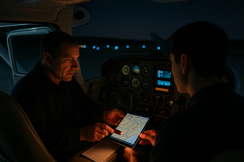
Night cross-country planning asks more of a pilot than simply flying the same route after sunset. Darkness changes how pilots see terrain, judge weather, find airports, read instruments, manage fatigue, and evaluate emergency options. A route that looks routine in daylight can become far less forgiving when visual references disappear and the pilot must rely more heavily on preflight planning, cockpit discipline, aircraft systems, and conservative decision-making.
For student pilots, private pilots, instrument students, and flight instructors, the challenge is not only meeting the applicable regulatory requirements for night operations. The larger safety question is whether the plan still makes sense when the pilot cannot easily see terrain, identify deteriorating visibility, spot unlit towers, or select a suitable off-airport landing area. This article focuses on hazards pilots often miss during night cross-country planning and how to build a more complete, practical plan before the airplane ever leaves the ramp.
Night Cross-Country Planning Is a Different Risk Picture
Daytime cross-country planning often emphasizes route selection, fuel, weather, airspace, alternates, aircraft performance, and navigation. Those items remain essential at night, but darkness changes their meaning. A pilot can still draw a course line, calculate fuel burn, review weather, and brief airspace. The difference is that the margins become harder to judge in real time. If visibility drops, the pilot may not see the warning signs as early. If the route crosses rural terrain, the ground may become a dark featureless area. If an airport is unfamiliar, runway lighting, taxiway layout, and surrounding terrain may be more difficult to interpret.
Night flying also places more emphasis on systems. Lighting, electrical power, instrument readability, avionics setup, flashlights, batteries, and backup navigation become more important because the pilot has fewer external cues to compensate for a failure. At night, a simple cockpit lighting problem can become a workload problem. A tablet overheating or battery failure may be more disruptive when the pilot is already using it for terrain, weather, airport diagrams, and chart reference.
The safest night cross-country plans tend to be built around redundancy and realistic escape options. That does not mean pilots should avoid night flying. It means they should treat darkness as an operational condition that changes route selection, altitude choices, fuel strategy, airport selection, and go/no-go criteria. Good planning asks, “What will this route look like if I lose outside visual references, if a runway light system is out, if the weather trends down, or if I need to divert quickly?”
Weather Hazards Are Harder to Recognize at Night
Weather is one of the most commonly underestimated night cross-country hazards because darkness hides visual clues. In daylight, a pilot may notice lowering ceilings, haze layers, virga, buildups, reduced visibility, or a change in horizon definition. At night, those clues can be subtle or absent until the aircraft is already close to instrument meteorological conditions. A flight conducted under visual flight rules may feel comfortable until the pilot realizes that the horizon has disappeared and the outside references are no longer reliable.
Night visibility can also be misleading. Lights from towns, roads, and airports may be visible through haze or light precipitation, creating the impression that conditions are better than they are. A pilot may see distant lights and assume the flight path is clear, while the actual flight visibility along the route is decreasing. Conversely, over sparsely populated areas, a perfectly clear night can look darker than expected simply because there are few ground lights. That can make it difficult to judge whether the problem is weather, terrain, or lack of cultural lighting.
Temperature and dew point spread, cloud bases, frontal movement, precipitation, winds aloft, freezing levels, and convective potential all deserve careful attention during night planning. Even when the forecast supports the flight, pilots should consider how quickly conditions could change and whether practical diversion airports are available along the route. Weather at the destination is only part of the problem. The route between departure and destination may cross terrain, water, rural areas, or temperature gradients that influence visibility and cloud formation.
Instrument-rated pilots are not immune to night weather risk. An instrument rating provides valuable capability, but it does not remove the need to evaluate aircraft equipment, pilot proficiency, icing potential, convective weather, alternates, fuel reserves, and approach options. A night IFR flight in a well-equipped aircraft with a current, proficient pilot is very different from a night VFR flight that assumes the weather will remain comfortably visual. The planning question is not simply whether the forecast is legal. It is whether the pilot, aircraft, route, and alternates provide enough margin if the forecast is imperfect.
Terrain, Obstacles, and the Black-Hole Effect
Terrain is one of the most unforgiving hazards in night cross-country operations. At night, terrain may be invisible until it is too close to matter. Mountain ridges, rising ground, towers, wind turbines, and other obstacles require deliberate preflight study, especially when the route crosses unfamiliar areas. A chart review should not be a quick glance at the magenta line. Pilots should understand maximum elevation figures, obstacle concentrations, terrain gradients, and safe altitudes along each segment of the route.
The so-called black-hole effect is a night visual illusion that can occur when a pilot approaches a runway surrounded by little or no ground lighting. Without normal visual references, the pilot may misjudge height, distance, and glidepath. This is especially relevant at airports near water, unlit terrain, open desert, farmland, or mountainous areas. A runway can appear isolated in a sea of darkness, and the pilot may be tempted to fly an approach path that is too low or otherwise unstable.
Runway slope, width, lighting intensity, and surrounding terrain can also affect perception. A narrow runway can appear farther away or higher than expected, while a wide runway can create the opposite impression. Bright approach or runway lights may alter depth perception, while weak or unfamiliar lighting may make the airport difficult to identify. These illusions are not limited to inexperienced pilots. They are human factors issues that can affect any pilot when visual references are degraded.
Planning can reduce these risks. Pilots should review airport diagrams, runway lengths, lighting systems, visual glidepath indicators if available, approach procedures when appropriate, surrounding terrain, and published traffic pattern information. Even for a VFR flight, reviewing an instrument approach plate for the destination or alternate can provide useful information about terrain, obstacles, runway alignment, lighting, and minimum safe altitudes. Pilots should not use procedures they are not authorized or prepared to fly, but the published information can still support situational awareness.
Airport Lighting and Services Are Easy to Assume Incorrectly
One hazard pilots often miss is the assumption that every airport on the route will be easy to find, properly lighted, and operational at night. That assumption can fail quickly. Some airports have pilot-controlled lighting, some lighting systems may be out of service, some runway lights may be difficult to see from certain angles, and some airports may have limited services after hours. Fuel availability, maintenance support, FBO hours, ground transportation, and ramp lighting can vary significantly.
Before a night cross-country flight, pilots should verify runway lighting, approach lighting if applicable, visual glidepath indicators, pilot-controlled lighting frequency and activation procedures, airport remarks, NOTAMs, fuel availability, and after-hours access. A lighted runway is not the same as a full-service nighttime diversion option. If a diversion is needed because of weather, passenger illness, low fuel, or aircraft abnormality, the pilot may need more than a strip of pavement. The plan should consider whether the airport is suitable for the aircraft, the pilot, and the situation.
Taxi operations deserve attention as well. Night taxi errors are more likely when the pilot is unfamiliar with the airport, signage is difficult to see, or the ramp layout is confusing. A preflight review of the airport diagram can prevent rushed decision-making after landing. Pilots should brief expected taxi routes, runway hold-short locations, hotspots if published, and lighting cues. At non-towered airports, they should also consider traffic pattern entries, runway selection, and communication discipline, particularly when multiple aircraft are operating in the area after dark.
Destination planning should include a realistic arrival briefing. Which runway is expected? What lighting should the pilot see? Is there a visual glidepath indicator? What are the surrounding terrain and obstacles? What is the missed approach or go-around plan, even if the flight is VFR? Where is the best alternate if the runway lights do not activate or the airport cannot be identified with confidence? These questions reduce uncertainty at the most workload-intensive part of the flight.
Fuel Planning Needs More Than a Legal Minimum
Fuel planning at night should be more conservative than simply meeting the applicable minimum requirement. Legal fuel reserves are minimum standards, not a guarantee that the flight has enough practical margin for unexpected headwinds, holding, reroutes, missed approaches, runway lighting issues, or diversion to a better airport. The darker and more remote the route, the more important practical fuel planning becomes.
A night cross-country plan should account for actual aircraft fuel burn, climb fuel, winds aloft, taxi time, expected routing, possible ATC changes, and the location of suitable fuel stops. Pilots should also evaluate whether fuel will actually be available at the planned stop during the expected arrival time. A self-serve pump may be available when the FBO is closed, but access, payment systems, lighting, and ramp layout should not be assumed without verification.
Fuel management during the flight is just as important as preflight calculation. Pilots should compare planned fuel burn to actual fuel remaining at meaningful checkpoints. If the aircraft has fuel totalizers or engine monitoring equipment, those tools can be helpful, but they do not replace proper fuel quantity verification and sound operating procedures. Night is a poor time to discover that the airplane is burning more than expected or that the planned fuel stop is not viable.
Conservative pilots build decision points into the route. A decision point is not a vague hope that conditions will improve. It is a location or time where the pilot compares actual fuel, weather, aircraft status, passenger condition, and route progress against the plan. If the flight is behind the plan, the safest decision may be to land early at a suitable airport rather than continue toward a destination with shrinking options.
Navigation and Automation Can Create Hidden Workload
Modern avionics and tablets make night cross-country planning more capable, but they can also create hidden workload. A pilot may become dependent on a moving map, terrain overlay, GPS direct routing, or automated flight guidance without maintaining enough independent awareness of terrain, airspace, weather, and alternates. At night, that dependency can be more hazardous because visual cross-checks are limited.
Route planning should include more than entering a direct-to destination. Pilots should evaluate whether the direct route crosses remote terrain, high obstacles, restricted or special-use airspace, large bodies of water, or areas with few diversion airports. A slightly longer route that follows highways, populated areas, lower terrain, or better airport options may provide a safer operational picture. For VFR pilots, ground lighting can help orientation, but it should not be the only navigation method. For IFR pilots, airway structure, minimum altitudes, communication coverage, and approach availability may influence route choice.
Automation management should be briefed before departure. If the aircraft has an autopilot, the pilot should understand its modes, limitations, disconnect procedures, and failure indications. If the autopilot is not available, the pilot should honestly assess whether hand-flying workload at night, possibly in turbulence or instrument conditions, remains within personal capability. A night cross-country is not the best environment to learn unfamiliar avionics under pressure.
Backup planning matters. Pilots should carry adequate lighting, ensure portable devices are charged, have charging cables available, and know how to navigate if the primary display fails. Paper charts or an independent electronic backup may be appropriate depending on the operation. The key is not nostalgia for older methods. The key is resilience. A single failed screen should not leave the pilot unsure of position, terrain, nearest airports, or safe altitude.
Fatigue, Vision, and Human Factors After Sunset
Night cross-country hazards are not only outside the airplane. The pilot’s body and brain are part of the risk picture. Fatigue can reduce attention, slow decision-making, and make routine tasks feel more demanding. A flight that begins after a full workday may technically fit into the schedule, but the pilot may not be operating at the same level as during a rested daytime flight. This is especially important for student pilots and low-time pilots who may already be managing a high workload.
Night vision also requires consideration. The eyes take time to adapt to darkness, and bright cockpit lights, phone screens, flashlights, or ramp lighting can reduce night adaptation. Pilots should manage cockpit lighting so instruments are readable without destroying outside vision. Red or dimmable lighting may help in some cockpits, but the priority is a lighting setup that allows accurate instrument reading and safe outside scanning.
Visual scanning at night is different from daytime scanning. Peripheral vision may detect dim objects better than direct staring, and pilots should avoid fixating on a single light source. Traffic can be difficult to judge because aircraft lights do not always provide reliable cues about distance, closure rate, or relative motion. Anti-collision lights, landing lights, and ADS-B traffic information can support awareness, but they do not remove the need for disciplined scanning and communication.
Personal health and oxygen use also deserve attention. Pilots should understand that night vision can be sensitive to physiological factors, including fatigue and reduced oxygen availability at altitude. The applicable oxygen regulations set legal requirements, but pilots may choose more conservative personal practices based on altitude, duration, health, and workload. The practical point is simple: if the pilot is tired, task-saturated, or physiologically stressed, night flying becomes less forgiving.
Emergency Options Are Less Obvious at Night
Every cross-country plan should consider emergency options, but night changes the quality of those options. During the day, a pilot may identify fields, roads, open areas, or terrain features if the engine fails. At night, many of those choices disappear into darkness. A dark area might be a flat field, but it might also be trees, water, rising terrain, wires, or uneven ground. A lighted area might offer roads or open spaces, but it may also include buildings, traffic, poles, and power lines.
This reality should influence route planning. A pilot may choose to remain within a reasonable distance of lighted airports, follow major roads, avoid extended overwater segments without appropriate planning, or select altitudes that provide more time and glide range. The best route is not always the shortest route. At night, a route with better emergency landing options and more diversion airports may be the more professional choice.
Emergency planning also includes aircraft systems. Electrical problems at night can quickly become serious because lighting, radios, navigation equipment, transponders, and some flight instruments may depend on electrical power. Pilots should know the aircraft’s electrical system, abnormal procedures, battery endurance considerations if published, and which equipment is essential. They should also ensure flashlights are accessible, not buried in a flight bag behind the seat.
A night emergency briefing should be practical, not dramatic. What is the nearest suitable airport along this segment? What altitude provides glide options? What terrain lies below? What lights would indicate a highway or town? What are the immediate actions for an engine problem, electrical issue, or smoke in the cockpit? A pilot who has considered these questions before takeoff is better prepared than one who begins thinking about them during an actual abnormal event.
Common Mistakes or Misunderstandings
One common mistake is treating night currency as the same thing as night proficiency. Being legally permitted to carry passengers at night is not the same as being comfortable and capable in night navigation, night landings, diversion planning, weather evaluation, and cockpit resource management. Pilots should separate minimum qualification from actual readiness.
Another mistake is planning a night VFR route as if the weather will be easy to judge visually. Night VFR can be safe and enjoyable when conditions, terrain, pilot proficiency, and aircraft equipment are suitable. The risk increases when a pilot assumes that visual cues will clearly reveal deteriorating conditions. If the horizon disappears, lights become blurred, or the pilot is uncertain about cloud clearance and visibility, the workload can escalate quickly.
Pilots also underestimate the importance of alternates during night operations. An alternate should not be selected only because it is close. It should be suitable. Suitability includes runway length, lighting, weather, terrain, approaches if needed, fuel, services, and pilot familiarity. An airport that looks acceptable on a chart may be much less useful if the runway lights are unavailable, the weather is marginal, or the approach path crosses dark rising terrain.
A fourth mistake is overreliance on direct GPS routing. Direct routing is convenient, but it may carry the aircraft over areas with poor emergency options, limited communications, high terrain, or few airports. At night, route structure should be chosen with more attention to escape options. A dogleg that follows lower terrain or keeps the aircraft closer to airports may be worth the extra time.
Finally, many pilots underestimate arrival workload. The last 20 minutes of a night cross-country can be busy: descending, configuring, communicating, identifying the airport, activating lighting, checking traffic, briefing runway alignment, monitoring terrain, and managing passengers. If the pilot arrives tired, low on fuel, or uncertain about the airport environment, a routine landing can become unnecessarily difficult.
Practical Example: The Route That Looks Easy on the Map
Consider a private pilot planning a 170-nautical-mile night VFR flight in a familiar single-engine airplane. The direct route is simple on the moving map. It crosses a rural area, passes near low hills, and arrives at a non-towered airport after the FBO is closed. The weather forecast is visual, and the pilot expects light winds. At first glance, the trip appears straightforward.
A more careful night cross-country planning process reveals several issues. The direct route passes over a long dark area with few lighted airports nearby. The destination has pilot-controlled lighting, but the pilot has not recently used that system and has not verified the correct frequency or lighting status. The closest alternate is shorter, has limited services, and sits near terrain. The planned fuel reserve is legal, but not generous if the pilot must divert after an unsuccessful arrival. The pilot also worked a full day before the flight and expects to depart later than originally planned.
With those hazards identified, the pilot adjusts the plan. The route is modified to remain closer to a highway corridor and within better reach of two lighted airports. The pilot verifies destination lighting and after-hours fuel information, reviews the airport diagram, briefs a go-around and diversion plan, and sets a decision point before crossing the darkest portion of the route. The pilot also raises the personal weather minimums for the flight and agrees that any unexpected visibility reduction will trigger an early landing rather than continued scud-running in darkness.
The flight may still be conducted, but it is now a different operation. The pilot has converted vague confidence into specific risk controls. That is the essence of good night planning. It is not about fear of darkness. It is about respecting what darkness hides.
Best Practices for Pilots
Effective night cross-country planning starts with a conservative mindset. The pilot should assume that some visual information available during the day will be reduced or unavailable at night. That assumption naturally leads to better route selection, more thoughtful fuel planning, improved airport briefings, and earlier decisions when conditions do not match the plan.
One useful practice is to brief the route in segments. For each segment, identify the safe altitude, terrain concerns, communication expectations, nearest suitable airports, weather trend, and decision points. Segment planning prevents the flight from becoming a single long commitment. It gives the pilot natural opportunities to reassess and divert if needed.
Another best practice is to choose alternates that are genuinely useful. A strong alternate has suitable runway length, reliable lighting, favorable weather, manageable terrain, and services that match the situation. For instrument pilots, approach availability and equipment requirements matter. For VFR pilots, lighting, weather, terrain, and ease of identification may be more important than simple distance from the destination.
Pilots should also prepare the cockpit before engine start. Flashlights should be tested and reachable. Charts and devices should be organized. Screen brightness should be adjusted. Frequencies, airport information, and backup plans should be available without excessive head-down time. The pilot should not be searching through menus, bags, or documents while descending toward an unfamiliar airport at night.
The following habits support safer night cross-country operations without turning the flight into a rigid checklist:
- Plan routes that favor terrain clearance, airport access, and emergency options, not only shortest distance.
- Verify runway lighting, airport services, NOTAMs, and after-hours fuel before departure.
- Use conservative weather minimums and reassess conditions at planned decision points.
- Carry accessible backup lighting and ensure electronic devices have adequate power.
- Brief arrival, go-around, and diversion plans before workload increases near the destination.
- Separate legal minimums from personal proficiency and practical safety margins.
Flight instructors can strengthen night training by asking scenario-based questions rather than simply completing required tasks. What would make this route unsuitable tonight? Which alternate is best if the runway lights fail? Where would you go if visibility drops by two miles? What terrain lies under this segment? How would you manage a tablet failure? These questions teach pilots to think ahead, which is the most important skill in night operations.
How Pilots Should Understand Regulatory Considerations
Night operations involve regulatory considerations that vary with the type of operation, aircraft equipment, flight rules, pilot privileges, passenger carriage, and airspace. Pilots should review the applicable rules for night currency, aircraft equipment, fuel reserves, lighting, oxygen, VFR or IFR operations, and any operating limitations that apply to the aircraft. The practical point is that regulations establish minimum requirements. They do not automatically answer whether a specific night cross-country flight is wise.
A pilot may satisfy the applicable rules and still face an unacceptable risk because of marginal weather, fatigue, poor alternates, unfamiliar terrain, inadequate recent experience, or aircraft equipment concerns. Conversely, a well-planned night flight with appropriate proficiency, weather, fuel, equipment, and alternates can be a valuable and safe part of pilot development. Good judgment lives in the space between minimum compliance and operational excellence.
When in doubt, pilots should consult current regulations, aircraft documents, official airport information, weather products, and qualified instructors or dispatch resources appropriate to the operation. For training flights, the instructor should make clear which items are legal requirements, which are school or operator policies, and which are recommended personal minimums. Confusing those categories can lead to poor decision-making later.
Frequently Asked Questions
Is night cross-country flying more dangerous than daytime flying?
Night flying introduces additional hazards, including reduced visual references, harder weather recognition, limited emergency landing options, fatigue, and greater dependence on aircraft lighting and electrical systems. It can be conducted safely when pilots plan conservatively, maintain proficiency, choose suitable routes, and respect the limitations created by darkness.
What is the biggest planning mistake pilots make at night?
A common mistake is planning the flight as if it were a daytime route. Pilots may focus on distance and fuel while underestimating terrain, airport lighting, weather identification, fatigue, and diversion suitability. Night planning should begin with the assumption that visual cues and emergency options will be reduced.
Should VFR pilots fly over remote areas at night?
Remote night VFR routes require careful judgment. Sparse lighting can make navigation, horizon recognition, and emergency landing site selection more difficult. A VFR pilot may choose a longer route that stays closer to airports, roads, lower terrain, or populated areas if that provides better safety margins.
How should pilots choose a night alternate airport?
A night alternate should be more than the nearest runway. Pilots should consider runway lighting, weather, terrain, runway length, approaches if applicable, fuel, services, communications, and familiarity. The best alternate is one that is realistically usable under the conditions that might cause the diversion.
Does an instrument rating solve night weather risk?
An instrument rating can greatly improve capability, but it does not eliminate risk. The pilot must still consider proficiency, aircraft equipment, weather hazards, icing or convective potential where relevant, fuel, alternates, and workload. Night IFR requires its own planning discipline.
What should student pilots learn from night cross-country training?
Student pilots should learn that night planning is not only about navigation and landings. It includes risk management, weather interpretation, terrain awareness, airport lighting, cockpit organization, fatigue recognition, and early diversion decisions. Those habits carry forward into all advanced flying.
Key Takeaways
- Night cross-country planning should treat darkness as an operational condition that changes route, fuel, weather, airport, and emergency planning.
- The hazards pilots often miss include deteriorating visibility, dark terrain, airport lighting assumptions, fatigue, limited emergency options, and overreliance on direct GPS routing.
- Regulatory compliance is only the starting point. Safe night flying also requires proficiency, conservative personal minimums, useful alternates, and clear decision points.