
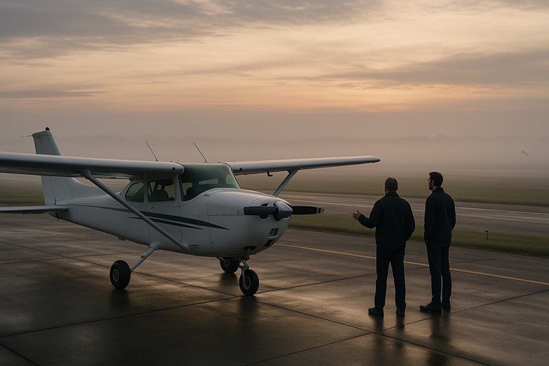
Radiation fog vs advection fog is more than a weather vocabulary question. For pilots, the way fog forms often determines when it appears, how quickly it changes, how far it spreads, and how many practical options remain once visibility starts to deteriorate. Two airports can both report low visibility in fog, yet the operational risk may be very different depending on whether the fog formed overnight in a cooling valley or arrived with a moist air mass moving across a cold coastline.
Understanding fog formation helps pilots move beyond a simple yes-or-no view of VFR conditions. It improves preflight planning, departure timing, alternate selection, fuel decisions, instructional risk management, and in-flight judgment. A student pilot preparing for a morning solo, an instrument pilot planning a coastal arrival, and a flight instructor evaluating pattern work after sunrise all need the same core skill: recognizing what type of fog is likely, what it tends to do next, and how that behavior changes the flight risk.
Fog Basics: Why Formation Matters
Fog is essentially a cloud at or near the surface. It forms when air near the ground becomes saturated, meaning the air temperature and dew point are close enough for water vapor to condense into tiny droplets. From the cockpit and the ramp, the practical result is reduced visibility, sometimes accompanied by a low ceiling or an obscured sky.
The important point for pilots is that fog is not one uniform hazard. Fog can form because the ground cools the air from below, because moist air moves over a colder surface, because air is lifted and cooled along terrain, or because precipitation adds moisture to cooler air below. Each formation process creates a different risk profile. Radiation fog and advection fog are two of the most important types for aviation because they are common, operationally significant, and easy to misunderstand.
Radiation fog is primarily a nighttime and early morning cooling problem. Advection fog is primarily an air-mass movement problem. That difference drives nearly every practical planning question: Is the fog likely to be local or widespread? Will sunrise help? Can it form with wind? Is another airport only 20 miles away likely to be clear? Is waiting one hour a reasonable strategy, or is the fog likely to persist?
What Is Radiation Fog?
Radiation fog forms when the ground loses heat through radiational cooling, usually at night. As the surface cools, it cools the air immediately above it. If that air is moist and the temperature falls to the dew point, condensation occurs and fog can form near the surface.
The classic setup includes clear skies, light wind, moist low-level air, and long enough nighttime cooling. Clear skies allow the surface to radiate heat away efficiently. Light wind can help mix the shallow layer just enough to deepen the fog, while too much wind may mix the air and prevent fog from forming as a surface-based layer. Very calm conditions can produce dew or frost instead of a well-developed fog layer, depending on the temperature, moisture, and local surface conditions.
Radiation fog is especially common in valleys, low-lying areas, near rivers, around moist fields, and in places where cool air drains and collects overnight. It may be highly localized. One airport can be below VFR minimums while another airport a short distance away remains usable, especially if terrain, elevation, drainage, or nearby water differs.
From a pilot’s perspective, the most useful feature of radiation fog is its typical daily timing. It often forms late at night or near dawn, becomes most restrictive around sunrise, and improves after solar heating and low-level mixing increase. That does not mean it always burns off quickly. A deeper fog layer, weak sun angle, extensive moisture, snow-covered ground, or continued low-level moisture can delay improvement. Still, radiation fog is generally tied to the overnight cooling cycle, so its trend is often easier to evaluate when compared with advection fog.
What Is Advection Fog?
Advection fog forms when moist air moves horizontally over a colder surface and is cooled to saturation from below. The word advection refers to horizontal movement of air. In aviation weather discussions, advection fog is often associated with coastal areas, cold ocean currents, cool lakes, snow-covered ground, or any surface cold enough to chill a moist moving air mass to its dew point.
Unlike radiation fog, advection fog does not require clear skies or calm nighttime conditions. It can form during the day or night and commonly occurs with wind. In fact, wind is part of the process because moist air must move over the colder surface. If the wind is strong enough, the fog layer may deepen, spread, or transition into low stratus, but the essential aviation concern remains the same: widespread low visibility and low ceilings can persist as long as the moist flow over the cold surface continues.
Advection fog can be more operationally stubborn than radiation fog. Sunrise may not fix it. If the underlying surface remains cold and moist air keeps moving over it, heating from the sun may be insufficient to dissipate the fog quickly. This is why coastal fog can disrupt aviation operations well beyond the early morning hours and why an airport that looked workable in a casual forecast review may remain IFR or marginal for much of the day.
For cross-country pilots, advection fog can also be deceptive because it may cover a broad region. When a moist marine layer moves inland or a warm moist air mass slides over cold terrain, nearby alternates may be affected at the same time. The risk is not just low visibility at the destination. It is the potential loss of multiple options across a route segment or terminal area.
Radiation Fog vs Advection Fog: The Operational Difference
The key difference between radiation fog and advection fog is the mechanism that cools the air to saturation. Radiation fog forms because the ground cools under favorable nighttime conditions. Advection fog forms because moist air moves over a colder surface. That distinction may sound academic, but it changes the flight decision.
Radiation fog tends to be more tied to time of day and local terrain. A pilot may see an airport report one-quarter mile visibility at sunrise, while airports on higher terrain or away from a river valley remain clear. A delay until midmorning may be a reasonable planning consideration if forecast trends, observations, and local experience support improvement. The risk is greatest when pilots assume the improvement will happen on a personal schedule rather than waiting for actual conditions to confirm it.
Advection fog tends to be more tied to air-mass movement and surface temperature contrast. It may cover a larger area, persist into the afternoon, and move inland or along a coastline with the wind. A short delay may not improve the situation if the same moist flow continues. The risk is greatest when pilots treat it like ordinary morning fog and expect the sun to solve the problem.
The two types can also overlap with other low-visibility processes. A region may start with radiation fog overnight, then retain low stratus after mixing begins. A marine layer may behave like advection fog near the coast and become terrain-enhanced farther inland. Weather is rarely organized for textbook simplicity. The goal is not to label every droplet perfectly. The goal is to understand the dominant process well enough to make a safer aviation decision.
Why This Matters in Real-World Aviation
Fog changes aviation risk because it attacks three things pilots depend on: visibility, ceiling, and predictability. Low visibility affects taxi, takeoff, landing, traffic avoidance, and visual navigation. Low ceilings reduce VFR route options and can make terrain or obstacle clearance planning more demanding. Poor predictability makes fuel, alternates, and timing more important.
In flight training, fog is a common source of pressure. Morning lessons are often scheduled because the air is smoother, temperatures are cooler, and aircraft availability may be better. Those same morning hours are also when radiation fog is most likely after a clear, moist night. A student may arrive at the airport to find the runway visible from the ramp but the far end hazy, or pattern visibility fluctuating between acceptable and unacceptable. This is a valuable teaching moment because legal minimums are not the same as instructional comfort, skill readiness, or margin.
For instrument pilots, fog is not automatically a no-go condition, but it raises the standard for planning and discipline. Instrument procedures, aircraft equipment, pilot currency, approach lighting, runway environment, missed approach planning, and alternate weather all matter. A pilot capable of flying an approach to published minimums still needs to consider taxi visibility, runway contamination if temperatures are low, fuel reserves, and whether the destination and alternate are affected by the same fog-producing process.
For VFR pilots, fog deserves special respect because it can create a fast transition from manageable weather to inadvertent IMC. Radiation fog may expand across a valley while surrounding ridges remain visible, encouraging continued flight until the escape route closes. Advection fog may move inland like a slow wall, reducing visibility at multiple airports along a coastline. In both cases, the danger is not only the fog itself. It is the pilot’s delay in accepting that the flight environment has changed.
How Pilots Should Understand Radiation Fog
Pilots should think of radiation fog as a local overnight cooling signal. If the evening temperature and dew point are close, winds are light, skies are mostly clear, and the airport sits in a valley or near moist ground, the setup deserves attention. The absence of fog at bedtime does not prove the morning will be clear. Radiation fog often develops late, after several hours of cooling.
Observations before departure are especially useful. Compare the current temperature-dew point spread with the trend overnight. Look at nearby reporting stations, but do not assume they all represent the departure airport accurately. Terrain and local moisture can make a major difference. A field near a river, lake, wet grass, or low drainage area may fog in before a station on higher or drier ground.
When radiation fog is present, improvement depends on heating and mixing. Pilots often describe this as fog burning off, but the process is really the air warming and mixing enough that the droplets evaporate or lift into a cloud layer. If the sun is strong and the fog is shallow, improvement can be noticeable. If the fog is deep, the sky above is overcast, or the season provides weak solar heating, improvement may be slow.
The practical lesson is to plan around observed trends, not hope. If you intend to wait for radiation fog to improve, monitor actual visibility, ceiling, satellite or surface observations when available, and pilot reports if appropriate. Do not launch because the clock says the fog should be gone. Launch when the conditions, trend, aircraft, pilot, and mission support the flight.
How Pilots Should Understand Advection Fog
Pilots should think of advection fog as a moving air-mass problem. The question is not simply, “Will the sun come up?” The better question is, “Will the moist flow over the cold surface stop, warm, dry out, or move away?” If the answer is no, advection fog can persist or spread.
Coastal aviation provides the clearest example. Moist marine air can move over colder water and create fog that affects shoreline airports, approach corridors, and nearby inland valleys. A runway may go from VFR to IFR as the fog bank moves in, even while airports farther inland remain clear for a time. Later, the fog may push inland and reduce visibility at those alternates too.
Advection fog can also occur away from the coast when warm moist air moves across a colder land surface, including snow-covered or chilled ground. Pilots sometimes underestimate this setup because it may happen under conditions that otherwise feel windy or dynamic, not calm and quiet. If a pilot associates all fog with still mornings, advection fog becomes easier to miss.
The practical lesson is to think spatially. Determine where the moist air is coming from, what surface it is crossing, and which airports are likely to share the same problem. If the destination, nearest alternate, and route corridor are all under the same moist flow, the safety margin is thinner than it appears on a single airport forecast.
Forecasts, Observations, and Pilot Judgment
Aviation weather planning should combine forecasts with current observations and a mental model of the weather process. Terminal forecasts, surface observations, area weather discussions, graphical weather products, webcams where available, and pilot reports can all contribute to the picture. The specific tools available vary by region and operation, but the decision-making principle is consistent: do not rely on a single data point when fog is the main hazard.
For radiation fog, the most useful question is whether conditions are trending toward or away from saturation during the overnight and early morning period. A small temperature-dew point spread, falling temperature, and light winds may support fog formation. After sunrise, improving visibility at multiple nearby stations may support a delay strategy. However, patchy improvement can be misleading. A runway environment may remain below personal or regulatory requirements even if the ramp begins to look better.
For advection fog, the most useful question is whether the air mass and wind pattern support continued fog. If the same moist flow remains in place, improvement at one station may be temporary or local. A hole in the fog is not the same as a reliable route. When fog is moving, the pilot should consider not only the current conditions but also where the fog will be during the arrival window.
Pilot judgment also includes recognizing personal limitations. A new private pilot flying VFR has a different margin than a proficient instrument pilot in a properly equipped aircraft operating under an IFR clearance. A flight instructor may choose to turn a fog delay into a ground lesson because the weather provides an excellent real-time learning opportunity. A commercial operator may have dispatch support and operating procedures that shape the decision. The weather hazard is the same, but the acceptable plan depends on the operation.
Common Mistakes or Misunderstandings
One common mistake is assuming all fog behaves like radiation fog. Pilots hear that fog often burns off after sunrise and apply that idea too broadly. That may be reasonable for shallow radiation fog under improving conditions, but it can be a poor assumption for advection fog. If moist air continues moving over a cold surface, daylight alone may not provide enough change.
Another mistake is treating fog as only a landing problem. Fog can affect the entire operation. Taxi visibility may be reduced before takeoff. A departure into low visibility can leave a VFR pilot with no safe visual reference. An instrument pilot may depart legally but later find the destination and alternates deteriorating under the same fog pattern. Ground operations, runway incursion risk, and communication workload can all increase when visibility is poor.
A third misunderstanding is believing that a nearby clear airport guarantees a clear route. With radiation fog, nearby differences can be real because fog may be localized. With advection fog, nearby differences can disappear quickly as the fog moves or expands. Pilots need to ask why one airport is clear and another is not. If the clear airport is simply ahead of the same advancing fog bank, it may not remain a reliable option.
A fourth mistake is relying on visibility alone. Ceiling matters too. Fog may lift into a low stratus layer, improving surface visibility while leaving a ceiling too low for the intended VFR route. For an instrument pilot, that may be manageable if the rest of the plan is sound. For a VFR pilot, it may simply change the hazard from surface fog to scud-running temptation.
Finally, pilots sometimes allow schedule pressure to redefine acceptable risk. Fog delays are frustrating because the airport can look almost usable. The airplane is ready, the passengers are waiting, and the forecast may hint at improvement. Good aeronautical decision-making requires separating inconvenience from safety margin. If conditions are below the pilot’s minimums, the correct decision is still to wait, reroute, file IFR if qualified and equipped, or cancel.
Practical Example: Morning Valley Fog vs Coastal Advection Fog
Consider two pilots planning short cross-country flights on the same day in different regions.
The first pilot is based at a small inland airport in a river valley. The previous evening was clear and calm after recent rain. At sunrise, the airport reports very low visibility in fog, while a station 25 miles away on higher terrain reports VFR conditions. The temperature and dew point are close, and the wind is light. This setup strongly suggests radiation fog. The pilot and instructor decide not to depart at the planned time. Instead, they monitor observations, brief an alternate lesson plan, and wait for actual improvement. By late morning, surface heating and mixing improve visibility at the departure airport. The flight may become reasonable if all other factors align, but the go decision is based on observed conditions, not the assumption that fog always disappears on schedule.
The second pilot is planning a coastal arrival. A moist onshore wind is moving across colder water toward the airport. The destination alternates between marginal VFR and IFR as fog moves across the field. Airports inland are still VFR, but satellite and surface observations suggest the marine layer is pushing inland. This setup points toward advection fog. A simple one-hour delay may not solve the problem because the air mass continues to feed fog into the area. The pilot evaluates inland alternates beyond the expected fog influence, considers whether an IFR flight is appropriate, reviews fuel and missed approach options if instrument qualified, and remains willing to divert before the coastal layer closes in.
Both scenarios involve fog, but the risk logic differs. In the valley case, the pilot is managing a local cooling problem with a likely daytime improvement trend. In the coastal case, the pilot is managing a moving, potentially widespread air-mass problem. The safer plan comes from understanding the formation process, not just reading the word fog in a weather report.
Best Practices for Pilots
Good fog decision-making starts before the engine turns. Pilots should compare the forecast with the physical setup. Ask whether the conditions support radiation fog, advection fog, or another low-visibility process. That mental model helps you judge whether the reported weather is likely to improve, worsen, or shift locations.
For radiation fog, pay close attention to overnight cooling, local terrain, moisture sources, and the temperature-dew point trend. Be especially cautious with early morning departures from low-lying airports after clear, calm nights. If delaying is part of the plan, define what improvement is required before you go. That definition should include visibility, ceiling, trend, route conditions, and personal minimums.
For advection fog, study the wind direction, air mass, surface temperatures, and geography. Coastal airports, cold water, snow-covered terrain, and moist flow deserve extra attention. Choose alternates that are not merely nearby, but meaningfully outside the same fog-producing environment when possible.
Several practical habits make fog operations safer:
- Use more than one weather source when fog is the primary hazard, especially when conditions are changing.
- Compare nearby airports by elevation, terrain, and exposure to moisture instead of distance alone.
- Set personal minimums that account for pilot proficiency, aircraft equipment, route complexity, and escape options.
- Be cautious when visibility improves but ceilings remain low, particularly for VFR operations.
- Do not let passengers, schedules, or aircraft availability pressure you into launching into marginal fog conditions.
Flight instructors can use fog days productively. A delayed flight can become a strong lesson in weather theory, METAR and TAF interpretation, risk management, and go/no-go decision-making. Students who learn how to reason through fog formation develop better judgment than students who only memorize definitions for a knowledge test.
Training Value for Student Pilots and Instructors
Radiation fog and advection fog are excellent teaching topics because they connect textbook meteorology to airport reality. Students can see how temperature, dew point, wind, terrain, and time of day affect actual operations. This makes weather training less abstract and more relevant to the decisions pilots make before every flight.
An instructor might ask a student to compare several nearby observations on a foggy morning. Which airport fogged in first? Which improved first? How do elevation and terrain explain the difference? Is the fog likely radiation-based or advection-based? What would make the plan safer? These questions teach pattern recognition and judgment, not rote memorization.
For instrument students, fog also provides a valuable discussion about approach planning and minimums. The lesson should not imply that an instrument rating makes fog harmless. Instead, it should emphasize disciplined planning, proficiency, aircraft capability, alternate selection, and missed approach readiness. Low visibility increases workload even for qualified pilots.
For VFR students, fog training should reinforce that marginal visibility can be a trap. A pilot may be tempted to stay low under a lifting fog layer or continue along a route because the next landmark is still visible. That mindset can lead toward terrain, obstacles, controlled airspace complications, or inadvertent instrument conditions. The better habit is to make conservative decisions early while good options remain available.
Operational Risk: Localized Fog Versus Widespread Fog
One of the most practical differences between radiation fog and advection fog is the likely scale of the problem. Radiation fog is often local or regional, strongly influenced by terrain and surface moisture. Advection fog can be regional or widespread because it is tied to air moving across a cold surface.
Localized fog can still be dangerous. A pilot departing a clear airport may encounter a fog-filled valley along the route. A destination may remain below minimums while the surrounding area looks clear from above. A training airport may have visibility that varies across the runway environment. Local does not mean minor.
Widespread fog creates a different challenge: options shrink. If many airports are affected, the pilot has fewer diversion choices. If the fog is moving, an airport that is clear now may not be clear later. For instrument pilots, widespread low visibility increases the importance of realistic fuel planning and alternate strategy. For VFR pilots, it may make the safest decision simple: wait for a better weather pattern.
The scale of the fog should shape the plan. A localized radiation fog event may support waiting, repositioning to a clear airport if appropriate, or adjusting a training schedule. A widespread advection fog event may require a larger route change, an IFR plan for qualified pilots, or cancellation.
Fog, Personal Minimums, and Legal Minimums
Pilots should be careful not to confuse legal minimums with good judgment. Regulations and operating rules establish required weather minimums for different types of flight, airspace, and operations, but those minimums are not a guarantee of safety. Fog can reduce margin quickly, particularly for pilots with limited experience or low recent proficiency.
Personal minimums should be more conservative when fog is forming, moving, or forecast to worsen. A VFR pilot may choose visibility and ceiling minimums well above the legal requirement because fog can obscure landmarks and reduce escape options. An instrument pilot may set higher personal approach minimums when flying single-pilot, at night, into an unfamiliar airport, or after a long duty day.
Good personal minimums also account for the type of fog. With radiation fog, a pilot might require a stable improving trend before departure. With advection fog, a pilot might require alternates outside the affected air mass and enough fuel to reach them comfortably. The formation process should influence the margin.
Frequently Asked Questions
What is the main difference between radiation fog and advection fog?
Radiation fog forms when the ground cools the air near the surface, usually at night under clear skies and light winds. Advection fog forms when moist air moves over a colder surface and cools to saturation. For pilots, the difference matters because radiation fog is often more local and time-of-day dependent, while advection fog can be more widespread and persistent.
Does radiation fog always burn off after sunrise?
No. Radiation fog often improves after sunrise as heating and mixing increase, but the timing is not guaranteed. Deep fog, weak sunlight, high moisture, cloud cover above the fog, or local terrain effects can delay improvement. Pilots should wait for actual weather conditions and trends to support the flight.
Can advection fog form when it is windy?
Yes. Advection fog depends on moist air moving over a colder surface, so wind is commonly part of the process. Stronger wind may change the depth or character of the fog and may produce low stratus, but pilots should not assume wind prevents advection fog.
Which type of fog is more dangerous for VFR pilots?
Either type can be dangerous. Radiation fog may be patchy and tempt a pilot to continue through valleys or low areas. Advection fog may cover a broad region and reduce escape options. The greater risk depends on the route, timing, pilot qualification, aircraft equipment, terrain, and how quickly conditions are changing.
How should an instrument pilot plan differently for fog?
An instrument pilot should consider approach capability, runway environment, missed approach planning, taxi visibility, fuel, alternates, and whether the destination and alternate are affected by the same fog process. Being instrument rated does not remove the need for conservative planning when visibility is low.
Why can one airport be fogged in while another nearby airport is clear?
Local terrain, elevation, surface moisture, drainage, wind exposure, and proximity to water can all influence fog formation. This is especially common with radiation fog, where low-lying areas may cool and saturate while nearby higher terrain remains clear.
Key Takeaways
- Radiation fog is mainly an overnight cooling problem, so pilots should evaluate local terrain, moisture, temperature-dew point trends, and actual post-sunrise improvement.
- Advection fog is an air-mass movement problem, so it can persist, spread, and affect multiple airports as moist air flows over a colder surface.
- The safest decisions come from understanding the formation process, setting conservative personal minimums, and choosing alternates based on weather pattern, not distance alone.