
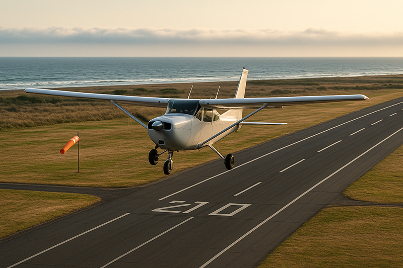
Sea-breeze fronts are one of the most important coastal weather hazards for general aviation pilots to understand. They can appear on otherwise pleasant flying days, shift surface winds quickly, create localized turbulence, trigger low clouds or showers, and change runway selection at coastal airports with little warning. For student pilots, flight instructors, private pilots, and aircraft operators who fly near shorelines, the sea-breeze front is not just a meteorology textbook topic. It is a practical flight planning and aeronautical decision-making issue.
This article explains how sea-breeze fronts form, why they matter to pilots, what signs to look for before and during flight, and how to manage the operational risks. The goal is not to make every pilot a meteorologist, but to help pilots recognize when a coastal weather pattern may affect takeoff performance, pattern work, cross-country planning, arrival timing, fuel decisions, and go/no-go judgment.
What Is a Sea-Breeze Front?
A sea breeze is a local wind circulation that develops because land and water heat at different rates. During the day, land surfaces usually warm faster than adjacent water. As the land heats the air above it, that air becomes less dense and tends to rise. Cooler, denser air over the water then moves inland to replace it. That inland-moving marine air is the sea breeze.
The leading edge of that cooler marine air is called a sea-breeze front. In aviation terms, it behaves like a small-scale boundary. It is not the same as a large synoptic cold front, but it can produce a noticeable wind shift, temperature change, turbulence, convergence, and cloud development along or near the boundary. In some locations the front may move inland only a short distance. In others, it may push many miles inland during the afternoon depending on the larger weather pattern, terrain, and strength of daytime heating.
For pilots, the word “front” is important because boundaries are places where air changes. Wind direction, wind speed, temperature, humidity, vertical motion, and visibility can all vary across short distances. A pilot departing an inland airport may encounter a different wind regime ten miles away near the coast. A pilot returning to a coastal airport may find that the runway favored at departure is no longer the best runway for landing.
Sea-breeze fronts are common near oceans, large gulfs, bays, and large lakes. The exact local behavior varies widely. A coastline with flat terrain, strong afternoon heating, and light background winds may support a well-defined sea breeze. A rugged coastline, strong gradient wind, widespread cloud cover, or colder season sun angle may produce a weaker or less predictable pattern.
How Sea-Breeze Fronts Form
The basic sea-breeze process starts with differential heating. Water has a high heat capacity and changes temperature slowly. Land heats and cools more quickly. On a sunny day, the land surface may become much warmer than the water surface by late morning or afternoon. That temperature contrast creates a pressure difference at low levels. The warmer air over land rises, and cooler marine air begins flowing inland near the surface.
As the marine air advances, it undercuts the warmer air over land. The leading edge of the marine air mass becomes the sea-breeze front. Air ahead of the front may be warmer, drier, and influenced by the prevailing inland flow. Air behind the front may be cooler, more humid, and moving from the water toward land. The boundary between those two air masses can be narrow enough for pilots to notice a rapid change in wind, temperature, and cloud base.
The strength of a sea breeze depends on several interacting factors. Strong solar heating over land tends to increase the land-water temperature contrast. Light or moderate background winds may allow the sea breeze to develop and move inland. If the background wind blows from land toward water, it can delay the sea breeze, sharpen the front, or make the eventual inland push more abrupt. If the background wind already blows onshore, the sea-breeze circulation may blend into the prevailing flow and be less distinct.
Humidity also matters. Marine air often contains more moisture than heated inland air. When the sea-breeze front forces air to rise, that moisture can help form cumulus clouds, low ceilings, or showers when the broader atmosphere is unstable enough. In more stable conditions, the front may produce little more than a wind shift and a line of haze or shallow clouds.
Terrain can enhance or disrupt the circulation. Coastal hills may channel the sea breeze into valleys. Urban surfaces can increase daytime heating and intensify localized circulations. Bays and peninsulas can create competing breeze patterns from multiple directions. Airports located near inlets, islands, river mouths, or coastal ridges may experience wind changes that differ from nearby reporting stations.
Why This Matters in Real-World Aviation
Sea-breeze fronts matter because general aviation often operates close to the surface, close to airports, and on schedules that overlap with afternoon heating. Training flights, sightseeing flights, aerial photography missions, local business trips, and weekend cross-countries may all be affected by a boundary that forms after departure and reaches the destination before arrival.
At coastal airports, the most obvious operational effect is a wind shift. A morning offshore or light variable wind can become an afternoon onshore wind. That may change the active runway, increase crosswind components, or create a tailwind for pilots who are slow to notice the change. At airports with limited runway options, a sea-breeze shift may turn a manageable departure into a more demanding crosswind operation.
The second major concern is turbulence and low-level wind shear near the boundary. The advancing cooler air interacts with warmer air ahead of it, and the shift in wind direction can produce mechanical and convective turbulence. The effect may be mild, but it can be uncomfortable or distracting in a light training aircraft, especially during climbout, final approach, or pattern work. A pilot who is already task-saturated may not connect the bumps and wind corrections to a sea-breeze front crossing the airport.
The third concern is visibility and cloud development. Marine air may carry moisture, haze, or low stratus inland. In some coastal regions, sea-breeze circulation can move low clouds toward airports that were reporting visual conditions earlier in the day. In unstable air, convergence along the front can support cumulus buildups or showers. Thunderstorms are not an automatic result of a sea-breeze front, but the boundary can become a focus for convective development when the atmosphere supports it.
Sea-breeze fronts also affect navigation and fuel planning. A pilot flying along the coast may encounter a headwind or crosswind that is stronger than expected. A pilot planning a late afternoon return may find that groundspeed, turbulence, and cloud cover differ from the morning leg. These effects are usually local, but local weather is exactly what matters when a pilot is close to terrain, airspace, traffic patterns, and fuel minimums.
How Pilots Should Understand This Topic
Pilots should think of the sea-breeze front as a moving boundary rather than a fixed coastal wind. The boundary has a timing, a depth, a direction of movement, and a set of weather changes associated with it. The most useful pilot question is not simply, “Will there be a sea breeze?” A better question is, “Where will the sea-breeze front be during my departure, en route segment, and arrival?”
Before flight, start with the big weather picture. A clear, warm day near the coast with light winds is a classic setup for sea-breeze development. If surface heating is strong and the pressure-gradient wind is weak, the local circulation has room to organize. If the forecast discussion, terminal forecast, or local weather products mention a sea breeze, wind shift, coastal convergence, low clouds, or afternoon showers, treat that information as operationally significant.
Then compare airport observations. Coastal and inland reporting stations may show different winds, temperatures, dew points, and visibility. A coastal airport may already have an onshore flow while an inland airport still reports a warm offshore or variable wind. That contrast can help identify the location of the boundary. If observations update and the wind shift appears to move inland from station to station, the front is advancing.
During flight, look outside. A sea-breeze front may be marked by a line of cumulus clouds, a haze boundary, a change in water texture near shore, or an area of localized showers. The signs are not always dramatic. Sometimes the cockpit clues are more subtle: a rising crosswind correction, a groundspeed change, lower outside air temperature, bumps at a particular altitude, or a sudden difference between the winds aloft forecast and what the aircraft is actually experiencing.
On approach, treat a sea-breeze wind shift like any other changing wind condition. Monitor the current automated weather, listen to traffic, compare windsock indications, and be ready to adjust runway selection or pattern entries in accordance with local procedures. If the airport has a control tower, expect the tower to manage runway use based on current conditions, but do not let that replace your own wind awareness. If the airport is nontowered, clear communication and careful observation become even more important.
For instructors, sea-breeze days can be excellent teaching opportunities. The phenomenon connects weather theory to actual aircraft control. Students can observe how a wind shift changes ground track, crab angle, runway selection, traffic pattern spacing, and landing technique. The lesson becomes especially valuable when the instructor links meteorology, aircraft performance, and decision-making rather than treating weather as a separate academic subject.
Operational Hazards Near Coastal Airports
The hazards associated with sea-breeze fronts are usually manageable when anticipated, but they can become serious when pilots are surprised. The most common operational issues occur close to the ground, where there is less time and altitude to diagnose a changing condition.
Takeoff and climb performance can be affected by temperature and wind changes. Cooler marine air may improve density altitude compared with hot inland air, but that does not automatically mean conditions are better. A shifting or gusty crosswind can make directional control more demanding, and a tailwind component on the wrong runway can reduce takeoff performance margins. Pilots should evaluate the actual wind and runway conditions rather than assuming that cooler air solves the problem.
Approach and landing can also be affected. If the sea breeze arrives while aircraft are in the pattern, the favored runway may change. A pilot who continues to land with a developing tailwind may experience a higher groundspeed, longer landing roll, and reduced margin on shorter runways. A pilot who changes runway direction without good traffic coordination at a nontowered airport may create a traffic conflict. The weather hazard and the traffic management hazard can appear at the same time.
Low-level turbulence is another concern. A sea-breeze front may produce a rough ride near the boundary, especially when the inland air is warm and unstable. In small aircraft, turbulence during final approach can lead to unstable airspeed control, excessive sink corrections, or overcontrolling. Good technique matters, but so does timing. If the boundary is crossing the field and conditions are deteriorating, delaying, diverting, or holding away from the airport may be the safer choice.
Ceiling and visibility changes deserve careful attention. In some coastal environments, marine stratus or fog can move inland behind the sea breeze. The airport may transition from comfortable visual conditions to marginal visual conditions over a relatively short period. That possibility is especially important for VFR pilots operating near sunset, over water, or in unfamiliar terrain. Even if the field remains technically VFR, lowering ceilings can reduce options and increase workload.
Sea-Breeze Fronts and Convective Weather
Sea-breeze fronts can act as lifting mechanisms. When the advancing marine air pushes under warm inland air, the warmer air is forced upward. If the air is moist and unstable enough, that lift can help initiate cumulus growth, showers, or thunderstorms. This is why coastal and near-coastal areas may see afternoon convection aligned with a sea-breeze boundary on some days.
It is important not to overstate the relationship. A sea-breeze front does not automatically mean thunderstorms. The atmosphere must still support convection. Stability, moisture depth, temperature aloft, upper-level support, and competing boundaries all affect whether clouds grow vertically or remain shallow. For pilots, the practical point is that a sea-breeze front can focus weather development in a specific corridor. If the broader forecast already includes convection, the boundary may help determine where storms first appear or intensify.
In flight, convective development along a sea-breeze front may appear as a line or cluster of cumulus clouds parallel to the coast or slowly moving inland. Early buildups may look harmless, but rapid vertical growth, darkening bases, virga, rain shafts, lightning, or outflow are signs that the situation is no longer just a local wind shift. General aviation pilots should avoid trying to thread developing convective cells near a coastal boundary, especially when options are limited by water, controlled airspace, terrain, or fuel.
Outflow from showers or thunderstorms can further complicate the sea-breeze pattern. A thunderstorm outflow boundary can collide with, reinforce, or override the sea-breeze front. Winds may shift more than once. A pilot who planned for a simple onshore breeze may instead face gusty, variable surface winds and rapidly changing weather. When convection is involved, conservative spacing and early diversion decisions are usually better than late problem-solving near the airport.
Common Mistakes or Misunderstandings
One common mistake is assuming that coastal weather is automatically benign on sunny days. A blue-sky morning can produce a challenging afternoon pattern if the land heats strongly and the sea breeze pushes inland. The absence of widespread bad weather does not eliminate localized hazards.
Another misunderstanding is treating the sea breeze as a uniform wind from the shoreline to far inland. In reality, the sea-breeze front may have a distinct leading edge. Conditions behind the front can differ sharply from conditions ahead of it. A pilot may depart in one air mass, cross the boundary en route, and land in another.
Pilots also sometimes rely too heavily on a single airport observation. Weather at a coastal airport may not represent conditions ten or twenty miles inland, and an inland observation may not reflect conditions at the shoreline. Comparing multiple stations is often more useful than fixating on one METAR.
Another error is overlooking timing. Sea breezes often strengthen during the late morning and afternoon, but the exact timing varies. A pilot who departs before the boundary develops may return after it has crossed the destination. For training flights, this can mean the lesson begins in calm conditions and ends with crosswinds or gusts that exceed the student’s current comfort level. For cross-country flights, it can affect route, alternate selection, and fuel reserves.
A further mistake is failing to brief the landing runway implications. If a sea-breeze shift is expected, discuss before departure how the active runway may change, how pattern entries will be handled, and what conditions would prompt a delay or diversion. This is especially valuable at nontowered airports where pilots must self-coordinate runway use safely.
Finally, some pilots underestimate the workload created by a localized weather change. The weather itself may be modest, but it can appear during a high-workload phase of flight. A wind shift on final, a runway change at a busy coastal airport, or unexpected bumps during a student solo can have an outsized effect because the pilot is already managing airspeed, altitude, traffic, communications, and aircraft configuration.
Practical Example
Consider a private pilot planning a summer afternoon flight from an inland airport to a coastal airport for lunch, followed by a return trip later in the day. The morning weather looks excellent. Winds are light and variable, visibility is good, and the forecast suggests visual conditions. The pilot notes that the coastal airport has a runway aligned roughly east-west, with water to the east.
By early afternoon, the land has heated substantially. The coastal airport begins reporting an easterly wind from the water, while an inland station still reports a light westerly wind. A line of small cumulus clouds appears a few miles inland from the shoreline. The pilot recognizes this as a likely sea-breeze front. Instead of assuming the original runway plan remains valid, the pilot checks updated observations, reviews nearby alternates, and calculates the expected crosswind and landing distance for the current runway options.
On arrival, the pilot listens carefully to traffic and notes that aircraft are transitioning to the opposite runway. The wind is not severe, but it is different from the departure briefing. The pilot enters the pattern with extra attention to groundspeed and spacing, avoids rushing the approach, and goes around when the first approach becomes unstable due to turbulence and a high groundspeed turn from base to final. The second approach is stabilized, aligned with the current wind, and completed normally.
The important lesson is not that sea-breeze fronts are always dangerous. In this example, the pilot manages the situation by recognizing the boundary, updating the plan, communicating clearly, and refusing to salvage an unstable approach. The same weather could have produced a much higher risk if the pilot had ignored the wind shift, continued toward a tailwind landing, or pressed into a congested pattern without a plan.
Best Practices for Pilots
Managing sea-breeze fronts begins with anticipation. If you are flying near a coastline, large bay, or large lake on a warm day, include local circulations in your weather briefing. The more localized the operation, the more important local knowledge becomes. A flight instructor or airport operator familiar with the area may know typical sea-breeze timing, favored wind shifts, and common trouble spots that are not obvious from a broad forecast.
Use multiple weather observations. Compare coastal and inland stations, then look for trends. A single wind report is a snapshot. A sequence of reports can show the boundary moving. Pay attention to wind direction, gusts, temperature, dew point, visibility, cloud bases, and remarks in automated observations when available. A drop in temperature with a wind shift toward the water can be a clue that marine air has arrived.
Think carefully about runway selection and performance. Do not let habit determine the runway. Use the current wind, runway condition, aircraft performance data, and your own proficiency. If the sea-breeze shift creates a crosswind near your personal minimums, that is not a failure. It is useful information. Choose a better runway if available, delay until conditions improve, divert, or fly with an instructor when training value and safety support that choice.
Maintain flexibility in the pattern. If winds are changing, expect other pilots to be adjusting too. At nontowered fields, make clear position reports, listen before transmitting, and avoid creating confusion by abruptly changing runway direction without understanding the traffic picture. At towered airports, comply with instructions while continuing to monitor aircraft performance and approach stability.
Respect unstable approaches. A sea-breeze front may create shifting winds, bumps, and variable groundspeed near the runway. If the aircraft is not stabilized, go around. A go-around is a normal maneuver and often the best answer to a changing low-altitude situation.
For VFR pilots, protect your weather margins. If marine clouds, haze, or showers are moving inland, do not wait until the only remaining option is scud running or pressing over water with limited visibility. For instrument-rated pilots, remember that local convective or low-level wind changes can still affect workload even when an instrument procedure is available.
- Brief the possibility of a sea-breeze front when flying near coasts, bays, or large lakes on warm days.
- Compare coastal and inland weather observations instead of relying on one airport report.
- Recheck winds and runway suitability before takeoff, arrival, and pattern work.
- Be alert for localized turbulence, low clouds, showers, or convective growth along the boundary.
- Use go-arounds, delays, and diversions early when conditions change faster than expected.
Training Applications for Students and Instructors
Sea-breeze fronts are useful teaching tools because they turn weather theory into something a pilot can see and feel. A student can read about differential heating in a ground lesson, then observe the same process in the windsock, cockpit wind correction, and airport traffic pattern. This connection helps students understand that weather is not separate from aircraft control. It is part of every takeoff, landing, and navigation decision.
Instructors can use sea-breeze days to teach preflight weather analysis. Ask the student to compare coastal and inland observations, identify the likely boundary location, and predict how the runway might change later in the day. During the flight, ask the student to note changes in crab angle, groundspeed, turbulence, and cloud development. After landing, review what happened and compare it with the preflight expectation.
For solo endorsements and local area training, sea-breeze awareness can support better personal minimums. A student who is comfortable in a calm morning pattern may not be ready for gusty afternoon crosswinds. Rather than treating this as a simple wind limit, instructors can explain the pattern behind the change. That gives the student a mental model for future decision-making.
Sea-breeze fronts also support scenario-based training. A realistic scenario might ask a student to plan a coastal return flight with an expected afternoon wind shift and possible lowering ceilings. The student must decide when to depart, what alternates to consider, how to manage fuel, and what cues would trigger a diversion. This type of exercise builds judgment without requiring actual exposure to poor conditions.
Preflight Weather Questions to Ask
A good weather briefing for coastal flying should go beyond the basic question of whether conditions are VFR or IFR. Sea-breeze fronts are local and time-dependent, so pilots should ask questions that reveal trends and boundaries. What is the temperature contrast between inland and coastal stations? Are winds light enough for local circulations to develop? Is the wind already onshore at the coast but not inland? Are cumulus clouds forming in a line parallel to the shoreline? Are forecasts suggesting a wind shift, coastal convergence, low clouds, or afternoon showers?
These questions are not a substitute for official weather products or a full briefing. They are a practical way to interpret the information you already have. Pilots should use approved weather sources, current observations, forecasts, and sound aeronautical decision-making appropriate to the flight.
Timing deserves special emphasis. If your departure is in the morning and your return is in the afternoon, you are planning two different weather problems. The return leg may involve more heating, stronger sea-breeze circulation, more turbulence, more traffic, and a different runway. Brief the return before you depart, then update it before you come home.
Frequently Asked Questions
Are sea-breeze fronts dangerous for general aviation?
They are not automatically dangerous, but they can create hazards that matter to light aircraft. Wind shifts, crosswinds, turbulence, lowering ceilings, showers, and changing runway use can increase workload, especially during takeoff, landing, and training operations.
How can a pilot identify a sea-breeze front before flight?
Compare coastal and inland weather observations, look for wind shifts toward an onshore flow, note temperature and dew point differences, and check forecasts for coastal wind changes, convergence, low clouds, or afternoon showers. A line of cumulus or haze near the coast may also mark the boundary.
Can a sea-breeze front cause thunderstorms?
A sea-breeze front can provide lift that helps initiate convection when the atmosphere is moist and unstable enough. It does not cause thunderstorms by itself. Pilots should be especially cautious when forecasts already mention convective potential.
Why do sea-breeze fronts often affect afternoon flights?
They are driven largely by daytime heating over land. As the land warms faster than nearby water, the temperature contrast can strengthen through late morning and afternoon, allowing cooler marine air to move inland.
Should VFR pilots avoid coastal flying when a sea breeze is forecast?
Not necessarily. Many sea-breeze days remain suitable for VFR flying. The key is to understand the timing, wind shift, cloud potential, and runway implications, then maintain conservative margins and update the plan as conditions change.
Do large lakes produce sea-breeze-like fronts?
Yes, large lakes can produce lake-breeze circulations that are similar in concept. The operational concerns for pilots are much the same: localized wind shifts, convergence, turbulence, cloud development, and changing conditions near the shoreline.
Key Takeaways
- Sea-breeze fronts are moving coastal boundaries that can change wind, temperature, turbulence, visibility, and cloud conditions over short distances.
- The greatest operational risk is often surprise: an afternoon wind shift or lowering ceiling can affect runway choice, approach stability, and VFR margins.
- Pilots should compare coastal and inland observations, brief the expected timing, and remain willing to go around, delay, or divert when local conditions change.