
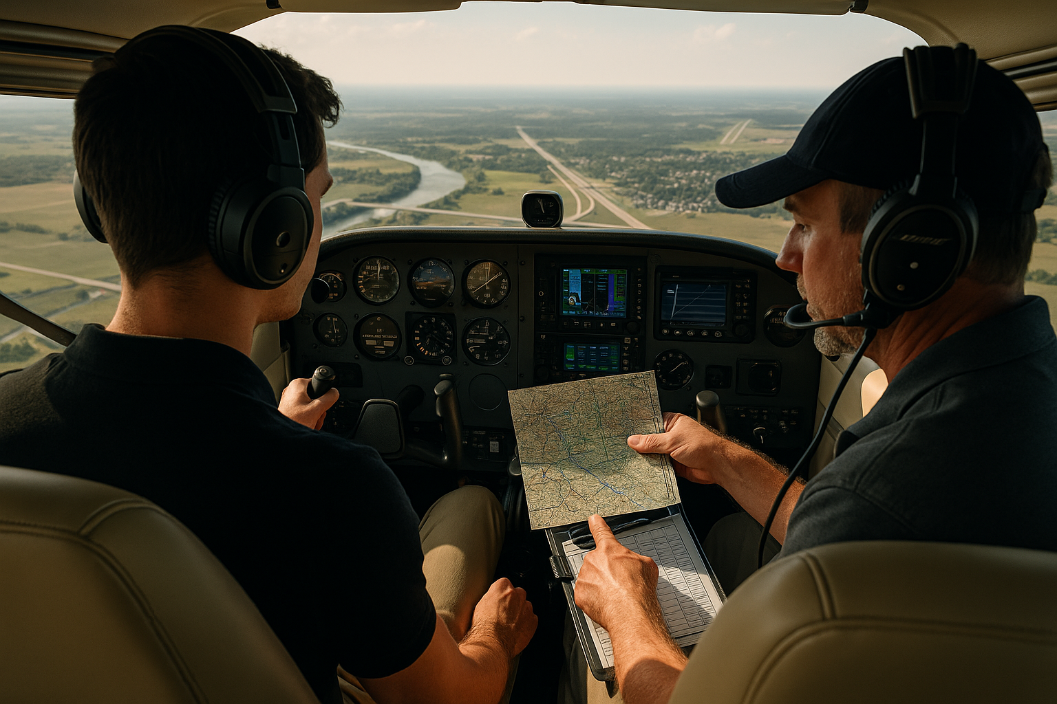
VFR navigation is an essential, often underestimated skill set for aspiring airline pilots. Even in a career that emphasizes instrument procedures, autopilots, and airline dispatch systems, the ability to navigate visually, interpret charts, and maintain positional awareness remains a practical advantage. This article explains why VFR navigation matters to airline aspirants and how to develop those skills deliberately for safer decision-making, better situational awareness, and stronger interview and assessment performance.
Read on for a practical breakdown of core VFR navigation principles, how they connect to airline operations and training, common misunderstandings, and concrete exercises you can use to keep these skills sharp. The primary keyword appears early because mastering VFR navigation is as relevant to a future airline pilot as it is to a general aviation pilot.
What VFR Navigation Really Means for an Airline-Bound Pilot
At its core, VFR navigation is about knowing where you are and where you are going using visual references, charts, basic instruments, and pilotage techniques. For airline aspirants, this includes the ability to read sectional charts, pick reliable checkpoints on the ground, estimate and verify groundspeed and time, plan meaningful alternates, and manage deviations when weather, traffic, or system failures require visual judgment.
VFR navigation is not a substitute for instrument flying. Rather, it is a complementary skill set that supports fundamental airmanship: the capacity to form a clear mental model of the aircraft's position relative to terrain, airspace, and airports. Airline operations add layers of automation, procedures, and ATC interactions. But pilots who can think visually and cross-check automation with real-world references maintain better situational awareness and are more resilient when systems fail or abnormal events occur.
Why This Matters in Real-World Aviation
Airline operations are procedural, but they are also people-centered. Decision-making, workload management, and handling non-normal events all depend on a clear mental picture of where the aircraft is. VFR navigation sharpens the following practical capabilities:
Situational awareness: Visual cross-checking of position helps confirm or correct what automation and instruments display.
Backup navigation: In the event of partial electrical failure, GPS anomalies, or discrepant navigation displays, being able to orient visually at a glance is valuable during critical phases of flight.
Decision-making under uncertainty: VFR skills support quick route changes, safe visual transitions, and diverted approaches when conditions permit.
Communication and crew resource use: Being able to describe visual checkpoints and geography concisely helps pilots coordinate with each other and with ATC.
In training and line operations, airline aspirants that demonstrate crisp, practical VFR navigation often show stronger judgment and a more rounded airmanship profile. These qualities are noticed in interviews, simulator sessions, and check rides.
How Pilots Should Understand VFR Navigation
Understanding VFR navigation means combining three domains: planning, in-flight techniques, and recovery when things do not go as planned. Each domain touches skills that translate into airline operations.
Planning involves selecting checkpoints, building a realistic timeline, accounting for wind and fuel, and identifying alternates and emergency options. For an airline aspirant, planning also means translating VFR familiarity into structured briefings. Think about how you would brief a visual segment to a co-pilot: be concise, use standard references, and highlight potential traps.
In-flight techniques are how you keep that plan accurate. This includes pilotage, dead reckoning, time and distance checks, and visual confirmation of fixes. Pilotage means recognizing terrain and man-made features on a chart and on the ground. Dead reckoning uses estimated groundspeed and heading to project position. Combine these with periodic instrument checks and cross-checks from available navigation aids.
Recovery and contingency means actions when visual cues fail, weather deteriorates, or navigation systems provide conflicting information. The right response depends on realistic self-assessment: divert to a known airport, request vectors from ATC, transition to instrument procedures if qualified and conditions permit, or execute a safe landing if necessary. Practice lost procedures and quick cross-checking to maintain control and reduce surprise during an event.
Core Elements of VFR Navigation: What to Train
Every aspirant should practice the following core elements so that VFR navigation becomes intuitive rather than a checklist copied from memory:
Chart interpretation: Read sectional symbols, airspace boundaries, reporting points, and topography. Learn to prioritize features that remain visible in typical weather conditions such as large rivers, major highways, railways, and distinct airport complexes.
Checkpoint selection: Pick checkpoints spaced at useful intervals. Use features that are distinctive, unlikely to change, and easy to reference from the cockpit at your planned altitude.
Time and distance planning: Translate map distance and planned groundspeed into realistic time estimates. Build in conservative buffers for deviations and traffic delays.
Wind assessment: Make a wind call and understand its effect on groundspeed and drift. Practice estimating wind aloft visually by noticing smoke plumes, wind turbines, or the movement of cloud features when available.
Cross-checking instruments: Use GPS, VOR, and flight instruments to confirm visual fixes. A strong VFR navigator uses all available cues and resolves discrepancies promptly.
Common Mistakes or Misunderstandings
Even experienced pilots can fall into traps when relying on visual navigation. Recognizing common mistakes helps prevent them.
Overreliance on single cues. Relying on one landmark or a single GPS readout invites error. Features can be misleading at different scales, and GPS can display an incorrect position if the receiver has issues. Cross-check across multiple sources.
Poor checkpoint selection. Picking subtle or transient features increases the chance of losing position. Avoid small ponds, isolated buildings that could be confused with others, or features that are obscured by seasonal foliage.
Underestimating wind. Wind-driven drift is the most common cause of being off-track visually. Failure to anticipate drift leads to late recognition of being away from the planned route.
Neglecting altitude and terrain. Low-level navigation can put an aircraft close to obstacles and make distant landmarks hard to see. Airline aspirants should practice scanning for terrain and obstacles while maintaining safe altitudes.
Assuming automation is infallible. Automation failures happen. Pilots who have practiced VFR navigation can maintain control and navigate effectively when displays are degraded or unreliable.
Practical Example: A Realistic Training Scenario
Scenario: You are a first officer candidate preparing for an interview day. The simulator will assess your ability to manage an approach into a busy metropolitan airport with a visual transition requested by ATC. The weather is marginal VFR with scattered cloud, and you must demonstrate quick, accurate visual navigation with good crew communication.
Before the session, brief your plan. Identify primary checkpoints from the initial approach fix to final runway visual point. Determine where you would accept a visual transition and where you would go missed or request vectors. Agree on a shared verbal model with your captain or examiner: callouts at every checkpoint, who flies which legs, and go/no-go criteria such as cloud base, visibility, or traffic spacing.
In the cockpit, use pilotage to confirm your initial fix visually. Start time and distance tracking. Expect drift and adjust heading proactively rather than reactively. Communicate succinctly: call the next checkpoint and the target time to reach it. If a navigation display flickers or shows an inconsistent track, announce that you are switching to visual cross-checks and call for assistance from the other pilot to monitor instruments while you fly visually.
This scenario combines planning, crew coordination, and the quick visual judgment that airline recruiters prize. The key training lesson is to practice translating VFR techniques into concise briefings and callouts that fit a multi-crew environment.
VFR Navigation and Technology: Use Tools Wisely
Modern avionics and portable devices add tremendous capability. Tablet-based moving maps, ADS-B traffic, and integrated flight decks make navigation easier. But technology can induce complacency. Use tools as partners, not substitutes.
Understand the limitations of each tool. For example, satellite navigation provides excellent position information but can fail or show delayed updates. Moving maps are useful for situational awareness but can produce tunnel vision if overused. Practice raw pilotage and dead reckoning in parallel with electronic navigation so you can revert quickly when necessary.
Another practical technique is to simulate failures during training flights. Fly cross-country legs with the moving map turned off or with your primary navigation display set to a different source. Teach yourself to navigate with the basic tools first and integrate automation as confirmation rather than primary guidance.
Bringing VFR Navigation into Airline-Type Flying
Airline flying is built on standard operating procedures, charts with published transitions, and ATC separation. Still, VFR navigation skills influence how pilots interpret visual cues during approach and taxi, brief an airport arrival, and manage unexpected visual segments.
For instance, when transitioning from instrument approach to a visual landing, quick visual identification of airport environment, runway patterns, and nearby terrain helps ensure a stabilized landing. In busy terminal areas, being able to read the ground below and identify positional markers at a glance supports better compliance with ATC instructions and more precise pilot flying inputs.
Also, small carriers and ferry flights sometimes operate under visual conditions where instrument procedures may be impractical. Airline aspirants who can demonstrate practical VFR navigation show flexibility and broader operational capability.
Training Exercises to Build and Maintain VFR Navigation Skills
Consistent practice is more effective than sporadic study. The following exercises are practical and transferable to multi-crew environments:
Local cross-country flights using only visual checkpoints and timed legs. Plan your route with conservative wind assumptions and periodically compare your estimate to your actual position using instruments after confirming visually.
Simulated equipment failures: rehearse navigation with your primary navigation display off, or with GPS unavailable. Force yourself to find fixes visually and by basic radio navigation aids if available.
Brief-and-fly drills: practice concise, structured briefings for visual segments and transitions. Include go/no-go criteria and contingency actions. Use a standard format and rehearse until the brief is crisp.
Vertical scanning and lookout practice. Improve your ability to spot key features at different distances and altitudes. This improves detection and reduces misidentification of landmarks.
Navigation in degraded visibility: fly under typical marginal VFR conditions with a safety pilot or instructor. Practice decision-making for divert or transition to instrument procedures when visibility deteriorates.
Common Interview and Assessment Scenarios Where VFR Navigation Pays Off
Recruiters and examiners may evaluate how you handle visual segments during simulator checks or scenario-based interviews. Examples include:
Visual approach briefings and transitions. Demonstrating a concise visual brief shows control of the flight path and awareness of hazards.
Handling partial automation failures during approach. Using visual techniques to confirm position and maintain a stabilized approach reduces task saturation.
Describing an alternate when diverting visually. Giving a clear rationale for the alternate and a realistic plan to get there demonstrates operational judgment.
Common Mistakes and Misunderstandings Revisited
To reinforce earlier points, here are common pitfalls and how to avoid them:
Confusing similar-looking features. Avoid relying on features that appear identical; verify with additional cross-checks.
Failing to update the mental model. If time and position calls do not match, stop and reset your situational picture rather than continue with an inaccurate assumption.
Inadequate crew communication. Use short, structured calls to keep both pilots aligned on the route and expected checkpoints.
Poor time management. Build and communicate realistic expectations for time between checkpoints and for fuel burn during contingency routing.
Best Practices for Pilots
Adopt these practical habits to maintain and improve your VFR navigation capability.
Plan visually before plugging everything into automation. Start with a mental picture and a rough plan of checkpoints and alternates.
Use layered cross-checks. Combine pilotage, dead reckoning, and instrument confirmation routinely.
Practice precise briefings. Structure visual briefings with expected checkpoints, timing, and go/no-go criteria.
Simulate degradations. Regularly fly segments with reduced electronic support to keep raw navigation skills polished.
Keep language clear. In multi-crew settings, short unambiguous phrases reduce confusion and speed resolution of conflicting information.
Frequently Asked Questions
Is VFR navigation still relevant for pilots who plan to fly only IFR in airlines?
Yes. VFR navigation trains visual situational awareness and mental map-building that support IFR flying. Visual cross-checks, terrain awareness, and quick identification of airports or ground references remain valuable when managing approaches, visual transitions, or automation anomalies.
How should a student pilot begin improving VFR navigation for an airline career?
Start with disciplined cross-country planning and flying. Prioritize consistent checkpoint selection, time and distance estimation, and conservative wind planning. Integrate these skills into multi-crew briefings and practice simulated failures so you can perform under pressure.
Can technology replace traditional VFR navigation training?
Technology enhances navigation but does not replace fundamental skills. Moving maps, ADS-B, and integrated displays are excellent aids but can fail or be misleading in certain conditions. Maintain core pilotage and dead reckoning abilities so you can navigate reliably without full reliance on automation.
What mistakes should I watch for during a visual approach in a busy terminal area?
Watch for fixation on the runway to the exclusion of traffic and terrain, misidentifying landmarks under time pressure, and failing to update your plan when ATC changes vectors. Keep callouts frequent and maintain mutual monitoring in the cockpit.
How do I practice VFR navigation under IFR or in a simulator?
Use simulator sessions to practice visual transitions, partial failures of navigation displays, and time-based cross-checks. In IFR flights, simulate visual segments with reduced automation and rehearse the brief, the visual identification, and the decision points for continuation or missed approach.
Key Takeaways
- Practical takeaway: Practice VFR navigation deliberately as a complement to instrument flying to build resilient situational awareness.
- Safety takeaway: Cross-check multiple sources and have conservative diversion plans to reduce risk when visual cues are ambiguous.
- Training takeaway: Incorporate simulated equipment degradations and concise visual briefings into your recurrent training to translate VFR skills into multi-crew airline contexts.