Weather decision-making for short cross-country flights is one of the most important judgment skills a pilot develops. A flight of 60, 90, or 150 nautical miles may feel familiar and manageable, especially when it begins and ends near home. That familiarity can be useful, but it can also lead pilots to underestimate how quickly weather can change across a relatively small area.
Short cross-country flying often sits in the uncomfortable middle ground between local pattern work and long-distance trip planning. The flight may not seem long enough to require extensive strategy, yet it can expose the pilot to different terrain, changing ceilings, reduced visibility, winds aloft, scattered showers, convective buildups, or a destination that is already trending worse than the departure airport. Good weather decisions on these flights are not about being overly cautious. They are about building a clear picture, recognizing uncertainty, and making decisions early enough that the pilot still has good options.
What Makes Short Cross-Country Weather Decisions Different
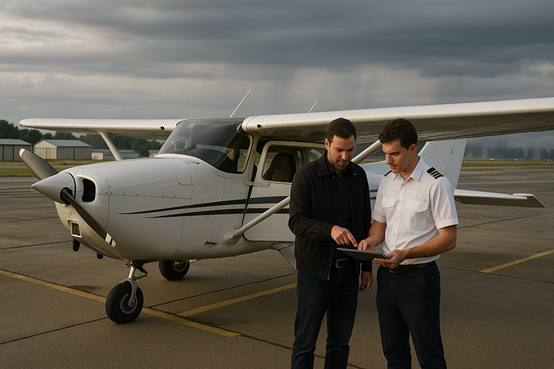
A short cross-country flight is often brief in clock time, but it is still a real transportation flight. The aircraft leaves the immediate airport environment, crosses changing airspace and terrain, and relies on a destination weather picture that may not match conditions at the departure point. A student pilot flying to a nearby towered airport, a private pilot taking passengers to lunch, or an instructor conducting cross-country training can all face the same fundamental question: is the weather good enough not only to depart, but to continue, arrive, and still have an escape plan?
The main challenge is scale. A pilot looking out the hangar door may see good visibility and a comfortable cloud base, while the destination 70 nautical miles away is under a lowering ceiling. A route that looks direct on the chart may pass over higher terrain, sparse landing areas, or a region where surface winds are stronger than expected. A summer morning can look excellent at departure and become unstable by early afternoon. In cooler seasons, a narrow temperature and dew point spread can lead to mist, low stratus, or fog that affects one airport while another remains clear.
Short flights also invite time pressure. Because the trip is close, pilots may think, “I can be there in less than an hour.” That may be true in still air, but a headwind, a reroute, a delayed departure, or a hold for traffic can quickly erode the margin. The decision should not be based on the shortest possible flight time. It should be based on the full operating picture, including preflight preparation, taxi, climb, en route conditions, descent, arrival, and the possibility of diverting.
Start With the Big Weather Picture
Good weather decisions begin with the broad picture before moving into airport-specific details. Pilots sometimes start with the departure METAR, the destination TAF, and a quick glance at a radar image. Those products are valuable, but they do not always explain why the weather is doing what it is doing or where it may go next. The better question is, “What weather system am I flying in, around, or toward?”
For a short cross-country, the big picture includes fronts, pressure systems, cloud cover, precipitation areas, convective potential, winds aloft, and the general trend. A stationary or slow-moving boundary may create localized changes in ceiling and visibility. A cold front may bring shifting winds, turbulence, showers, or thunderstorms. A high-pressure day may be clear and stable, but it may also support morning fog in valleys or haze in certain regions. A warm, moist air mass may feel benign early in the day and become more challenging as heating increases.
This broad review helps the pilot decide whether the flight is operating inside stable, improving, marginal, deteriorating, or uncertain conditions. That classification matters. A flight that begins in marginal but improving weather is very different from one that begins in good conditions but is trending downward along the route. For visual flight rules operations, a lowering ceiling or declining visibility can steadily reduce options. For instrument flight rules operations, convective activity, icing potential, low approach minimums, or destination weather trends can change the risk profile even when the flight is legal and procedurally possible.
Airport Weather Is Only Part of the Decision
Departure and destination weather reports are essential, but they do not describe every mile between the two airports. On a short flight, the pilot may be tempted to treat the route as a straight line between two weather observations. That can be misleading. Weather stations are fixed points. The airplane moves through space where conditions may differ from what is reported at either end.
For VFR pilots, ceilings and visibility along the route are often more important than the destination report alone. A destination reporting good VFR may not help if the route crosses an area of lower ceilings, smoke, rain showers, or rising terrain. Likewise, the departure airport may be visual while the first 20 miles along the route are limited by mist or low clouds. Pilots should look for en route observations from airports near the route, pilot reports when available, radar and satellite trends, graphical forecasts, and any advisories that point to widespread or hazardous conditions.
For IFR pilots, the route picture is also critical. An instrument clearance provides structure and separation services, but it does not remove weather risk. The pilot still needs to evaluate convective weather, icing potential, turbulence, cloud tops, approach options, alternate planning, fuel strategy, and the practical consequences of a missed approach or diversion. A short IFR cross-country can be demanding because there may be little time between departure, climb, setup for arrival, and approach briefing. Weather complexity can compress workload quickly.
Ceilings, Visibility, and the VFR Trap
Many weather decisions for short cross-country flights come down to ceiling, visibility, and terrain clearance. A cloud ceiling is the height of the lowest cloud layer reported as broken or overcast, while visibility describes how far the pilot or observing system can see horizontally. Both can vary significantly across a short route.
The common trap is treating “legal VFR” as the same thing as “a good VFR cross-country day.” Regulations define minimum conditions for operating in different airspace, but practical safety margins depend on pilot experience, terrain, aircraft performance, navigation workload, traffic density, and the availability of alternatives. A student pilot on an early solo cross-country, for example, generally needs more margin than an experienced pilot flying the same route in familiar weather. A route over flat farmland with many airports offers different options than a route over wooded hills, water, or congested terrain.
Marginal VFR conditions deserve special caution. Reduced visibility can make checkpoints harder to identify, increase reliance on instruments and moving maps, and reduce time to see other aircraft or obstacles. Lower ceilings can push a VFR pilot closer to terrain, towers, or busy traffic patterns. In unfamiliar areas, the combination of low ceilings and reduced visibility can gradually remove escape routes without an obvious single moment of danger. The safe decision is often made before takeoff, or at a clearly identified turnback point, rather than after the pilot has already flown into narrowing weather.
Trends Matter More Than a Snapshot
A weather report is a snapshot. A forecast is an educated projection. A safe decision uses both, but gives special attention to the trend. Is visibility improving after morning fog? Are ceilings lifting as daytime heating develops? Are showers building along the route? Is the wind increasing ahead of a front? Is the destination forecast to remain usable through the expected arrival time, or is it near a threshold that would change the plan?
For short flights, timing can be deceptive. A pilot may think a nearby destination reduces exposure, but a delay of 45 minutes can place the flight into a different weather period. A training flight that was planned for midmorning may depart closer to noon. A lunch trip can become an afternoon return in convective weather. A sunset arrival can become more demanding if visibility lowers or if the pilot is less comfortable operating at night.
The practical habit is to look at the trend before deciding, then update the trend before engine start, and again before committing to the route if conditions are changing. This does not mean a pilot must obsess over weather products. It means the pilot should understand whether the plan is gaining margin, losing margin, or depending on uncertainty.
Winds Are a Weather Decision, Not Just a Performance Detail
Wind is sometimes treated as a simple runway selection issue, but on a short cross-country it affects nearly every part of the decision. Surface wind determines crosswind component, taxi and takeoff handling, arrival workload, and the usability of runways at departure, destination, and alternates. Winds aloft affect groundspeed, fuel planning, turbulence, route selection, and the timing of arrival.
A short flight into an unexpected headwind can become a longer flight than planned. That may not be a problem if fuel planning is conservative and daylight is abundant. It can become a problem if the pilot planned tightly, passengers are pressuring the schedule, or weather is forecast to deteriorate. Tailwinds can create their own issues by increasing groundspeed in descent and approach planning, especially for lower-time pilots who are still building cockpit management skills.
Crosswind decisions should be based on more than a single number. The pilot should consider runway width, gust spread, mechanical turbulence from nearby buildings or terrain, aircraft loading, pilot proficiency, and recent practice. A destination may be within aircraft capability but beyond the pilot’s current comfort or training level. That is not a failure of skill. It is a decision-making cue. Good pilots recognize when conditions are not aligned with their current proficiency.
Convective Weather and Short Routes
Thunderstorms and convective buildups require special respect on short cross-country flights. The fact that a destination is nearby does not make convective weather less significant. A storm cell can block a route, affect an airport, produce strong wind shifts, reduce visibility in heavy rain, or create turbulence and hazards well outside the visible precipitation core.
Weather radar and cockpit displays can be useful tools, but they should not be treated as permission to pick through convective weather. Images may have delays, coverage limitations, or interpretation challenges. A pilot should use radar as part of strategic decision-making, not as a close-range steering tool around hazardous weather. When convection is in the area, the safer plan is often to delay, reroute well away from the weather, or cancel.
Short flights can be especially vulnerable to “it is just over there” thinking. A pilot may see sunshine at departure and assume there is enough room to complete the trip before storms build. That assumption needs to be tested against timing, direction of movement, outflow boundaries, destination escape options, and the need for a return flight. The outbound leg may be manageable while the return becomes unreasonable.
IFR Does Not Automatically Solve the Weather Problem
Instrument training gives pilots powerful tools, but IFR capability should not be confused with immunity from weather risk. An IFR pilot can operate in cloud and reduced visibility within the privileges and limitations of the operation, but the decision still depends on aircraft equipment, pilot proficiency, weather hazards, approach availability, fuel reserves, alternate options, and workload.
On a short IFR cross-country, workload can be compressed. After takeoff, the pilot may need to contact departure, intercept a course, manage automation or hand flying, monitor weather, brief an approach, configure the aircraft, and prepare for a missed approach in a short period of time. Add turbulence, icing concerns, convective activity, or a low ceiling at the destination, and a seemingly simple flight can become demanding.
For pilots who are instrument rated but not recently experienced in actual instrument conditions, weather decision-making should include proficiency, not just currency. A pilot may meet the administrative requirements to act as pilot in command but still be rusty in scan, workload management, approach briefing, and missed approach execution. In that case, a short IFR flight in benign actual conditions with an instructor may be excellent training. A solo trip in low weather with passengers may not be a wise first step back.
Personal Minimums Should Fit the Flight, Not Just the Pilot
Personal minimums are practical boundaries a pilot sets above regulatory minimums based on experience, proficiency, aircraft, route, terrain, and mission. They are not static numbers carved in stone. They should mature as a pilot gains skill, and they should become more conservative when the flight includes unfamiliar airports, night conditions, passengers, complex airspace, higher terrain, or changing weather.
For short cross-country flights, personal minimums should address more than takeoff and landing. Useful categories include minimum ceiling and visibility for the route, maximum surface wind and crosswind, minimum fuel on landing, minimum daylight margin, convective weather avoidance, and comfort with destination and alternate airports. The purpose is not to create bureaucracy for the pilot. The purpose is to make decisions before emotion, convenience, or social pressure enters the cockpit.
Instructors can use short cross-country flights to teach personal minimums in a practical way. Instead of asking only, “Is it legal?” the instructor can ask, “What would make this flight comfortable, what would make it marginal, and what would cause us to stop?” That conversation helps students see weather as a decision environment rather than a memorized set of products.
Why This Matters in Real-World Aviation
Weather decision-making matters because pilots rarely encounter weather as a perfect textbook example. Real flights involve incomplete information, time pressure, passenger expectations, schedule goals, and changing conditions. The best pilots are not those who always launch. They are the ones who consistently protect options.
In flight training, short cross-country flights are where students first combine navigation, communication, aircraft control, weather interpretation, and aeronautical decision-making away from the immediate support of the home airport. This is a major developmental step. The student is learning not only how to fly to another airport, but how to think like pilot in command.
For certificated pilots, short flights can be deceptively casual. The route may be familiar, the aircraft may be easy to operate, and the pilot may have completed the trip many times. That familiarity can create confidence, but it can also reduce planning discipline. A good pilot treats each flight as a fresh assessment. Familiar terrain does not make low ceilings higher. Familiar airports do not reduce crosswind. A familiar route does not stop a line of showers from moving faster than expected.
For aviation professionals and instructors, the lesson is cultural as much as technical. Students learn weather judgment by watching how experienced pilots talk about uncertainty. If an instructor treats a marginal forecast as a puzzle to solve at any cost, the student may learn to push. If the instructor explains the margins, discusses alternatives, and makes a conservative decision when appropriate, the student learns that cancellation, delay, or diversion are normal tools of professional airmanship.
How Pilots Should Understand This Topic
Pilots should understand weather decision-making as a continuous process. It begins during planning, continues before departure, remains active in flight, and ends only after the aircraft is parked. A preflight weather briefing is not a one-time ritual. It is the first step in building and updating a mental model.
A useful mental model answers five practical questions. First, what is the weather doing now? Second, what is it expected to do during my departure, en route phase, arrival, and possible return? Third, what are the hazards that could make the flight difficult or unsafe? Fourth, what options do I have if the forecast is wrong? Fifth, what decision points will I use before I am forced into a poor choice?
Decision points are especially valuable on short cross-country flights. A pilot might decide that if the ceiling has not lifted by a certain time, the flight will be delayed. Another pilot might identify a midpoint airport as a weather checkpoint. A VFR pilot may choose a route with several suitable airports nearby rather than the shortest route over poor landing options. An IFR pilot may decide that if the destination weather drops below a personally comfortable level, the flight will go to a better alternate rather than attempt an approach to minimums.
The key is to make these decisions while the aircraft is still on the ground or while the pilot still has time, fuel, and airspace to choose. Waiting until the situation feels urgent is poor strategy. Good weather decisions are usually calm, early, and somewhat boring. That is exactly what makes them effective.
Common Mistakes or Misunderstandings
One common mistake is using a destination forecast as the entire weather plan. A forecast for the destination is important, but the route, timing, alternates, and return plan matter as well. If the destination looks acceptable but the route is deteriorating, the flight may still be a poor choice.
Another mistake is assuming short distance equals low risk. A short cross-country can involve busy airspace, rising terrain, low ceilings, gusty winds, and a narrow fuel or daylight margin. The aircraft does not know the trip was supposed to be easy. It only responds to the conditions it is flown in.
Pilots also misunderstand weather products when they treat them as guarantees. Reports describe observed conditions at a time and place. Forecasts communicate expected conditions and uncertainty. Radar images may not represent what the pilot will encounter at the exact moment of flight. The correct response is not distrust. It is disciplined interpretation.
A more subtle error is failing to plan the return leg. Many short cross-country flights are round trips. The weather that supports the outbound flight may not support the return. Afternoon winds, convective development, lowering ceilings, fog formation, or night conditions can change the risk picture. A pilot who treats the destination as the end of the decision process may find the second leg far more challenging than expected.
Finally, pilots sometimes allow social pressure to influence weather choices. Passengers may not understand why a flight is delayed when the sky looks good overhead. Friends may be waiting at the destination. A rental schedule may create perceived urgency. Professional decision-making requires the pilot to separate convenience from safety. The weather does not negotiate with the calendar.
Practical Example
Consider a private pilot planning a 95-nautical-mile VFR flight from a home airport to a nearby regional airport for lunch. The departure airport is reporting good visibility with scattered clouds. The destination is VFR, but the ceiling has lowered over the past two hours. Several airports along the route show visibility that varies from good to reduced in light rain. The forecast suggests improving conditions later in the afternoon at the destination, but a separate area of showers is moving toward the route from the west.
A rushed decision might focus on the current VFR reports and the short distance. The pilot may think, “It is only about an hour.” A better decision process looks at the trend and the options. The ceiling at the destination is moving downward, the route has variable visibility, and showers are approaching. The pilot asks whether the route offers good diversion airports, whether terrain or towers will reduce comfort if ceilings drop, whether the return flight will occur before or after showers affect the area, and whether passengers will pressure the schedule.
The pilot identifies two reasonable choices. One is to delay departure until the trend becomes clearer and the showers either pass or weaken. The other is to cancel the lunch flight and use the time for local practice where the aircraft can remain close to the home airport and avoid the uncertain route. If the pilot still elects to depart, the plan includes a firm turnback point, a nearby diversion airport, conservative fuel planning, and a commitment not to continue into lowering ceilings or reduced visibility.
The teaching value of this example is that no single weather item makes the decision. The risk emerges from the combination of short distance, changing ceilings, route variability, passenger expectations, and a return-leg requirement. That is real-world weather decision-making.
Best Practices for Pilots
The best weather decisions are built from habits that are simple enough to use consistently. Pilots should start with a full route-based picture rather than a departure-and-destination-only view. They should evaluate trends, not just current conditions. They should compare weather to personal minimums and current proficiency. They should preserve options by planning alternates, fuel margin, and decision points.
A short list can help organize the process without turning flying into a paperwork exercise:
- Review the broad weather pattern before focusing on individual airport reports.
- Compare current observations with forecasts to understand whether conditions are improving, stable, or deteriorating.
- Evaluate the route, terrain, airspace, and available diversion airports, not just the destination.
- Set personal minimums for the specific flight, including ceilings, visibility, winds, fuel, daylight, and passenger considerations.
- Identify clear no-go, delay, turnback, and divert triggers before departure.
- Update the weather picture before engine start and remain willing to change the plan in flight.
For student pilots, the most important best practice is to discuss the decision out loud with an instructor. Explain what you see, what concerns you, what you would do if the forecast changes, and where you would divert. This develops judgment far better than simply asking whether the flight is approved.
For instructors, the best practice is to model conservative, transparent reasoning. Students should hear experienced pilots say things such as, “This is legal, but it does not leave enough margin for today’s training objective,” or “The route is acceptable now, but the trend is not strong enough for a passenger flight.” That kind of language teaches the difference between minimum compliance and sound airmanship.
Building a Weather Decision Routine
A consistent routine reduces the chance of missing something important. The routine does not need to be complex. It should move from strategic to tactical. Start with the regional weather setup. Then examine current observations and forecasts for the departure airport, destination, route, and alternates. Review hazards such as convection, icing, turbulence, low ceilings, reduced visibility, and strong winds. Then decide whether the flight aligns with the pilot’s proficiency, aircraft capability, mission, and available options.
Once the decision is made, the pilot should still monitor for change. Weather is dynamic. If the flight is delayed, update the plan. If the route changes, update the weather assessment. If passengers are added, consider whether the risk tolerance changes. If the return flight will occur later than planned, reassess the second leg as a separate flight.
This routine is especially helpful for local-area cross-country flights that pilots repeat often. Repetition can breed shortcuts. A routine keeps the pilot honest. The goal is not to make every flight difficult. The goal is to make the decision process resilient enough that a familiar route does not hide an unfamiliar hazard.
Frequently Asked Questions
Is a short cross-country flight safer because it is close to home?
Not automatically. A shorter route may reduce exposure time, but it can still include low ceilings, poor visibility, gusty winds, terrain, busy airspace, or limited diversion options. The quality of the weather and the availability of good choices matter more than distance alone.
What weather information should pilots review before a short cross-country?
Pilots should review the broad weather pattern, current airport observations, forecasts, route conditions, winds aloft, radar and satellite trends when relevant, pilot reports when available, and any weather advisories that may affect the flight. The key is to evaluate the entire route and timing, not only the departure and destination airports.
How conservative should student pilots be with weather?
Student pilots should use conservative limits that match their training stage, instructor guidance, route familiarity, and aircraft operation. Early cross-country flights should preserve generous margins for ceiling, visibility, wind, daylight, and diversion options. The goal is to build judgment gradually, not to test the edge of capability.
Does an instrument rating make short cross-country weather less risky?
An instrument rating provides important capability, but it does not eliminate weather risk. IFR pilots still need to consider proficiency, aircraft equipment, convective weather, icing potential, turbulence, approach options, alternate planning, fuel, and workload. A short IFR flight can become busy very quickly.
When should a pilot delay instead of cancel?
Delay can be a good option when the weather trend is clearly improving, the pilot has schedule flexibility, and the later flight still leaves adequate daylight, fuel, and alternate options. Cancellation is often the better choice when the trend is uncertain, hazards are increasing, or pressure to complete the flight could affect judgment.
What is the best way to improve weather decision-making skill?
The best improvement comes from repeated, structured practice. Before flights, compare forecasts to actual observations and discuss decisions with instructors or experienced pilots. After flights, review what the weather actually did. Over time, this builds practical judgment and a more accurate sense of personal minimums.
Key Takeaways
- Short cross-country flights deserve full route-based weather planning, including trends, alternates, winds, ceilings, visibility, and return-leg conditions.
- Legal weather minimums do not automatically provide a comfortable or safe margin for every pilot, aircraft, route, or training objective.
- Strong weather decisions are made early, updated often, and supported by personal minimums, clear decision points, and a willingness to delay, divert, or cancel.