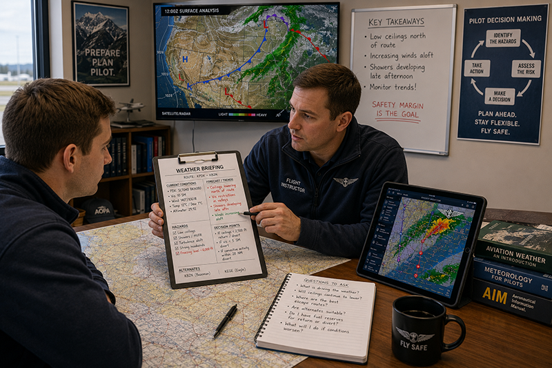
Weather information is one of the most valuable decision-making tools available to pilots, but not every line in a briefing deserves the same level of attention. Some weather details are routine background information. Others are early warnings that the flight may require a different altitude, a different route, a delayed departure, an alternate plan, or a firm no-go decision. The skill is not simply reading aviation weather products. The skill is recognizing which weather information deserves extra attention before it becomes an operational problem.
For student pilots, this is often where weather training becomes real. A METAR may look acceptable, a TAF may appear legal for the planned operation, and the radar picture may seem quiet. Yet a closer look at trends, nearby reports, ceilings, visibility restrictions, convective potential, winds aloft, freezing levels, or pilot reports may reveal a much more complicated picture. For experienced pilots and flight instructors, the same principle applies: safe weather decision-making depends on understanding the meaning behind the data, not just collecting more data.
This article explains how pilots can identify weather information that deserves extra scrutiny during preflight planning and in-flight monitoring. It focuses on practical aviation use: what to slow down and study, what to compare across products, what common traps to avoid, and how to build a more disciplined weather review process without turning every flight into an exercise in overanalysis.
What Makes Weather Information Worth Extra Attention?
Weather information deserves extra attention when it affects the margin between the planned flight and the conditions the pilot, aircraft, route, or operation can safely handle. That margin may involve visibility, ceiling, wind, turbulence, icing, convective weather, terrain clearance, fuel planning, alternate options, or pilot workload. A weather detail becomes important when it changes the practical risk of the flight, even if it does not automatically make the flight illegal or impossible.
One of the most useful habits a pilot can develop is to separate weather data into two categories. The first category is descriptive information: what is happening or forecast to happen. The second category is operational meaning: what that information does to the flight. A surface observation showing a lowering ceiling is not just a ceiling number. It may affect departure options, pattern work, VFR cloud clearance, an instrument approach decision, or the availability of nearby airports. Winds aloft are not just numbers on a chart. They may affect groundspeed, fuel reserves, turbulence exposure, and whether a planned altitude still makes sense.
Extra attention is also warranted when weather information is inconsistent. If a TAF suggests improving conditions but nearby METARs show a deteriorating trend, the discrepancy should not be ignored. If radar imagery looks benign but satellite imagery shows developing cloud tops near the route, the pilot should ask whether the available products are showing different stages of the same weather process. If an automated observation reports acceptable visibility but human reports, PIREPs, or nearby airports suggest localized restrictions, the pilot should investigate rather than accept the most convenient answer.
The goal is not to find a reason to cancel every flight. The goal is to identify the weather factors that require a conscious decision. When a pilot recognizes the items that deserve extra attention, the go/no-go decision becomes less emotional and more structured. The pilot can ask better questions, brief passengers more honestly, coordinate with instructors or dispatchers more effectively, and choose conservative options earlier.
Weather Products That Often Contain High-Value Clues
Aviation weather is intentionally presented through multiple products because no single product tells the whole story. Observations, forecasts, advisories, radar, satellite, graphical tools, and pilot reports all contribute different information. The most important details often emerge when pilots compare several products and look for agreement, disagreement, and trends.
METARs and SPECI reports deserve close review because they describe observed conditions at specific reporting locations. Pilots should look beyond the current ceiling and visibility. The direction of change matters. A sequence of observations may show falling ceilings, reduced visibility, gusting winds, temperature and dew point convergence, pressure changes, or the arrival of precipitation. A single observation is a snapshot. A sequence is a story.
TAFs deserve extra attention when they include temporary conditions, probability groups, significant wind shifts, low ceilings, restricted visibility, thunderstorms, or timing that coincides with departure, arrival, or alternate planning. A forecast that looks acceptable for most of the day may still contain a short window of challenging conditions at exactly the wrong time. Pilots should pay close attention to when forecast changes are expected, how sharp the transition may be, and whether the flight plan depends on a forecast improvement actually occurring.
AIRMETs, SIGMETs, and convective SIGMETs are especially important because they call attention to weather hazards that may affect broad areas. These products should not be treated as distant background notices. If the route, altitude, or time period intersects the affected area, the pilot should evaluate what the hazard means for the specific aircraft and operation. Turbulence, icing, instrument meteorological conditions, mountain obscuration, and convective activity can each change the risk profile of a flight in different ways.
PIREPs can be especially valuable because they describe what pilots have actually encountered. A PIREP may confirm forecast turbulence, identify cloud tops or bases, report icing, describe visibility, or indicate that conditions are better or worse than expected. Like any weather information, PIREPs must be interpreted carefully. They are location-specific, time-sensitive, and aircraft-specific. A turbulence report from a larger aircraft does not always translate directly to a light training aircraft, and a smooth ride reported an hour ago may not reflect current conditions. Still, pilot reports often provide operational color that forecasts alone cannot provide.
Radar and satellite imagery can reveal developing patterns, but they require careful interpretation. Radar can help pilots identify precipitation location and intensity, but cockpit or internet weather displays may not represent real-time conditions at the aircraft’s exact position. Satellite imagery can show cloud cover, cloud movement, and sometimes the development of deeper clouds. Neither tool should be used as a single source for thunderstorm avoidance or tactical maneuvering without understanding its limitations.
Winds aloft forecasts are another source of high-value information. Strong headwinds can affect fuel planning and arrival reserves. Tailwinds may be helpful, but they can also create descent planning issues or mask the impact of a return leg into wind. Wind shear, gusty surface winds, or large differences between surface winds and winds aloft may indicate mechanical turbulence, low-level turbulence, or a more demanding approach and landing environment. For training flights, winds that are technically within limits may still exceed the student’s current proficiency or lesson objectives.
Why This Matters in Real-World Aviation
Weather judgment affects every phase of flight. During preflight planning, it shapes route selection, altitude choice, fuel planning, passenger briefing, and alternate strategy. During taxi and departure, it influences whether the pilot continues, delays, or returns. En route, it affects diversion decisions, communication with air traffic control, and workload management. Near the destination, it can determine whether an approach, pattern entry, or landing attempt remains reasonable.
In real-world flying, weather risk often increases gradually. A pilot may not encounter one dramatic decision point. Instead, small details accumulate: a lowering ceiling, a stronger-than-forecast headwind, a growing line of precipitation, a PIREP of moderate turbulence near the planned altitude, or visibility that remains legal but increasingly marginal. Each item may seem manageable alone. Together, they can erode the safety margin and increase workload.
This is especially important in training environments. A student pilot may focus on whether the weather is legal for the lesson, while the instructor must also consider the instructional value, the student’s workload, the aircraft’s performance, the availability of safe practice areas, and the ability to return if conditions change. A day with gusty crosswinds may be ideal for an advanced crosswind lesson but unsuitable for a first solo. A low but legal VFR ceiling may allow a local flight in some circumstances, yet it may not support the intended training objective or provide enough flexibility if the area becomes congested or weather lowers further.
For instrument pilots, the same concept applies in a different way. Legal minimums do not automatically equal practical comfort or safety. A forecast that includes ceilings near approach minimums, convective weather near the route, or possible icing at planned altitudes deserves a deeper review. The pilot should consider proficiency, recency, aircraft equipment, missed approach options, fuel reserves, alternate airports, terrain, and the likelihood that conditions will change before arrival.
For aviation professionals, recognizing weather information that deserves extra attention is also a communication skill. Dispatchers, instructors, charter pilots, maintenance teams, airport operators, and flight school managers all benefit when weather concerns are expressed clearly. Instead of saying, “The weather looks bad,” a more useful statement is, “The current trend shows ceilings lowering along the return route, and the TAF includes temporary visibility restrictions near our planned arrival time.” Specific weather concerns lead to better operational decisions.
How Pilots Should Understand Weather Information Practically
Weather analysis should begin with the big picture and then narrow toward the route, altitude, airport, and time of flight. A pilot who starts with only the departure METAR and destination TAF may miss the larger pattern driving the weather. The big picture includes fronts, pressure systems, moisture, stability, terrain effects, and broad areas of precipitation or convective potential. Even a basic understanding of the larger setup helps the pilot interpret individual reports more intelligently.
After the big picture, the pilot should focus on timing. Weather is rarely static. A route that is reasonable at 0900 local may be unsuitable by early afternoon if convection is expected to develop. A morning fog layer may improve with heating, but a forecast improvement should not be treated as a guarantee. A cold front may bring wind shifts, turbulence, lowering ceilings, or precipitation that affects one part of the route before another. Timing deserves extra attention whenever the flight depends on being ahead of, behind, or between weather features.
Location matters just as much as timing. Weather products are often valid for areas, reporting points, or forecast zones, but aircraft fly through specific airspace. Terrain, water, urban heat, valleys, coastal boundaries, and local wind patterns can produce conditions that differ from nearby reporting stations. A nearby airport report may be useful, but it may not describe conditions over a mountain pass, along a shoreline, or in an unreported rural area.
Altitude is another practical filter. A surface report may show manageable conditions while winds, turbulence, icing potential, or cloud layers aloft create a different set of concerns. Conversely, a low cloud deck may be a major issue for VFR operations but less restrictive for an appropriately equipped and proficient instrument flight, provided all other risks are addressed. Pilots should avoid treating weather as a two-dimensional map. The vertical structure of the atmosphere matters.
Trend analysis is often where pilots find the most useful clues. A current METAR showing 5 miles visibility and a 2,500-foot ceiling may appear acceptable, but if the previous reports showed 10 miles, then 7 miles, then 5 miles, with a steadily lowering ceiling, the trend deserves attention. Similarly, a TAF that improves later in the day should be compared with actual observations. If reality is lagging behind the forecast, the pilot should be cautious about planning around the forecast improvement.
Finally, pilots should connect weather information to personal and operational minimums. Personal minimums are not a substitute for regulations or aircraft limitations, but they are a practical tool for managing risk. A pilot may be legally qualified to operate in certain conditions while still deciding that the combination of weather, fatigue, terrain, aircraft equipment, passenger pressure, or proficiency does not support the flight. Weather information deserves extra attention when it approaches the pilot’s personal minimums or when multiple moderate risk factors appear together.
Weather Details That Should Slow the Pilot Down
Some weather cues should cause a pilot to pause and investigate further. They do not automatically mean the flight cannot be made, but they should not be skimmed.
Lowering ceilings are one of the most common cues. For VFR pilots, lowering ceilings reduce route flexibility, terrain clearance options, and emergency landing choices. For instrument pilots, they may affect departure procedures, approach planning, alternate considerations, and missed approach strategy. A ceiling that is adequate now may not be adequate later if the trend continues.
Visibility restrictions also deserve close attention, especially when the cause is fog, mist, haze, smoke, precipitation, blowing snow, or dust. Visibility can vary significantly over short distances, and forward visibility in flight may feel different from a surface report. Student pilots should be taught that legal visibility is not the same as comfortable navigation visibility, especially in unfamiliar areas or near terrain.
Thunderstorm potential requires respect even when storms have not yet formed. Pilots should pay attention to convective forecasts, unstable air masses, building cumulus, rapidly changing radar returns, and forecast timing. The absence of a storm at departure does not guarantee an uneventful arrival if the flight crosses an area where development is expected. Convective weather can bring severe turbulence, lightning, hail, strong downdrafts, heavy precipitation, and rapid wind shifts. Avoidance planning should begin early, not after the cockpit display becomes crowded with returns.
Icing information deserves special care because it depends on temperature, moisture, altitude, cloud structure, and aircraft capability. Pilots should evaluate freezing levels, cloud layers, precipitation, reports of icing, and whether the aircraft is approved and equipped for the expected conditions. Even when icing is not forecast, temperatures near freezing in visible moisture should prompt careful review. For aircraft not approved for flight into known icing conditions, icing potential can become a decisive no-go factor.
Turbulence information should be considered in relation to aircraft type, passenger tolerance, pilot proficiency, terrain, and mission. Light turbulence may be mostly a comfort issue in one operation but a training limitation in another. Moderate or greater turbulence forecasts or reports may affect altitude selection, route choice, and whether the flight should proceed. Mountain wave, low-level mechanical turbulence, convective turbulence, and turbulence near frontal boundaries each require different thinking.
Wind deserves more attention than many pilots give it. Surface wind affects takeoff, landing, taxi, crosswind control, and runway selection. Winds aloft affect groundspeed, fuel burn, drift correction, and ride quality. Gust spreads can increase workload during approach and landing. Wind shifts can signal frontal passage or changing local conditions. A crosswind component that is acceptable for the airplane may still be inappropriate for a student’s current ability or a pilot’s recent experience.
Common Mistakes and Misunderstandings
One common mistake is treating weather briefing as a box to check rather than a decision process. A pilot may gather plenty of information but fail to ask what it means. The value of weather information is not in the number of products reviewed. It is in the quality of the judgment that follows.
Another misunderstanding is relying too heavily on a single product. A destination TAF is useful, but it is not the whole weather picture. A current METAR is useful, but it may not represent conditions along the route. A radar image is useful, but it may not show future development or non-precipitation hazards. A weather app can be convenient, but convenience should not replace interpretation.
Pilots also sometimes focus on legality while neglecting margins. A VFR flight may meet minimum weather requirements but still be a poor choice due to low ceilings, reduced visibility, terrain, unfamiliar airspace, or limited diversion options. An instrument flight may be legal but still demanding if the pilot is not proficient, the weather is near minimums, or alternate options are weak. Legal does not automatically mean wise.
Confirmation bias is another risk. Pilots naturally want the weather to support the plan. That can lead to emphasizing favorable reports and minimizing unfavorable ones. A disciplined pilot looks for disconfirming information. If one product suggests the flight is reasonable and another raises concern, the concern deserves investigation. The safest pilots are often the ones most willing to challenge their own first impression.
A related mistake is underestimating weather changes during relatively short flights. Many pilots associate weather deterioration with long cross-country operations, but a local training flight can also be affected by fog development, gust fronts, lowering ceilings, sea breeze changes, or convective buildup. A short flight is not automatically a low-weather-risk flight.
Finally, pilots sometimes fail to define decision points before departure. If the weather is marginal or changing, it is helpful to decide in advance what conditions will trigger a delay, return, diversion, altitude change, or route change. Without preplanned decision points, pilots may continue gradually into worse conditions simply because no single moment feels decisive.
Practical Example: A VFR Cross-Country With Subtle Warning Signs
Consider a private pilot planning a daytime VFR cross-country in a single-engine training aircraft. The departure airport is reporting good visibility and a scattered layer. The destination is forecast to remain VFR. At first glance, the flight appears straightforward. The pilot has flown the route before, the airplane is familiar, and the direct route avoids complex airspace.
A closer review reveals several items that deserve extra attention. Along the route, a few intermediate airports are reporting ceilings lower than both the departure and destination. The temperature and dew point are close at one reporting station in a river valley. Winds aloft show a stronger headwind than expected, which will lengthen the flight and reduce fuel margin unless the pilot adjusts the plan. A recent PIREP reports light to moderate turbulence near the planned cruising altitude. The forecast discussion and graphical products suggest that a weak boundary may move through the area later in the day, with ceilings lowering behind it.
None of these details automatically cancels the flight. Together, however, they change the planning conversation. The pilot may choose a route with more airports nearby, carry additional fuel if appropriate and within weight limits, depart earlier, select a lower turbulence altitude if conditions permit, or delay until the weather trend becomes clearer. The pilot may also establish firm decision points: turn around if ceilings along the route fall below a personal minimum, divert if groundspeed drops below a planned threshold, or remain local instead of continuing if turbulence is stronger than expected.
This example illustrates the central idea. The most important weather information is not always dramatic. Often, it is a cluster of ordinary details that reduce flexibility. Recognizing those details early gives the pilot more options and less pressure.
Best Practices for Pilots Reviewing Weather
A good weather review is structured but not mechanical. Pilots should develop a repeatable flow that starts broadly, narrows to the route and airports, and ends with operational decisions. The process should include both preflight planning and a plan for updating weather in flight when appropriate.
One effective method is to begin with the overall weather pattern, then review current observations, forecasts, advisories, radar and satellite imagery, winds aloft, PIREPs, and airport-specific considerations. After reviewing the products, the pilot should summarize the major threats in plain language. For example: “The main concerns are lowering ceilings north of the route, a stronger headwind than planned, and possible turbulence near the ridge line.” If the pilot cannot summarize the concerns clearly, the briefing may not yet be complete.
Pilots should also compare forecast conditions against actual observations. Forecasts are essential, but actual trends show whether the atmosphere is behaving as expected. If a forecast calls for improvement and the observations support that trend, confidence may increase. If the observations do not support the forecast, caution is appropriate. This does not mean the forecast is wrong, but it does mean the pilot should avoid depending on an improvement that has not yet appeared.
Another best practice is to brief alternatives before they are needed. A diversion airport is more useful if the pilot has already reviewed its runway layout, weather, fuel availability if relevant, terrain, communications, and approach options if operating IFR. In marginal weather, the question should not be, “Where could I go if this gets worse?” The better question is, “At what point will I go there, and what will the arrival look like?”
For instructors, weather review should be taught as scenario-based decision-making, not memorization. Students should learn to explain why a weather item matters. Instead of simply identifying a TAF line, the student should describe how that forecast affects the lesson. Instead of reading a wind report, the student should consider runway selection, crosswind correction, aircraft performance, and whether the conditions match the training objective.
The following habits can improve weather decision-making without making the process unnecessarily complicated:
- Review trends, not just current conditions.
- Compare multiple weather products for agreement and conflict.
- Identify the top two or three weather threats before departure.
- Connect each weather concern to a specific operational decision.
- Set conservative decision points before workload increases.
- Update the plan when actual conditions differ from expectations.
The best pilots are not those who can recite the most weather products. They are the pilots who can turn weather information into timely, conservative, and well-explained decisions.
How Flight Instructors Can Teach This Skill
Flight instructors have an important role in helping students recognize weather information that deserves extra attention. Early in training, students may look for simple answers: Is it VFR? Is the wind within limits? Is the lesson still on? Those questions are understandable, but they are only the beginning. Instructors should gradually guide students toward more complete thinking.
A useful instructional technique is to ask students to identify the “weather trap” in a briefing. The trap may be a temporary forecast condition, a developing visibility restriction, an unfavorable wind trend, a lowering ceiling along the return route, or a PIREP that changes altitude planning. This encourages students to look for operational meaning rather than simply reading reports aloud.
Instructors can also use post-flight debriefing to compare forecast and actual conditions. If the wind was stronger than expected, discuss how it affected groundspeed, pattern work, and workload. If turbulence was reported and encountered, compare the report with the actual ride. If the ceiling lowered sooner than expected, discuss what cues were visible before the change became obvious. This helps students develop weather intuition based on disciplined observation rather than guesswork.
For instrument students, instructors should emphasize that weather review includes both procedural and judgment components. The student may be able to brief an approach correctly, but the larger question is whether the overall weather environment supports the flight. Ceilings near minimums, convective activity near the route, icing potential, or weak alternate options should prompt a broader discussion about risk management.
In-Flight Weather Monitoring
Preflight weather analysis is only the first part of the process. Weather can change, forecasts can be imperfect, and conditions may vary across a route. Pilots should remain alert to signs that actual weather is diverging from expectations. Those signs may include an unforecast cloud layer, worsening visibility, stronger turbulence, unexpected precipitation, changing winds, or radio reports from other aircraft.
In-flight weather tools can be helpful, but they must be used with judgment. Cockpit displays, datalink weather, ATC information, onboard radar in equipped aircraft, and pilot reports can all support better decisions. However, pilots should understand the limitations of each tool and avoid using strategic weather information as though it were precise tactical guidance. This is especially important near convective weather, where conditions can change quickly and avoidance margins matter.
Visual cues remain important. Building cumulus, virga, lowering cloud bases, obscured terrain, rapidly changing visibility, blowing dust, or darkening precipitation shafts can all indicate changing weather. Pilots should not ignore what they see out the windshield because a display appears more reassuring.
When weather begins to deteriorate, early action is usually safer than waiting. A 20-degree course change, a climb or descent, a return to the departure airport, or a diversion to a nearby suitable airport is easier to manage while fuel, visibility, altitude, and workload margins remain healthy. Delayed decisions often become harder decisions.
Frequently Asked Questions
What weather information should pilots review first?
Pilots should begin with the big weather picture, then narrow the review to current observations, forecasts, advisories, radar, satellite, winds aloft, PIREPs, and airport-specific details. Starting broadly helps the pilot understand why individual reports look the way they do.
Is a legal weather minimum enough to make a flight safe?
No. Legal minimums are only one part of the decision. Pilots should also consider proficiency, aircraft capability, terrain, route options, fuel planning, passenger factors, workload, and whether the weather is improving, stable, or deteriorating.
Why are trends so important in aviation weather?
Trends show whether conditions are improving, deteriorating, or remaining stable. A single report may look acceptable, but a sequence of reports can reveal lowering ceilings, reduced visibility, increasing winds, or other changes that affect the flight.
How should pilots use PIREPs?
PIREPs should be used as real-world reports from other aircraft, but they must be interpreted in context. Consider the report’s age, location, altitude, aircraft type, and whether the conditions are likely to apply to your route and operation.
What should a pilot do when weather products disagree?
Disagreement between products should prompt further review, not selective acceptance of the most favorable information. Compare observations, forecasts, advisories, radar, satellite, and pilot reports, then make a conservative decision based on the uncertainty.
When should a pilot delay or cancel because of weather?
A pilot should delay or cancel when weather conditions or uncertainty reduce safety margins beyond what is appropriate for the pilot, aircraft, route, and mission. If the plan depends on optimistic assumptions or leaves few good alternatives, delaying is often the more professional decision.
Key Takeaways
- Weather information deserves extra attention when it affects margins, timing, route flexibility, altitude choice, fuel planning, or pilot workload.
- Look for trends and conflicts between products. Deteriorating conditions, inconsistent forecasts, and unfavorable PIREPs should slow the decision process down.
- Good weather judgment connects data to action: delay, depart earlier, change altitude, adjust the route, choose an alternate, remain local, or cancel when appropriate.