
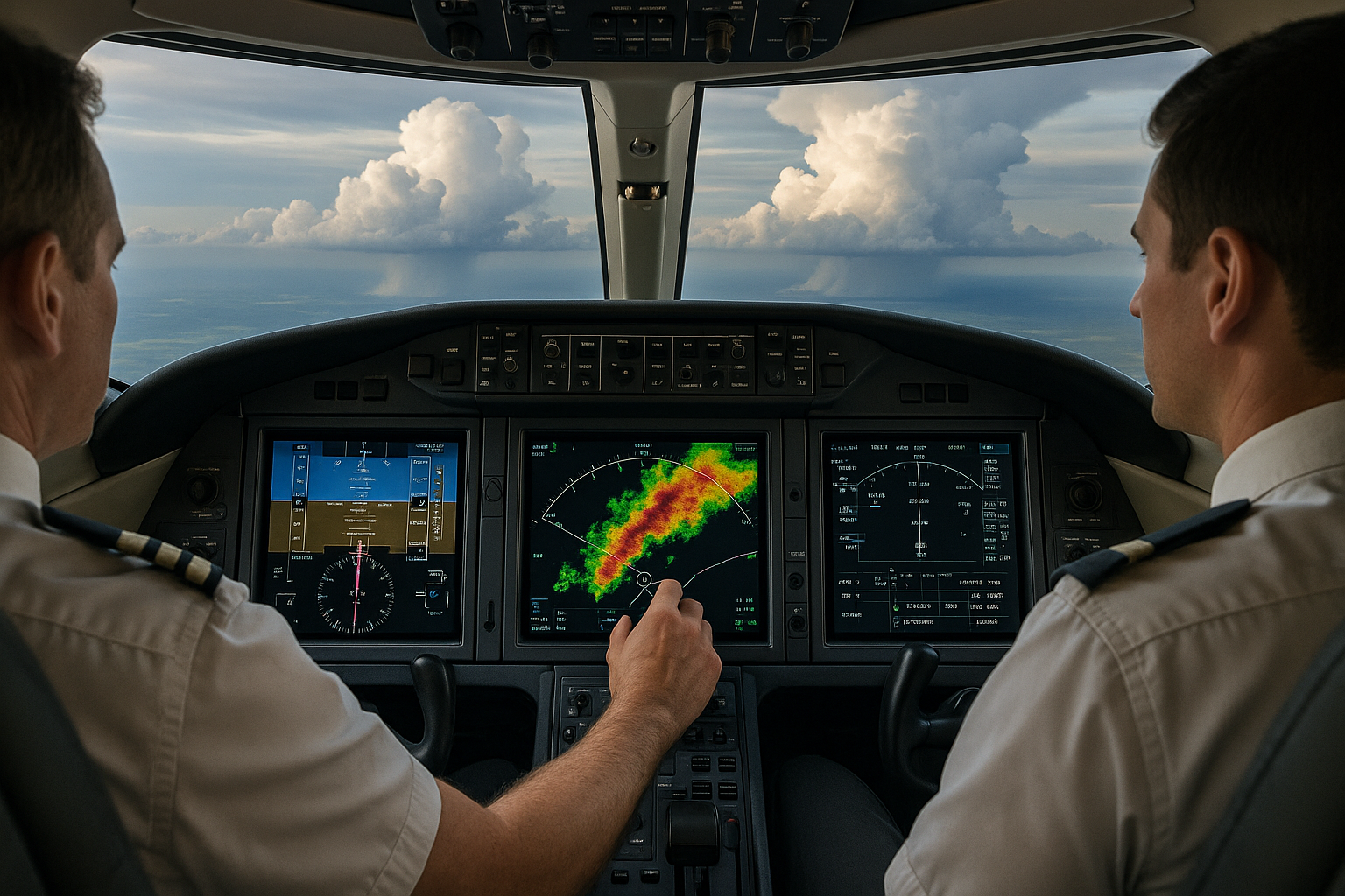
Weather radar systems are a core tool for in-flight weather awareness, but pilots often misinterpret what the display is telling them. Accurate radar interpretation requires understanding how the equipment forms and presents echoes, what environmental effects alter returns, and how human factors shape decisions. This article explains common errors that degrade situational awareness and offers practical training, operational, and safety-oriented guidance for pilots, instructors, and avionics technicians.
Read on to learn how radar beam geometry, attenuation, system controls, maintenance, and cognitive traps lead to predictable errors. The goal is not to replace manufacturer manuals or airworthiness guidance but to build operational judgment you can apply in flight planning, training flights, and real-world weather encounters.
How Weather Radar Systems Work: A Practical Overview
At a practical level, onboard weather radar transmits microwave energy and receives the portion scattered back by hydrometeors, such as raindrops, hail, or snow. The display shows relative reflected energy, often using color coding to represent increasing echo intensity. Pilots should think of the display as a map of returned energy, not a direct map of hazard severity. Return strength depends on the type, size, concentration, and distribution of hydrometeors as well as the radar beam geometry and settings.
Key operational concepts every pilot should know include beam height and tilt, range scale, gain or sensitivity, and the effect of attenuation. Beam height increases with distance and altitude above the radar, so distant echoes may represent very different altitudes than nearby echoes. Tilt controls the elevation of the beam relative to the aircraft and is the most effective cockpit control a pilot uses to reveal lower-level structure beneath a storm or to avoid ground clutter.
Most modern systems include modes that highlight turbulence or forecast storm tops, but those features differ by manufacturer and are complementary to, not replacements for, pilot judgment. Weather radar provides a tactical, short-range view of precipitation structure and intensity; it does not show wind shear, icing potential, or the full 3D structure of a convective cell without additional information or training.
Why This Matters in Real-World Aviation
Poor radar interpretation contributes to unsafe weather encounters when pilots either overtrust or dismiss the display. Overreliance can produce a false sense of security, leading to flight into severe turbulence, hail, or embedded convective activity. Dismissing the radar because of clutter, noise, or unexpected colors can cause missed opportunities to avoid hazards. Training, preflight planning, and understanding the radar's operational limits directly influence safety margins and go/no-go decisions.
From a flight instructor's perspective, weather radar training is an opportunity to teach systems knowledge and decision-making simultaneously. For commercial and corporate operations, it contributes to standard operating procedures that combine radar imagery with pilot reports, ATIS, dispatch briefings, and airborne weather data to form a consistent operational picture.
How Pilots Should Understand Weather Radar Data
Adopt a mental model that treats the radar image as a representation of reflected energy with several modifiers. When looking at the screen, ask: what is the beam sampling at this range? Is attenuation masking echoes behind heavy precipitation? Has tilt or range selection biased the picture? Are there signs of low-level returns that could indicate wind-driven convective buildups?
Use these practical interpretations:
Color does not equal hazard level one-to-one. Color is a function of returned signal intensity. For example, strong returns can be caused by intense rain or hail; weak returns might still hide severe downdrafts or turbulence between the radar and surface.
Shadowing is common. Heavy precipitation near the aircraft can attenuate the beam and mask activity behind it. That can make the radar understate the hazards beyond a line of heavy returns.
Range scale matters. A broad range scale compresses detail and hides small but intense cores. A short range scale can exaggerate the lateral extent of an echo relative to the aircraft's position.
Tilt adjustments are the single most important immediate action to disambiguate whether strong echoes are low-level convective cores or higher-level stratiform returns.
Common Errors and Misunderstandings
This section describes the errors pilots and operators most frequently encounter. These errors are a mix of system limitations and human factors that affect interpretation and decision-making.
1. Misreading Color as Absolute Severity
Pilots often assume that green is safe, yellow is caution, and red is dangerous. While convenient, this simplification can be misleading. Color scales are relative and can vary by manufacturer, configuration, and user settings. A green area with strong vertical shear or embedded convective cells can present serious turbulence despite a comparatively modest return strength. Conversely, very intense returns over higher levels might look alarming but be above cruising altitude and less relevant to the current flight path.
2. Failing to Account for Attenuation and Beam Blocking
Attenuation occurs when heavy precipitation absorbs and scatters radar energy, reducing signal strength behind the precipitation. This creates shadow zones where echoes are weak or absent despite significant weather beyond. Beam blocking can happen when terrain, structure, or the aircraft itself intercepts the beam, producing false gaps or ground clutter. The operational effect is underestimation of hazards beyond heavy echo regions.
3. Improper Use of Tilt and Range
Not adjusting tilt or using inappropriate range settings is a persistent pilot error. If tilt is too high, the radar samples storm tops and misses low-level activity. If tilt is too low, ground returns and sea clutter can dominate the display. Range selection also alters the view; pilots should zoom to see the structure of the cell they intend to avoid and then widen for strategic routing, not remain fixed on one scale.
4. Overreliance on Onboard Radar Alone
Weather radar is an excellent tactical tool, but it provides limited strategic context. Exclusive dependence on the onboard display can lead to late deviations or underestimating the extent of convective lines. Combine radar with preflight briefings, ATC weather updates, pilot reports, and airborne weather services where available to form a fuller picture.
5. Ignoring System Limitations and Mode Differences
Different radar modes—such as turbulence detection, vertical profile, or ground mapping—change how returns are processed and displayed. Pilots who do not understand mode-specific limitations can misinterpret artifacts as real weather or miss relevant hazards entirely. Training should include hands-on practice in all modes the aircraft supports.
6. Cognitive Biases and Expectation Errors
Human factors play a major role. Confirmation bias causes pilots to discount radar echoes that conflict with expectations. Plan continuation bias can push pilots to accept deteriorating radar images to maintain schedule. Stress and workload reduce the time available for correct tilt and range adjustments. Recognizing these tendencies is the first step in countering them.
7. Misinterpreting Non-Precipitation Returns
Weather radar will sometimes display non-weather echoes: ground clutter, birds, volcanic ash, or even sea clutter. These returns can be mistaken for precipitation. Being able to recognize patterns that indicate non-meteorological echoes—such as returns closely hugging coastlines, uniform shallow bands, or returns that disappear with a small tilt change—improves decision-making.
Practical Example: A Realistic Flight Scenario
Imagine a turboprop on an IFR cross-country at 12,000 ft with a convective line ahead. The pilot, using weather radar, sees a band of yellow and red returns 30 miles ahead. Without adjusting tilt, the pilot interprets the band as a continuous threat and plans a significant diversion. By reducing range to examine the band and lowering tilt, the pilot reveals that the intense red returns are concentrated at mid-levels and that a narrow corridor of lower returns exists at low levels to the right. A timely call to ATC and a slight routing change allows the flight to transit through the corridor where echoes are weaker at the aircraft's altitude. The crew also supplements airborne radar imagery with ATIS and a PIREP from a nearby aircraft, confirming turbulence reports near the high returns and avoiding the strongest cores.
Two operational lessons emerge: first, the importance of tilt and range manipulation to understand the vertical distribution of echoes; second, the value of cross-referencing other sources before committing to a course of action.
Best Practices for Pilots and Instructors
Good habits minimize radar interpretation errors and improve safety margins. Use these practical recommendations during training and operations.
Practice tilt and range changes on training flights until adjustments become procedural and quick.
Always cross-check onboard radar with external sources when available, including ATC, pilot reports, and text-based products during preflight planning.
When in doubt, give convective echoes a wide berth. Tactical escapes are often shorter and safer than attempting penetration or close transits.
Brief likely radar interpretations and go/no-go criteria before departure, especially on flights where convective weather is possible.
Understand how maintenance status affects reliability. A misaligned antenna, degraded transmitter power, or a faulty processor can change echo presentation; report suspect performance immediately.
Include radar interpretation in recurrent training and scenario-based instruction that integrates human factors and decision-making under time pressure.
Training and Procedural Recommendations
Integrate radar training into broader weather education. Classroom time should cover beam geometry, attenuation phenomena, and display limitations. Simulators and live-cockpit training provide valuable practice for tilt manipulation, range selection, and decision-making. Encourage students to narrate their reasoning when interpreting live radar to reveal cognitive steps and biases instructors can correct.
Operationally, SOPs should define standard scan patterns, tilt defaults for different phases of flight, and minimum separation distances from high-intensity echoes. If the operation uses automated weather services or enriched displays, ensure pilots understand how those services process data and their update rates.
Maintenance and Avionics Considerations
Reliable radar performance starts on the ground. Avionics technicians and pilots should ensure antenna condition, cabling, and processor firmware are current and free of damage. Ground testing and built-in test procedures can reveal degraded transmitter power or receiver sensitivity. Keep a log of performance anomalies and address them via maintenance channels rather than attempting in-flight workarounds.
Be mindful that different avionics suites present returns differently. Pilots transitioning between aircraft should review the specific radar user guide and practice in non-critical conditions before relying on a new system in weather. Fidelity between radar color scales, turbulence modes, and processing logic is not guaranteed across manufacturers.
Frequently Asked Questions
How should I use tilt to check for low-level hazards?
Start with the aircraft's recommended cruise tilt or a neutral setting, then lower tilt in small increments while watching for an increase in low-level returns close to your track. Lowering tilt can reveal shallow convective cells or precipitation that the higher-angle beam missed. If returns increase dramatically with small tilt changes, expect stronger low-level activity. Always monitor for ground clutter as tilt approaches zero.
Can weather radar detect turbulence?
Weather radar primarily detects precipitation and scatterers, not turbulence directly. Some systems include turbulence modes that infer likely turbulence from echo structure and vertical development. Use turbulence indicators as supplemental information, not definitive proof. Combine radar with pilot reports, knowledge of convective processes, and an understanding of wind shear and gust fronts to assess turbulence risk.
Why do returns disappear behind a heavy echo?
Frequently this is attenuation at work. Heavy precipitation near the radar can absorb or scatter transmitted energy, reducing the radar's ability to see beyond that area. This creates a shadow or gap where returns appear weak or absent, even if hazardous weather exists beyond the dense echo. Adjusting tilt or changing course to view the area from a different aspect can help, as can cross-referencing other data sources.
How do I distinguish sea clutter or ground clutter from real precipitation?
Sea clutter and ground clutter tend to occupy shallow bands near the aircraft and often disappear when the tilt is increased slightly. They may also form along coastlines or mirror surface features. If returns vanish with a small tilt change or remain stationary relative to the aircraft's movement, treat them as suspicious and validate with other sources before concluding they represent precipitation.
Is green always safe to fly through?
No. Green denotes lower returned energy, but it is not a guarantee of safety. Low-intensity precipitation can still be associated with turbulence, icing, or wind shear. Consider altitude, cloud type, and recent pilot reports before deciding to penetrate any echo. When in doubt, avoid and reroute.
Human Factors: Decision-Making and Radar Use
Technology reduces uncertainty but does not eliminate it. Pilots make safer choices when they adopt a cautious mindset and recognize cognitive traps. Use briefings to establish thresholds for deviation, equip crews with simple rules for when to request reroutes, and practice deteriorating-situation scenarios during recurrent training to build automatic, appropriate responses.
Encourage crew resource management in single-pilot operations by using available automation and seeking external help from ATC or dispatch. Communicate your radar interpretation clearly to ATC, including relative bearing and range to echoes, so controllers can coordinate spacing and reroutes effectively.
Key Takeaways
- Practical takeaway: Use tilt and range actively to reveal the vertical distribution of echoes before committing to a route change.
- Safety takeaway: Do not rely on a single data source. Combine radar with pilot reports, ATC updates, and preflight weather briefings to build situational awareness.
- Training takeaway: Include hands-on radar practice and scenario-based decision training in recurrent programs to reduce misinterpretation and cognitive bias.
Final Operational Advice
Weather radar systems are powerful, but safe use depends on pilot knowledge, procedure, and conservative judgement. Keep a mental model of what the radar is sampling at each range, adjust controls proactively, and treat radar imagery as one element of a broader weather picture. When systems present ambiguity, prefer greater separation from convective cores and consult other sources before narrowing gaps or accepting marginal routes.
Weather radar proficiency grows with deliberate practice. Instructors should emphasize live-cockpit interpretation and decision-making under realistic workload. Operators should maintain avionics to specification and keep pilots trained on any system-specific quirks. With the right habits and respect for limitations, radar becomes an effective enabler of safe weather avoidance rather than a source of false confidence.