
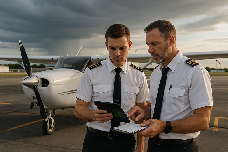
Weather trends before departure are one of the most useful clues a pilot can use to decide whether a flight is becoming safer, riskier, or simply more uncertain. A single METAR, a quick look at the radar, or a glance at the ceiling forecast can tell you what conditions are reported at one moment. Trend analysis tells you what the atmosphere is doing over time, and that is often where the real operational picture begins to appear.
For student pilots, flight instructors, private pilots, instrument pilots, and aviation professionals, preflight weather analysis is not just about answering the basic question of whether conditions are legal. It is about understanding whether the flight environment is stable, improving, deteriorating, or behaving differently than expected. This article explains how pilots can detect weather trends before departure using practical aviation weather products, disciplined comparison, and sound aeronautical decision-making.
What Weather Trends Mean Before Departure
A weather trend is the direction and rate of change in aviation weather conditions. It may involve ceilings lowering, visibility improving, winds increasing, thunderstorms developing, pressure falling, temperature and dew point converging, or a forecast changing across multiple issuances. The key idea is that pilots should not treat weather as a static snapshot. Weather moves, evolves, weakens, strengthens, and sometimes surprises the forecast.
Before departure, trend analysis helps answer several practical questions. Are conditions moving toward or away from personal minimums? Is the current weather consistent with the forecast? Are the forecast timing and intensity realistic based on observations? Is there enough margin for the route, destination, alternate options, fuel planning, daylight, terrain, and pilot proficiency? These questions are more useful than simply asking whether the departure airport is VFR or whether a destination TAF still looks acceptable.
Trend awareness begins by comparing observations over time. A pilot looking at the last several METARs can see whether the ceiling has been steady at a comfortable level or stepping down toward marginal conditions. A radar loop can show whether precipitation is weakening or organizing into a line. Satellite imagery can show whether widespread cloud cover is expanding, breaking up, or filling in behind a front. Surface analysis can reveal whether a pressure system or boundary is likely to drive additional changes during the planned flight window.
The goal is not to become a meteorologist. The goal is to become a more disciplined aviation decision-maker. Pilots do not need to predict every detail of the atmosphere. They do need to recognize when the trend is reducing their options, increasing workload, or making the forecast less dependable.
Start With a Time-Based Weather Picture
The first mistake many pilots make is collecting weather products as separate items rather than assembling them into a timeline. A METAR shows a report at a specific time. A TAF describes expected conditions over forecast periods. Radar and satellite loops show movement and development. Winds aloft forecasts show how conditions may change with altitude and direction of travel. Pilot reports can add real-world confirmation of turbulence, icing, cloud tops, visibility, and ride quality where available.
A time-based weather picture organizes these products around the planned flight. Instead of asking what the weather is right now, ask what it was two or three hours ago, what it is doing now, what it is forecast to do during taxi, departure, climb, cruise, descent, arrival, and the period after the planned arrival. This approach is especially important when flying near weather minimums, across frontal systems, near convective activity, in mountainous terrain, at night, or in aircraft with limited performance or equipment.
For example, a departure airport may report an acceptable ceiling and visibility at the moment, but the last four observations may show a steady lowering ceiling and a narrowing temperature-dew point spread. At the destination, the TAF may still show conditions above your comfort level, but recent observations at nearby airports may be trending down faster than forecast. That combination does not automatically cancel the flight, but it should prompt deeper analysis and a more conservative plan.
Trend detection works best when pilots compare multiple sources rather than relying on one product. Observations tell you what is happening. Forecasts tell you what is expected. Radar, satellite, surface charts, and aviation discussions can help explain why. When those sources agree, confidence improves. When they disagree, uncertainty increases, and uncertainty should be treated as an operational risk.
Observations: METAR Trends, Nearby Airports, and PIREPs
METARs are one of the most direct tools for detecting pre-departure weather trends. A single METAR gives current reported wind, visibility, weather, clouds, temperature, dew point, altimeter setting, and remarks when included. Several METARs in sequence give the trend. Pilots should look for the direction of change and the rate of change, not merely the latest observation.
Ceiling and visibility trends deserve close attention. If ceilings have moved from comfortable VFR to marginal VFR over a short period, the pilot should consider whether the trend could continue during the flight. If visibility is fluctuating due to mist, precipitation, smoke, haze, or fog, the pilot should consider whether those fluctuations are local, widespread, temporary, or expanding. In instrument operations, a lowering ceiling or visibility trend may increase approach workload, alternate planning importance, fuel considerations, and the need for a realistic missed approach plan.
Wind trends matter just as much. A steady increase in surface wind may affect taxi, takeoff roll, crosswind control, turbulence, climb performance, and runway selection. A changing wind direction may indicate frontal passage, outflow boundaries, sea-breeze influence, terrain effects, or other local weather mechanisms. Gust spread is also operationally important because a wide difference between sustained wind and gusts can make aircraft control more demanding, especially for student pilots and light aircraft.
Nearby airports are often more revealing than the departure airport alone. Weather rarely respects airport boundaries. If stations upwind are showing lower ceilings, reduced visibility, heavier precipitation, or stronger winds, those conditions may move toward the departure airport. Conversely, improving conditions upwind can build confidence that current restrictions may lift. The useful question is not simply what nearby airports report, but which nearby airports are meteorologically connected to your route by wind flow, terrain, fronts, or precipitation movement.
PIREPs, when available, add an important real-world layer. A forecast may suggest a smooth climb above a cloud layer, but pilot reports may indicate turbulence or icing potential in a particular altitude band. A destination may report acceptable surface conditions while inbound aircraft report low cloud tops, moderate turbulence, or poor visibility on approach. PIREPs are not complete coverage, and absence of a report does not prove absence of a hazard, but relevant reports can help validate or challenge the preflight picture.
Forecast Trends: Reading TAFs as a Story, Not a Checkbox
TAFs are often treated as pass-fail documents. Pilots may look for the departure time, arrival time, ceiling, visibility, and wind, then move on. A better method is to read the TAF as a weather story. What is the overall pattern? Are conditions expected to improve, deteriorate, fluctuate, or remain stable? Are temporary periods expected? Is the timing close to your departure or arrival window? Has the forecast changed significantly from the previous issuance?
Changes between TAF issuances can be especially useful. If the forecast has been amended or the timing has shifted, ask why. A forecast that keeps lowering ceilings earlier than previously expected may indicate a faster-moving system or less confidence in the original forecast. A forecast that improves gradually but observations lag behind the improvement should be viewed cautiously. The atmosphere does not improve just because the forecast period says it should.
Temporary conditions and probability language, when included in aviation forecasts, should not be dismissed as unlikely or irrelevant. From an operational standpoint, a temporary period of low visibility, convective activity, strong gusts, or low ceilings can occur at exactly the wrong time for arrival, diversion, or training operations. A short-lived weather event may be manageable if you have fuel, alternates, proficiency, and flexibility. It may be unacceptable if the flight plan depends on everything happening on schedule.
TAF trend analysis should also include the destination and suitable alternates, not just the departure point. Weather that is improving at the destination but deteriorating at alternates can create a planning trap. Weather that is legal at both destination and alternate but trending downward across a broad region may reduce practical escape options. A pilot who identifies that trend before departure has more choices than a pilot who discovers it after takeoff.
Pressure, Temperature, Dew Point, and Fog Potential
Not every important weather trend is obvious on radar. Pressure changes, temperature-dew point spread, and local cooling can signal changing conditions before they appear dramatic. A falling altimeter setting may indicate the approach of lower pressure or a weather system. A rising altimeter setting may suggest improving stability in some patterns, though local context always matters. The trend is more useful than a single number.
The temperature-dew point spread is particularly useful for anticipating fog, mist, low stratus, and reduced visibility, especially during overnight, early morning, or humid conditions. When temperature and dew point are close together, the air is near saturation. If the temperature continues to cool, or moisture increases, fog or low clouds may develop. This is not a guarantee, but it is a strong reason to examine recent observations, terrain, wind, sky cover, and forecast details carefully.
Fog trends can be deceptive. A departure airport may remain clear while nearby low-lying airports report rapidly reducing visibility. A valley airport may become restricted while a ridge-top airport remains VFR. Light wind can allow radiation fog to form, while stronger wind may mix the boundary layer and produce low stratus instead. Pilots operating in areas with coastal influence, river valleys, or terrain-driven microclimates should develop local knowledge and compare multiple reporting points before assuming conditions are uniform.
Temperature trends also affect aircraft and route decisions. Heat can influence density altitude and performance planning. Cold temperatures can affect icing risk when visible moisture is present and may require careful evaluation of aircraft equipment, pilot qualification, and the expected altitude environment. The broader point is that weather trend analysis is not only about visibility and clouds. It is about understanding how the changing atmosphere affects the airplane and the mission.
Radar, Satellite, and Convective Trend Detection
Radar is valuable because it shows precipitation location and movement, but pilots should avoid treating radar as a complete picture of all hazards. A radar loop is more useful than a still image because it reveals motion, growth, decay, and organization. Before departure, pilots should look at whether precipitation is building, weakening, filling in along the route, or moving faster than expected.
Convective weather requires particular caution. Thunderstorms can produce severe turbulence, strong updrafts and downdrafts, lightning, heavy precipitation, hail, wind shear, and rapidly changing visibility. A pilot does not need to launch close to a thunderstorm for it to influence the flight. Outflow boundaries can change surface winds and trigger new development away from the original cell. Lines of storms can close route options and make diversion planning more complex.
Satellite imagery complements radar by showing cloud patterns and development before precipitation appears. Visible satellite can be useful during daylight for identifying expanding cumulus fields, cloud breaks, and low cloud coverage. Infrared satellite can help detect cloud tops and broader systems at night or when visible imagery is unavailable. In practice, a pilot may use satellite to see whether a scattered cloud field is growing vertically, whether low clouds are eroding, or whether a large shield of clouds is advancing toward the route.
For preflight planning, the trend question is simple: is the weather ahead of the airplane becoming more organized, more widespread, or more intense? If so, the pilot should consider delaying, rerouting, filing a different plan, adding fuel, selecting better alternates, or canceling. If weather is weakening or moving away, the pilot should still verify that the forecast timing, route, and available options support the flight.
Winds Aloft, Fronts, and Route-Level Trends
Surface weather does not always tell the whole story. Winds aloft can influence groundspeed, fuel planning, turbulence, cloud movement, and the timing of weather systems along a route. A strong headwind may reduce fuel reserves if not accounted for. A stronger-than-expected tailwind may change arrival timing, which could be helpful or harmful depending on destination weather. Wind shear between levels can contribute to turbulence and make climb or descent less comfortable.
Frontal systems are classic trend producers. Ahead of a front, a pilot may see changing winds, lowering ceilings, increasing precipitation, temperature shifts, pressure changes, and turbulence. Behind a front, conditions may improve in some respects while winds and turbulence increase. The exact effects depend on the air masses, season, terrain, moisture, and system strength. Pilots should avoid applying simplistic rules and instead look for the observed pattern around the route.
Route-level trend analysis also includes terrain and airspace considerations. A lowering ceiling over flat terrain may leave more practical options than the same ceiling lowering over mountains. Reduced visibility near complex airspace can increase workload. Strong winds over ridges can create turbulence concerns even when the surface observation at a nearby airport appears manageable. Weather trends should be interpreted in relation to the airplane, pilot, route, terrain, and mission, not in isolation.
Why This Matters in Real-World Aviation
Real-world flights rarely fail because a pilot lacked access to one more weather product. More often, the risk increases when a pilot sees the products but does not integrate them into a coherent decision. Trend detection helps pilots move from weather collection to weather interpretation.
In flight training, weather trends are a powerful teaching tool. A student may learn to decode a METAR or TAF early in training, but the next level is learning to explain what the sequence means for the flight. A good instructor can ask: What has changed in the last two hours? What is changing faster than forecast? What is your exit strategy if this trend continues? Those questions build judgment rather than rote weather decoding.
For instrument pilots, trend detection supports workload management. Launching into marginal but stable conditions is different from launching into marginal and deteriorating conditions. A pilot may be legally and technically capable of flying an approach, but if alternates are also deteriorating and convective weather is approaching, the practical risk picture changes. Trend awareness helps maintain margins before cockpit workload rises.
For aviation operators, dispatchers, and flight departments, weather trends support operational consistency. Training flights, repositioning legs, maintenance test flights, and passenger operations all benefit from a shared understanding of improving, deteriorating, and uncertain weather. A conservative delay on the ground is often easier to manage than a rushed diversion or an airborne decision made with limited time.
How Pilots Should Understand This Topic
Pilots should understand weather trends as part of risk management, not as a separate meteorology exercise. The purpose is to decide whether the flight can be conducted with acceptable margins. The same trend can have different implications for different pilots and aircraft. A lowering ceiling may be acceptable for a proficient instrument pilot in a well-equipped aircraft with strong alternate options. It may be a clear no-go for a student pilot planning solo pattern work.
A practical way to think about trend analysis is to divide the flight into phases. During departure, consider ceilings, visibility, wind, runway condition if applicable, convective proximity, and climb options. During en route flight, consider terrain clearance, cloud layers, turbulence, icing potential when relevant, fuel, winds aloft, and diversion airports. During arrival, consider forecast timing, approach availability for instrument operations, traffic and airspace complexity, daylight, alternate conditions, and the trend after arrival.
Then ask whether the weather is moving toward or away from your limits in each phase. If the weather is moving away from your limits and observations confirm the forecast, confidence may improve. If the weather is moving toward your limits, the pilot should increase caution. If observations and forecasts disagree, the pilot should treat the situation as uncertain and build in more margin or choose not to depart.
This is where personal minimums become practical. Personal minimums should not be static numbers used only at the moment of takeoff. They should include trend thinking. For instance, a pilot may be comfortable departing with a certain ceiling if it is stable or improving, but not if it has been lowering steadily for an hour. A pilot may accept gusty winds when runway alignment is favorable and the trend is steady, but not if gusts are increasing rapidly ahead of a frontal passage.
Common Mistakes or Misunderstandings
One common mistake is anchoring on the first weather picture. A pilot checks the weather early in the morning, sees acceptable conditions, and mentally commits to the flight. Later updates show deterioration, but the pilot interprets them through the lens of the original plan. Good preflight discipline requires updating the decision as the weather changes, even if that means disappointing passengers, rescheduling a lesson, or changing the route.
Another mistake is treating legal minimums as a complete safety margin. A flight may be legally possible and still be unwise for the pilot, airplane, route, or mission. Trend analysis helps identify when a legal flight is becoming operationally fragile. If success depends on the weather remaining exactly as forecast, the plan may not have enough resilience.
Pilots also sometimes overvalue the most convenient report. If the departure airport reports good conditions but airports along the route are trending down, the favorable local observation may be misleading. Similarly, a destination TAF that looks acceptable may not be enough if nearby observations suggest the forecast timing is optimistic. Weather products should be cross-checked against each other.
A further misunderstanding involves radar. Pilots may look at a still radar image and conclude that a route is open, without checking movement or development. A gap between cells may close quickly, precipitation may build along a boundary, or a line may move faster than expected. Radar loops and time-based analysis are essential for understanding convective and precipitation trends.
Finally, some pilots fail to account for their own trend. Fatigue, recent experience, proficiency, and workload tolerance matter. Deteriorating weather is more demanding when the pilot is tired, rusty, unfamiliar with the route, operating at night, or managing passengers. Weather risk is never separate from human performance.
Practical Example: A VFR Cross-Country With Marginal Trends
Consider a private pilot planning a daytime VFR cross-country in a light single-engine airplane. The route is about two hours, with a destination near a line of low hills. The first weather check shows VFR at departure, VFR along most of the route, and marginal but acceptable conditions at the destination. The TAF suggests gradual improvement by the planned arrival time.
Instead of stopping there, the pilot reviews the last several METARs. The departure airport is stable, but airports halfway along the route show visibility gradually decreasing in light rain. The destination has reported a ceiling that has lowered over the last three observations, even though the TAF still indicates improvement soon. A nearby airport upwind of the destination reports lower ceilings than forecast. Satellite imagery shows a broad cloud deck moving more slowly than expected, and radar shows light precipitation filling in along the last third of the route.
The pilot now has a different picture. The flight is not simply VFR with a forecast improvement. It is a flight toward an area where conditions are not improving as forecast and may be trending toward lower margins near terrain. The pilot evaluates options: delay departure for another update cycle, shorten the flight to a closer airport, file and fly under instrument flight rules if qualified and current with appropriate aircraft and planning, select a different route, or cancel.
In this example, the best decision depends on pilot qualification, aircraft capability, terrain, airspace, alternate airports, fuel, daylight, and comfort level. The important point is that trend detection changed the conversation. Instead of launching based on a favorable forecast, the pilot recognized that observations were not yet supporting the forecast. That recognition happened on the ground, where choices were easiest.
Best Practices for Pilots
Effective weather trend detection is a habit. It becomes easier when pilots use the same disciplined process before each flight, then adjust the depth of analysis to match the complexity of the day. A short local flight in stable high pressure may require less analysis than a long cross-country near fronts, convective weather, terrain, or freezing conditions. But even simple flights benefit from asking whether conditions are improving, deteriorating, or uncertain.
Begin early enough to see change. Checking weather five minutes before engine start gives you current conditions, but it may not reveal the trend. A better practice is to review weather earlier, then update the picture closer to departure. For longer or more complex flights, continue monitoring until departure and be prepared to change the plan.
Compare observations with forecasts. If the TAF predicted improvement by a certain time and observations show no improvement, pause. If conditions are deteriorating faster than forecast, build in additional margin. If forecasts have been amended repeatedly, treat timing and intensity with caution. Forecast changes are not a failure of the system; they are information about uncertainty.
Use geography intelligently. Look upstream along the wind flow, along the route, near terrain features, and around the destination. Choose comparison airports that help answer specific questions. A station 50 miles away may be very useful if it is upwind of your route, while a closer airport may be less relevant if terrain or coastal effects make its weather unrelated.
Think in terms of options. Before departure, decide what you will do if the trend continues. Where will you land early? How much fuel margin do you want? What weather would cause a delay or cancellation? What conditions would make you turn around? These decisions are easier and more objective when made before takeoff.
A concise pre-departure trend review might include the following areas:
- Compare the last several observations at departure, destination, alternates, and relevant nearby airports.
- Review the latest forecast and note whether it has changed from earlier versions.
- Use radar and satellite loops to evaluate movement, development, and clearing trends.
- Assess wind, pressure, temperature, dew point, and cloud trends for signs of changing conditions.
- Decide whether the trend improves, reduces, or leaves unchanged your safety margin.
The list is not meant to replace a full weather briefing or sound operational planning. It is a practical way to make sure the pilot is interpreting change, not just collecting weather snapshots.
Frequently Asked Questions
How far back should pilots look when checking weather trends?
There is no single time period that fits every flight, but pilots should look far enough back to identify meaningful change. For many routine flights, the last several observations can reveal whether ceilings, visibility, wind, and pressure are stable or changing. For complex weather systems, pilots should look at a broader time window and update the analysis closer to departure.
Is a current METAR enough for a go/no-go decision?
A current METAR is important, but it is not enough by itself for a complete decision. It reports conditions at a particular station and time. Pilots should compare it with previous observations, nearby airports, forecasts, radar, satellite imagery, route weather, and operational factors such as terrain, fuel, alternates, and proficiency.
What is the most important weather trend before departure?
The most important trend depends on the flight. For a VFR pilot, lowering ceilings and visibility may be the critical issue. For an instrument flight, destination and alternate trends may be more important. For any pilot, convective development, rapidly changing winds, icing potential when applicable, and forecast uncertainty can become decisive.
How should pilots handle a forecast that does not match observations?
When observations and forecasts disagree, pilots should treat the situation as uncertain. That does not automatically mean the flight is impossible, but it does mean the pilot should seek more information, build in more margin, consider delaying, and avoid plans that depend on optimistic timing.
Can weather trends improve enough to justify a delayed departure?
Yes, delaying can be an excellent risk management tool when trends are improving and observations begin to support the forecast. The key is to wait for actual evidence of improvement, not merely the scheduled forecast time. A delay is most useful when it increases options, reduces workload, and improves confidence in the weather picture.
Should student pilots use the same trend analysis as experienced pilots?
Student pilots should learn the same principles, but apply more conservative margins and work closely with an instructor. Trend analysis is an important training skill because it teaches students to think beyond decoding weather reports and toward practical go/no-go decisions.
Key Takeaways
- Weather trends before departure help pilots understand whether conditions are improving, deteriorating, stable, or uncertain, which is more useful than relying on a single weather snapshot.
- Safety margins shrink when ceilings, visibility, winds, precipitation, or convective activity move toward pilot, aircraft, route, or mission limits.
- Sound preflight decisions come from comparing observations, forecasts, radar, satellite, nearby airports, and operational factors before committing to the flight.