
Chapter 15
Airspace
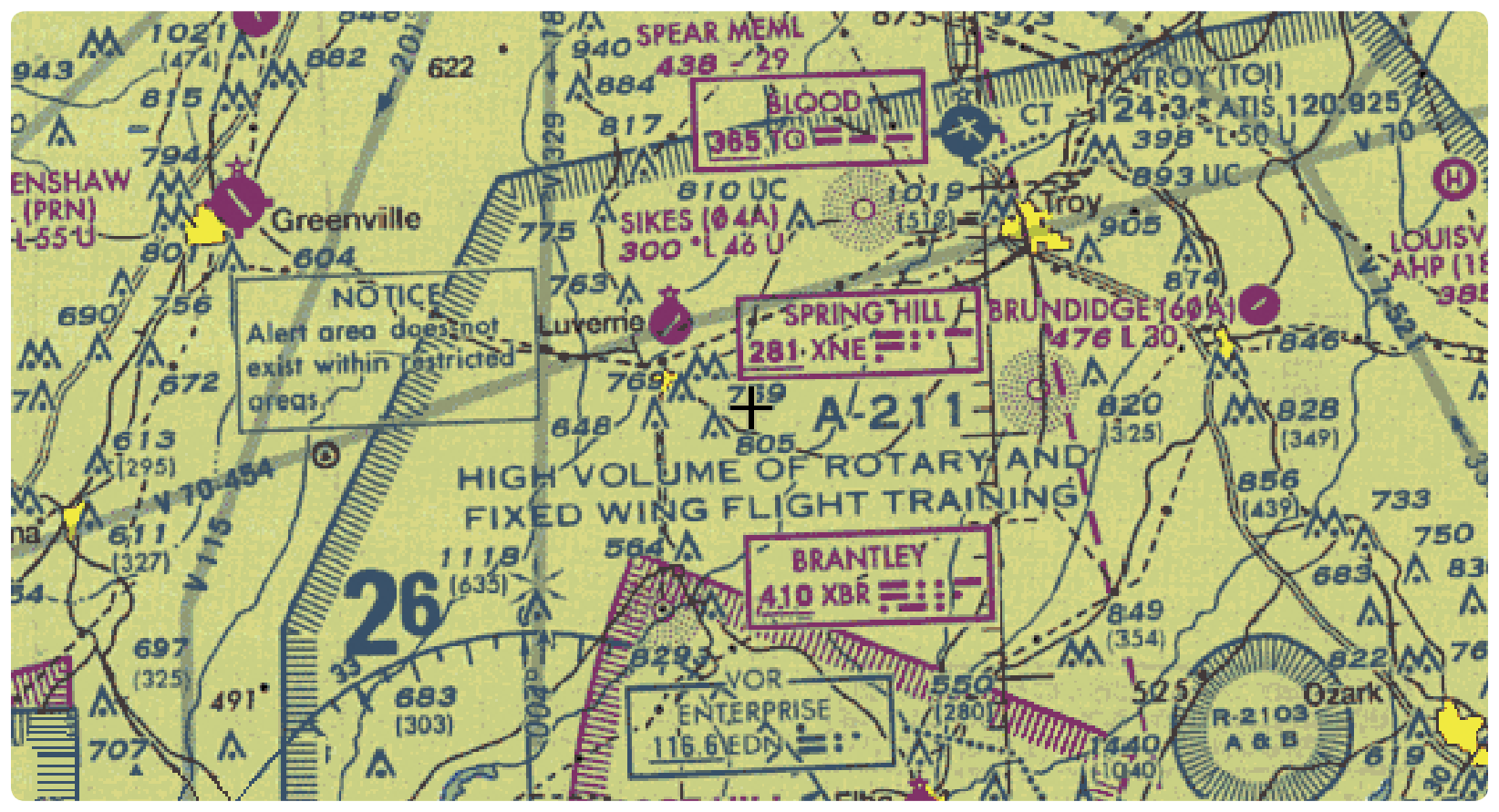
pilots of areas that may contain a high volume of pilot training or an unusual type of aerial activity. Pilots should exercise caution in alert areas. All activity within an alert area shall be conducted in accordance with regulations, without waiver, and pilots of participating aircraft, as well as pilots transiting the area, shall be equally responsible for collision avoidance. [Figure 15-6]
Controlled Firing Areas (CFAs)
CFAs contain activities that, if not conducted in a controlled environment, could be hazardous to nonparticipating aircraft. The difference between CFAs and other special use airspace is that activities must be suspended when a spotter aircraft, radar, or ground lookout position indicates an aircraft might be approaching the area. There is no need to chart CFAs since they do not cause a nonparticipating aircraft to change its flight path.
Other Airspace Areas
“Other airspace areas” is a general term referring to the majority of the remaining airspace. It includes:
- Local airport advisory (LAA)
- Military training route (MTR)
- Temporary flight restriction (TFR)
- Parachute jump aircraft operations
- Published VFR routes
- Terminal radar service area (TRSA)
- National security area (NSA)
- Air Defense Identification Zones (ADIZ) land and water based and need for Defense VFR (DVFR) flight plan to operate VFR in this airspace
- Intercept Procedures and use of 121.5 for communication if not on ATC already
- Flight Restricted Zones (FRZ) in vicinity of Capitol and White House
- Special Awareness Training required by 14 CFR 91.161 for pilots to operate VFR within 60 NM of the Washington, DC VOR/DME
- Wildlife Areas/Wilderness Areas/National Parks and request to operate above 2,000 AGL
- National Oceanic and Atmospheric Administration (NOAA) Marine Areas off the coast with requirement to operate above 2,000 AGL
- Tethered Balloons for observation and weather recordings that extend on cables up to 60,000
Local Airport Advisory (LAA)
An advisory service provided by Flight Service Station (FSS) facilities, which are located on the landing airport, using a discrete ground-to-air frequency or the tower frequency when the tower is closed. LAA services include local airport advisories, automated weather reporting with voice broadcasting, and a continuous Automated Surface Observing System (ASOS)/Automated Weather Observing Station (AWOS) data display, other continuous direct reading instruments, or manual observations available to the specialist.
Military Training Routes (MTRs)
MTRs are routes used by military aircraft to maintain proficiency in tactical flying. These routes are usually established below 10,000 feet MSL for operations at speeds in excess of 250 knots. Some route segments may be defined at higher altitudes for purposes of route continuity. Routes are identified as IFR (IR), and VFR (VR), followed by a number. [Figure 15-7] MTRs with no segment above 1,500 feet AGL are identified by four number characters (e.g., IR1206, VR1207). MTRs that include one or more segments above 1,500 feet AGL are identified by three number characters (e.g., IR206, VR207). IFR low altitude en route charts depict all IR routes and all VR routes that
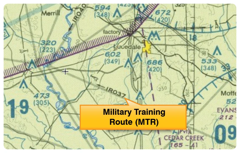
accommodate operations above 1,500 feet AGL. IR routes are conducted in accordance with IFR regardless of weather conditions. VFR sectional charts depict military training activities, such as IR, VR, MOA, restricted area, warning area, and alert area information.
Temporary Flight Restrictions (TFR)
A flight data center (FDC) Notice to Airmen (NOTAM) is issued to designate a TFR. The NOTAM begins with the phrase “FLIGHT RESTRICTIONS” followed by the location of the temporary restriction, effective time period, area defined in statute miles, and altitudes affected. The NOTAM also contains the FAA coordination facility and telephone number, the reason for the restriction, and any other information deemed appropriate. The pilot should check the NOTAMs as part of flight planning.
Some of the purposes for establishing a TFR are:
- Protect persons and property in the air or on the surface from an existing or imminent hazard.
- Provide a safe environment for the operation of disaster relief aircraft.
- Prevent an unsafe congestion of sightseeing aircraft above an incident or event, that may generate a high degree of public interest.
- Protect declared national disasters for humanitarian reasons in the State of Hawaii.
- Protect the President, Vice President, or other public figures.
- Provide a safe environment for space agency operations.