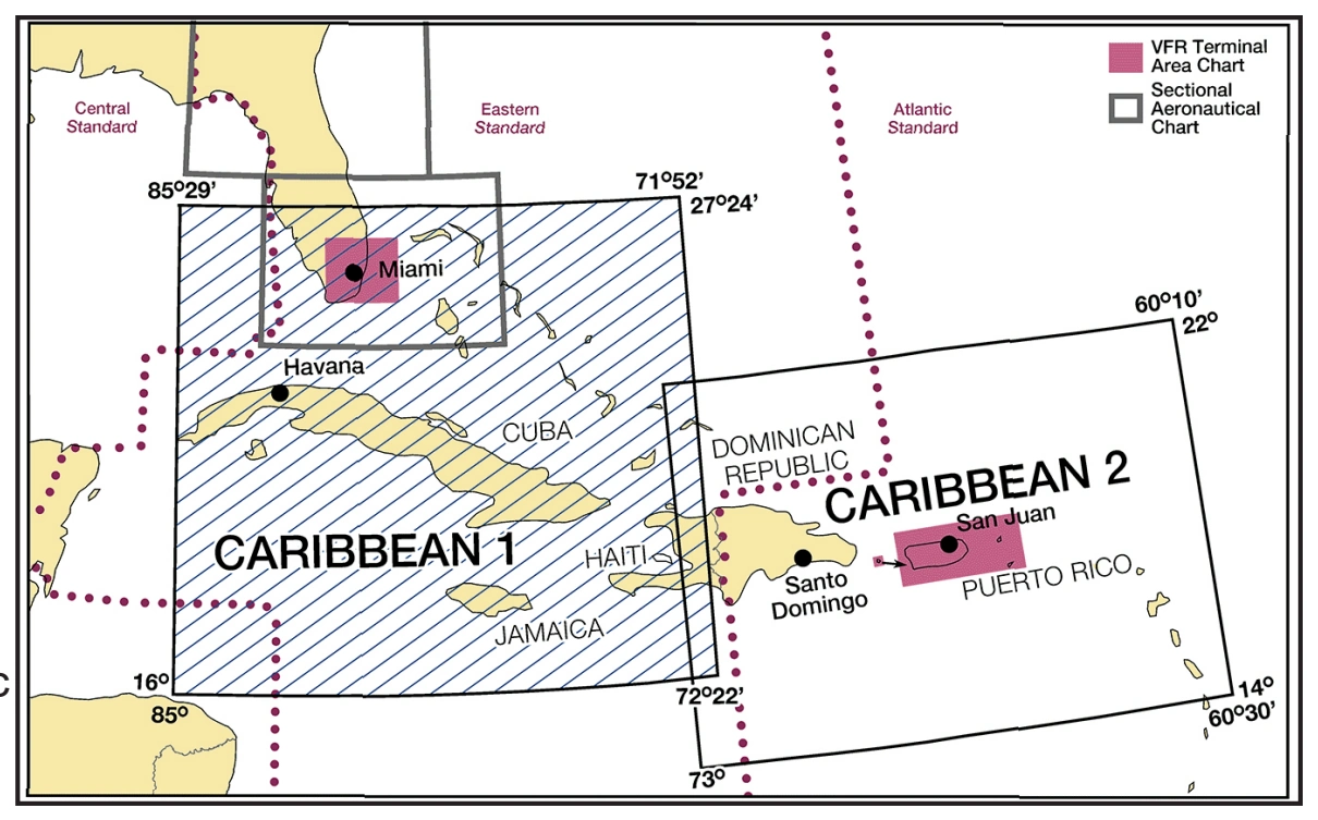
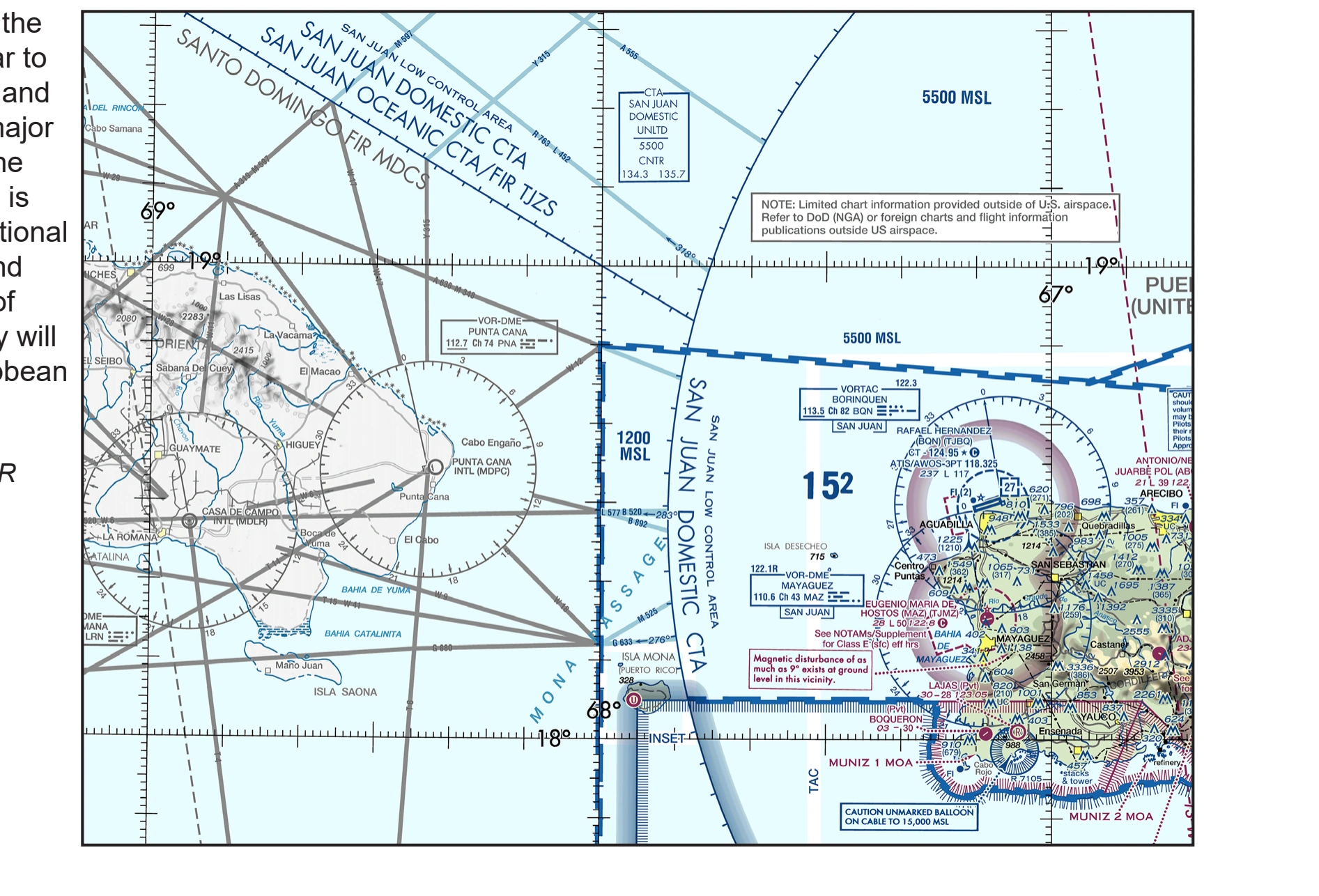
Caribbean VFR Aeronautical Chart coverage and examples.
Source page 58
Caribbean VFR Aeronautical Charts (CAC)
CARIBBEAN VFR AERONAUTICAL CHARTS (CAC) — source page 58.
CARIBBEAN VFR AERONAUTICAL CHARTS (CAC) — source page 58.
CARIBBEAN VFR AERONAUTICAL CHARTS (CAC) The Caribbean Charts are published as two VFR Charts: Caribbean 1 (CAC-1) covers Southern Florida, Cuba, Haiti and the Bahamas; Caribbean 2 (CAC-2) covers Puerto Rico, Haiti, Dominican Republic, the Lesser Antilles and Leeward Islands. Charts are updated every 56-day chart cycle. Caribbean Charts are designed for VFR flights and provide aeronautical and topographic information of the Caribbean. The aeronautical information includes airports, radio aids to navigation, Class airspace and special use airspace in U.S. and major airports, and radio aids to navigation in foreign areas. The topographic information includes city tint, populated places, principal roads, drainage patterns and shaded relief. The chart symbols used on the Caribbean Charts are similar to those used in the Sectional and Terminal Area Charts, the major difference being in scale. The Caribbean VFR Chart scale is 1:1,000,000 versus the Sectional Chart Scale of 1:500,000 and Terminal Area Chart Scale of 1:250,000. Chart symbology will appear smaller on the Caribbean VFR Charts. Example from Caribbean 2 VFR Aeronautical Chart
Cookie Preferences
We use cookies to operate this website, improve performance, understand site traffic, and personalize your experience. Essential cookies are always active because they are required for the website to function.
Required for basic site functionality and security.
Help us understand how visitors use the website so we can improve it.
May be used for advertising, remarketing, or social media features.
You can update your choices anytime using Cookie Settings. View Privacy Policy