
Chapter 9
Global Circulations and Jet Streams
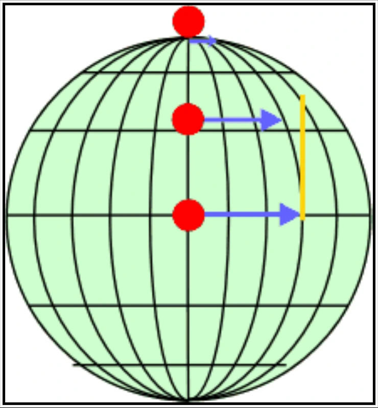
The momentum of air as it travels around the Earth is conserved, which means as the air that is over the Equator starts moving toward one of the poles, it keeps its eastward motion constant. The Earth below the air, however, moves slower, as that air travels toward the poles. The result is that the air moves faster and faster in an easterly direction (relative to the Earth’s surface below) the farther it moves from the Equator.
9.4.2 Location
In addition, with the three cell circulations mentioned previously, the regions around 30° N/S and 50°–60° N/S are areas where temperature changes are the greatest (see Figure 9-4). As the difference in temperature between the two locations increases, the strength of the wind increases. Therefore, the regions around 30° N/S and 50°–60° N/S are also regions where the wind in the upper atmosphere is the strongest.
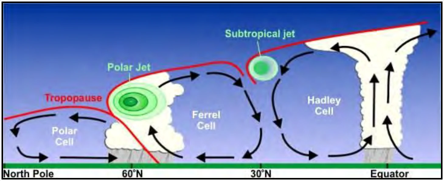
The 50°–60° N/S region is where the polar jet is located with the subtropical jet located around 30° N (see Figure 9-5). Jet streams vary in height from around flight level (FL) 200 to FL450 and can reach speeds of more than 275 miles per hour (mph) [239 knots (kt)/442 kilometers per hour (km/h)].
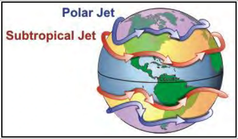
The actual appearance of jet streams results from the complex interaction between many variables, such as the location of high- and low-pressure systems, warm and cold air, and seasonal changes. They meander around the globe, dipping and rising in altitude/latitude, splitting at times and forming eddies, and even disappearing altogether to appear somewhere else.
Jet streams also follow the Sun, in that as the Sun’s elevation increases each day in the spring, the jet streams shift north, moving into Canada by summer. As autumn approaches and the Sun’s elevation decreases, the jet stream moves south into the United States, helping to bring cooler air to the country.
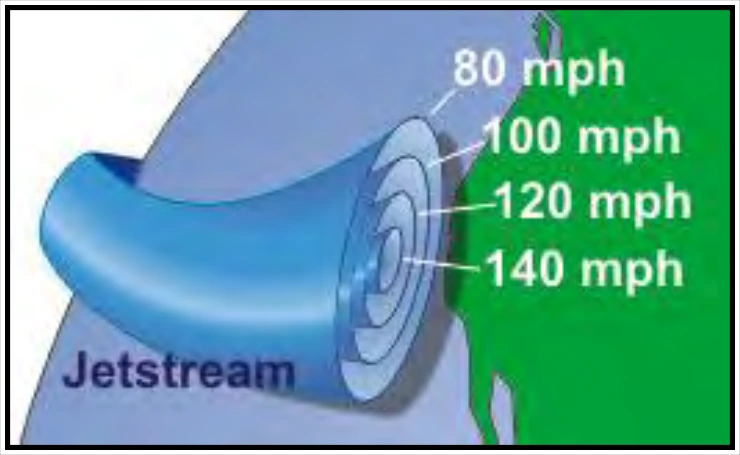
The jet stream is often indicated by a line on maps and is displayed this way by television meteorologists. The line generally points to the location of the strongest wind (see Figure 9-6). In reality, jet streams are typically much wider. A jet stream is a region where winds increase toward a core of highest speed, rather than just a distinct location.
One way of visualizing this is to consider a river. The river’s current is generally the strongest in the center, with decreasing strength as one approaches the river’s bank. It can be said that jet streams are rivers of air.