
Chapter 13
Aviation Weather Services
The controller’s primary function is to provide safe separation between aircraft. Any additional service, such as weather avoidance assistance, can only be provided to the extent that it does not detract from the primary function. It’s also worth noting that the separation workload is generally greater than normal when weather disrupts the usual flow of traffic. ATC radar limitations and frequency congestion may also be a factor in limiting the controller’s capability to provide additional service.
Electronic Flight Displays (EFD) /Multi- Function Display (MFD) Weather
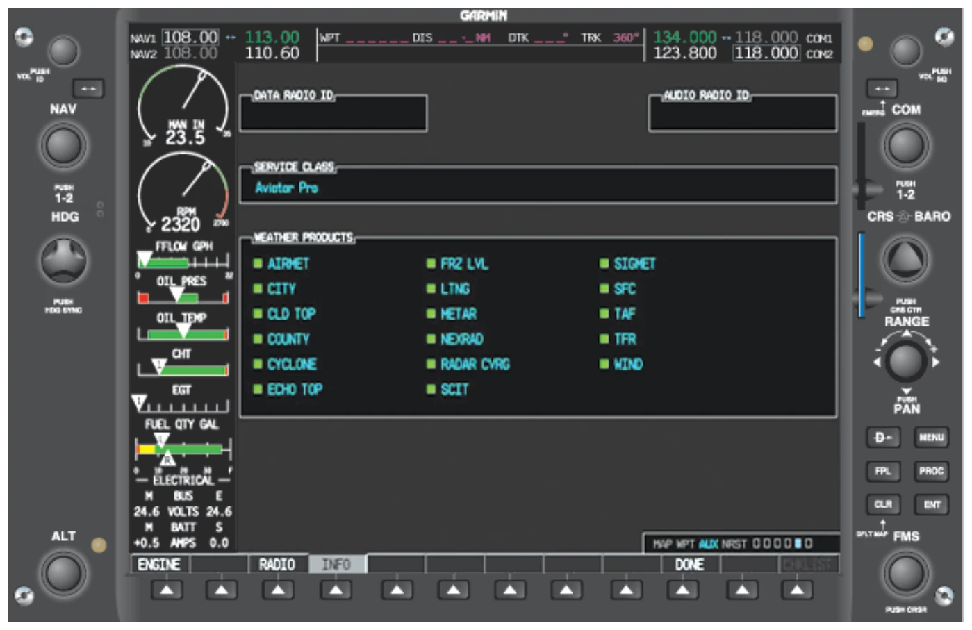
Many aircraft manufacturers now include data link weather services with new electronic flight display (EFD) systems. EFDs give a pilot access to many of the data link weather services available.
Products available to a pilot on the display pictured in
indicate the soft key to press in order to access the data.
- Graphical NEXRAD data (NEXRAD)
- Graphical METAR data (METAR)
- Textual METAR data
- Textual terminal aerodrome forecasts (TAF)
- City forecast data
- Graphical wind data (WIND)
- Graphical echo tops (ECHO T,,,OPS)
- Graphical cloud tops (CLD TOPS)
- Graphical lightning strikes (LTNG)
- Graphical storm cell movement (CELL MOV)
- NEXRAD radar coverage (information displayed with the NEXRAD data)
- SIGMETs/AIRMETs (SIG/AIR)
- Surface analysis to include city forecasts (SFC)
- County warnings (COUNTY)
- Freezing levels (FRZ LVL)
- Hurricane track (CYCLONE)
- Temporary flight restrictions (TFR)
Pilots must be familiar with any EFD or MFD used and the data link weather products available on the display.
Weather Products Age and Expiration
The information displayed using a data link weather link is near real time but should not be thought of as instantaneous, up-to-date information. Each type of weather display is stamped with the age information on the MFD. The time is referenced from Zulu when the information was assembled at the ground station. The age should not be assumed to be the time when the FIS received the information from the data link.
Two types of weather are displayed on the screen: “current” weather and forecast data. Current information is displayed by an age while the forecast data has a data stamp in the form of “__ / __ __: __.” [Figure 13-16]
The Next Generation Weather Radar System (NEXRAD)
The NEXRAD system is comprised of a series of 159 Weather Surveillance Radar-1988 Doppler (WSR-88D) sites situated throughout the United States, as well as selected overseas sites. The NEXRAD system is a joint venture between the United States Department of Commerce (DOC), the United States DOD, as well as the United States Department of Transportation (DOT). The individual agencies that have control over the system are the NWS, Air Force Weather Agency (AFWA) and the FAA. [Figure 13-17]
NEXRAD data for up to a 2,000 mile range can be displayed. It is important to realize that the radar image is not real time and can be up to 5 minutes old. The NTSB has reported on 2 fatal accidents where in-cockpit NEXRAD mosaic imagery was available to pilots operating near quickly-developing and fast-moving convective weather. In one of these accidents, the images were from 6 to 8 minutes old. In some cases, NEXRAD data can age significantly by the time the mosaic image is created. In some extreme latency cases, the actual
age of the oldest NEXRAD data in the mosaic can exceed the age indication in the cockpit by 15 to 20 minutes. Even small-time differences between the age indicator and actual conditions can be important for safety of flight, especially when considering fast-moving weather hazards, quickly developing weather scenarios, and/or fast-moving aircraft. At no time should the images be used as storm penetrating radar nor to navigate through a line of storms. The images display should only be used as a reference.
NEXRAD radar is mutually exclusive of Topographic (TOPO), TERRAIN and STORMSCOPE. When NEXRAD is turned on, TOPO, TERRAIN, and STORMSCOPE are turned off because the colors used to display intensities are very similar.
Lightning information is available to assist when NEXRAD is enabled. This presents a more comprehensive picture of the weather in the surrounding area.
In addition to utilizing the soft keys to activate the NEXRAD display, the pilot also has the option of setting the desired range. It is possible to zoom in on a specific area of the display in order to gain a more detailed picture of the radar display. [Figure 13-18]
What Can Pilots Do?
Remember that the in-cockpit NEXRAD display depicts where the weather WAS, not where it IS. The age indicator does not show the age of the actual weather conditions, but rather the age of the mosaic image. The actual weather conditions could be up to 15 to 20 minutes OLDER than the age indicated on the display. You should consider this