Chapter 16
Navigation
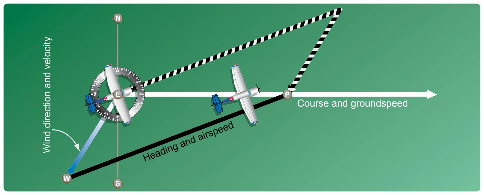
In actual practice, the triangle illustrated in Figure 16-19 is not drawn; instead, construct a similar triangle as shown by the blue, yellow, and black lines in Figure 16-20, which is explained in the following example.
Suppose a flight is to be flown from E to P. Draw a line on the aeronautical chart connecting these two points; measure its direction with a protractor, or plotter, in reference to a meridian. This is the TC, which in this example is assumed to be 090° (east). From the NWS, it is learned that the wind at the altitude of the intended flight is 40 knots from the northeast (045°). Since the NWS reports the wind speed in knots, if the true airspeed of the aircraft is 120 knots, there is no need to convert speeds from knots to mph or vice versa.
Now, on a plain sheet of paper draw a vertical line representing north to south. (The various steps are shown in Figure 16-21.)
Step 1
Place the protractor with the base resting on the vertical line and the curved edge facing east. At the center point of the base, make a dot labeled “E” (point of departure) and at the curved edge, make a dot at 90° (indicating the direction of the true course) and another at 45° (indicating wind direction).
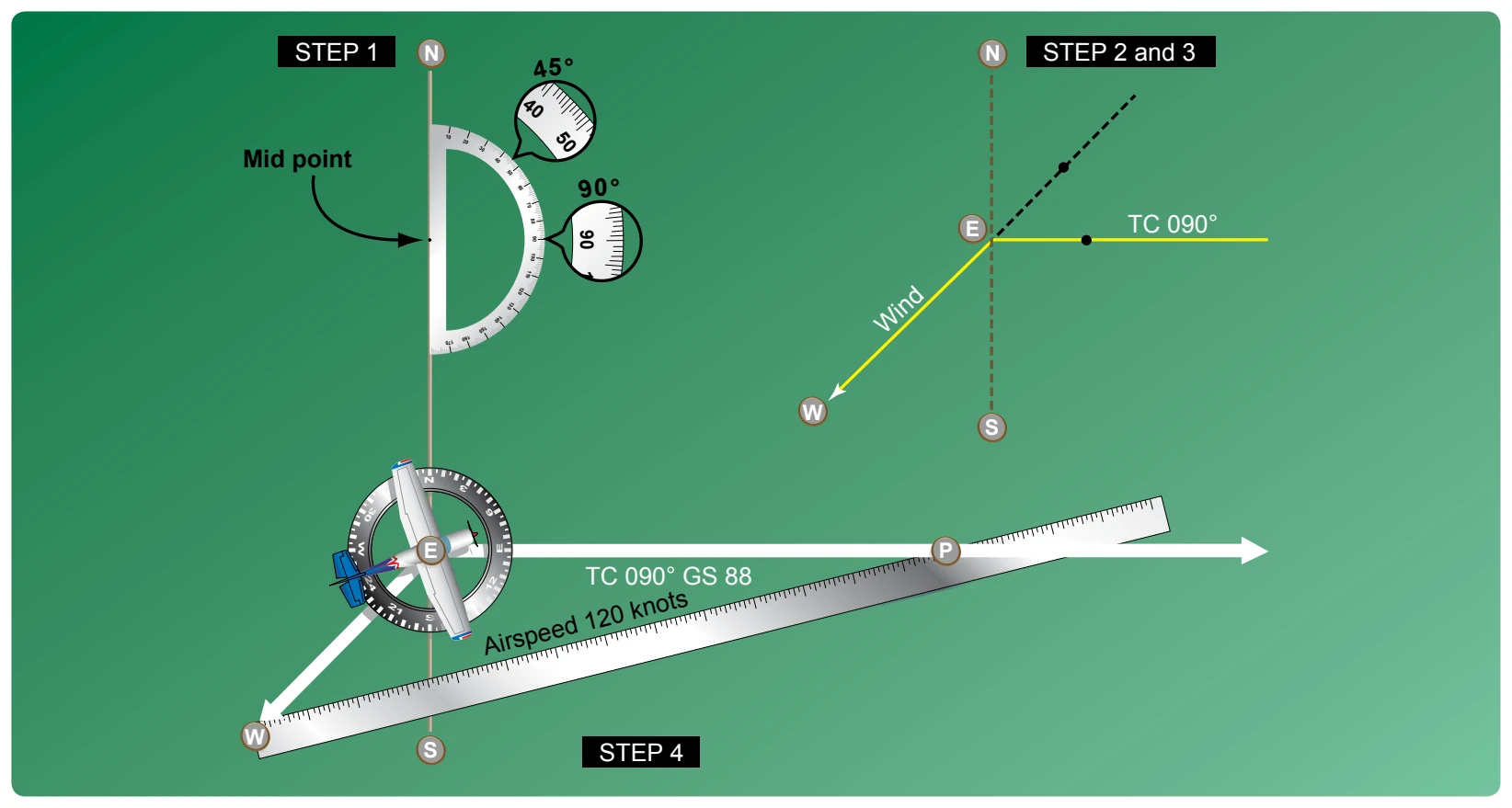
Step 2
With the ruler, draw the true course line from E, extending it somewhat beyond the dot by 90°, and labeling it “TC 090°.”
Step 3
Next, align the ruler with E and the dot at 45°, and draw the wind arrow from E, not toward 045°, but downwind in the direction the wind is blowing making it 40 units long to correspond with the wind velocity of 40 knots. Identify this line as the wind line by placing the letter “W” at the end to show the wind direction.
Step 4
Finally, measure 120 units on the ruler to represent the airspeed, making a dot on the ruler at this point. The units used may be of any convenient scale or value (such as ¼ inch = 10 knots), but once selected, the same scale must be used for each of the linear movements involved. Then place the ruler so that the end is on the arrowhead (W) and the 120-knot dot intercepts the TC line. Draw the line and label it “AS 120.” The point “P” placed at the intersection represents the position of the aircraft at the end of 1 hour. The diagram is now complete.
The distance flown in 1 hour (GS) is measured as the numbers of units on the TC line (88 NMPH or 88 knots). The TH necessary to offset drift is indicated by the direction of the airspeed line, which can be determined in one of two ways:
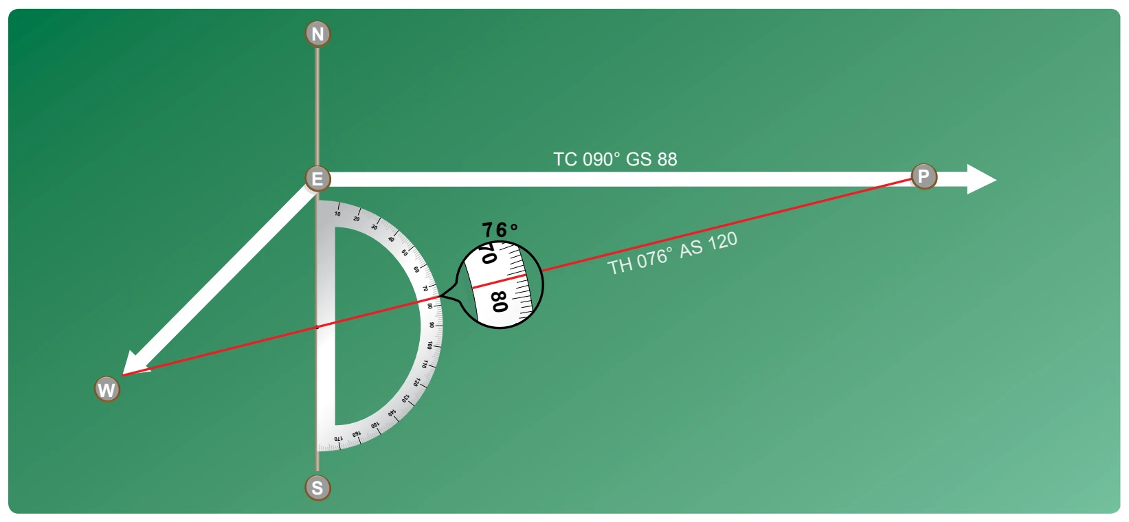
- By placing the straight side of the protractor along the north-south line, with its center point at the intersection of the airspeed line and north-south line, read the TH directly in degrees (076°). [Figure 16-22]
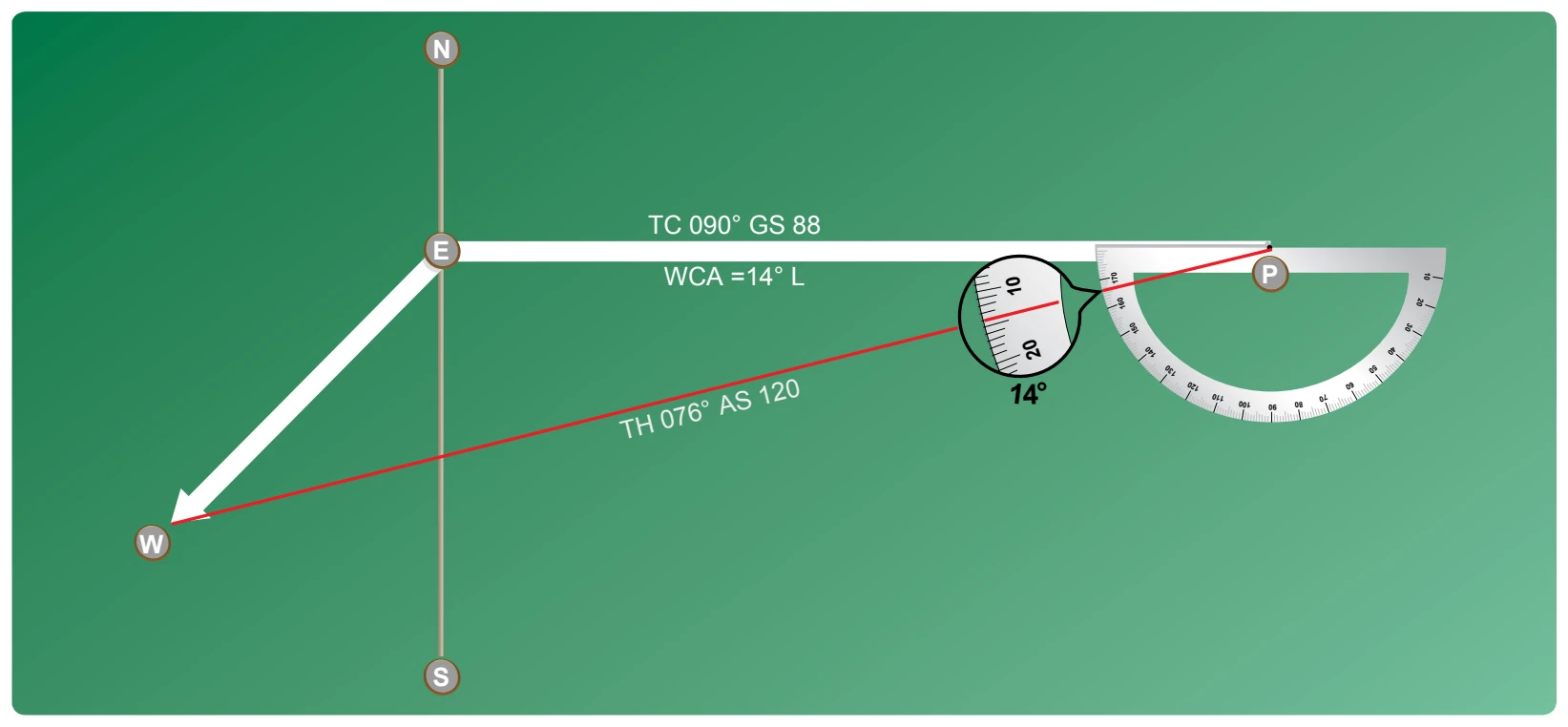
- By placing the straight side of the protractor along the TC line, with its center at P, read the angle between the TC and the airspeed line. This is the WCA, which must be applied to the TC to obtain the TH. If the wind blows from the right of TC, the angle is added; if from the left, it is subtracted. In the example given, the WCA is 14° and the wind is from the left; therefore, subtract 14° from TC of 090°, making the TH 076°. [Figure 16-23]
After obtaining the TH, apply the correction for magnetic variation to obtain magnetic heading and the correction for compass deviation to obtain a compass heading. The compass heading can be used to fly to the destination by dead reckoning.
To determine the time and fuel required for the flight, first find the distance to your destination by measuring the length of the course line drawn on the aeronautical chart (using the appropriate scale at the bottom of the chart). If the distance measures 220 NM, divide by the GS of 88 knots, which gives 2.5 hours, or 2:30, as the time required. If fuel consumption is 8 gallons an hour, 8 × 2.5 or about 20 gallons is used.