User-friendly explanations of instrument approach charts, planviews, profiles, minimums, airport diagrams, departures, arrivals, and visual procedures.
Source page 97
U.S. Terminal Procedures Publication
The U.S. Terminal Procedures Publication (TPPs) includes the Instrument Approach Procedures (IAPs), Departure Procedures (DPs) charts, Standard Terminal Arrival (STAR) charts, Charted Visual Flight Procedure (CVFP) charts, and Airport Diagrams. Also included are Takeoff Minimums, (Obstacle) Departure Procedures, Diverse Vector Area (RADAR Vectors), RADAR and Alternate Minimum textual procedures.
EXPLANATION OF TPP TERMS AND SYMBOLS
The information and examples in this section are based primarily on the IFR (Instrument Flight Rules) Terminal Procedures Publication (TPP). The publication legends list aeronautical symbols with a brief description of what each symbol depicts. This section will provide more detailed information of some of the symbols and how they are used on TPP charts.
FAA Terminal charts are prepared in accordance with specifications of the Interagency Air Committee (IAC) and their supporting technical groups for the purpose of standardization, which are approved by representatives of the Federal Aviation Administration (FAA), and the Department of Defense (DoD).
The Terminal Procedure Publication is made up of the following charts:
Instrument Approach Procedure (IAP) Charts
Airport Diagrams
Departure Procedures (DP)
Standard Terminal Arrival (STAR) Charts
Charted Visual Flight Procedure (CVFP) Charts
Source page 98
INSTRUMENT APPROACH PROCEDURE CHART
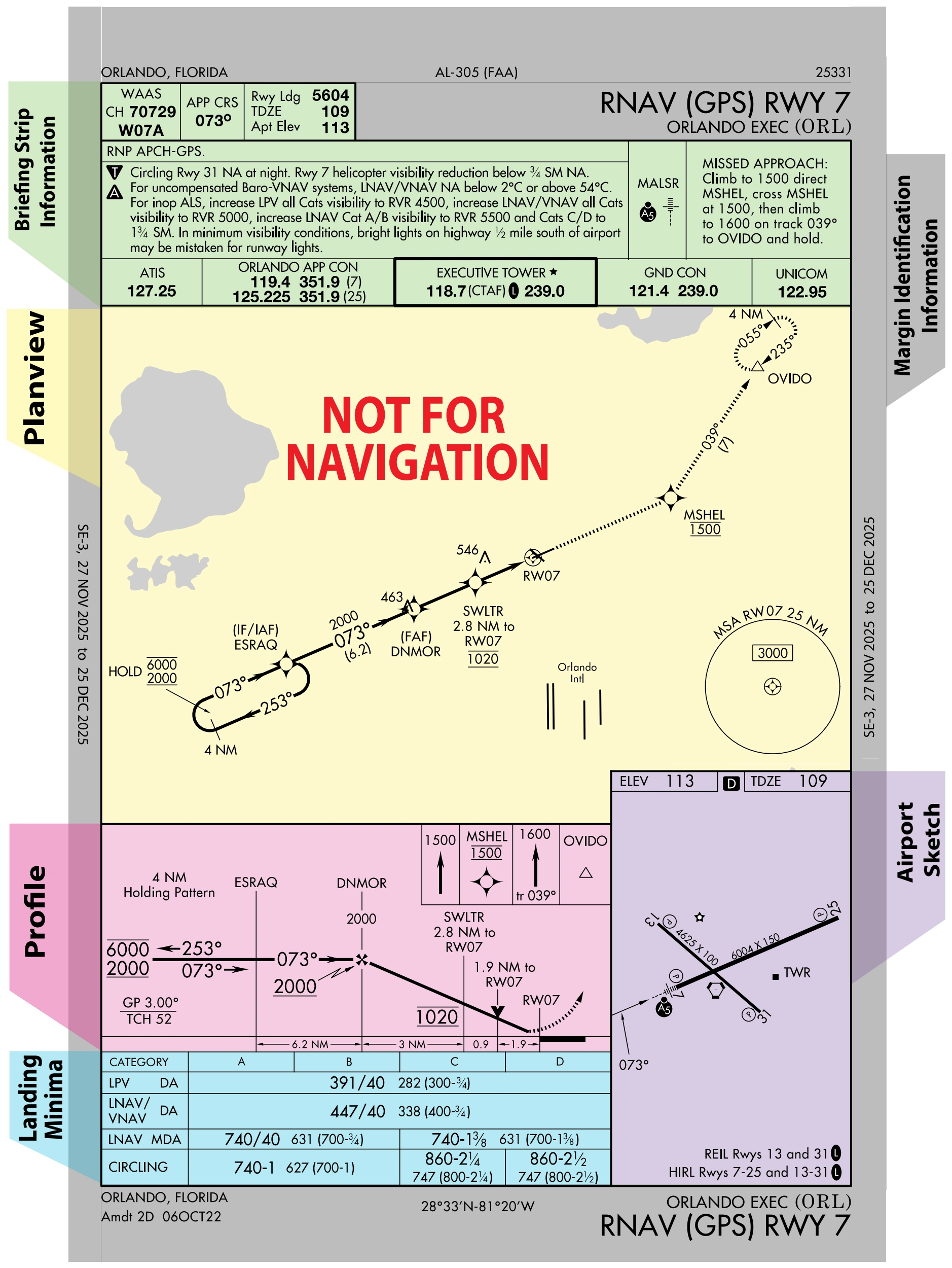
The IAPs (charts) are divided into various sections:
The IAPs (charts) are divided into various sections: — source page 98.
INSTRUMENT APPROACH PROCEDURE CHART The IAPs (charts) are divided into various sections: Margin Identification Information Profile View Briefing Strip Information Landing Minimums Planview Airport Sketch Missed Approach Information Airport Sketch Information Information Landing Minima Planview NOT FOR NAVIGATION
Source page 99
Margin Identification Information
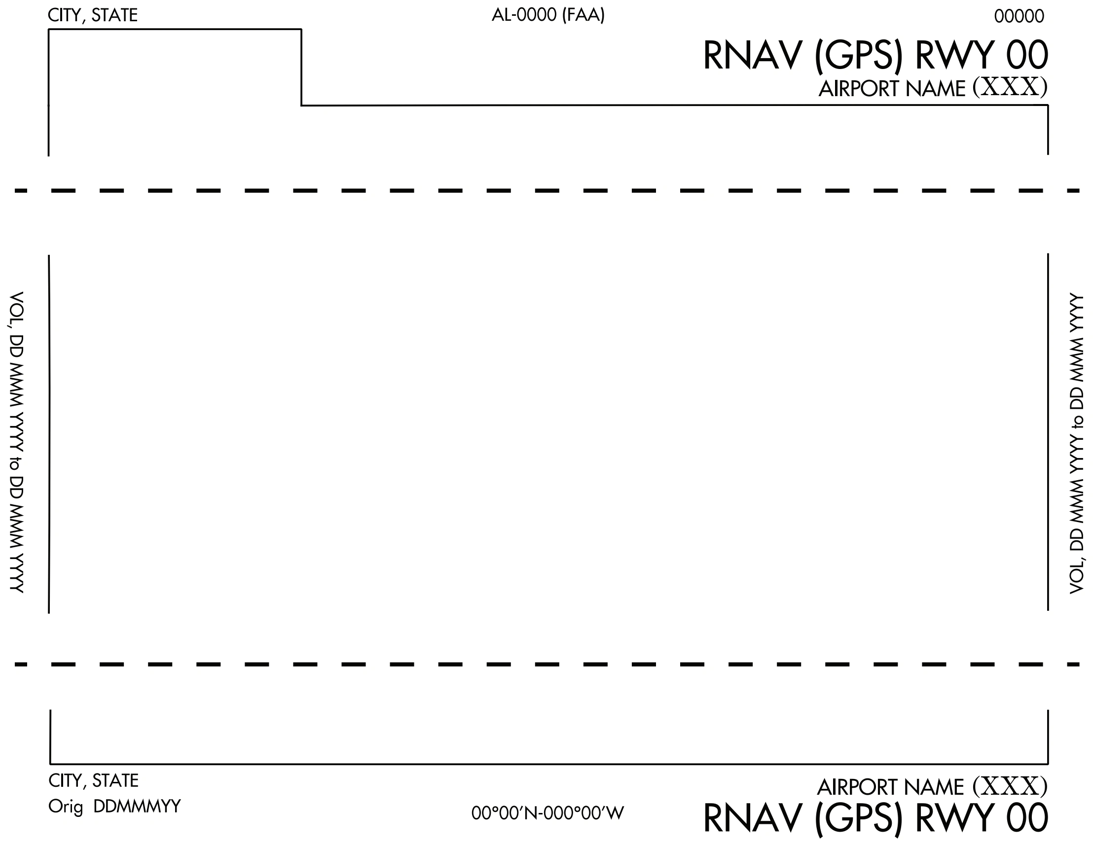
The margin identification at the top, bottom, and sides of the chart provides information about the airport location, procedure identification, and chart currency. The charts are organized by city first, then airport name and state, with the exception of military charts, which are organized by airport name. Going from the top of the chart, reading from… — source page 99.
The margin identification at the top, bottom, and sides of the chart provides information about the airport location, procedure identification, and chart currency. The charts are organized by city first, then airport name and state, with the exception of military charts, which are organized by airport name. Going from the top of the chart, reading from left to right, and going down the chart, Margin Identification Information is organized in the following way.
The hash marks along the top and bottom borders of military Instrument Approach Charts indicate that the procedure was designed using High Altitude criteria contained in FAA Order 8260.3. These procedures are designed to support high performance military aircraft operations and are not intended for civilian use.
Military IAP border hash marks — high-altitude criteria / military-only procedure — source page 99.
Margin Identification Information The margin identification at the top, bottom, and sides of the chart provides information about the airport location, procedure identification, and chart currency. The charts are organized by city first, then airport name and state, with the exception of military charts, which are organized by airport name. Going from the top of the chart, reading from left to right, and going down the chart, Margin Identification Information is organized in the following way. The hash marks along the top and bottom borders of military Instrument Approach Charts indicate that the procedure was designed using High Altitude criteria contained in FAA Order 8260.3. These procedures are designed to support high performance military aircraft operations and are not intended for civilian use.
Cookie Preferences
We use cookies to operate this website, improve performance, understand site traffic, and personalize your experience. Essential cookies are always active because they are required for the website to function.
Required for basic site functionality and security.
Help us understand how visitors use the website so we can improve it.
May be used for advertising, remarketing, or social media features.
You can update your choices anytime using Cookie Settings. View Privacy Policy