Aviation Training Experts™

other

Aeronautical Chart Users’ Guide

FAA Chart Users’ Guide Version 9 July 2026

VFR Sectional and Terminal Area Charts

Responsive VFR Sectional and Terminal Area Chart legends for airports, radio aids, airspace, procedures, culture, hydrography, and relief.

Chart Limits Outline on Sectional of Terminal Area Chart TAC Outline of Special Chart on Sectional and Terminal Area Chart Outline on Sectional of Inset Chart NAVIGATIONAL AND PROCEDURAL INFORMATION (Continued) CULTURE Railroads Single Track Double Track More Than Two Tracks Electric Non-operating, Abandoned or Under Construction Roads Dual-Lane Divided Highway Category 1 Primary Category 2 Secondary Category 2 Trails Category 3 Provides symbolization for dismantled railroad when combined with label “dismantled railroad.” Railroad Yards Limiting Track To Scale Location Only Railroad Stations Railroad Sidings and Short Spurs Road Markers Interstate Route No. U.S. Route No. Air Marked Identification Label Road Names Roads Under Construction
Source page 35

CULTURE (Continued)

Related Features to Railroads and Roads

Bridges and Viaducts
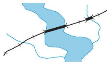
FAA aeronautical chart visual associated with “Railroad” (source page 35).
Railroad — source page 35.
Railroad

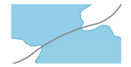
Causeways

FAA aeronautical chart visual associated with “Causeway symbol” (source page 35).
Causeway symbol — source page 35.

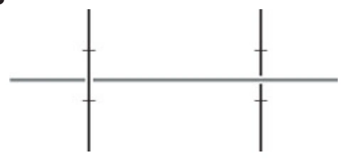
Overpasses and Underpasses

FAA aeronautical chart visual associated with “Overpass/underpass symbols” (source page 35).
Overpass/underpass symbols — source page 35.

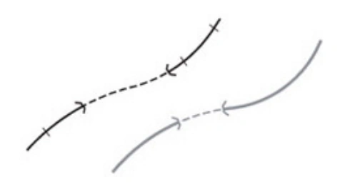
Tunnels-Road and Railroad

FAA aeronautical chart visual associated with “Road-and-railroad tunnel symbols” (source page 35).
Road-and-railroad tunnel symbols — source page 35.

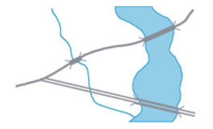
Bridges and Viaducts

FAA aeronautical chart visual associated with “Road bridge/viaduct crossing water” (source page 35).
Road bridge/viaduct crossing water — source page 35.
Road

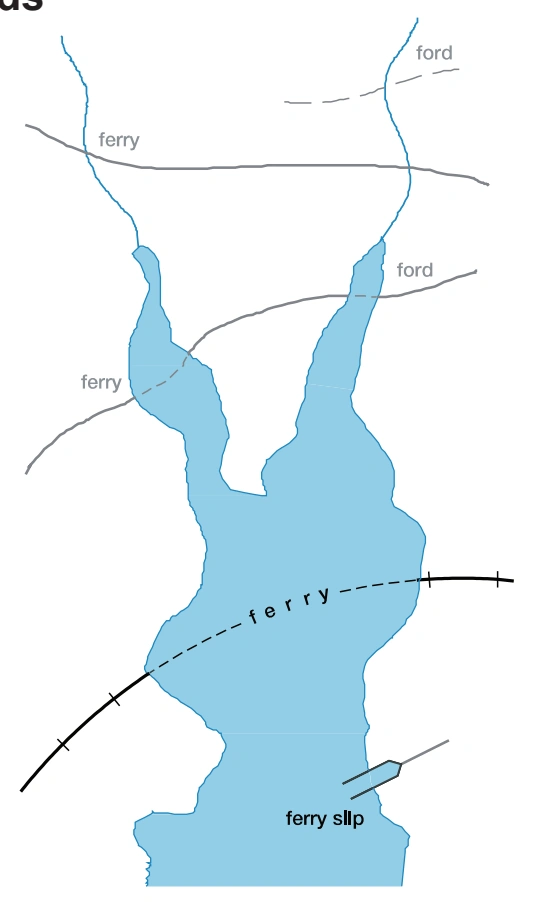
Ferries, Ferry Slips and Fords

FAA aeronautical chart visual associated with “Ferries, ferry slips, and fords” (source page 35).
Ferries, ferry slips, and fords — source page 35.

Populated Places

FAA aeronautical chart visual associated with “Yellow tinted areas indicate populated places.” (source page 35).
Yellow tinted areas indicate populated places. — source page 35.