Responsive VFR Sectional and Terminal Area Chart legends for airports, radio aids, airspace, procedures, culture, hydrography, and relief.
Yellow tinted areas indicate populated places.
Small circle indicates an area too small to depict using yellow tint.
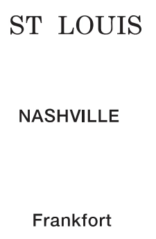
Font Style and Size indicate the category of the populated area:
Large Cities Category 1 - population more than 250,000
Cities and Large Towns Category 2 — source page 35.
Cities and Large Towns Category 2
- population 25,000 to 250,000
Towns and Villages Category 3
- population less than 25,000
CULTURE (Continued) Related Features to Railroads and Roads Bridges and Viaducts Railroad Causeways Overpasses and Underpasses Tunnels-Road and Railroad Bridges and Viaducts Road Ferries, Ferry Slips and Fords Populated Places Yellow tinted areas indicate populated places. Small circle indicates an area too small to depict using yellow tint. Font Style and Size indicate the category of the populated area: Large Cities Category 1 - population more than 250,000 Cities and Large Towns Category 2 - population 25,000 to 250,000 Towns and Villages Category 3 - population less than 25,000
Source page 36
CULTURE (Continued)
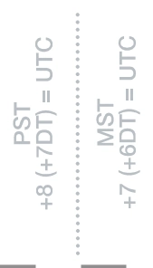
Time Zones
Date Line — source page 36.
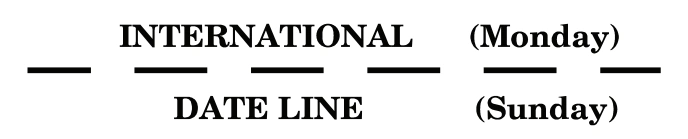
Date Line
International Date Line — Monday/Sunday labels — source page 36.
Boundaries
International
State or Province — source page 36.
State or Province
Cookie Preferences
We use cookies to operate this website, improve performance, understand site traffic, and personalize your experience. Essential cookies are always active because they are required for the website to function.
Required for basic site functionality and security.
Help us understand how visitors use the website so we can improve it.
May be used for advertising, remarketing, or social media features.
You can update your choices anytime using Cookie Settings. View Privacy Policy