
Chapter 11
Air Masses, Fronts, and the Wave Cyclone Model
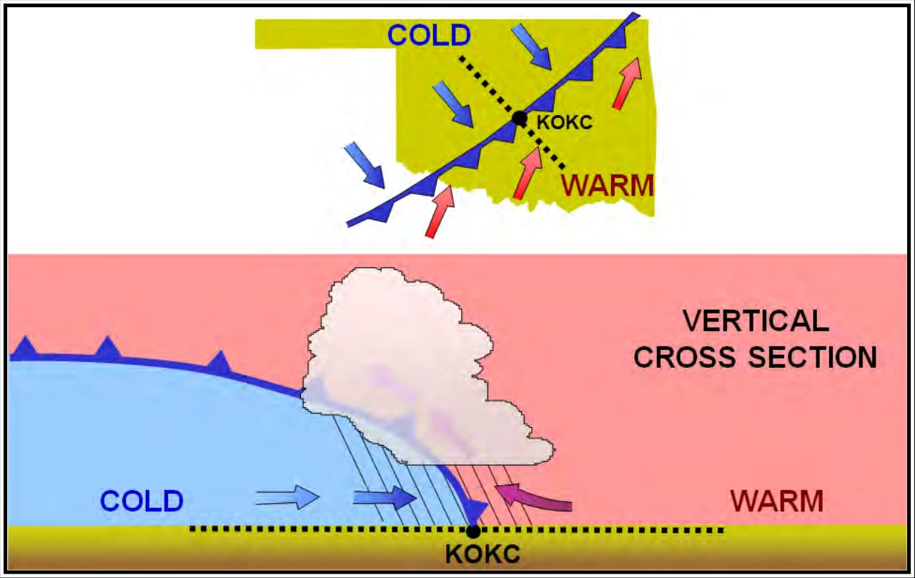
The rapidly ascending air causes the temperature to decrease suddenly, forcing the creation of clouds. The type of clouds that form depends on the stability of the warmer air mass. A cold front in the Northern Hemisphere is normally oriented in a northeast to southwest manner and can be several hundred miles long, encompassing a large area of land.
Prior to the passage of a typical cold front, cirriform or towering cumulus clouds are present, and cumulonimbus clouds may develop. Rain showers may also develop due to the rapid development of clouds. A high dewpoint and falling barometric pressure are indicative of an imminent cold front passage.
As the cold front passes, towering cumulus or cumulonimbus clouds continue to dominate the sky. Depending on the intensity of the cold front, heavy rain showers form and may be accompanied by lightning, thunder, and/or hail. More severe cold fronts can also produce tornadoes. During cold front passage, the visibility is poor with winds variable and gusty, and the temperature and dewpoint drop rapidly. A quickly falling barometric pressure bottoms out during frontal passage, and then begins a gradual increase. After frontal passage, the towering cumulus and cumulonimbus clouds begin to dissipate to cumulus clouds with a corresponding decrease in the precipitation. Good visibility eventually prevails with the winds from the west-northwest. Temperatures remain cooler and the barometric pressure continues to rise.
Fast-moving cold fronts are pushed by intense pressure systems far behind the actual front. The friction between the ground and the cold front retards the movement of the front and creates a steeper frontal surface. This results in a very narrow band of weather, concentrated along the leading edge of the front. If the warm air being overtaken by the cold front is relatively stable, overcast skies and rain may occur for some distance behind the front. If the warm air is unstable, scattered thunderstorms and rain showers may form. A continuous line of thunderstorms, or squall line, may form along or ahead of the front. Squall lines present a serious hazard to pilots as squall-type thunderstorms are intense and move quickly. Behind a fast-moving cold front, the skies usually clear rapidly, and the front leaves behind gusty, turbulent winds and colder temperatures.
11.3.3 Stationary Front
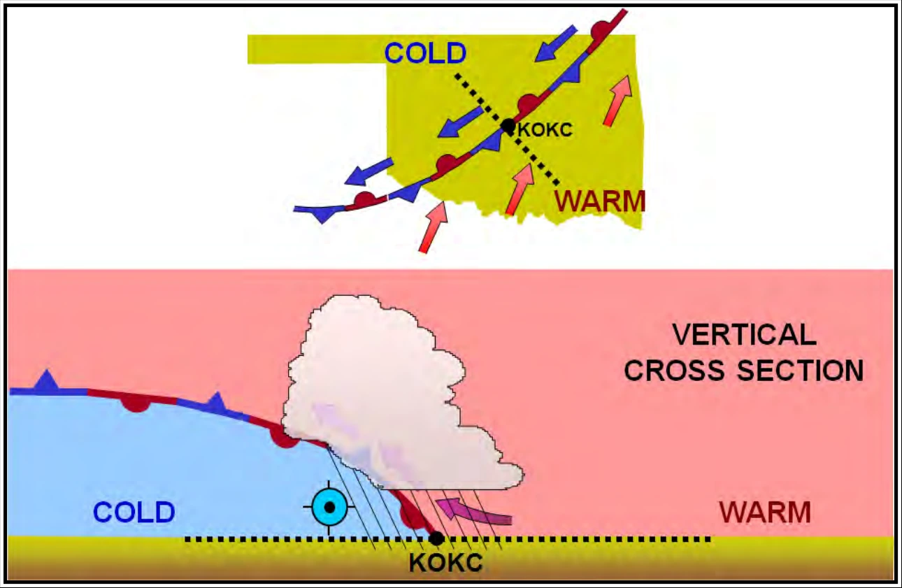
When the forces of two air masses are relatively equal, the boundary or front that separates them remains stationary and influences the local weather for days. This front is called a stationary front. Stationary frontal slope can vary, but clouds and precipitation would still form in the warm rising air along the front (see Figure 11-7). The weather associated with a stationary front is typically a mixture that can be found in both warm and cold fronts.
11.3.4 Occluded Front
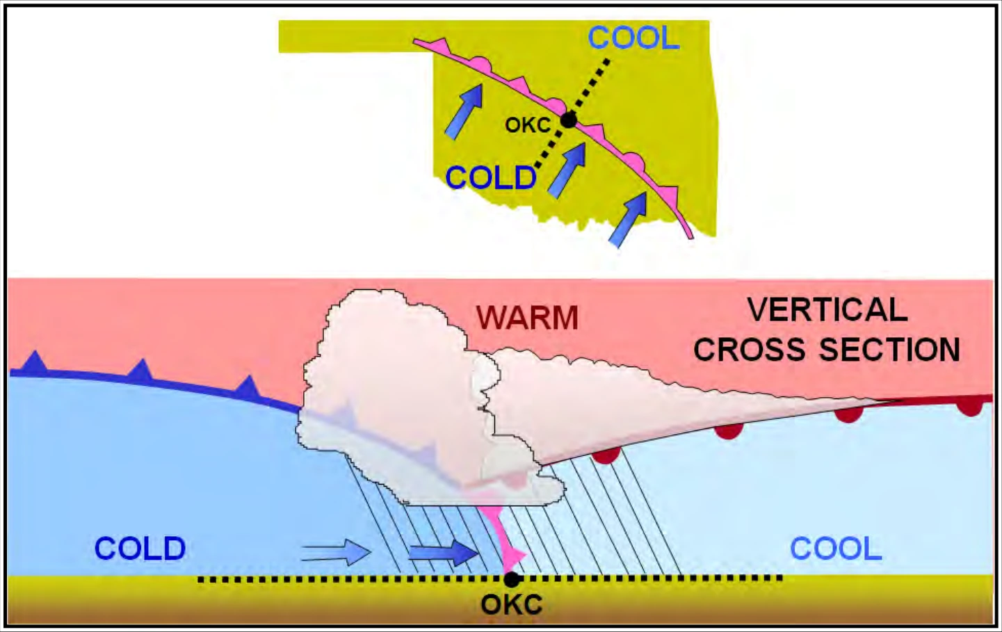
Cold fronts typically move faster than warm fronts, so in time they catch up to warm fronts. As the two fronts merge, an occluded front forms (see Figure 11-8). At the occluded front, the cold air undercuts the retreating cooler air mass associated with the warm front, further lifting the already rising warm air. Clouds and precipitation can occur in the areas of frontal lift along, ahead of, and behind the surface position of an occluded front. As the occluded front approaches, warm front weather prevails but is immediately followed by cold front weather.
There are two types of occluded fronts that can occur, and the temperatures of the colliding frontal systems play a large part in defining the type of front and the resulting weather.
A cold front occlusion occurs when a fast-moving cold front is colder than the air ahead of the slow-moving warm front. When this occurs, the cold air replaces the cool air and forces the warm front aloft into the atmosphere. Typically, the cold front occlusion creates a mixture of weather found in both warm and cold fronts, providing the air is relatively stable.
A warm front occlusion occurs when the air ahead of the warm front is colder than the air of the cold front. When this is the case, the cold front rides up and over the warm front. If the air forced aloft by the warm front occlusion is unstable, the weather is more severe than the weather found in a cold front occlusion. Embedded thunderstorms, rain, and fog are likely to occur.
11.4 The Wave Cyclone Model
A wave cyclone3 is a low-pressure circulation that forms and moves along a front. The circulation about the cyclone center tends to produce a wavelike kink along the front. Wave cyclones are the primary weather producers in the mid-latitudes. They are large lows that generally travel from west to east along a front. They last from a few days to more than a week.
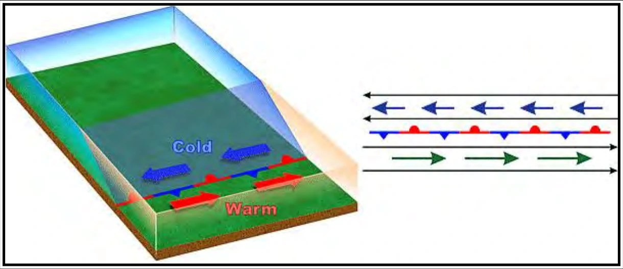
A wave cyclone typically follows a predictable evolution. Initially, there is a stationary front separating warm air from cold air (see Figure 11-9).
A low-pressure wave forms on the front (see Figure 11-10). The front develops a kink where the wave develops. Precipitation develops with the heaviest intensity (dark green) located in the zone of lift along the front.