
Chapter 11
Air Masses, Fronts, and the Wave Cyclone Model
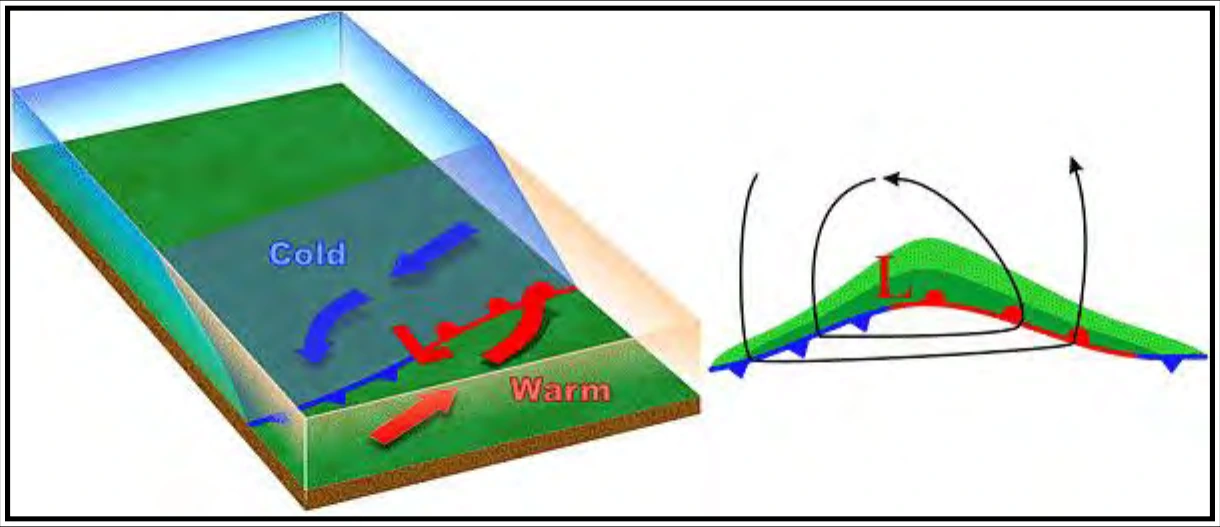
As the wave intensifies, both the cold and warm fronts become better organized (see Figure 11-11).
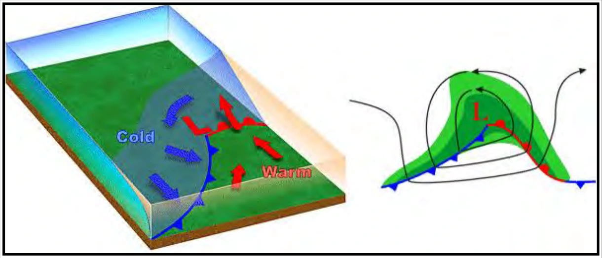
In the fourth stage, the wave becomes a mature low (see Figure 11-12). The occluded front forms as the cold front overtakes the warm front.
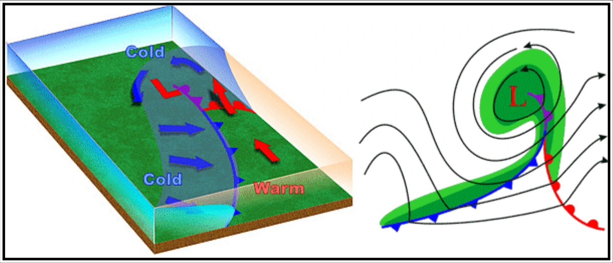
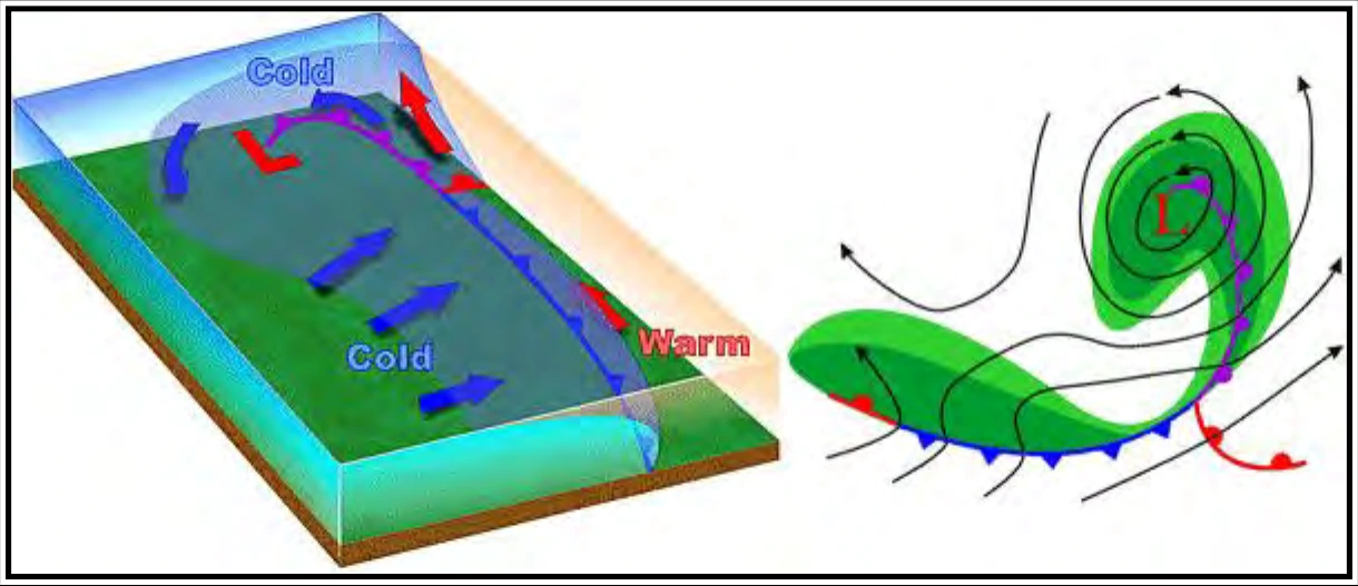
As the cold front continues advancing on the warm front, the occlusion increases and eventually cuts off the supply of warm moist air (see Figure 11-13). This causes the low to gradually dissipate.
11.5 Dryline
A dryline is a low-level boundary, hundreds of miles long, and separating moist and dry air masses. In the United States, it typically lies north-south across the southern and central High Plains during the spring and early summer, where it separates moist (mT) air from the Gulf of America to the east and dry desert (cT) air from the southwestern states to the west (see Figure 11-14).
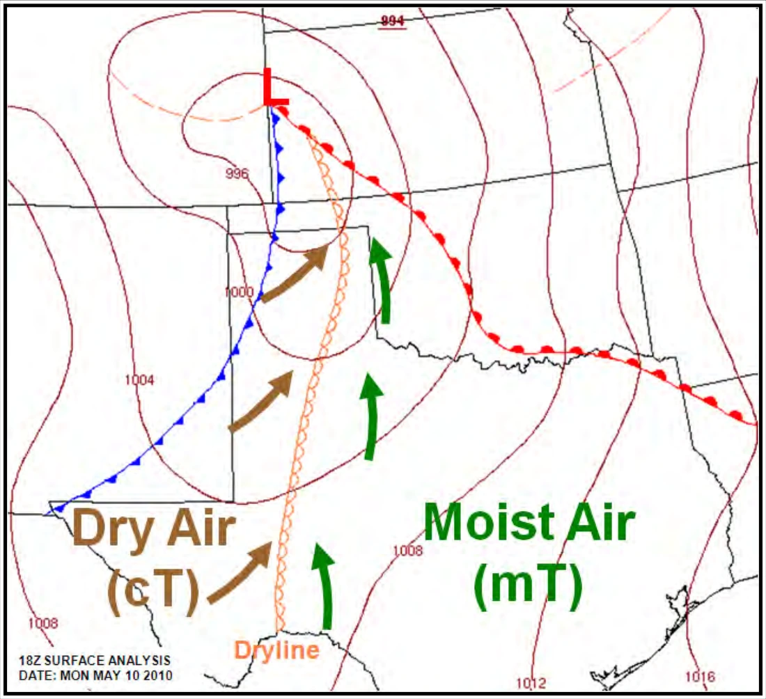
The dryline typically advances eastward during the afternoon and retreats westward at night. However, a strong wave cyclone can sweep the dryline eastward into the Mississippi Valley, or even farther east, regardless of the time of day. Low-level clouds and early morning fog often prevail in the moist air, while generally clear skies mark the dry side. Severe and sometimes tornadic thunderstorms often develop along a dryline or in the moist air just to the east of it, especially when it begins moving eastward.
A typical dryline passage results in a sharp drop in humidity (hence the name), clearing skies, and a wind shift from south or southeasterly to west or southwesterly. Blowing dust and rising temperatures also may follow, especially if the dryline passes during the daytime. These changes occur in reverse order when the dryline retreats westward.