
Chapter 15
Weather Radar
15.2.15.1.1 Intensity of Liquid Precipitation
The most significant factor in determining the reflectivity of liquid particles is the size of the precipitation particle (see Figure 15-20).
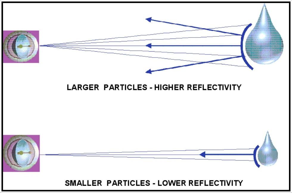
Larger particles have greater reflectivity than smaller particles. For example, a particle with a 1/4-in diameter backscatters the same amount of energy as 64 particles that each have a 1/8-in diameter.
Radar images/intensity scales are associated with reflectivities that are measured in dBZ. The dBZ values increase based on the strength of the return signal from targets in the atmosphere.
Typically, liquid precipitation-sized particle reflectivities are associated with values that are 15 dBZ or greater. Values less than 15 dBZ are typically associated with liquid cloud-sized particles. However, these lower values can also be associated with dust, pollen, insects, or other small particles in the atmosphere.
15.2.15.1.2 Convective Precipitation
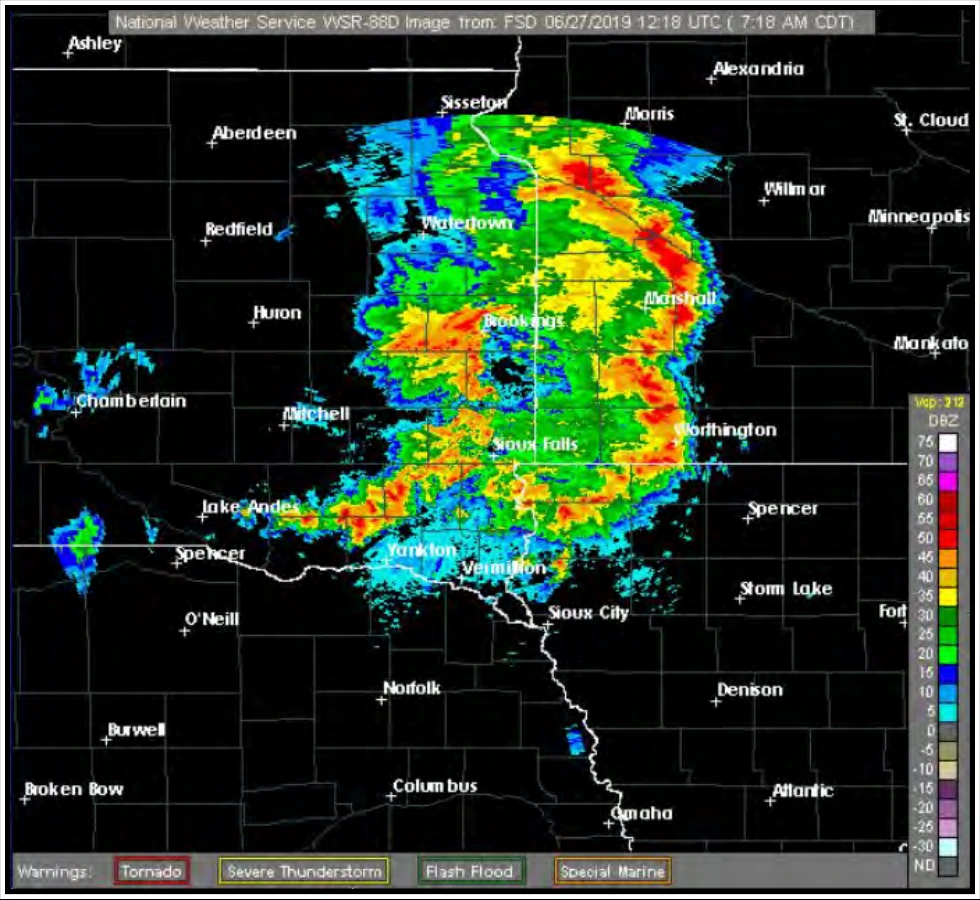
Convective precipitation (see Figure 15-21) is distinguished by the following radar characteristics:
- Echoes tend to form as lines or cells.
- Reflectivity gradients are strong.
- Precipitation intensities generally vary from moderate to extreme.
- Occasionally, precipitation intensities can be light.
- Echo patterns change rapidly when animating the image.
Numerous hazards are associated with convective precipitation. These hazards include turbulence, Low-Level Wind Shear (LLWS), strong and gusty surface winds, icing above the freezing level, hail, lightning, tornadoes, and localized IFR conditions below the cloud base due to heavy precipitation.
15.2.15.1.3 Stratiform Precipitation
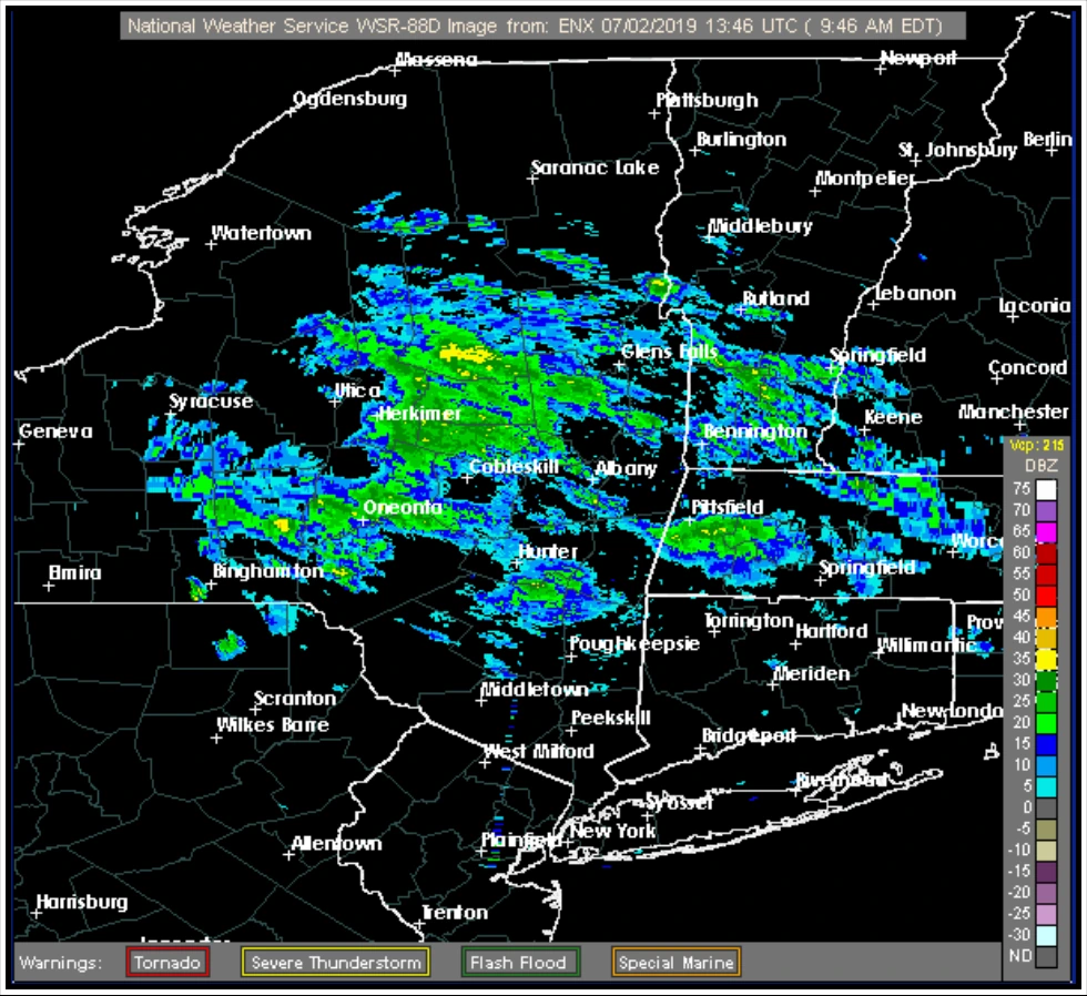
Stratiform precipitation (see Figure 15-22) has the following radar characteristics:
- Widespread in aerial coverage.
- Weak reflectivity gradients.
- Precipitation intensities are generally light or moderate (39 dBZ or less).
- Occasionally, precipitation intensities can be stronger.
- Echo patterns change slowly when animating the image.
Hazards associated with stratiform precipitation include possible widespread icing above the freezing level, low ceilings, and reduced visibilities.
15.2.15.1.4 Intensity of Snow
A radar image cannot reliably be used to determine the intensity of snowfall. However, snowfall rates generally increase with increasing reflectivity.
15.2.15.1.5 Bright Band
Bright band is a distinct feature observed by radar that denotes the freezing (melting) level. The term originates from a band of enhanced reflectivity that can result when a radar antenna scans through precipitation. The freezing level in a cloud contains ice particles that are coated with liquid water. These particles reflect significantly more energy (appearing to the radar as large raindrops) than the portions of the cloud above and below the freezing layer.