Chapter 15
Weather Radar
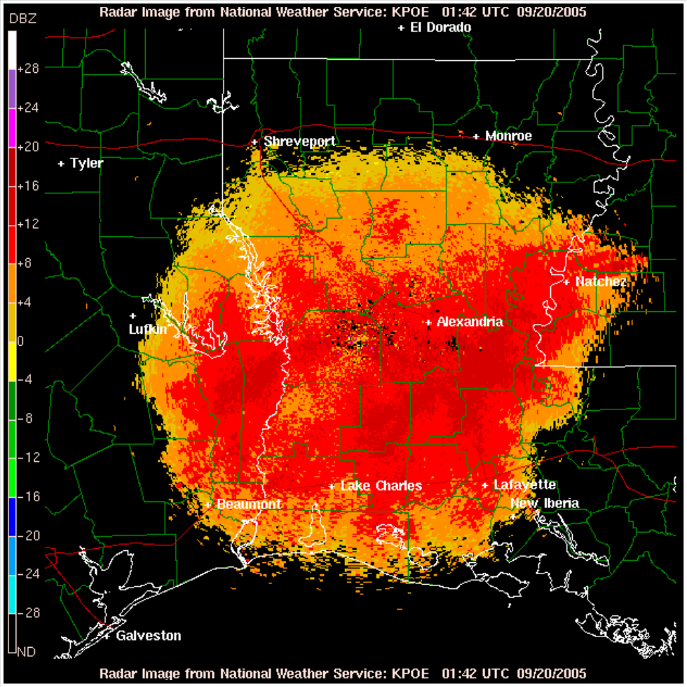
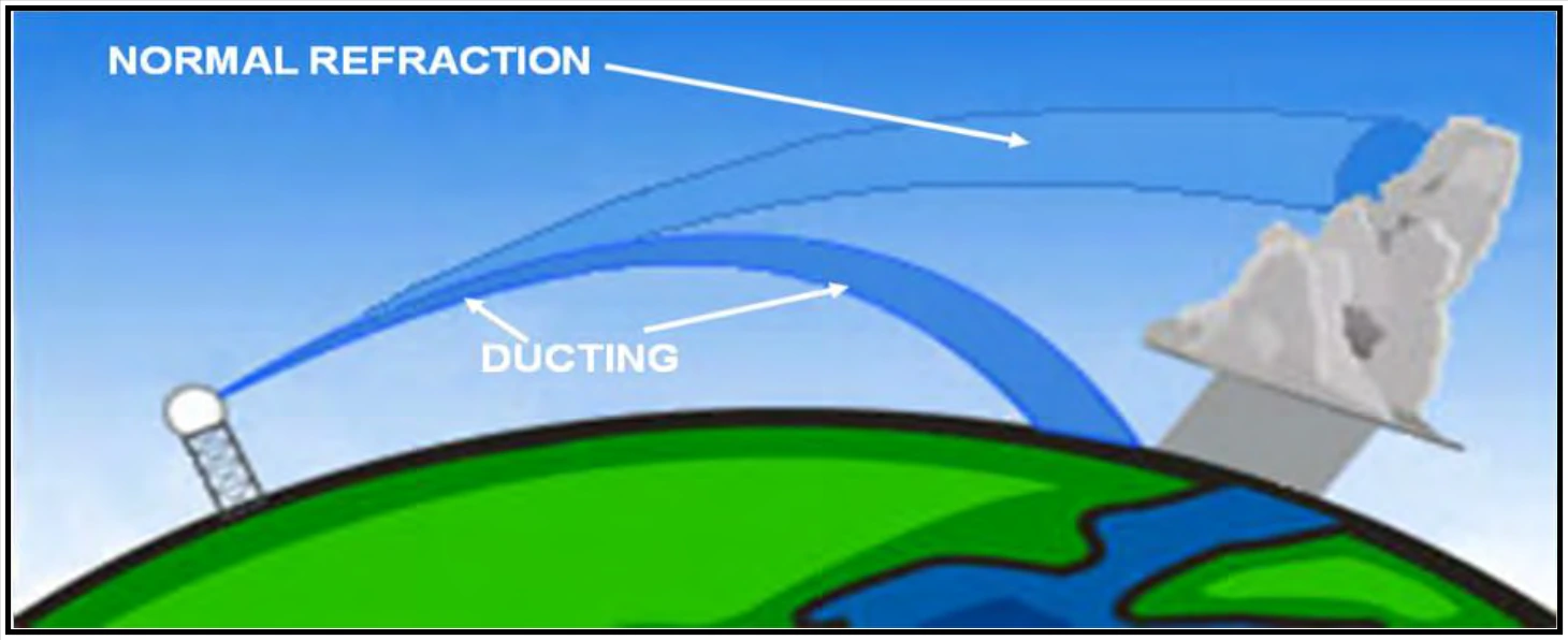
If the atmospheric condition that causes superrefraction bends the beam equal to, or greater than, the Earth’s curvature, then a condition called ducting (or trapping) occurs (see Figure 15-11).
When ducting occurs, the radar beam will hit the surface of the Earth, causing some of the beam’s energy to backscatter. This often leads to false echoes, also known as anomalous propagation (AP), to appear in the radar display.
15.2.8 Radar Beam Overshooting and Undershooting
Radar beam overshooting may occur because the lowest radar beam can be higher than the top of precipitation. This will most likely occur with stratiform precipitation and low-topped convection. For example, at a distance of 124 NM from the radar, the lowest radar beam is at an altitude of approximately 18,000 ft; at 248 NM the beam height is approximately 54,000 ft. Any precipitation with tops below these altitudes and distances will not be displayed on a single-site radar image. Therefore, it is quite possible that precipitation may be occurring where none appears on the single-site radar image.
Radar overshooting occurs more often in the mountainous western United States where some radars are located on a mountaintop (e.g., the WSR-88D near Cedar City, UT).
Radar undershooting occurs when precipitation occurs above the lowest radar beam, usually with high-cloud-based precipitation near the radar site. This often occurs in the western United States during the summer months.
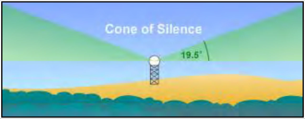
Undershooting may occur at and near the radar site even in mosaic products when the precipitation is above the highest elevation angle. This region above the radar is known as the “cone of silence” (see Figure 15-12).
15.2.9 Beam Blockage
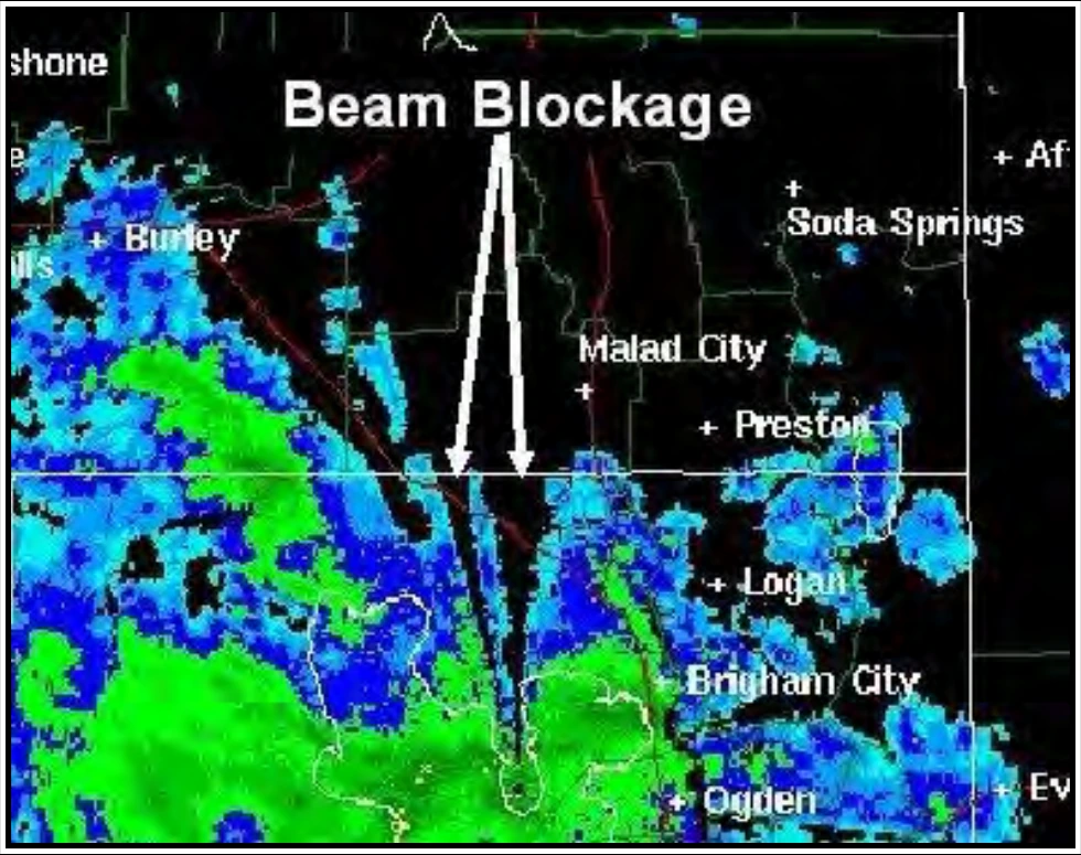
Beam blockage (see Figure 15-13) occurs when the radar beam is blocked by terrain and is particularly predominant in mountainous terrain. See Section 24.6.1 for more information on the WSR-88D.
Beam blockage is most easily seen on the lowest radar beam (also known as “Base Reflectivity,” “Lowest Tilt,” and “Reflectivity at Lowest Altitude”) images where it appears as a pie-shaped area (or areas) perpetually void of echoes. When animating the imagery, the beam blockage area will remain clear of echoes even as precipitation and other targets pass through. In many cases, the beam blockage effect seen on a single-site radar can be minimized by viewing mosaic images.
15.2.10 Ground Clutter
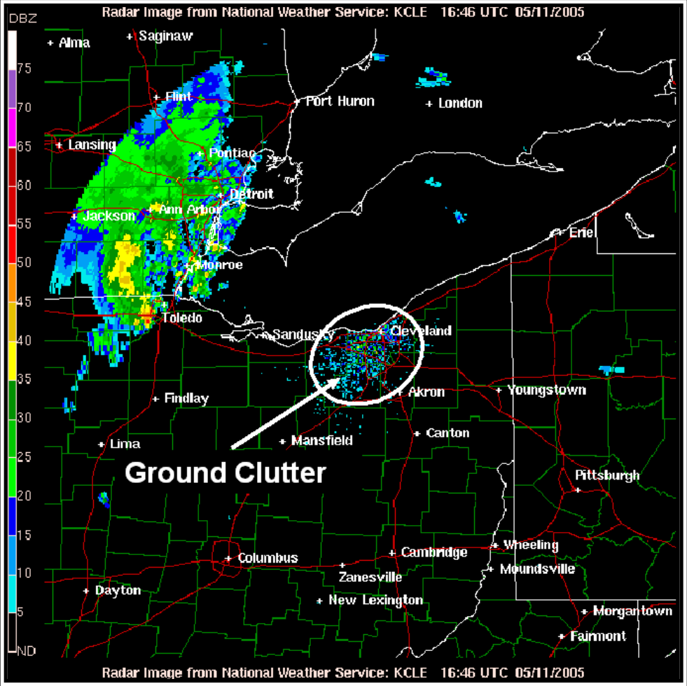
Ground clutter (see Figure 15-14) is radar echoes’ returns from trees, buildings, or other objects on the ground. It appears as a roughly circular region of high reflectivity at ranges close to the radar. Ground clutter appears stationary when animating images and can mask precipitation located near the radar. Most ground clutter is automatically removed from WSR-88D imagery, so typically it is does not interfere with image interpretation.
15.2.11 Ghost
A ghost (see Figure 15-15) is a diffused echo in apparently clear air caused by a “cloud” of point targets, such as insects, or by refraction returns of the radar beam in truly clear air.
The latter case commonly develops at sunset due to superrefraction during the warm season. The ghost develops as an area of low reflectivity echoes (typically less than 15 decibels of Z (dBZ)) near the radar site and quickly expands. When animating the imagery, the ghost echo shows little movement.