
Chapter 16
Mountain Weather
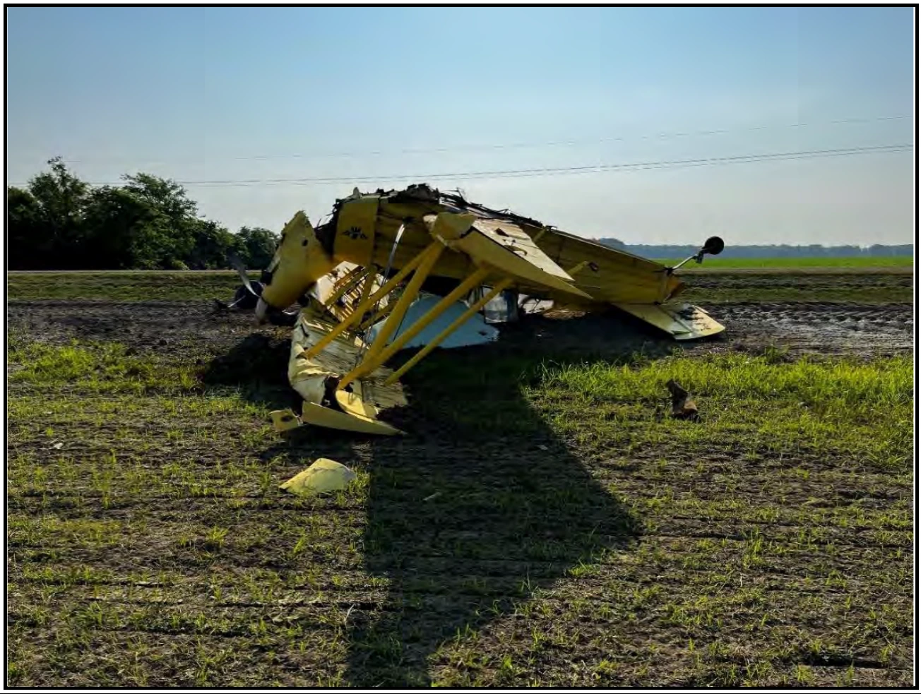
(Photo courtesy of the National Transportation Safety Board (NTSB))
16.2.6.4 Boras
The Glossary of Meteorology10 defines a bora as a “fall wind with a source so cold that, when the air reaches the lowlands or coast, the dynamic warming is insufficient to raise the air temperature to the normal level for the region; hence it appears as a cold wind.” Cold air building up on one side of a mountain range will often be blocked. However, if it deepens sufficiently, it will eventually spill over the mountain barrier and accelerate down the opposite slope, on rare occasions reaching speeds as high as 80 kt.
The resulting low-level winds and turbulence can be a significant hazard for aircraft that are flying in the vicinity of the down-rush of air caused by the bora. The danger is heightened by the fact that the exact timing and location of the air surge is difficult to forecast. There are at least two primary causes of boras:
- cold fronts aligned parallel to the mountain range and moving perpendicular to it, with the cold air eventually spilling over; and
- cold outflow, from thunderstorms over or near a mountain range, that builds up to sufficient depth to spill over and down the opposite slope.
The latter phenomenon is short-lived and very difficult to predict; the strong thunderstorm winds typically last less than one hour. However, strong downslope winds accompanying and following cold front passages can persist for several hours. Only the initial stages of such winds have true bora or fall-wind characteristics; these winds appear to evolve into severe downslope windstorms associated with breaking waves aloft and, therefore, become potentially dangerous at all altitudes, not just within a few thousand feet of the surface.
In many areas along the eastern slopes of the Rocky Mountains, and in particular in Colorado, prefrontal windstorms with very warm lee-side temperatures are known as chinooks; post-cold frontal windstorms with cold lee-side winds are often called bora windstorms, or boras. Thus, the term bora in these areas can mean both the initial strong burst of a cold downslope wind and any subsequent downslope windstorm. In the case of eastern-slope boras, the best indicators during the preflight briefing are the presence of a strong cold front moving through the area (i.e., with much colder air behind the front), with associated rapid frontal movement (on the order of 30 kt or more). Surface observations (as reported in a METAR), particularly special observations of strong, rapidly changing surface winds from the west or northwest, along with decreasing temperature, may warn of bora activity. The indicators for breaking internal gravity waves should not be ignored. Western-slope boras are less common and are usually associated with a strong buildup of extremely cold arctic air on the eastern slopes.
16.2.6.5 Other Phenomena
In addition to the vortex phenomena previously discussed, vortices or strong shear zones may be generated locally by strong flow past individual mountain peaks and crags, or through gaps and passes across mountain ranges.
The point is that strong wind flow in the vicinity of irregular terrain can produce a multitude of disturbances of varying size and strength, many without reliable visual indicators. Their presence should be suspected when flying downwind of rugged terrain, whenever the wind flow at ridge level exceeds about 20 kt.
16.2.7 Visual Indicators of Orographic Wind Fields
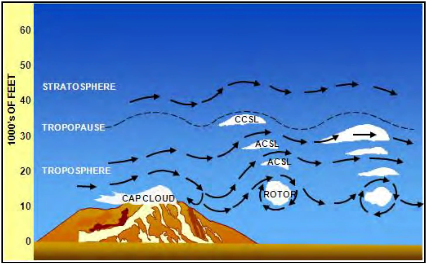
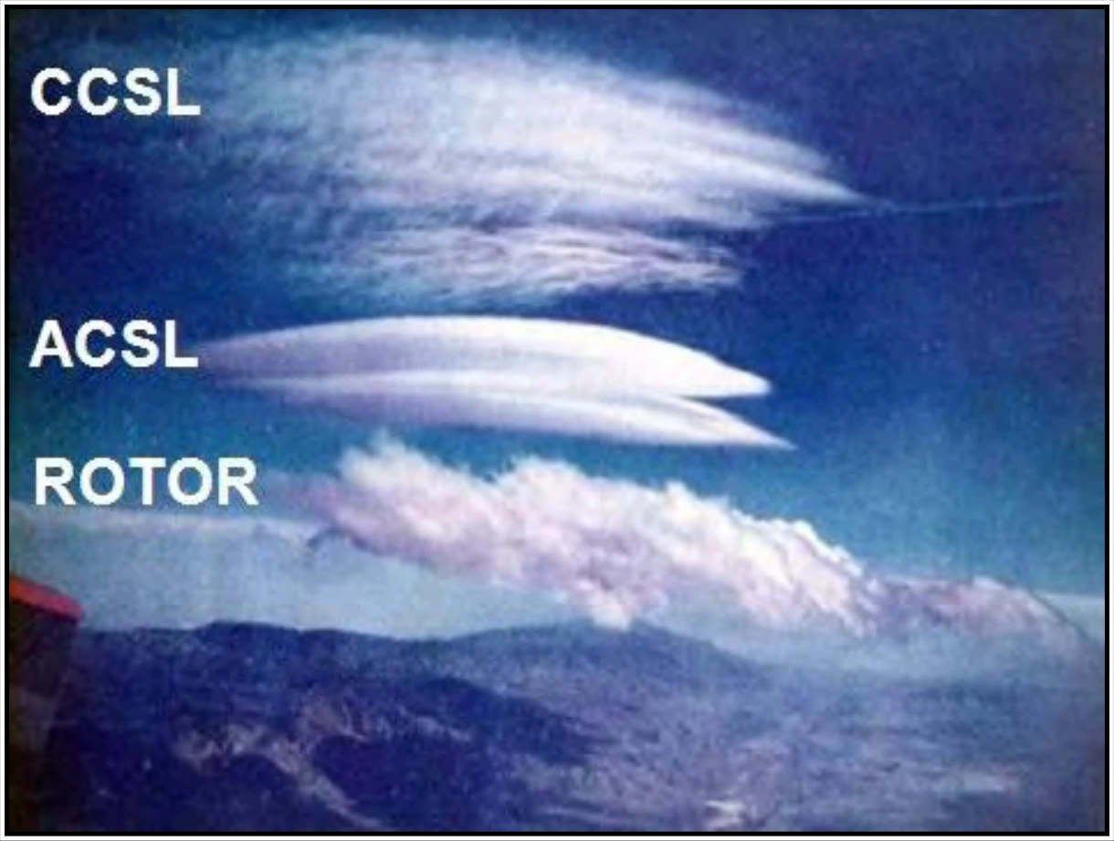
Figure 16-15 provides a schematic of mountain waves and possible associated clouds. The most distinctive clouds are the sharp-edged, lens-shaped (or almond-shaped) lenticular clouds. When sufficient moisture is present in the upstream flow, mountain waves can produce interesting cloud formations, including cap clouds, Cirrocumulus Standing Lenticular (CCSL), ACSL, and rotor clouds (see Figure 16-16). These clouds provide visual proof that mountain waves exist. However, these clouds may be absent if the air is too dry.
16.3 Mountain/Valley Breezes and Circulation
See Sections 10.6.4, 10.6.5, and 10.6.6 for information on mountain/valley breezes and circulation.
16.4 Mountain/Valley Fog
See Section 18.1.1.1.1.1 for information on mountain/valley fog.