
Chapter 19
Turbulence
CAT intensity can vary significantly along any flightpath. Common dimensions of a turbulent area associated with a jet stream are on the order of 100–300 mi long, elongated in the direction of the wind, 50–100 mi wide, and 5,000 ft deep. These areas may persist from 30 minutes to one day.
The threshold wind speed in the jet stream for CAT is generally considered to be 110 kt. The probability of encountering CAT increases proportionally with the rapidity of the decrease in wind speed away from the jet core. This is known as wind shear. It is not the wind speed itself that causes CAT; it is the wind shear that is turbulent to an aircraft, as the atmosphere bounces in waves or actually overturns. Moderate CAT is considered likely when the vertical wind shear is 5 kt per 1,000 ft or greater, and/or the horizontal wind shear is 40 kt per 150 mi or greater.
Jet streams stronger than 110 kt (at the core) have potential for generating significant turbulence near the sloping tropopause above the core, in the jet stream front below the core, and on the low-pressure side of the core.
Wind shear and its accompanying CAT in jet streams are more intense above, and to the lee of, mountain wave ranges. CAT should be anticipated whenever the flightpath traverses a strong jet stream in the vicinity of mountainous terrain.
Both vertical and horizontal wind shear are, of course, greatly intensified in mountain wave conditions. Therefore, when the flightpath traverses a mountain-wave-type of flow, it is desirable to fly at turbulence penetration speed and avoid flight over areas where the terrain drops abruptly, even though there may be no lenticular clouds to identify the condition.
CAT is also related to vertical shear. If vertical shear is greater than 5 kt per 1,000 ft, turbulence is likely.
Curving jet streams are more apt to have turbulent edges than straight ones, especially jet streams that curve around a deep pressure trough.
Wind shift areas associated with pressure troughs and ridges are frequently turbulent. The magnitude of the wind shear is the important factor.
19.2.4 Wind Shear
Wind shear is the sudden, drastic change in wind speed and/or direction over a small area, from one level or point to another, usually in the vertical (see Figure 19-7). Wind shear occurs in all directions, but for convenience, it is measured along vertical and horizontal axes, thus becoming horizontal and vertical wind shear.
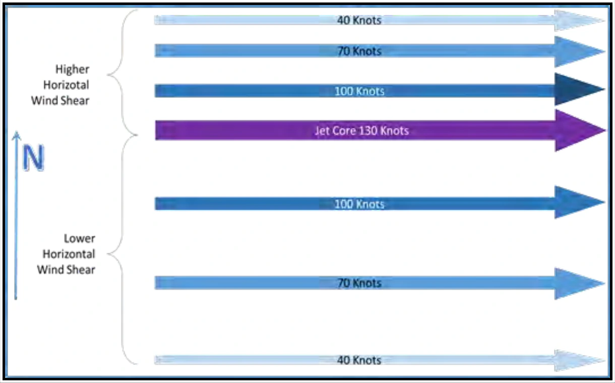
It is important to remember that wind shear can affect any flight at any altitude (e.g., at upper levels near jet steams or near the ground due to convection). Wind shear can subject an aircraft to violent updrafts and downdrafts, as well as abrupt changes to the horizontal movement of the aircraft. While wind shear may be reported, it often remains undetected and is a silent aviation weather hazard. Always be alert to the possibility of wind shear, especially when flying in and around thunderstorms and frontal systems.
Some references or publications may use the term “severe wind shear.” They may define the term as a wind shear that exceeds the performance capability of the aircraft or a wind shear producing airspeed changes greater than 15 kt or vertical speed changes greater than 500 feet per minute (fpm).
19.2.4.1 Non-Convective Low-Level Wind Shear (LLWS)
Wind variations at low altitude have long been recognized as a serious hazard to airplanes during takeoff and approach. These wind variations can result from a large variety of meteorological conditions such as topographical conditions, temperature inversions, sea breezes, frontal systems, and strong surface winds.
While wind shear can occur at any altitude; non-convective LLWS is especially hazardous due to the proximity of an aircraft to the ground. Non-convective LLWS is defined as a wind shear of 10 kt or more per 100 ft in a layer more than 200 ft thick that occurs within 2,000 ft of the surface. So, what does this mean? It means that within the lowest 2,000 ft, the wind speed and/or direction is changing rapidly in a 200-ft layer (see Figure 19-8). Non-convective LLWS is commonly associated with passing frontal systems, temperature inversions, and strong upper-level winds (greater than 25 kt).
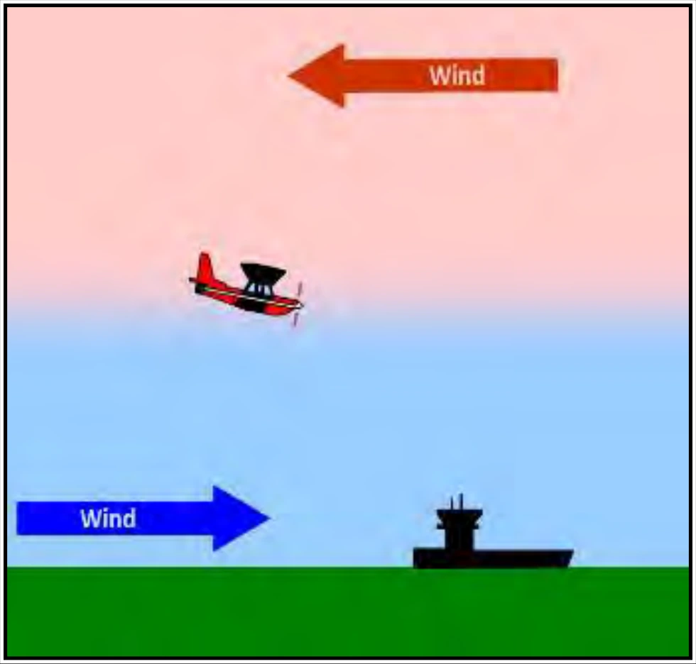
19.2.4.2 Convective Wind Shear
See Section 22.7.3 for information on convective wind shear.