
Chapter 26
Advisories
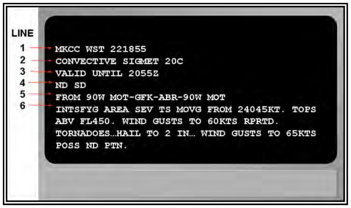
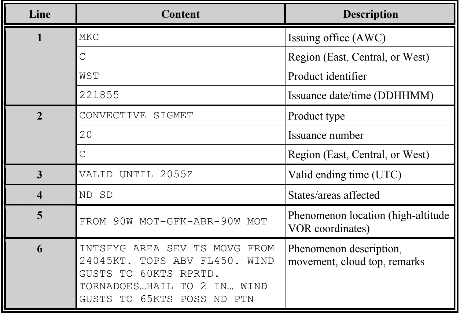
The Convective SIGMET in Figure 26-6 is decoded as the following:
- (Line 1) Convective SIGMET issued for the central portion of the United States on the 22nd day of the month at 1855Z.
- (Line 2) This is the 20th Convective SIGMET issued on the 22nd day of the month for the central United States as indicated by “20C.”
- (Line 3) Valid until 2055Z.
- (Line 4) The affected states are North Dakota and South Dakota.
- (Line 5) From 90 NM west of Minot, ND; to Grand Forks, ND; to Aberdeen, SD; to 90 NM west of Minot, ND.
- (Line 6) An intensifying area of severe thunderstorms moving from 240° at 45 kt (to the northeast). Thunderstorm tops above FL450. Wind gusts to 60 kt reported. Tornadoes, hail with diameter of two inches, and wind gusts to 65 kt possible in the North Dakota portion.
26.2.4.2.5 Convective SIGMET Outlook
Each Convective SIGMET bulletin includes a two- to six-hour outlook at the end of the bulletin. The content and order of each bulletin is as follows:
- Beginning and ending valid times.
- Location of expected Convective SIGMET issuances delineated by high-altitude VOR coordinates for the outlook valid time.
26.2.4.2.6 Convective SIGMET Cancellations
Convective SIGMETs are not cancelled but are superseded by the next Convective SIGMET in the series.
26.2.4.2.7 Convective SIGMET Amendments
Amended Convective SIGMETs are not issued. Instead, a new Convective SIGMET is issued for that region.
26.2.4.2.8 Convective SIGMET Corrections
Corrections to Convective SIGMETs are issued as necessary. The corrected Convective SIGMET is identified by a “COR” located at the end of the first line after the issuance UTC date/time.
26.2.5 Outside the CONUS
26.2.5.1 SIGMET Issuance Criteria—Outside the CONUS
U.S. SIGMETs outside the CONUS are issued when any of the following conditions affect or, in the judgment of the forecaster, are expected to affect an area judged to have a significant impact on the safety of aircraft operations:
- Thunderstorm—of type below:*
- Obscured (OBSC TS).
- Embedded (EMBD TS).
- Widespread (WDSPR TS).
- Squall line (SQL TS).
- Isolated severe (ISOL SEV TS).
- Severe turbulence (SEV TURB).
- Severe icing (SEV ICE); with freezing rain (SEV ICE (FZRA)).
- Widespread dust storm (WDSPR DS).
- Widespread sandstorm (WDSPR SS).
- Volcanic ash (VA).
- Tropical cyclone (TC).
*Tornado (TDO), funnel cloud (FC), waterspout (WTSPT), and heavy hail (HVY GR) may be used as further descriptions of the thunderstorm, as necessary.
26.2.5.2 SIGMET Issuance Time and Valid Period—Outside the CONUS
A SIGMET is an unscheduled product issued any time conditions reaching SIGMET criteria are occurring or expected to occur within a four-hour period. A SIGMET outside the CONUS can have a valid period up to, but not exceeding, four hours, except for volcanic ash (VA) and tropical cyclone (TC), which can be valid up to six hours. SIGMETs for continuing phenomena will be reissued at least every four (or six) hours as long as SIGMET conditions continue to occur in the area of responsibility.