
Chapter 27
Forecasts
27.4.2.7.2 Thunderstorm Descriptor
The TS descriptor is treated differently than other descriptors in the following cases:
- When nonprecipitating thunderstorms are forecast, TS may be encoded as the sole significant weather phenomenon; and
- When forecasting thunderstorms with freezing precipitation (FZRA or FZDZ), the TS descriptor is included first, followed by the intensity and weather phenomena.
Example:
TS -FZRA
When a thunderstorm is included in the significant weather group (even using vicinity, VCTS), the cloud group (N N N h h h ) includes a forecast cloud type of CB. See the following example for encoding VCTS.
Example:
-FZRA VCTS BKN010CB
27.4.2.7.3 Fog Forecast
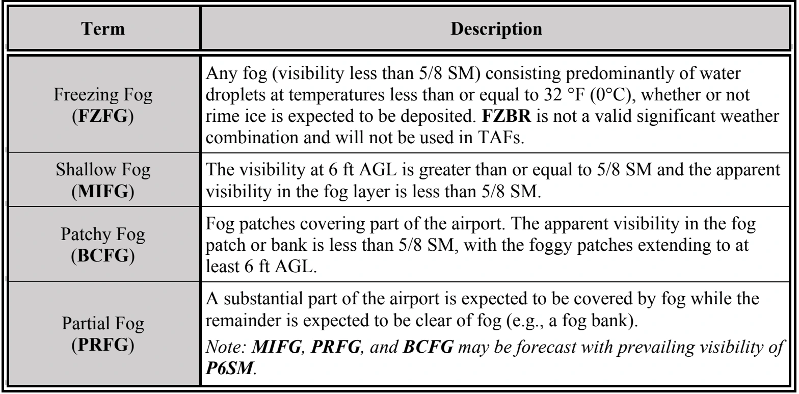
A visibility threshold must be met before a forecast for fog (FG) is included in the TAF. When forecasting a fog-restricted visibility from 5/8 to 6 SM, the phenomenon is coded as BR (mist). When a fog-restricted visibility is forecast to result in a visibility of less than 5/8 SM, the code FG is used. The forecaster never encodes weather obstruction as mist (BR) when the forecast visibility is greater than 6 SM (P6SM).
Fog-related terms are used as described in Table 27-4.
Examples:
1/2SM FG
Fog is reducing visibilities to less than 5/8 SM, therefore FG is used to encode the fog.
3SM BR
Fog is reducing visibilities to between 5/8 and 6 SM, therefore BR is used to encode the fog.
27.4.2.8 Vicinity (VC)
In the United States, vicinity (VC) is defined as a donut-shaped area between 5 SM and 10 SM from the center of the airport’s runway complex. NWS TAFs may include a prevailing condition forecast of fog, showers, and thunderstorms in the airport’s vicinity. A prevailing condition is defined as a greater than or equal to 50 percent probability of occurrence for more than half of the subdivided forecast time period. VC is not included in temporary (TEMPO) or probability (PROB) groups.
The significant weather phenomena in Table 27-5 are valid for use in prevailing portions of NWS’ TAFs in combination with VC.