Appendix A: Cloud Types
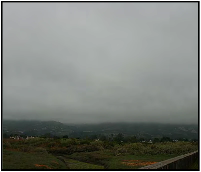
The particulate composition of stratus is quite uniform, usually of fairly widely dispersed water droplets and, at lower temperatures, of ice crystals (although this is much less common). Halo phenomena may occur with this latter composition.
Stratus produces little or no turbulence, but temperatures near or below freezing can create hazardous icing conditions. When stratus is associated with fog or precipitation, the combination can become troublesome for visual flying.
Stratus most commonly occurs as a gray, fairly uniform, and featureless single layer of low cloud. Occasionally, it can be dark or threatening, although at most it can only produce weak precipitation. This feature makes it fairly easy to distinguish it from nimbostratus (Ns), which nearly always produces rain, snow, or ice pellets. Fog will often lift into a layer of stratus by an increase in wind or a rise in temperature. Stratus is sometimes comparatively thin, and the disk of the Sun or Moon may be seen with a clear outline.
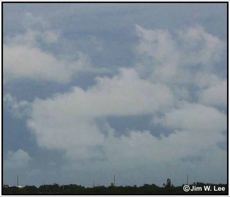
Stratus fractus (StFra) and/or cumulus fractus (CuFra) (see Figure A-12) are ragged shreds of low clouds that always appear in association with other clouds for a short time before, during, and a short time after precipitation. They often form beneath lowering altostratus (As) or nimbostratus (Ns). They also occur beneath cumulonimbus (Cb) and precipitating cumulus (Cu) and are collectively known as “scud clouds.”
A.3.4 Cumulonimbus (Cb)
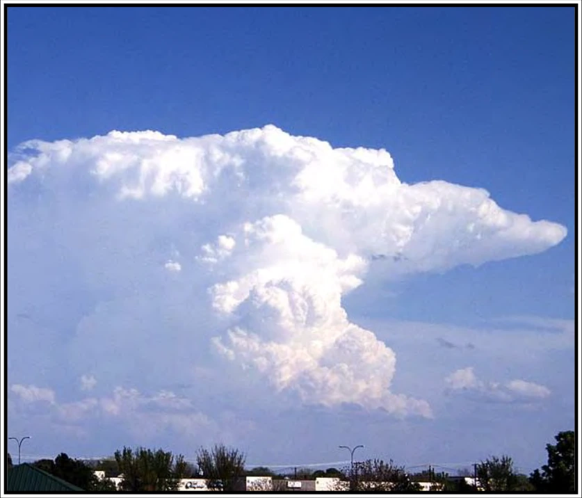
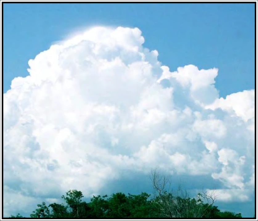
Cumulonimbus (Cb) (see Figure A-13 and Figure A-14) is a cloud type, exceptionally dense and vertically developed, occurring either as isolated clouds or as a line or wall of clouds with separated upper portions. These clouds appear as mountains or huge towers, at least a part of the upper portions of which are usually smooth, fibrous, or striated, and almost flattened as it approaches the tropopause. This part often spreads out in the form of an anvil or vast plume. Under the base of cumulonimbus, which is often very dark, there frequently exist virga, precipitation, and low, ragged clouds, either merged with it or not. Its precipitation is often heavy and always of a showery nature. The usual occurrence of lightning and thunder within or from this cloud leads to its popular appellations: thundercloud, thunderhead (the latter usually refers only to the upper portion of the cloud), and thunderstorm.
Cumulonimbus is composed of water droplets and ice crystals, the latter almost entirely in its upper portions. It also contains large water drops, snowflakes, snow pellets, and sometimes hail. The liquid water forms may be substantially supercooled. Cumulonimbus contains nearly the entire spectrum of flying hazards, including extreme turbulence.
In Figure A-13, no part of the cloud top has acquired a fibrous appearance or any anvil development. The protuberances tend to form a whitish mass without striations. Showers or thunderstorms may occur. The presence of lightning/thunder differentiate between this cloud and towering cumulus. Cumulus, stratocumulus, or stratus may also be present.
In Figure A-14, the characteristic shape of these clouds can only be seen as a whole when viewed from a distance. The tops of these massive clouds show a fibrous or striated structure that frequently resembles an anvil, plume, or huge mass of hair. They may occur as an isolated cloud or an extensive wall and squalls, hail, and/or thunder often accompany them. Underneath the base, which is often very dark, stratus fractus frequently form and, in storms, these may be only a few hundred feet above the Earth’s surface, and they can merge to form a continuous layer. Mammatus (a cellular pattern of pouches) may form, especially on the underside of the projecting anvil, and may appear particularly prominent when the Sun is low in the sky. A whole variety of other clouds, such as dense cirrus, altocumulus, altostratus, stratocumulus, cumulus, and stratus may also be present.