
Chapter 10
IFR Flight
Two conditions lead to the formation of fog. Either the air is cooled to saturation, or sufficient moisture is added to the air until saturation occurs. In either case, fog can form when the temperature/dewpoint spread is 5° or less. Pilots planning to arrive at their destination near dusk with decreasing temperatures should be particularly concerned about the possibility of fog formation.
Volcanic Ash
Volcanic eruptions create volcanic ash clouds containing an abrasive dust that poses a serious safety threat to flight operations. Adding to the danger is the fact that these ash clouds are not easily discernible from ordinary clouds when encountered at some distance from the volcanic eruption.
When an aircraft enters a volcanic ash cloud, dust particles and smoke may become evident in the cabin, often along with the odor of an electrical fire. Inside the volcanic ash cloud, the aircraft may also experience lightning and St. Elmo’s fire on the windscreen. The abrasive nature of the volcanic ash can pit the windscreens, thus reducing or eliminating forward visibility. The pitot-static system may become clogged, causing instrument failure. Severe engine damage is probable in both piston and jet-powered aircraft.
Every effort must be made to avoid volcanic ash. Since volcanic ash clouds are carried by the wind, pilots should plan their flights to remain upwind of the ash-producing volcano. Visual detection and airborne radar are not considered a reliable means of avoiding volcanic ash clouds. Pilots witnessing volcanic eruptions or encountering volcanic ash should immediately pass this information along in the form of a pilot report. The National Weather Service (NWS) monitors volcanic eruptions and estimates ash trajectories. This information is passed along to pilots in the form of SIGMETs.
As for many other hazards to flight, the best source of volcanic information comes from PIREPs. Pilots who witness a volcanic eruption or encounter volcanic ash in flight should immediately inform the nearest agency. Volcanic Ash Forecast Transport and Dispersion (VAFTAD) charts are also available; these depict volcanic ash cloud locations in the atmosphere following an eruption and also forecast dispersion of the ash concentrations over 6- and 12-hour time intervals. See AC 00-45, Aviation Weather Services.
Thunderstorms
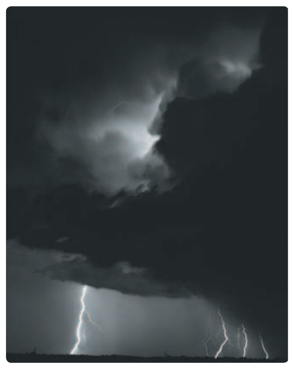
A thunderstorm packs just about every weather hazard known to aviation into one vicious bundle. Turbulence, hail, rain, snow, lightning, sustained updrafts and downdrafts, and icing conditions are all present in thunderstorms. Do not take off in the face of an approaching thunderstorm or fly an aircraft that is not equipped with thunderstorm detection in clouds or at night in areas of suspected thunderstorm activity. [Figure 10-16]
There is no useful correlation between the external visual appearance of thunderstorms and the severity or amount of turbulence or hail within them. All thunderstorms should be considered hazardous, and thunderstorms with tops above 35,000 feet should be considered extremely hazardous.
Weather radar, airborne or ground based, normally reflects the areas of moderate to heavy precipitation (radar does not detect turbulence). The frequency and severity of turbulence generally increases with the radar reflectivity closely associated with the areas of highest liquid water content of the storm. A flightpath through an area of strong or very strong radar echoes separated by 20 to 30 miles or less may not be considered free of severe turbulence.
The probability of lightning strikes occurring to aircraft is greatest when operating at altitudes where temperatures are between –5 ° C and +5 ° C. In addition, an aircraft flying in the clear air near a thunderstorm is also susceptible to lightning strikes. Thunderstorm avoidance is always the best policy.
Wind Shear
Wind shear can be defined as a change in wind speed and/or wind direction in a short distance. It can exist in a horizontal or vertical direction and occasionally in both. Wind shear can occur at all levels of the atmosphere but is of greatest concern during takeoffs and landings. It is typically associated with thunderstorms and low-level temperature inversions; however, the jet stream and weather fronts are also sources of wind shear.
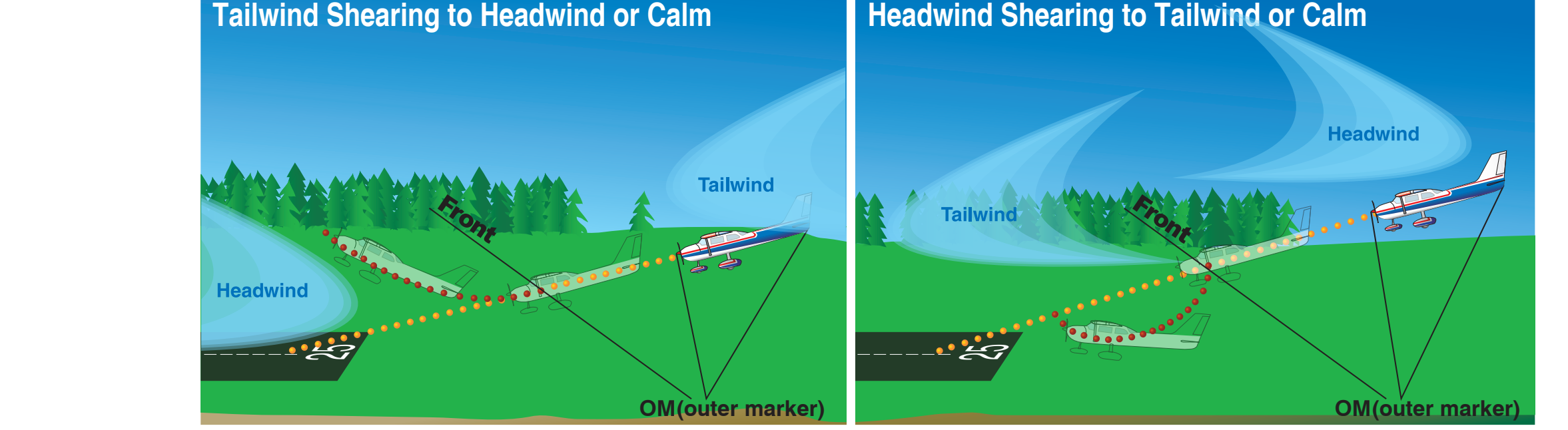
As Figure 10-17 illustrates, while an aircraft is on an instrument approach, a shear from a tailwind to a headwind causes the airspeed to increase and the nose to pitch up with a corresponding balloon above the glidepath. A shear from a headwind to a tailwind has the opposite effect, and the aircraft will sink below the glidepath.
A headwind shear followed by a tailwind/downdraft shear is particularly dangerous because the pilot has reduced power and lowered the nose in response to the headwind shear. This leaves the aircraft in a nose-low, power-low configuration when the tailwind shear occurs, which makes recovery more difficult, particularly near the ground. This type of wind shear scenario is likely while making an approach in the face of an oncoming thunderstorm. Pilots should be alert for indications of wind shear early in the approach phase and be ready to initiate a missed approach at the first indication. It may be impossible to recover from a wind shear encounter at low altitude.
To inform pilots of hazardous wind shear activity, some airports have installed a Low-Level Wind Shear Alert System (LLWAS) consisting of a centerfield wind indicator and several surrounding boundary-wind indicators. With this system, controllers are alerted of wind discrepancies (an indicator of wind shear possibility) and provide this information to pilots. A typical wind shear alert issued to a pilot would be: “Runway 27 arrival, wind shear alert, 20 knot loss 3 mile final, threshold wind 200 at 15”
In plain language, the controller is advising aircraft arriving on runway 27 that at about 3 miles out they can expect a wind shear condition that will decrease their airspeed by 20 knots and possibly encounter turbulence. Additionally, the airport surface winds for landing runway 27 are reported as 200° at 15 knots.
Pilots encountering wind shear are encouraged to pass along pilot reports. Refer to AIM for additional information on wind shear PIREPs.