
Chapter 10
IFR Flight
VFR-On-Top
Pilots on IFR flight plans operating in VFR weather conditions may request VFR-on-top in lieu of an assigned altitude. This permits them to select an altitude or flight level of their choice (subject to any ATC restrictions).
Pilots desiring to climb through a cloud, haze, smoke, or other meteorological formation and then either cancel their IFR flight plan or operate VFR-on-top may request a climb to VFR-on-top. The ATC authorization contains a top report (or a statement that no top report is available) and a request to report upon reaching VFR-on-top. Additionally, the ATC authorization may contain a clearance limit, routing, and an alternative clearance if VFR-on-top is not reached by a specified altitude.
A pilot on an IFR flight plan, operating in VFR conditions, may request to climb/descend in VFR conditions. When operating in VFR conditions with an ATC authorization to “maintain VFR-on-top/maintain VFR conditions,” pilots on IFR flight plans must:
- Fly at the appropriate VFR altitude as prescribed in 14 CFR part 91.
- Comply with the VFR visibility and distance-from-cloud criteria in 14 CFR part 91.
- Comply with IFR applicable to this flight (minimum IFR altitudes, position reporting, radio communications, course to be flown, adherence to ATC clearance, etc.).
Pilots operating on a VFR-on-top clearance should advise ATC before any altitude change to ensure the exchange of accurate traffic information.
ATC authorization to “maintain VFR-on-top” is not intended to restrict pilots to operating only above an obscuring meteorological formation (layer). Rather, it permits operation above, below, between layers, or in areas where there is no meteorological obstruction. It is imperative pilots understand, however, that clearance to operate “VFR-on-top/VFR conditions” does not imply cancellation of the IFR flight plan.
Pilots operating VFR-on-top/VFR conditions may receive traffic information from ATC on other pertinent IFR or VFR aircraft. However, when operating in VFR weather conditions, it is the pilot’s responsibility to be vigilant to see and avoid other aircraft.
This clearance must be requested by the pilot on an IFR flight plan. VFR-on-top is not permitted in certain areas, such as Class A airspace. Consequently, IFR flights operating VFR-on-top must avoid such airspace.
VFR Over-The-Top
VFR over-the-top must not be confused with VFR-on-top. VFR-on-top is an IFR clearance that allows the pilot to fly VFR altitudes. VFR over-the-top is strictly a VFR operation in which the pilot maintains VFR cloud clearance requirements while operating on top of an undercast layer. This situation might occur when the departure airport and the destination airport are reporting clear conditions, but a low overcast layer is present in between. The pilot could conduct a VFR departure, fly over the top of the undercast in VFR conditions, then complete a VFR descent and landing at the destination. VFR cloud clearance requirements would be maintained at all times, and an IFR clearance would not be required for any part of the flight.
Conducting an IFR Flight
To illustrate some of the concepts introduced in this chapter, follow along on a typical IFR flight from the Birmingham International Airport (BHM), Birmingham, Alabama to Gulfport-Biloxi International Airport (GPT), Gulfport, Mississippi. [Figure 10-18] For this trip, a Cessna 182 with a call sign of N1230A is flown. The aircraft is equipped with dual navigation and communication radios, a transponder, and a GPS system approved for IFR en route, terminal, and approach operations.
Preflight
The success of the flight depends largely upon the thoroughness of the preflight planning. The evening before the flight, pay close attention to the weather forecast and begin planning the flight.
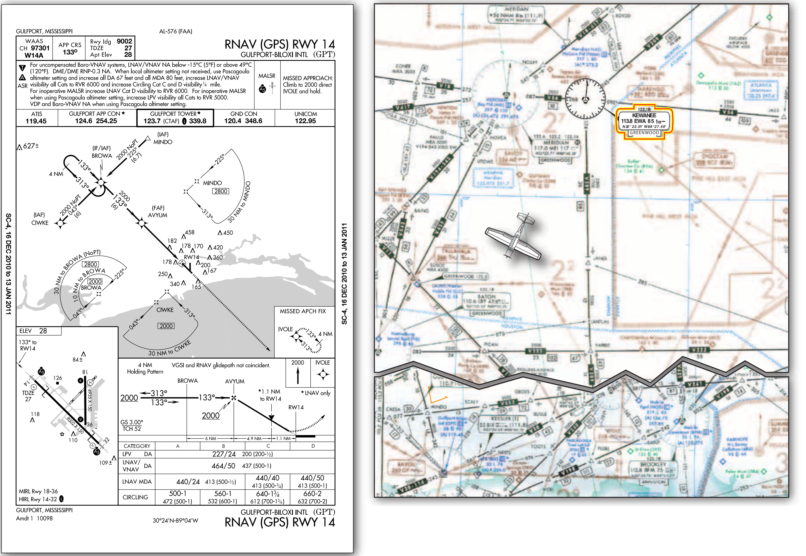
The Weather Channel indicates a large, low-pressure system has settled in over the Midwest, pulling moisture up from the Gulf of Mexico and causing low ceilings and visibility with little chance for improvement over the next couple of days. To begin planning, gather all the necessary charts and materials, and verify everything is current. This includes en route charts, approach charts, DPs, STAR charts, the GPS database, as well as an A/FD, some navigation logs, and the aircraft’s POH/AFM. The charts cover both the departure and arrival airports and any contingency airports that will be needed if the flight cannot be completed as planned. This is also a good time for the pilot to consider recent flight experience, pilot proficiency, fitness, and personal weather minimums to fly this particular flight.
Check the A/FD to become familiar with the departure and arrival airport, and check for any preferred routing between BHM and GPT. Next, review the approach charts and any DP or STAR that pertains to the flight. Finally, review the en route charts for potential routing, paying close attention to the minimum en route and obstacle clearance altitudes.
After this review, select the best option. For this flight, the Birmingham Three Departure [Figure 10-2] to Brookwood VORTAC, V 209 to Kewanee VORTAC, direct to Gulfport using GPS would be a logical route. An altitude of 4,000 feet meets all the regulatory requirements and falls well within the performance capabilities of the aircraft.
Next, call 1-800-WX-BRIEF to obtain an outlook-type weather briefing for the proposed flight. This provides forecast conditions for departure and arrival airports, as well as the en route portion of the flight including forecast winds aloft. This also is a good opportunity to check the available NOTAMs.