Helicopter Route Chart airports, radio aids, airspace, navigation, procedure, and cultural symbols.
Group Obstruction
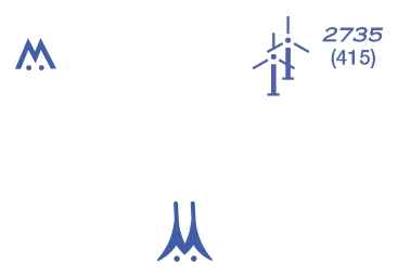
Group-obstruction symbols — above 299/below 1,000 ft AGL and 1,000 ft or higher, with light/elevation examples — source page 55.
Above 299’ and below 1000’ AGL
1000’ and higher AGL
Wind Turbine Farms
When highest wind turbine is unverified, UC will be shown after MSL value. — source page 55.
When highest wind turbine is unverified, UC will be shown after MSL value.
Maximum Elevation Figure — 12,400 ft — source page 55.
(see VFR Terms tab for explanation)
NAVIGATIONAL AND PROCEDURAL INFORMATION
Special Conservation Areas National Park, Wildlife Refuge, Primitive and Wilderness Areas, etc. VFR Checkpoints Underline indicates proper name of VFR Checkpoint. Obstruction Above 299’ and below 1000’ AGL 1000’ and higher AGL High-Intensity Obstruction Lights High-intensity lights may operate part-time or by proximity activation. Navigation Data NOAA Regulated National Marine Sanctuary Designated Areas VFR Waypoints Stand-Alone Collocated with VFR Checkpoint Collocated with VFR Checkpoint & Reporting Point Group Obstruction Above 299’ and below 1000’ AGL 1000’ and higher AGL Wind Turbine Farms 2894 UC When highest wind turbine is unverified, UC will be shown after MSL value. Maximum Elevation Figure (MEF) (see VFR Terms tab for explanation) AIRSPACE INFORMATION (Continued) NAVIGATIONAL AND PROCEDURAL INFORMATION
Source page 56
CULTURE
Roads
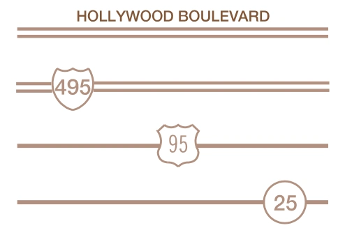
Road symbols — dual-lane/divided highway, major boulevard/street, primary highway — source page 56.
Dual-Lane:
Divided Highways
Major Boulevards & Major Streets
Primary
Boundaries
Cookie Preferences
We use cookies to operate this website, improve performance, understand site traffic, and personalize your experience. Essential cookies are always active because they are required for the website to function.
Required for basic site functionality and security.
Help us understand how visitors use the website so we can improve it.
May be used for advertising, remarketing, or social media features.
You can update your choices anytime using Cookie Settings. View Privacy Policy