Aviation Training Experts™

other

Aeronautical Chart Users’ Guide

FAA Chart Users’ Guide Version 9 July 2026

Helicopter Route Charts

Helicopter Route Chart airports, radio aids, airspace, navigation, procedure, and cultural symbols.

name of VFR Checkpoint.

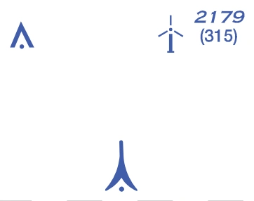
Obstruction

FAA aeronautical chart visual associated with “Obstruction symbols — above 299/below 1,000 ft AGL and 1,000 ft or higher, with light/elevation examples” (source page 55).
Obstruction symbols — above 299/below 1,000 ft AGL and 1,000 ft or higher, with light/elevation examples — source page 55.
Above 299’ and below 1000’ AGL
1000’ and higher AGL
FAA aeronautical chart visual associated with “High-intensity lights may operate” (source page 55).
High-intensity lights may operate — source page 55.
High-intensity lights may operate
part-time or by proximity activation.

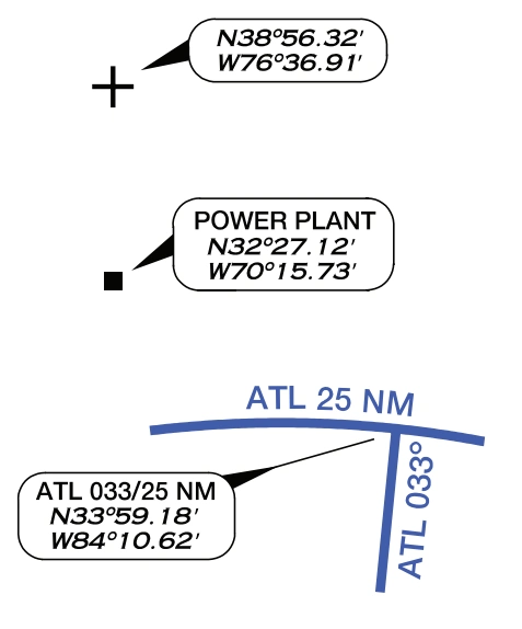
Navigation Data

FAA aeronautical chart visual associated with “Navigation-data examples — point coordinates, named-object coordinates, radial/distance callout” (source page 55).
Navigation-data examples — point coordinates, named-object coordinates, radial/distance callout — source page 55.
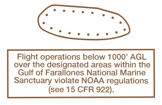
NOAA Regulated National
FAA aeronautical chart visual associated with “Marine Sanctuary Designated” (source page 55).
Marine Sanctuary Designated — source page 55.
Marine Sanctuary Designated
Areas

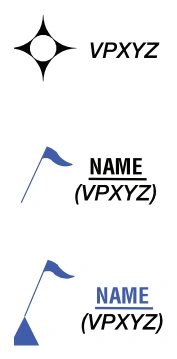
VFR Waypoints

FAA aeronautical chart visual associated with “VFR-waypoint symbols — stand-alone, collocated with checkpoint, collocated with checkpoint/reporting point” (source page 55).
VFR-waypoint symbols — stand-alone, collocated with checkpoint, collocated with checkpoint/reporting point — source page 55.
Stand-Alone
Collocated with VFR Checkpoint
& Reporting Point