Helicopter Route Chart airports, radio aids, airspace, navigation, procedure, and cultural symbols.
The type of area shall be
spelled out in large areas if space permits.
One-way Route
Helicopter-route symbols — one-way route and altitude-changeover point — source page 54.
Altitude Changeover Point
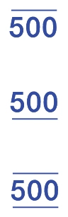
Recommended Altitudes
Recommended-altitude legend — maximum, minimum, recommended — source page 54.
Maximum Altitude
Minimum Altitude
Recommended Altitude
AIRSPACE INFORMATION (Continued) Miscellaneous Activity Areas Aerobatic Practice Area Glider Operations Hang Glider Activity Ultralight Activity Unmanned Aircraft Activity Parachute Jumping Area with Frequency Space Launch Activity Area Military Training Routes (MTR) Helicopter Routes Primary Route with Route Name and Tower Frequency Secondary Route Transition Symbol Reporting Points Non-compulsory Compulsory Reporting Point Name Foreign Airspace Note Police Zones Special Use Airspace Only the airspace effective below 18,000 feet MSL is shown. The type of area shall be spelled out in large areas if space permits. One-way Route Altitude Changeover Point Recommended Altitudes Maximum Altitude Minimum Altitude Recommended Altitude
Source page 55
AIRSPACE INFORMATION (Continued)
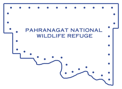
Special Conservation Areas
Pahranagat National Wildlife Refuge boundary — source page 55.
National Park, Wildlife Refuge,
Primitive and Wilderness Areas, etc.
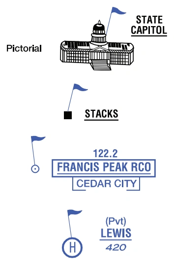
VFR Checkpoints
VFR-checkpoint examples — state capitol, stacks, RCO, Lewis — source page 55.
Underline indicates proper
Cookie Preferences
We use cookies to operate this website, improve performance, understand site traffic, and personalize your experience. Essential cookies are always active because they are required for the website to function.
Required for basic site functionality and security.
Help us understand how visitors use the website so we can improve it.
May be used for advertising, remarketing, or social media features.
You can update your choices anytime using Cookie Settings. View Privacy Policy