Aviation Training Experts™

other

Aeronautical Chart Users’ Guide

FAA Chart Users’ Guide Version 9 July 2026

Helicopter Route Charts

Helicopter Route Chart airports, radio aids, airspace, navigation, procedure, and cultural symbols.

Helipads located at major airports
(when requested)

Ultralight Flight Park

FAA aeronautical chart visual associated with “Ultralight Flight Park symbol” (source page 50).
Ultralight Flight Park symbol — source page 50.
FAA aeronautical chart visual associated with “Foreign Airport Note — only airport names and ICAO identifiers shown” (source page 50).
Foreign Airport Note — only airport names and ICAO identifiers shown — source page 50.
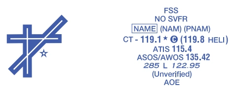
FAA aeronautical chart visual associated with “Helicopter-chart airport-data-grouping example” (source page 50).
Helicopter-chart airport-data-grouping example — source page 50.
Automated Terminal Information Service
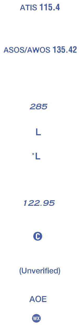
FAA aeronautical chart visual associated with “Helicopter airport-data symbols — ATIS, ASOS/AWOS, elevation, lighting, UNICOM/CTAF, unverified heliport, airport of entry, weather camera” (source page 50).
Helicopter airport-data symbols — ATIS, ASOS/AWOS, elevation, lighting, UNICOM/CTAF, unverified heliport, airport of entry, weather camera — source page 50.
Automated Surface Weather Observing Systems (shown when full-time ATIS is not
available). Some ASOS/AWOS
facilities may not be located at airports.
Elevation in feet
Lighting in operation Sunset to Sunshine
Lighting limitations exists, refer
to Chart Supplement
UNICOM - Aeronautical advisory station
Follows the Common Traffic Advisory Frequency (CTAF)
nverified Heliport
Airport of Entry
Weather Camera