Aviation Training Experts™

other

Aeronautical Chart Users’ Guide

FAA Chart Users’ Guide Version 9 July 2026

Helicopter Route Charts

Helicopter Route Chart airports, radio aids, airspace, navigation, procedure, and cultural symbols.
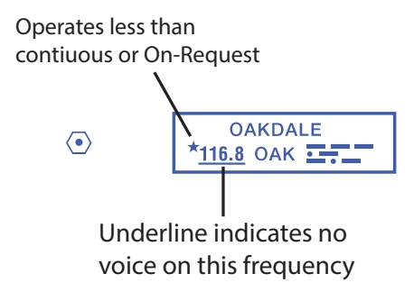
VOR
FAA aeronautical chart visual associated with “VOR” (source page 51).
VOR — source page 51.
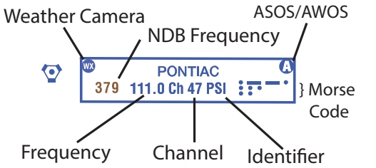
FAA aeronautical chart visual associated with “Annotated NAVAID information box — Weather Camera, ASOS/AWOS, NDB frequency, Morse code, frequency, channel, and identifier” (source page 51).
Annotated NAVAID information box — Weather Camera, ASOS/AWOS, NDB frequency, Morse code, frequency, channel, and identifier — source page 51.
When an NDB NAVAID shares the same name and Morse Code as the VOR NAVAID the frequency can be collocated inside the same box to conserve space.
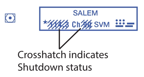
FAA aeronautical chart visual associated with “VOR-DME — Salem, shutdown crosshatch” (source page 51).
VOR-DME — Salem, shutdown crosshatch — source page 51.
FAA aeronautical chart visual associated with “DME — Provo Channel 21 (108.4)” (source page 51).
DME — Provo Channel 21 (108.4) — source page 51.

Flight Service Station (FSS)

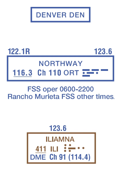
FAA aeronautical chart visual associated with “Heavy line box indicates Flight Service Station (FSS). Frequencies 121.5, 122.2 and 243.0 are available at many Alaskan FSSs and are not shown above boxes. All other frequencies are shown.” (source page 51).
Heavy line box indicates Flight Service Station (FSS). Frequencies 121.5, 122.2 and 243.0 are available at many Alaskan FSSs and are not shown above boxes. All other frequencies are shown. — source page 51.
Heavy line box indicates Flight Service Station (FSS). Frequencies 121.5, 122.2 and 243.0 are available at many Alaskan FSSs and are not shown above boxes. All other frequencies are shown.
Certain FSSs provide Airport Advisory Service, refer to Chart Supplement.
R - Receive Only

Non-Directional Radio Beacon (NDB)

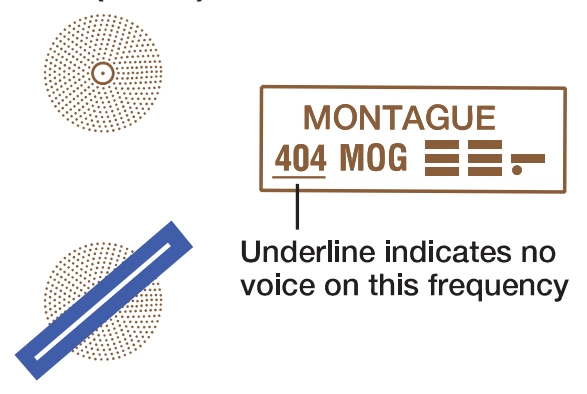
FAA aeronautical chart visual associated with “Non-Directional Radio Beacon (NDB)” (source page 51).
Non-Directional Radio Beacon (NDB) — source page 51.
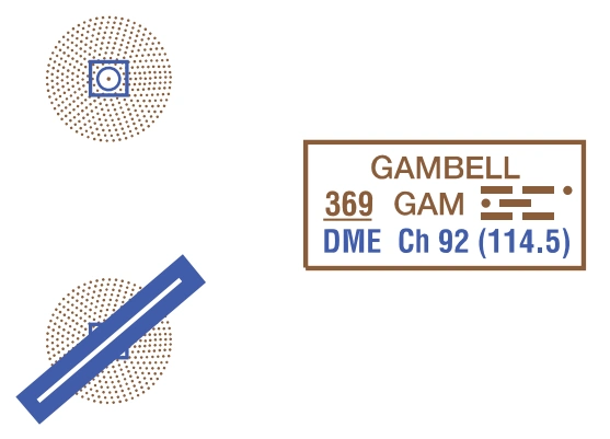
FAA aeronautical chart visual associated with “NDB-DME — Gambell 369 GAM / DME Ch 92 (114.5)” (source page 51).
NDB-DME — Gambell 369 GAM / DME Ch 92 (114.5) — source page 51.

NAVAID Used to Define

Class B Airspace
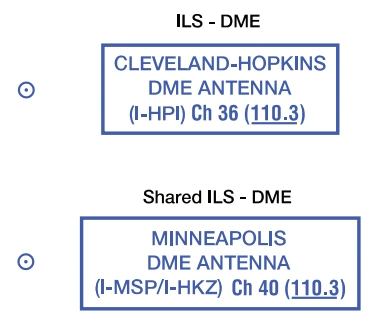
FAA aeronautical chart visual associated with “NAVAIDs used to define Class B airspace — shared Cleveland-Hopkins and Minneapolis ILS-DME examples” (source page 51).
NAVAIDs used to define Class B airspace — shared Cleveland-Hopkins and Minneapolis ILS-DME examples — source page 51.

Broadcast Stations (BS)

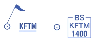
FAA aeronautical chart visual associated with “Broadcast stations — KFTM / BS KFTM 1400, on-request/VFR-checkpoint flag” (source page 51).
Broadcast stations — KFTM / BS KFTM 1400, on-request/VFR-checkpoint flag — source page 51.
On request by the proper authority or when a VFR Checkpoint.