Aviation Training Experts™

other

Aeronautical Chart Users’ Guide

FAA Chart Users’ Guide Version 9 July 2026

IFR Enroute Low/High Altitude Symbols

IFR low- and high-altitude enroute chart legends, symbols, examples, and procedures.

FAA aeronautical chart visual associated with “Morse-code chart — A–Z / 0–9” (source page 95).
Morse-code chart — A–Z / 0–9 — source page 95.

CULTURE

Boundaries

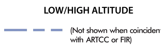
FAA aeronautical chart visual associated with “International boundary — low/high altitude; dashed, omitted when coincident with ARTCC/FIR” (source page 95).
International boundary — low/high altitude; dashed, omitted when coincident with ARTCC/FIR — source page 95.
International
U.S./Russia Maritime Line
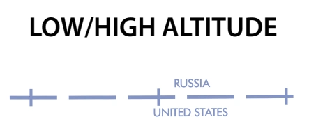
FAA aeronautical chart visual associated with “U.S./Russia maritime line — low/high altitude” (source page 95).
U.S./Russia maritime line — low/high altitude — source page 95.
Date Line
FAA aeronautical chart visual associated with “International Date Line — Sunday/Monday day labels” (source page 95).
International Date Line — Sunday/Monday day labels — source page 95.

HYDROGRAPHY

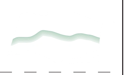
FAA aeronautical chart visual associated with “Hydrography — shoreline symbols” (source page 95).
Hydrography — shoreline symbols — source page 95.

TOPOGRAPHY

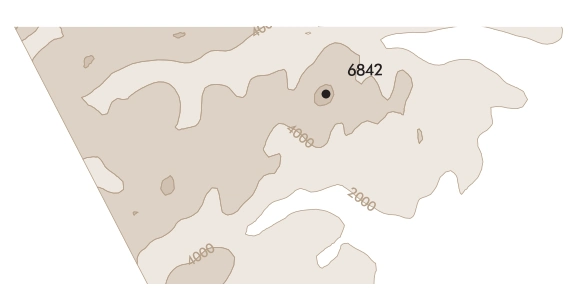
FAA aeronautical chart visual associated with “TOPOGRAPHY” (source page 95).
TOPOGRAPHY — source page 95.
MORSE CODE ISOGONIC LINE AND LOW/HIGH CHARTS VALUE ENLARGEMENT AREA TIME ZONE All time is Coordinated Universal Time (UTC) During periods of Daylights Savings Time (DT), effective hours will be one hour earlier than shown. All states observe DT except Arizona and Hawaii MATCH MARK LOW/HIGH CHARTS HYDROGRAPHY SHORELINES TOPOGRAPHY TERRAIN Area Charts CULTURE Boundaries LOW/HIGH ALTITUDEInternational U.S./Russia Maritime Line LOW/HIGH ALTITUDE Date Line LOW/HIGH ALTITUDE Navigational and Procedural Information (Continued)