IFR low- and high-altitude enroute chart legends, symbols, examples, and procedures.
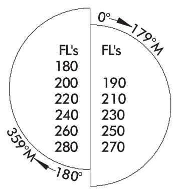
IFR within controlled airspace as assigned by ATC.
ALL courses are magnetic.
Cruising Altitudes - High Charts - U.S. Only
IFR within controlled airspace 18,000’ MSL to FL280
as assigned by ATC
All courses are magnetic. — source page 94.
All courses are magnetic.
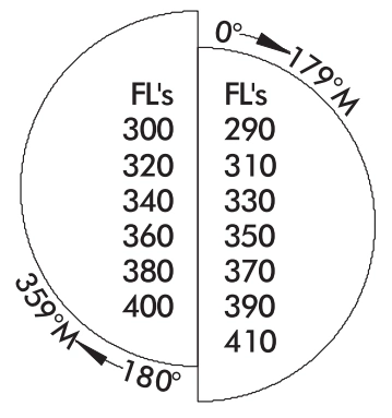
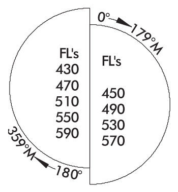
RVSM Levels FL290 to FL410 FL430 and above
RVSM cruising altitudes — flight levels FL290 through FL410 — source page 94.
No VFR or VFR On Top — source page 94.
No VFR or VFR On Top
authorized above FL285 in
RVSM airspace.
Cruising Altitudes - Low Charts - U.S. Only IFR outside controlled airspace. IFR within controlled airspace as assigned by ATC. ALL courses are magnetic. VFR above 3000’ AGL unless otherwise authorized by ATC. Cruising Altitudes - High Charts - U.S. Only IFR within controlled airspace 18,000’ MSL to FL280 as assigned by ATC All courses are magnetic. VFR or VFR On Top add 500’ No VFR flights within Class A Airspace above 3000’ AGL unless otherwise authorized RVSM Levels FL290 to FL410 FL430 and above No VFR or VFR On Top authorized above FL285 in RVSM airspace. NAVIGATIONAL AND PROCEDURAL INFORMATION
Source page 95
Navigational and Procedural Information (Continued)
Isogonic line/value — 10°W — source page 95.
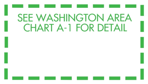
Enlargement-area callout — See Washington Area Chart A-1 for detail — source page 95.
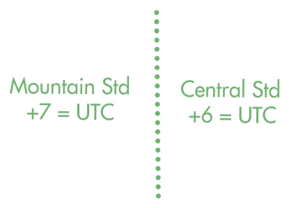
Time-zone boundary — Mountain Standard +7 UTC / Central Standard +6 UTC — source page 95.
Low/high chart match mark symbol — source page 95.
Cookie Preferences
We use cookies to operate this website, improve performance, understand site traffic, and personalize your experience. Essential cookies are always active because they are required for the website to function.
Required for basic site functionality and security.
Help us understand how visitors use the website so we can improve it.
May be used for advertising, remarketing, or social media features.
You can update your choices anytime using Cookie Settings. View Privacy Policy