IFR low- and high-altitude enroute chart legends, symbols, examples, and procedures.
Special Use Airspace - U.S. — source page 92.
Special Use Airspace - U.S. — source page 92.
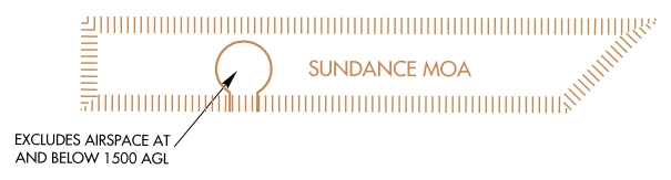
AIRSPACE INFORMATION (Continued) Special Use Airspace - U.S. Low and High Charts Low Charts Only P - Prohibited Area R - Restricted Area W - Warning Area See Airspace Tabulation on each chart for complete documentation information on: Area Identification Effective Altitude Operating Times Controlling Agency Voice Call A - Alert Area * Alert Areas do not extend into Class A, B, C and D airspace, or Class E airport surface areas. MOA - Military Operations Area See Airspace Tabulation on each chart for complete documentation information on: Area Identification Effective Altitude Operating Times Controlling Agency Voice Call Example: P-56 - Washington DC, Area A-1 Chart Example: P-40 and R-4009 - Washington DC, Area A-1 Chart Example: R3601A - Example: W-50
Source page 93
AIRSPACE INFORMATION (Continued)
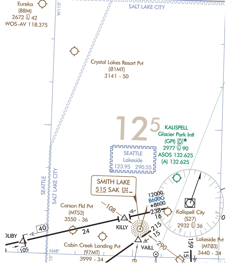
Off Route Obstruction Clearance Altitude (OROCA)
OROCA is computed similarly to the Maximum Elevation Figure (MEF) found on Visual charts except that it provides an additional vertical buffer of 1,000 feet in designated non-mountainous areas and a 2,000 foot vertical buffer in designated mountainous areas within the United States.
Example: 12,500 feet
Example: 12,500 feet — source page 93.
Off Route Obstruction Clearance Altitude example — Low L-13 Chart — source page 93.
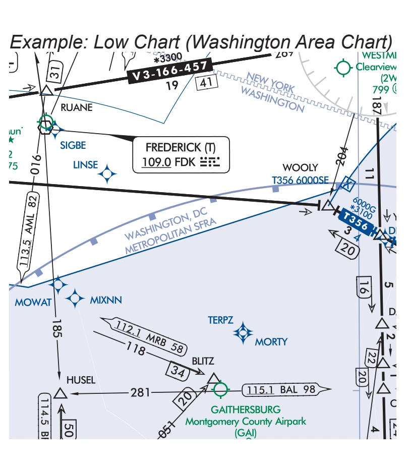
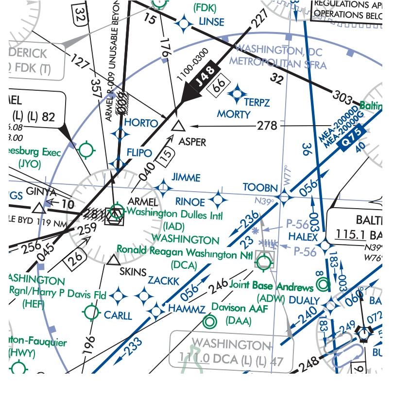
Special Flight Rules Area (SFRA)
Special Flight Rules Area (SFRA) — source page 93.
Washington SFRA low-chart example — source page 93.
Washington, D.C. Special Flight Rules Area example — High Chart H-12 — source page 93.
AIRSPACE INFORMATION (Continued) Off Route Obstruction Clearance Altitude (OROCA) Low Charts Only OROCA is computed similarly to the Maximum Elevation Figure (MEF) found on Visual charts except that it provides an additional vertical buffer of 1,000 feet in designated non-mountainous areas and a 2,000 foot vertical buffer in designated mountainous areas within the United States. Example: 12,500 feet Example: Low L-13 Chart Special Flight Rules Area (SFRA) Low and High Charts SFRA Symbology Example: Low Chart (Washington Area Chart) Example: High Chart (H-12)
Source page 94
NAVIGATIONAL AND PROCEDURAL INFORMATION
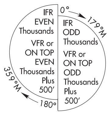
Cruising Altitudes - Low Charts - U.S. Only
IFR outside controlled airspace.
IFR within controlled airspace as assigned by ATC. — source page 94.
Cookie Preferences
We use cookies to operate this website, improve performance, understand site traffic, and personalize your experience. Essential cookies are always active because they are required for the website to function.
Required for basic site functionality and security.
Help us understand how visitors use the website so we can improve it.
May be used for advertising, remarketing, or social media features.
You can update your choices anytime using Cookie Settings. View Privacy Policy