IFR low- and high-altitude enroute chart legends, symbols, examples, and procedures.
Latitude, Longitude
Controlling FSS Radio or FSS Name (AK)
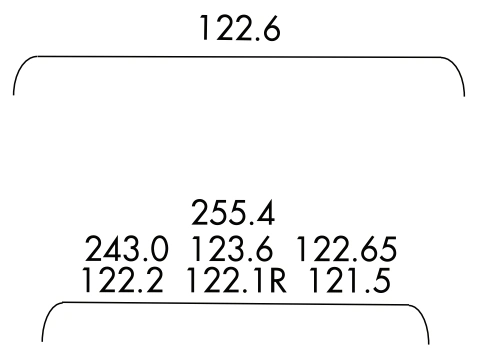
RCO formats — single/multiple, R/T suffix meanings — source page 77.
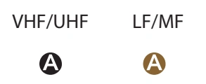
NAVAID boxes — thin/shadow VHF/UHF and LF/MF — source page 77.
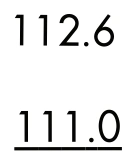
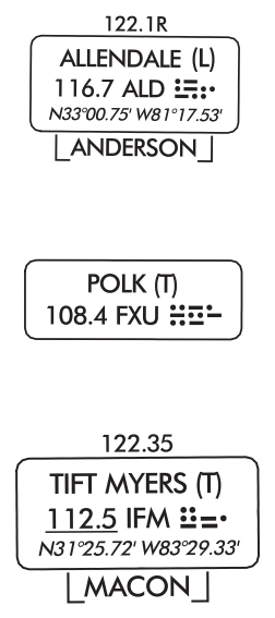
RADIO AIDS TO NAVIGATION (Continued) LOW ALTITUDE ILS LOCALIZER ILS Localizer Course with additional navigation function ILS Localizer Back Course with additional navigation function HIGH ALTITUDE - ALASKA VOR/DME RNAV WAYPOINT DATA Coordinates Frequency Identifier Reference Facility Elevation Radial/Distance (Facility to Waypoint) ILS Localizer Example with Back Course (Chart: Enroute Low L-1 US) NAVIGATION AND COMMUNICATION BOXES - COMMON ELEMENTS LOW ENROUTE CHARTS RCO Frequencies NAVAID Name, SSV(s) FREQ, Ident, CH, Morse Code Latitude, Longitude Controlling FSS Radio or FSS Name (AK) COMMON ELEMENTS (HIGH AND LOW CHARTS) RCO Frequency Single Frequency Multiple Frequencies Frequencies transmit and receive except those followed by R and T: R - Receive Only T - Transmit Only NAVAID Box Thin line NAVAID boxes without frequency(s) and FSS radio name indicates no FSS frequencies available. (AK only) Shadow NAVAID box indicates NAVAID and Flight Service Station (FSS) have same name. HIGH ENROUTE CHARTS RCO Frequencies NAVAID Name Frequency, Ident, SSV(s), Channel Latitude, Longitude Controlling FSS Radio or FSS Name (AK) VHF/UHF LF/MF
Source page 78
RADIO AIDS TO NAVIGATION (Continued)
Navigation and Communication Boxes - Common Elements
NAVAID STANDARD SERVICE VOLUME (SSV) CLASSIFICATIONS
(VL), (T), etc. indicate SSV. See “NAVAID STANDARD SERVICE VOLUME (SSV) CLASSIFICATIONS” on page 66 or the Chart Supplement for SSV Altitude and Range Boundaries.
Voice Transmitted
No Voice Transmitted
Voice communications via NAVAID — voice/no-voice examples — source page 78.
NAVAID shutdown status — VHF/UHF and LF/MF — source page 78.
Part-time/on-request NAVAIDs — VHF/UHF and LF/MF — source page 78.
ASOS/AWOS - Automated Surface Observing Station/Automated Weather Observing Station
Latitude and Longitude coordinates are provided for those NAVAIDs that make up part of a route/airway or a holding pattern. All TACAN facilities will include geographic coordinates.
ASOS/AWOS indicators — VHF/UHF and LF/MF — source page 78.
NAVAID lat/long formats — low/high enroute — source page 78.
Low-enroute VOR examples — Allendale receive-only, Polk service volume, Tift Myers receive/transmit — source page 78.
Cookie Preferences
We use cookies to operate this website, improve performance, understand site traffic, and personalize your experience. Essential cookies are always active because they are required for the website to function.
Required for basic site functionality and security.
Help us understand how visitors use the website so we can improve it.
May be used for advertising, remarketing, or social media features.
You can update your choices anytime using Cookie Settings. View Privacy Policy