Responsive VFR Sectional and Terminal Area Chart legends for airports, radio aids, airspace, procedures, culture, hydrography, and relief.
Intersections
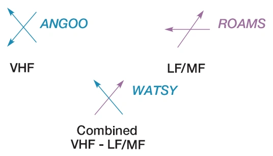
Named intersections used as — source page 32.
Named intersections used as
reporting points. Arrows are directed toward facilities that establish intersection.
AIRSPACE INFORMATION (Continued) VFR Transition Routes Appropriate notes as required may be shown. Uni-directional Bi-directional Bi-directional with NAVAID Ident and Radial TAC only Terminal Radar Service Area (TRSA) TRSA Name TRSA Boundaries TRSA Sectors Appropriate notes as required may be shown. Examlple: Los Angeles Example: Harrisburg, PA NAVIGATIONAL AND PROCEDURAL INFORMATION Isogonic Line and Value Isogonic lines and values shall be based on the five year epoch magnetic variation model. Local Magnetic Notes Unreliability Notes Intersections Named intersections used as reporting points. Arrows are directed toward facilities that establish intersection. Aeronautical Lights By Request Site Rotating or Oscillating Isolated Location Rotating Light with Flashing Code Identification Light Rotating Light with Course Lights and Site Number FAA Chart Users Guide - VFR Symbology - Sectional and Terminal Area Charts
Source page 33
NAVIGATIONAL AND PROCEDURAL INFORMATION (Continued)
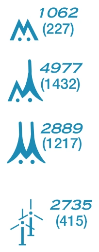
Above 200’ & below 1000’ AGL (above 299’ AGL in urban area) — source page 33.
Above 200’ & below 1000’ AGL (above 299’ AGL in urban area)
1000’ and higher (AGL)
At least two in group
1000’ and higher (AGL)
Wind Turbines
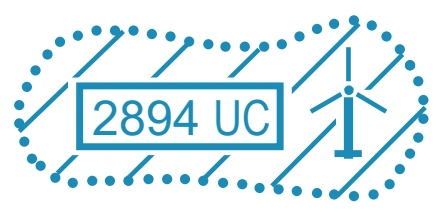
Wind Turbine Farms
When highest wind turbine is unverified, UC will be shown after MSL value. — source page 33.
When highest wind turbine is unverified, UC will be shown after MSL value.
Maximum Elevation Figure (MEF)
Cookie Preferences
We use cookies to operate this website, improve performance, understand site traffic, and personalize your experience. Essential cookies are always active because they are required for the website to function.
Required for basic site functionality and security.
Help us understand how visitors use the website so we can improve it.
May be used for advertising, remarketing, or social media features.
You can update your choices anytime using Cookie Settings. View Privacy Policy