Responsive VFR Sectional and Terminal Area Chart legends for airports, radio aids, airspace, procedures, culture, hydrography, and relief.
Wind Turbine
High-Intensity Obstruction Lights
Less than 1000’ (AGL) — source page 33.
Less than 1000’ (AGL)
1000’ and higher (AGL)
Wind Turbine
Group obstruction
Wind Turbines
High-intensity lights may operate part-time or by proximity activation.
Airport Beacons Rotating or Flashing Isolated Locations VFR Checkpoints Underline indicates proper name of VFR Checkpoint. Waypoints RNAV VFR Stand-Alone VFR Collocated with Checkpoint Obstruction Above 200’ & below 1000’ AGL (above 299’ AGL in urban area) Under Construction (UC) or reported and position/elevation unverified 1000’ and higher (AGL) Wind Turbine High-Intensity Obstruction Lights Less than 1000’ (AGL) 1000’ and higher (AGL) Wind Turbine Group obstruction Wind Turbines High-intensity lights may operate part-time or by proximity activation. Marine Lights With Characteristics of Light Red White Green Blue Orange Black Yellow Sector Fixed Single Occulting Group Occulting Composite Group Occulting Isophase Flashing Group Flashing Composite Group Flashing Quick Interrupted Quick/Interrupted Quick Flashing Morse Code Fixed and Flashing Alternating Group Long Flash Group Quick Flashing Very Quick Flashing Group Very Quick Flashing Interrupted Very Quick Flashing Ultra Quick Flashing Interrupted Ultra Quick Flashing * Marine Lights are white unless otherwise noted. Alternating lights are red and white unless otherwise noted. Group Obstruction Above 200’ & below 1000’ AGL (above 299’ AGL in urban area) 1000’ and higher (AGL) At least two in group 1000’ and higher (AGL) Wind Turbines Wind Turbine Farms 2894 UC When highest wind turbine is unverified, UC will be shown after MSL value. Maximum Elevation Figure (MEF) (see VFR Terms tab for explanation) Land Light NAVIGATIONAL AND PROCEDURAL INFORMATION (Continued)
Source page 34
NAVIGATIONAL AND PROCEDURAL INFORMATION (Continued)
Chart Limits
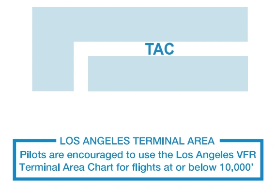
Outline on Sectional of Terminal Area Chart
TAC chart-limit outline and Los Angeles Terminal Area note — source page 34.
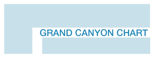
Outline of Special Chart on
Grand Canyon special-chart outline — source page 34.
Sectional and Terminal Area Chart
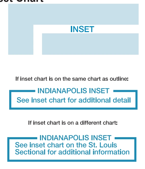
Outline on Sectional of Inset Chart
Inset-chart outlines and same/different-chart notes — source page 34.
Cookie Preferences
We use cookies to operate this website, improve performance, understand site traffic, and personalize your experience. Essential cookies are always active because they are required for the website to function.
Required for basic site functionality and security.
Help us understand how visitors use the website so we can improve it.
May be used for advertising, remarketing, or social media features.
You can update your choices anytime using Cookie Settings. View Privacy Policy