
Chapter 10
Wind
Locally, the shape of the coastline plays an important role in the development of convection along sea breezes (see Figure 10-15). A narrow peninsula or island is generally an area of strong convective development during the late morning or early afternoon. This is because the sea breezes that formed along opposing shores merge near the center of the peninsula or island.
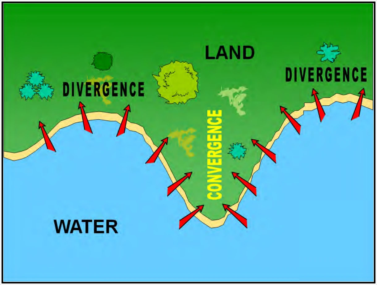
In Figure 10-15, convergence occurs where sea breezes merge from opposite directions. Stronger lift may be sufficient to initiate showers and thunderstorms if the air mass is sufficiently moist and unstable.
10.6.2 Land Breeze
A land breeze (see Figure 10-16) is a coastal breeze blowing from land to sea caused by the temperature difference when the sea surface is warmer than the adjacent land. Land breezes usually occur at night and during early morning.
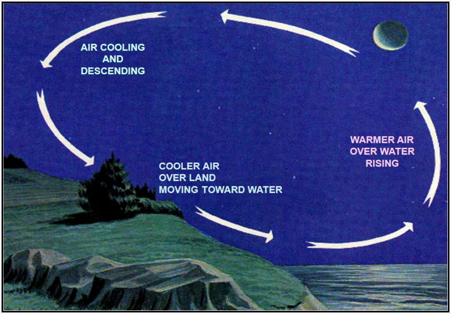
Air above the land becomes cooler (denser) than air above the water due to conduction. This is because land cools faster than water. Low-level pressure gradients develop with higher pressure over the cooler land and lower pressure over the warmer water.
Low-level winds develop in the direction of the PGF. Thus, the wind blows from the land to the water. The land breeze is usually weaker than the sea breeze. The air rises over water and sinks over land. Clouds and precipitation may develop in the rising air over the water.
10.6.3 Lake Breeze
A lake breeze (see Figure 10-17) is a local wind that blows from the surface of a large lake onto the shores during the afternoon and is caused by the temperature difference when the lake surface is colder than the adjacent land. The lake breeze is similar in origin to the sea breeze and is common in the Great Lakes. Both occur during the warm season, primarily spring and summer. Both are easiest to detect in light synoptic wind conditions.
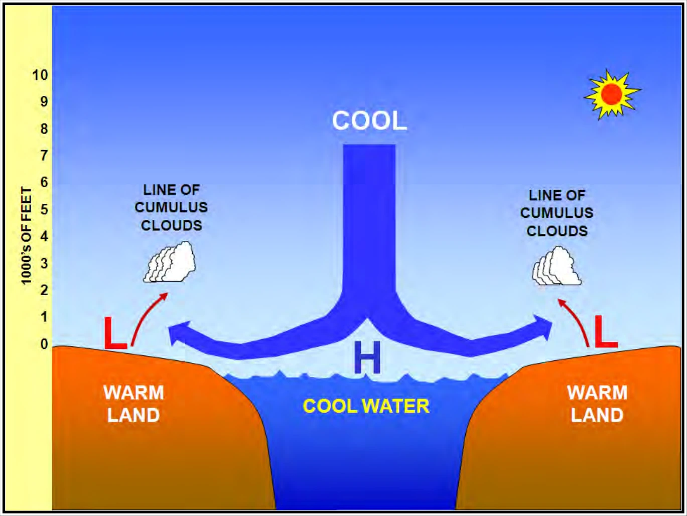
As with sea breezes, thunderstorms are favored in the upward motion branch of the lake breeze circulation. This is especially true where breezes from adjacent lakes collide.
The strength of the lake breeze circulation is affected by a lake’s depth. A shallow lake (e.g., Lake Erie and Lake St. Clair) warms up rapidly and is less effective as the source of a lake breeze in summer than a deep lake (e.g., the other Great Lakes).
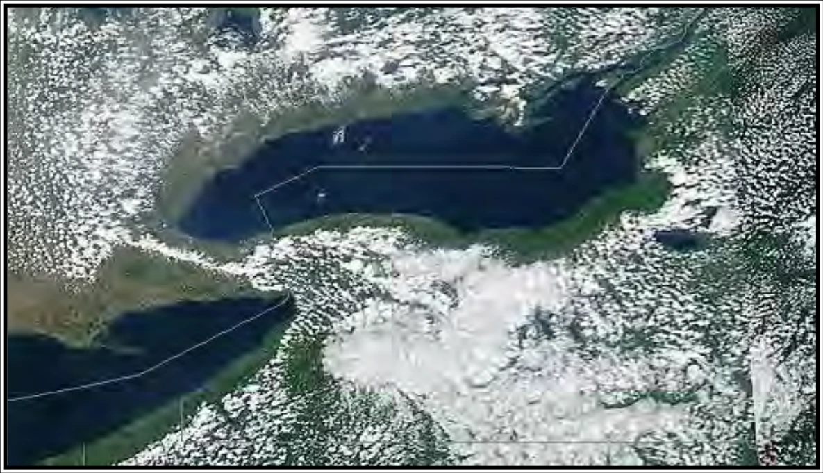
In Figure 10-18, the sinking air behind the lake breeze inhibits clouds over Lake Ontario and Lake Erie and for miles inland.
10.6.4 Valley Breeze
A valley breeze (see Figure 10-19) is a wind that ascends a mountain valley during the day. Air in contact with the sloping terrain becomes warmer (less dense) than air above the valley. This is because the air in contact with the sloping terrain heats up faster than air above the valley.
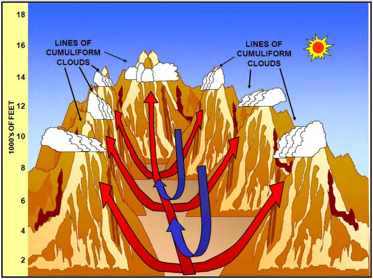
Pressure gradients develop (along a horizontal reference) with lower pressure over the warmer sloping terrain and higher pressure over the cooler valley. Winds develop in the direction of the PGF. Thus, the wind blows from the valley up the mountain slopes. Air rises over sloping terrain and sinks over the valley. Clouds and precipitation may develop over mountain slopes.