
Chapter 16
Mountain Weather
16.1 Introduction
This chapter focuses on mountain waves and adverse winds. Other mountain weather phenomena are discussed in other chapters, which are noted.
16.2 Mountain Waves and Adverse Winds
The atmosphere is a fluid in motion. Just as the swiftly flowing water in a stream develops waves and eddies as it passes over and around obstructions, so does the atmosphere contain disturbances that develop as it interacts with mountainous terrain. These atmospheric eddies can range in size from a few centimeters to tens or hundreds of kilometers and can present the pilot with relatively smooth air, or with turbulence of potentially destructive intensity, and the likelihood of loss of control.
When the atmosphere encounters a mountainous barrier, a number of responses are possible. If the wind is weak or the moving air mass exceptionally dense, the mountains may act as a dam, preventing the motion of air over the barrier. More frequently, strong winds flow over or around mountains or ridges. If the surrounding atmosphere is unstable, the vertical displacement of the air will (if sufficient moisture is present) lead to thunderstorm formation or at least the development of deep convective clouds. However, if the wind is sufficiently strong and the surrounding atmosphere is stable, a wave will develop.
The wave that results from vertical displacement of a stable air mass over a mountain or ridge can generally take one of two forms: vertically propagating mountain waves or trapped lee waves. Both types of waves can be hazardous to aviation operations. The particular type of wave or combination of waves that forms depends on the nature of the mountain range and on atmospheric properties upwind of the mountain. It is possible for both types of waves to exist at the same time. It also is possible to have hybrid or intermediate forms (i.e., waves that are only partially trapped).
The most severe mountain wind events usually occur when the large-scale (or synoptic) winds are strongest, from late autumn to early spring. During the remainder of the year, when the synoptic winds are normally much weaker, hazardous winds in the vicinity of mountains are more likely to be associated with thunderstorms and their outflow fields.
The mountain-induced flow fields to be discussed in this section are frequently accompanied by visual indicators (such as lenticular and rotor clouds or blowing dust). However, this is not always the case, and extremely severe wind events can occur with little or no visual warning of their presence.
16.2.1 Gravity Waves
In order for gravity waves to develop, the atmosphere must possess at least some degree of static stability. As stable air is deflected vertically by an obstacle (e.g., when an air mass moves over a mountain ridge), it resists the displacement because as it rises, it is heavier than the air surrounding it, and gravity is acting to return it to its equilibrium level. Because of its negative buoyancy, the deflected air begins to return to its original level once it has cleared the ridge. However, its momentum will cause it to overshoot the original altitude, warming by compression and now becoming less dense than the surrounding air. As a result, it begins to rise back to the equilibrium altitude, overshoots once more, and continues through a period of oscillations before the resulting wave motion dampens out. This process is depicted in Figure 16-1.
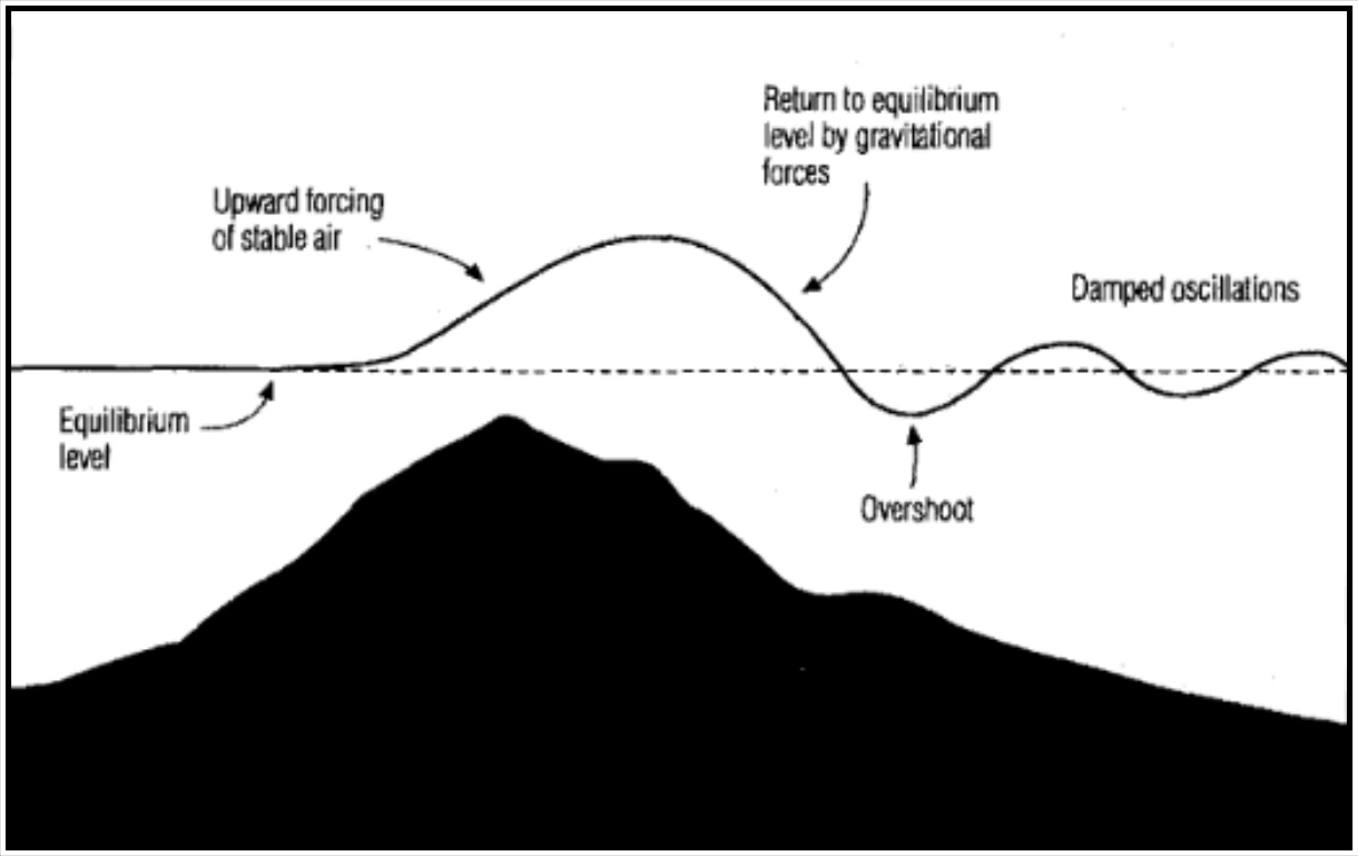
The described gravity wave will have measurable wavelength, amplitude, phase speed, and period. The period of this type of atmospheric disturbance is related to the temperature of the air and the “spread” between the existing lapse rate and the dry adiabatic lapse rate (or, equivalently, the degree of stability present). In general, the large-scale wind (wind shear) changes in altitude and temperature (lapse rate), the size and shape of the mountain or ridge over which the air is moving, and the orientation of the wind relative to the ridge line all work together in determining the character of the disturbance that develops.
16.2.2 Kelvin-Helmholtz (K-H) Waves
When wind shear is very strong, another type of wave is possible. These waves, called gravity-shear or K-H waves, can occur when the kinetic energy inherent in the shear can overcome the damping effects of a stable temperature lapse rate. This effect is illustrated in Figure 16-2.
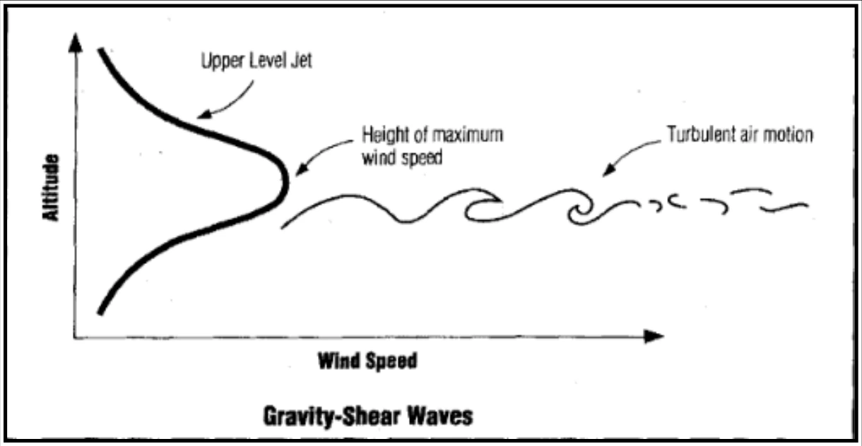
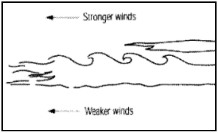
If the wind shear that penetrates the layer of the atmosphere is weak (some wind shear is nearly always present), a shear-induced wave motion will not occur. However, if the magnitude of the wind shear exceeds a critical value, wave motions will begin spontaneously within the shear layer, resulting in a K-H wave. The amplitude of the resulting wave will grow with the kinetic energy in the surrounding wind field until, like an ocean wave breaking on the shore, the wave overturns and breaks down into turbulence. The resulting turbulence can have a range of effects on aircraft. The clouds associated with shear-induced gravity waves can frequently be observed in the atmosphere, as shown in Figure 16-3 and Figure 16-4.
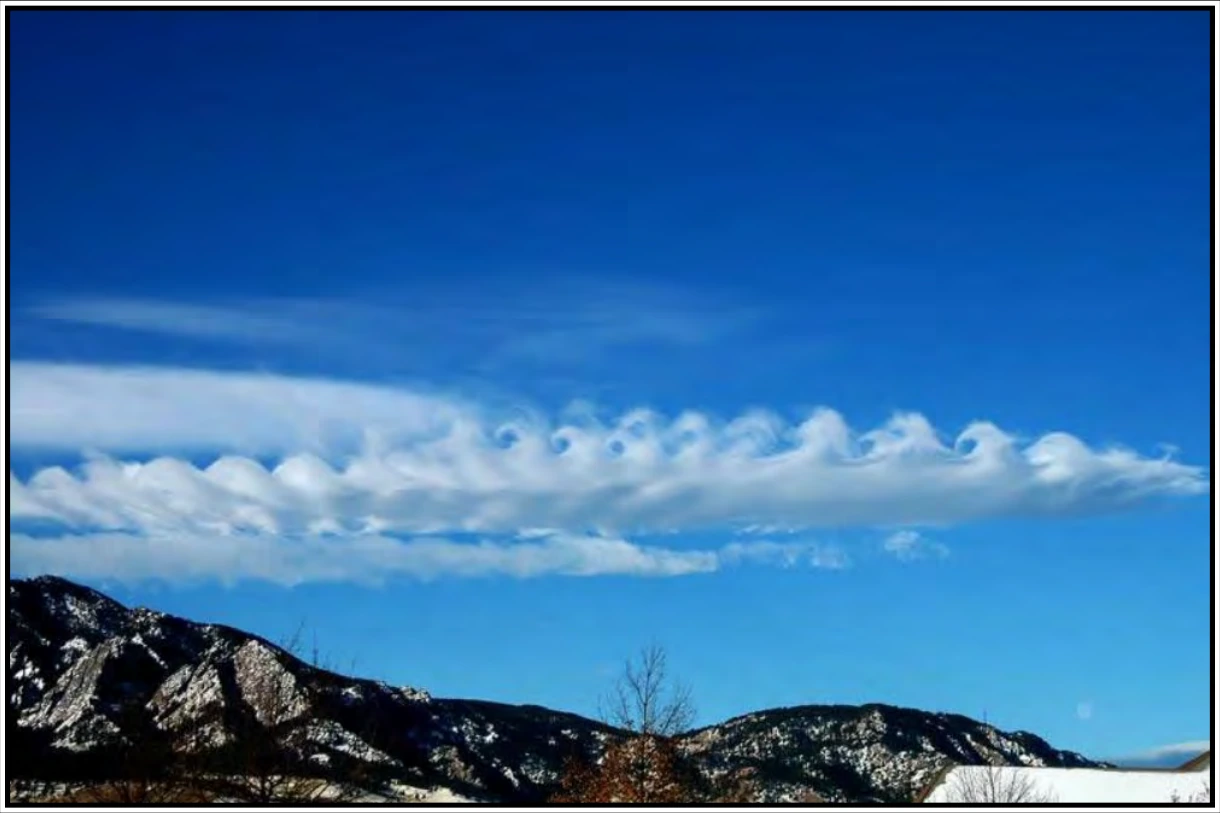
(Photo Credit: University Corporation for Atmospheric Research (UCAR))
K-H waves are quite common in the atmosphere; they can form in the vicinity of thunderstorms, in shear layers near the jet stream, and in association with stable regions of the atmosphere that are topped by a strong wind-shear layer (such as the top of a pool of cold air on the lee side of a mountain). In fact, K-H instability induced by the wind shear associated with strong winds aloft is likely the chief source of high-level turbulence away from mountain ranges [clear-air turbulence (CAT)]. The mechanism that causes this type of disturbance can be compared to that of a flag flapping in a breeze. The flapping is a result of instabilities created by the wind shear along the flexible surface of the flag, analogous to the wind shear through a very stable (but shallow) layer of the atmosphere.