Chapter 18
Weather and Obstructions to Visibility
18.1.1.1.2 Advection Fog
Advection fog (see Figure 18-5 and Figure 18-6) forms when moist air moves over a colder surface and the subsequent cooling of that air to below its dewpoint. It is most common along coastal areas but often moves deep into continental areas. At sea, it is called sea fog. Advection fog deepens as wind speed increases up to about 15 kt. Wind that is generally stronger than 15 kt lifts the fog into a layer of low stratus or stratocumulus clouds.
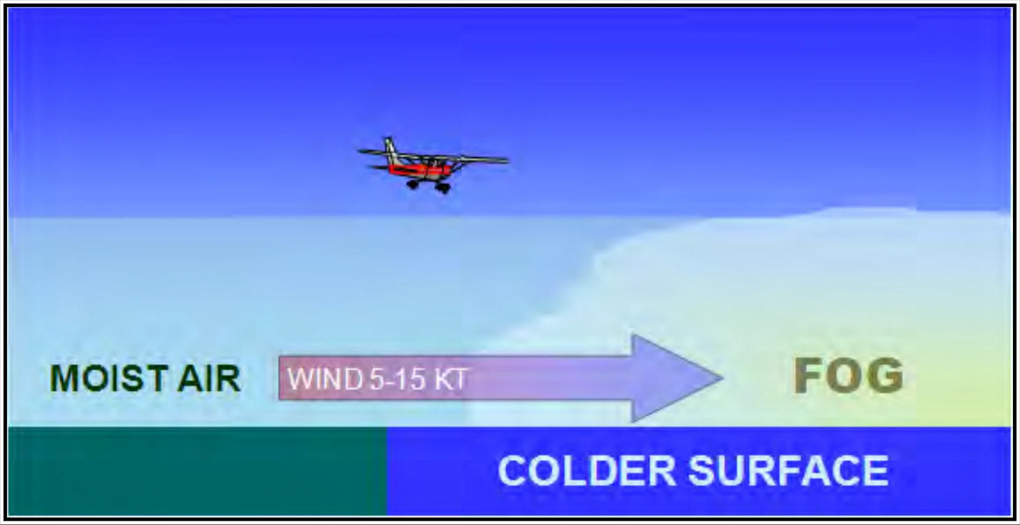
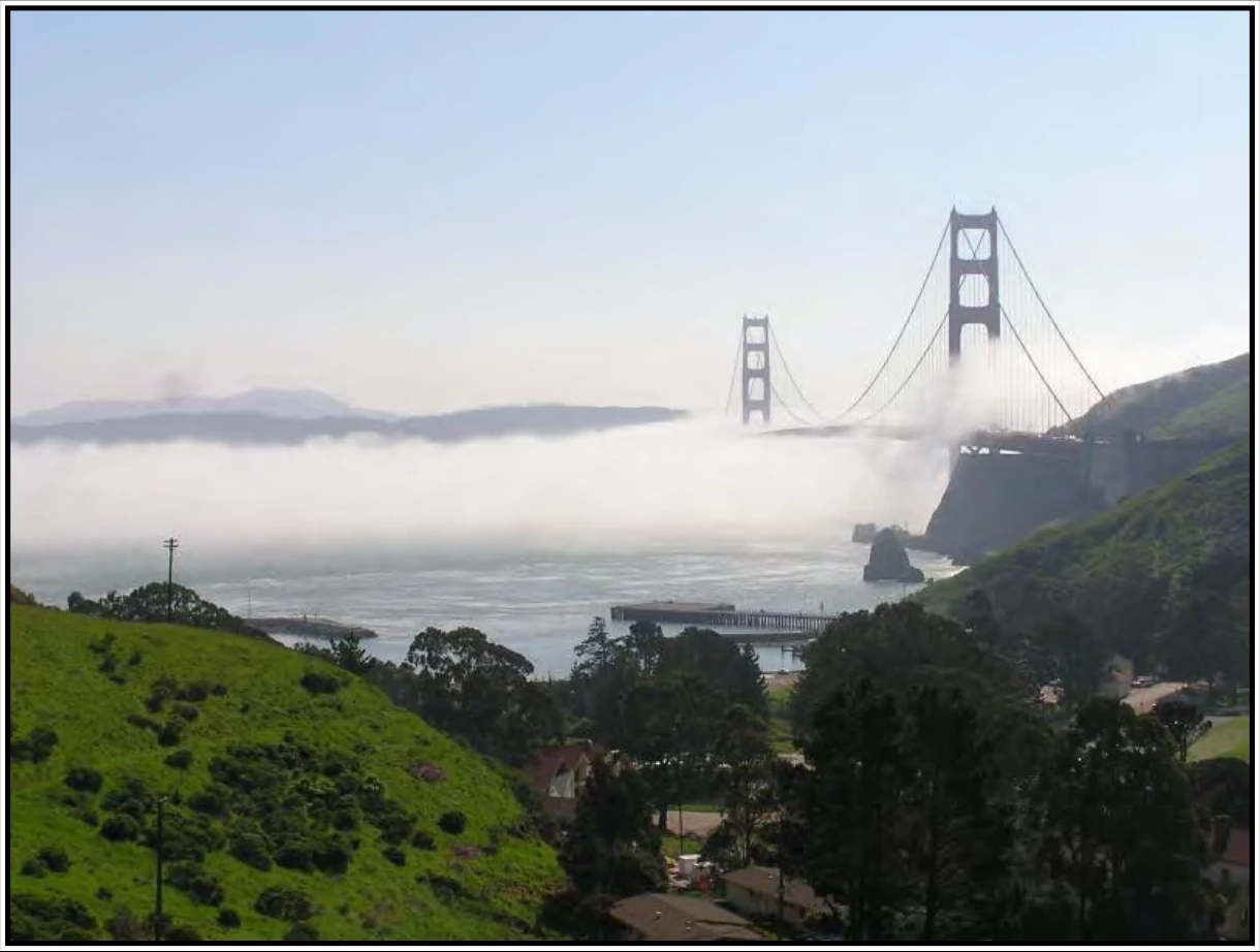
The West Coast of the United States is quite vulnerable to advection fog. This fog frequently forms offshore as a result of cold water and then is carried inland by the wind. It can remain over the water for weeks, advancing over the land during night and retreating back over the water the next morning.
During the winter, advection fog over the central and eastern United States results when moist air from the Gulf of America spreads northward over cold ground. The fog may extend as far north as the Great Lakes.
Water areas in northern latitudes have frequent dense sea fog in summer as a result of warm, moist, tropical air flowing northward over colder Arctic waters.
A pilot will notice little difference between flying over advection fog and over radiation fog. Also, advection fog is usually more extensive and much more persistent than radiation fog. Advection fog can move in rapidly regardless of the time of day or night.
18.1.1.1.3 Upslope Fog
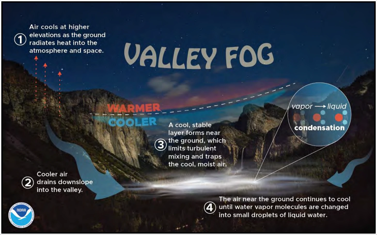
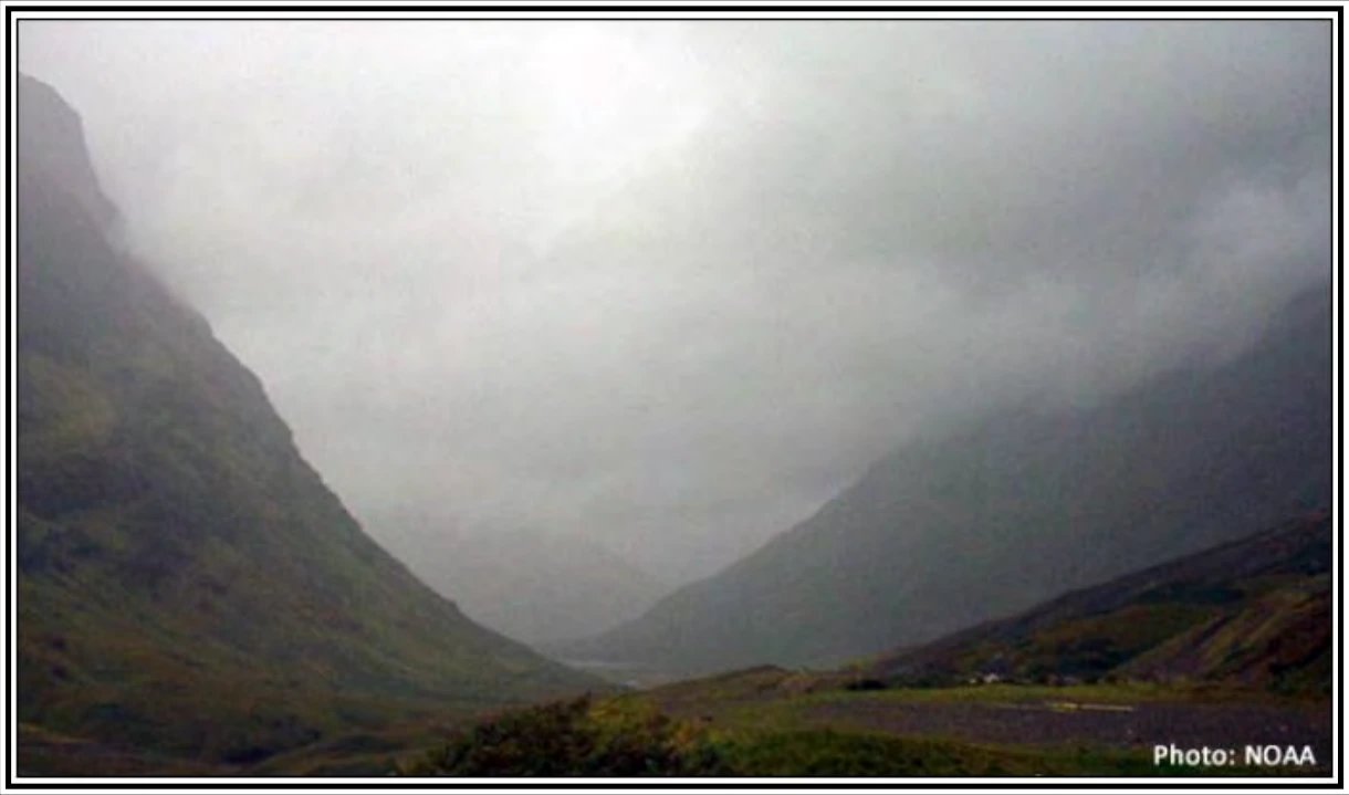
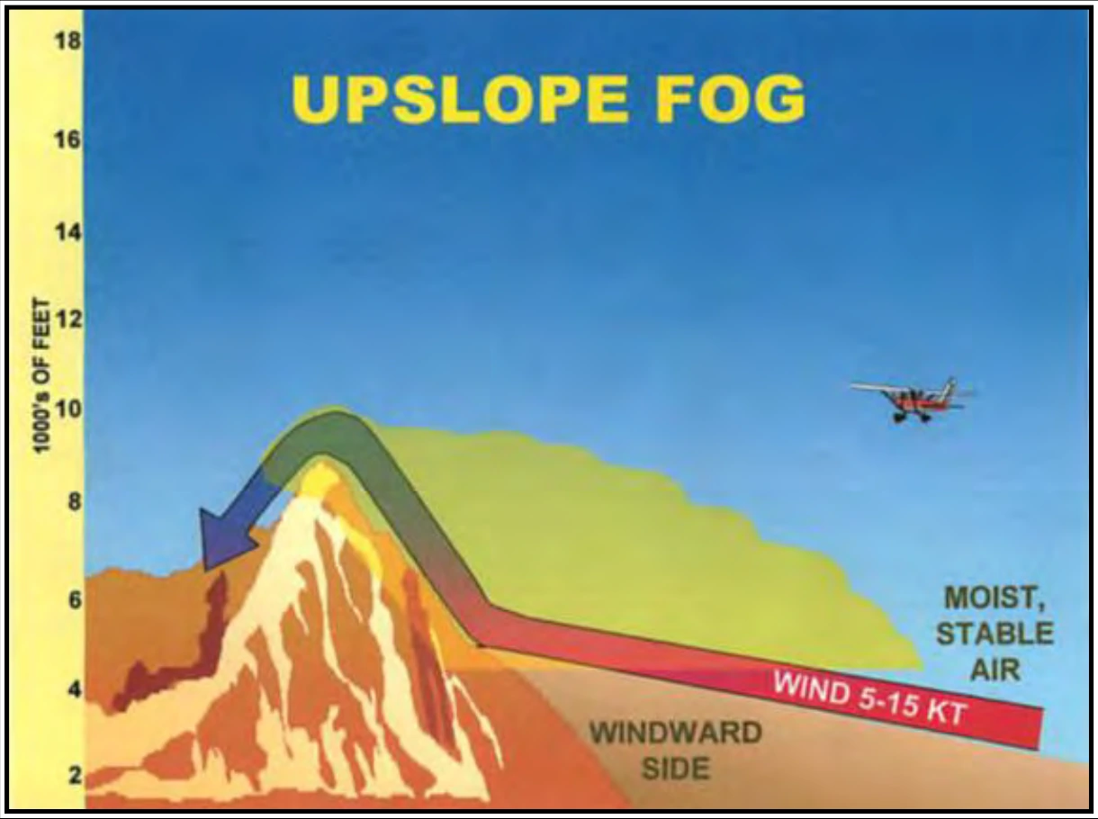
Upslope fog forms as a result of moist, stable air being adiabatically cooled to or below its dewpoint as it moves up sloping terrain (see Figure 18-7). Winds speeds of 5–15 kt are most favorable since stronger winds tend to lift the fog into a layer of low stratus clouds. Unlike radiation fog, it can form under cloudy skies. Upslope fog is common along the eastern slopes of the Rocky Mountains and somewhat less frequent east of the Appalachian Mountains. Upslope fog is often quite dense and extends to high altitudes.
18.1.1.1.4 Frontal Fog
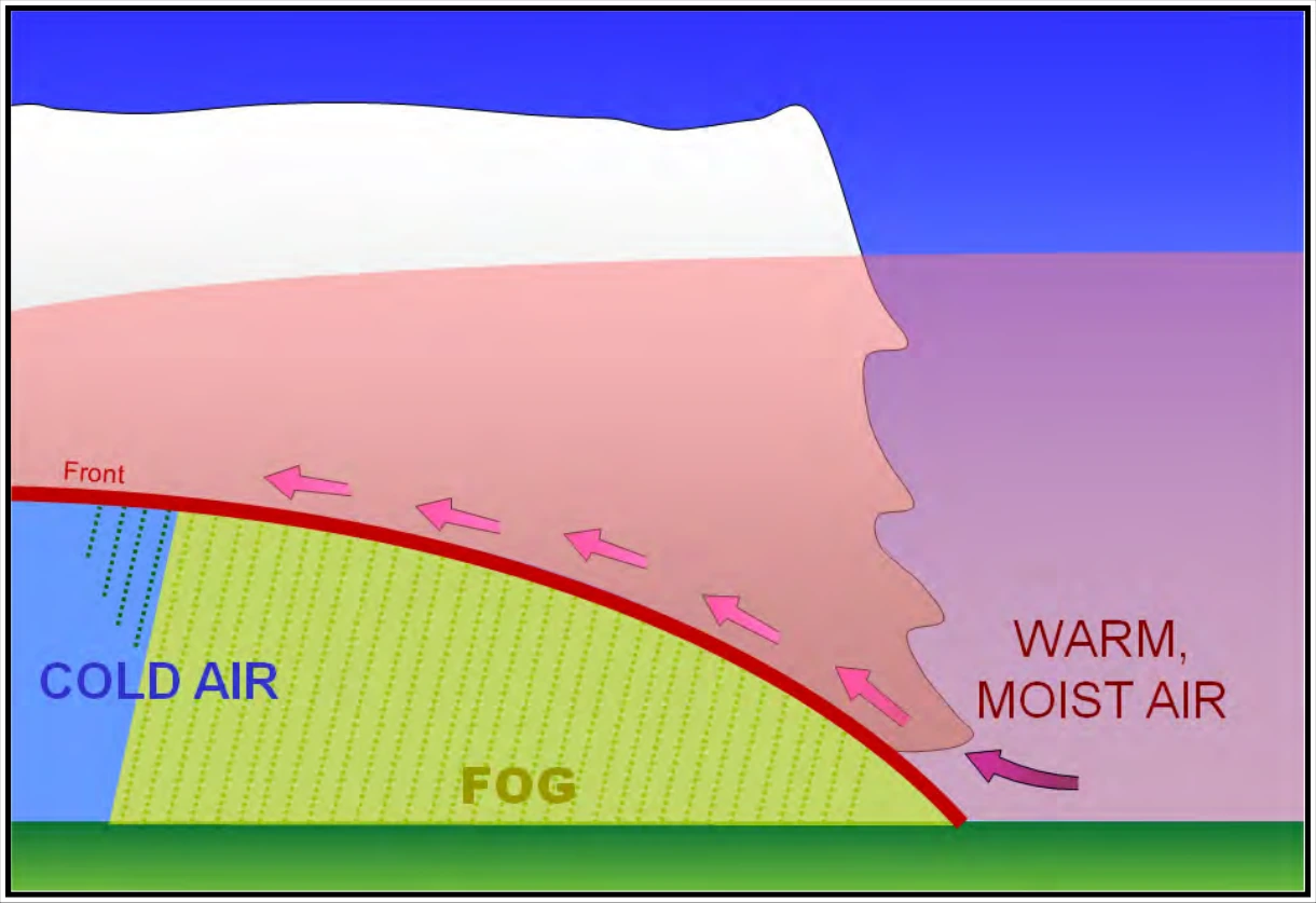
When warm, moist air is lifted over a front, clouds and precipitation may form. If the cold air below is near its dewpoint, evaporation (or sublimation) from the precipitation may saturate the cold air and form fog (see Figure 18-8). A fog formed in this manner is called frontal (or precipitation-induced) fog. The result is a more or less continuous zone of condensed water droplets reaching from the ground up through the clouds. Frontal fog can become quite dense and continue for an extended period of time. This fog may extend over large areas, completely suspending air operations. It is most commonly associated with warm fronts but can occur with other fronts as well.
18.1.1.1.5 Steam Fog
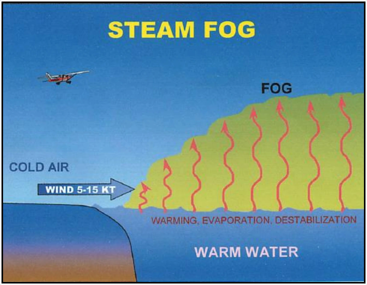
When very cold air moves across relatively warm water, enough moisture may evaporate from the water surface to produce saturation. As the rising water vapor meets the cold air, it immediately recondenses and rises with the air that is being warmed from below. Because the air is destabilized, fog appears as rising filaments or streamers that resemble steam. This phenomenon is called steam fog (see Figure 18-9). It is commonly observed over lakes and streams on cold autumn mornings and over the ocean during the winter when cold air masses move off the continents and ice shelves. Steam fog is often very shallow, for as the steam rises, it reevaporates in the unsaturated air above. However, it can be dense and extend over large areas.
Steam fog is associated with a shallow layer of unstable air; thus, pilots can expect convective turbulence flying through it. On occasion, columns of condensed vapor rise from the fog layer, forming whirling steam devils, which appear similar to the dust devils on land.