
Chapter 18
Weather and Obstructions to Visibility
18.1.1.1.6 Freezing Fog
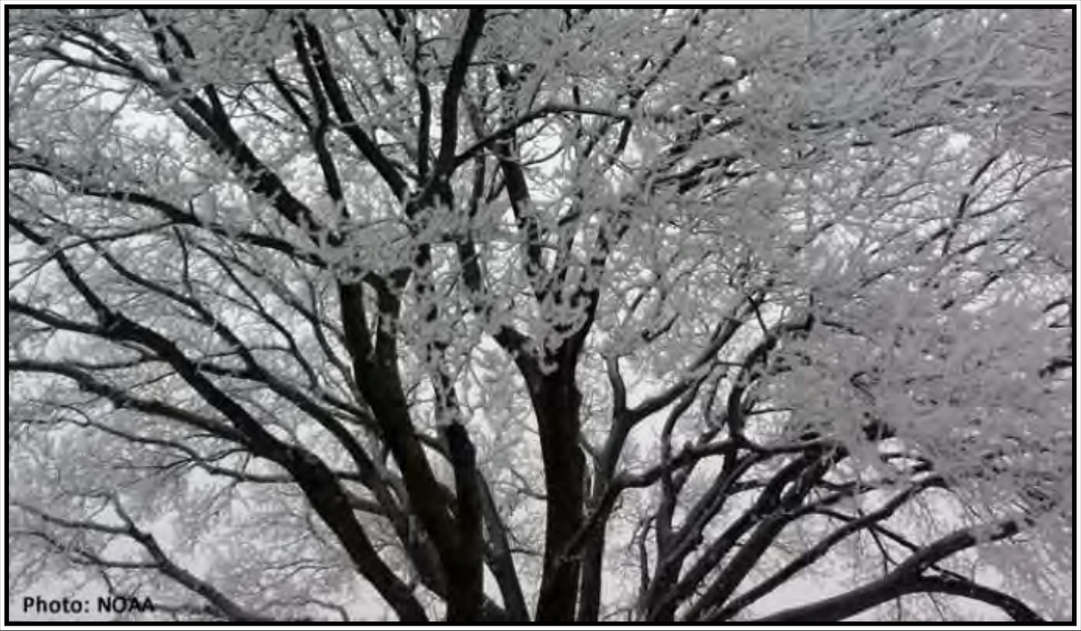
Freezing fog occurs when the temperature falls to 32°F (0°C) or below. Tiny supercooled liquid water droplets in fog can freeze instantly on exposed surfaces when surface temperatures are at or below freezing. Surfaces that these droplets may freeze on include tree branches, stairs and rails, sidewalks, roads, and vehicles (see Figure 18-10). For those flying, or even taxiing, a layer of ice can form on the aircraft, making flight very dangerous unless the aircraft is treated or has effective deicing equipment.
18.1.2 Mist
Mist is a visible aggregate of minute water droplets or ice crystals suspended in the atmosphere that reduces visibility to less than 7 SM (11 km), but greater than, or equal to, 5/8 SM (1 km). Mist forms a thin grayish veil that covers the landscape. It is similar to fog but does not obstruct visibility to the same extent.
Mist may be considered an intermediate between fog and haze. It has lower relative humidity (95 to 99 percent) than fog and does not obstruct visibility to the same extent. However, there is no distinct line between any of these categories.
18.1.3 Haze
Haze is a suspension in the air of extremely small particles invisible to the naked eye and sufficiently numerous to give the air an opalescent appearance. It reduces visibility by scattering the shorter wavelengths of light. Haze produces a bluish color when viewed against a dark background and a yellowish veil when viewed against a light background. Haze may be distinguished by this same effect from mist, which yields only a gray obscuration. Certain haze particles increase in size with increasing relative humidity, drastically decreasing visibility. While visibility is a measure of how far one can see, including the ability to see the textures and colors therein, haze is the inability to view a similar scene with equal clarity.
Haze occurs in stable air and is usually only a few thousand feet thick but may extend upwards to 15,000 ft (4,600 m). A haze layer has a definite ceiling above which in-flight (air-to-air) visibility is unrestricted. At or below this level, the slant range (air-to-ground) visibility is poor. Visibility in haze varies greatly, depending on whether the pilot is facing into or away from the Sun.
18.1.4 Smoke
Smoke is a suspension in the air of small particles produced by combustion due to fires, industrial burning, or other sources. It may transition to haze when the particles travel 25–100 mi (40–160 km) or more, the larger particles have settled, and others become widely scattered through the atmosphere.
Not only can smoke reduce visibility to zero, but many of its compounds are highly toxic and/or irritating. The most dangerous is carbon monoxide, which can lead to carbon monoxide poisoning, sometimes with supporting effects of hydrogen cyanide and phosgene.
When skies are clear above a surface-based layer of haze or smoke, visibility generally improves during the day. Heating during the day may cause convective mixing, spreading the smoke or haze to a higher altitude, and decreasing the concentration near the surface. However, the improvement is slower than the clearing of fog. Fog evaporates, but haze and smoke must be dispersed by the movement of air. A thick layer of clouds above haze or smoke may block sunlight, preventing dissipation. Visibility will improve little, if any, during the day.
18.1.5 Precipitation
Precipitation is any of the forms of water particles, whether liquid or solid, that fall from the atmosphere and reach the ground. Snow, rain, and drizzle are types of precipitation. Heavy snow may reduce visibility to zero. Rain seldom reduces surface visibility below 1 mi except in brief, heavy showers.
Drizzle usually restricts visibility to a greater degree than rain. It forms in stable air, falls from stratiform clouds, and is typically accompanied by fog. When drizzle changes to light rain, visibility usually improves because the droplet size increases, meaning there are fewer droplets per unit area.
For more information on precipitation, see Chapter 14, Precipitation.
18.1.6 Blowing Snow
Blowing snow is snow lifted from the surface of the Earth by the wind to a height of 6 ft (2 m) or more above the ground and blown about in such quantities that the reported horizontal visibility is reduced to less than 7 SM (11 km). Light, dry powder snow is most prone to being blown by the wind. When strong winds keep the snow suspended up to 50 ft (15 m) or so, obscuring the sky, and reducing surface visibility to near zero, it is called a whiteout. Visibility improves rapidly when the wind subsides.